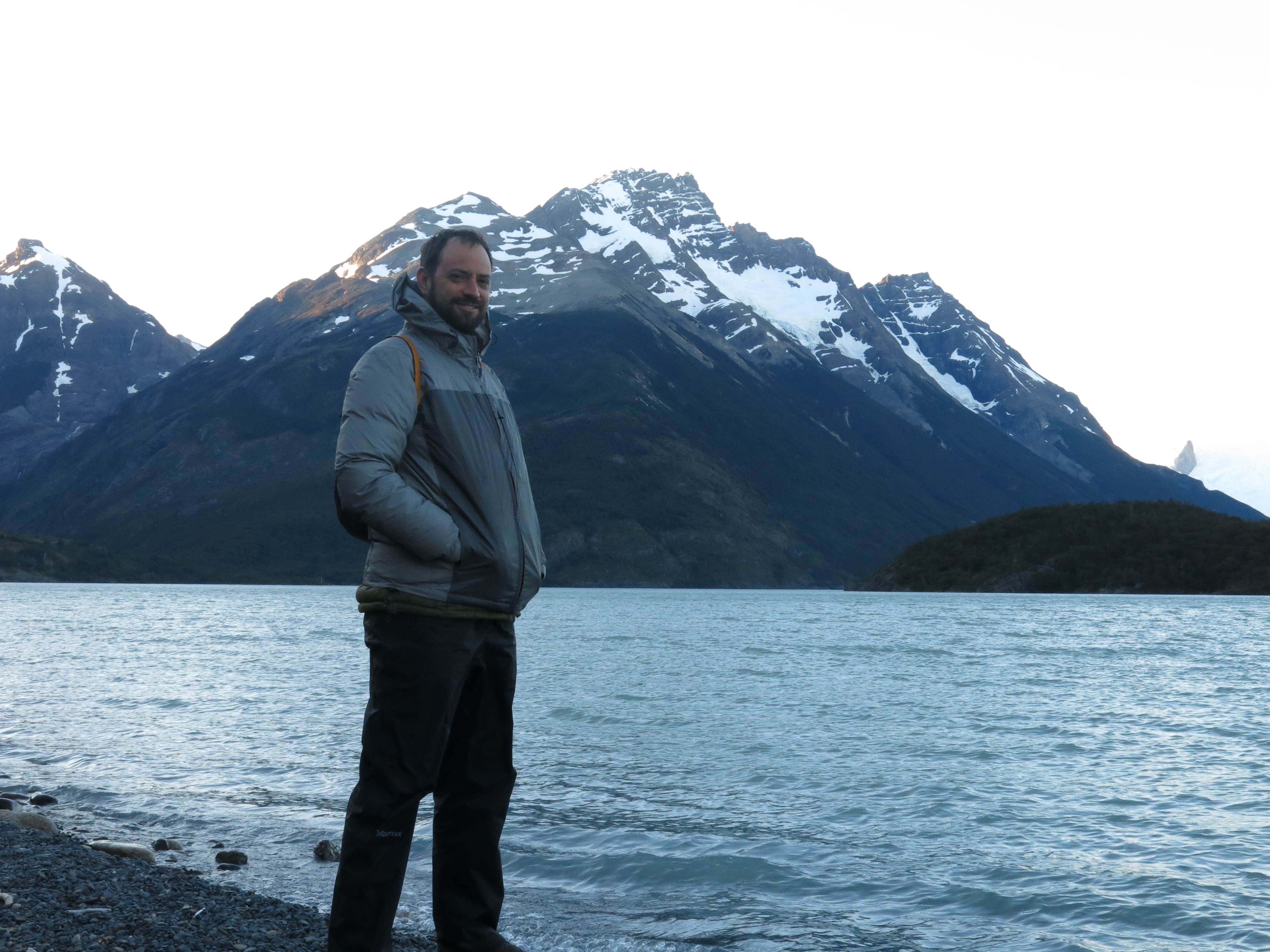
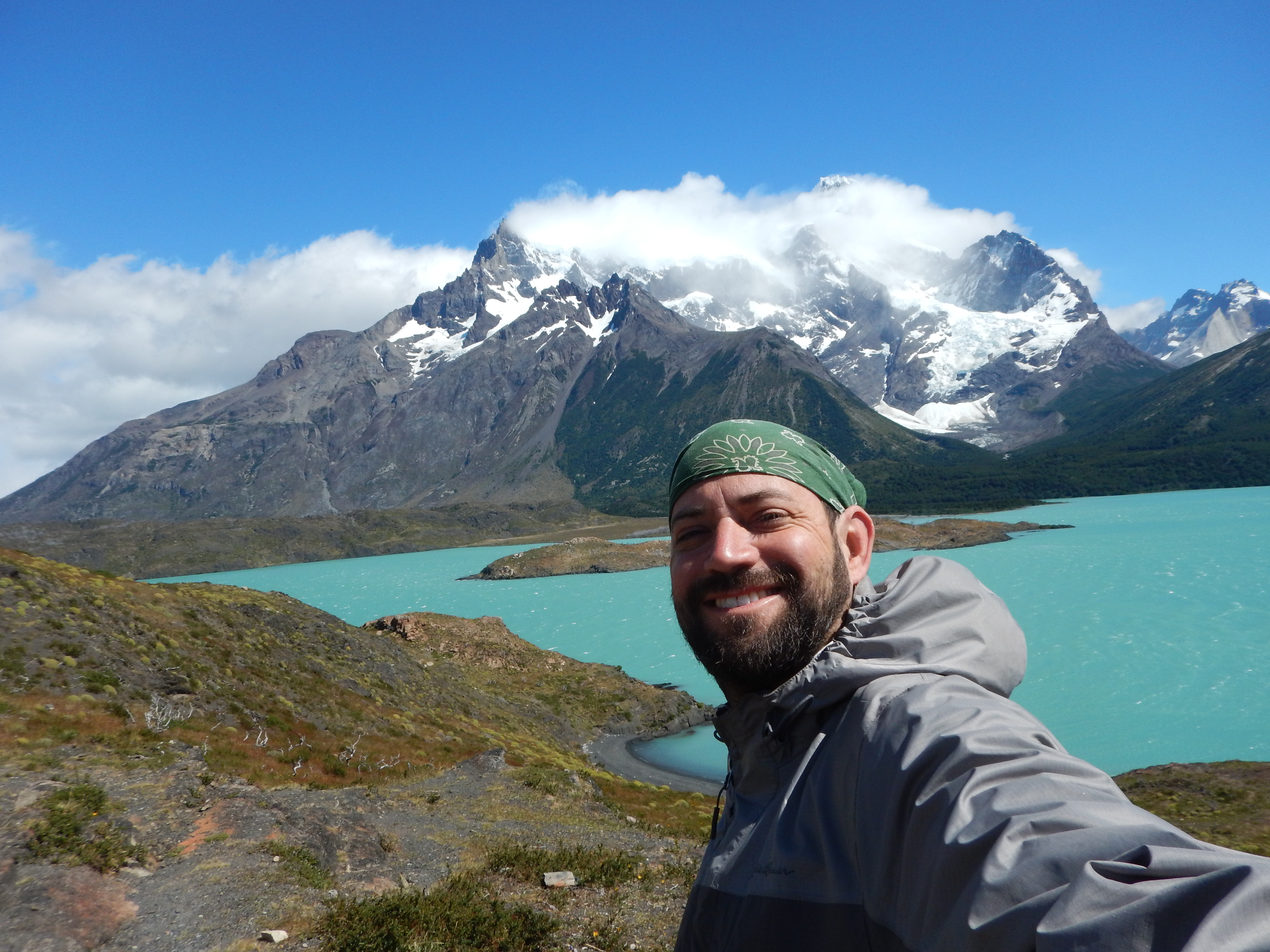
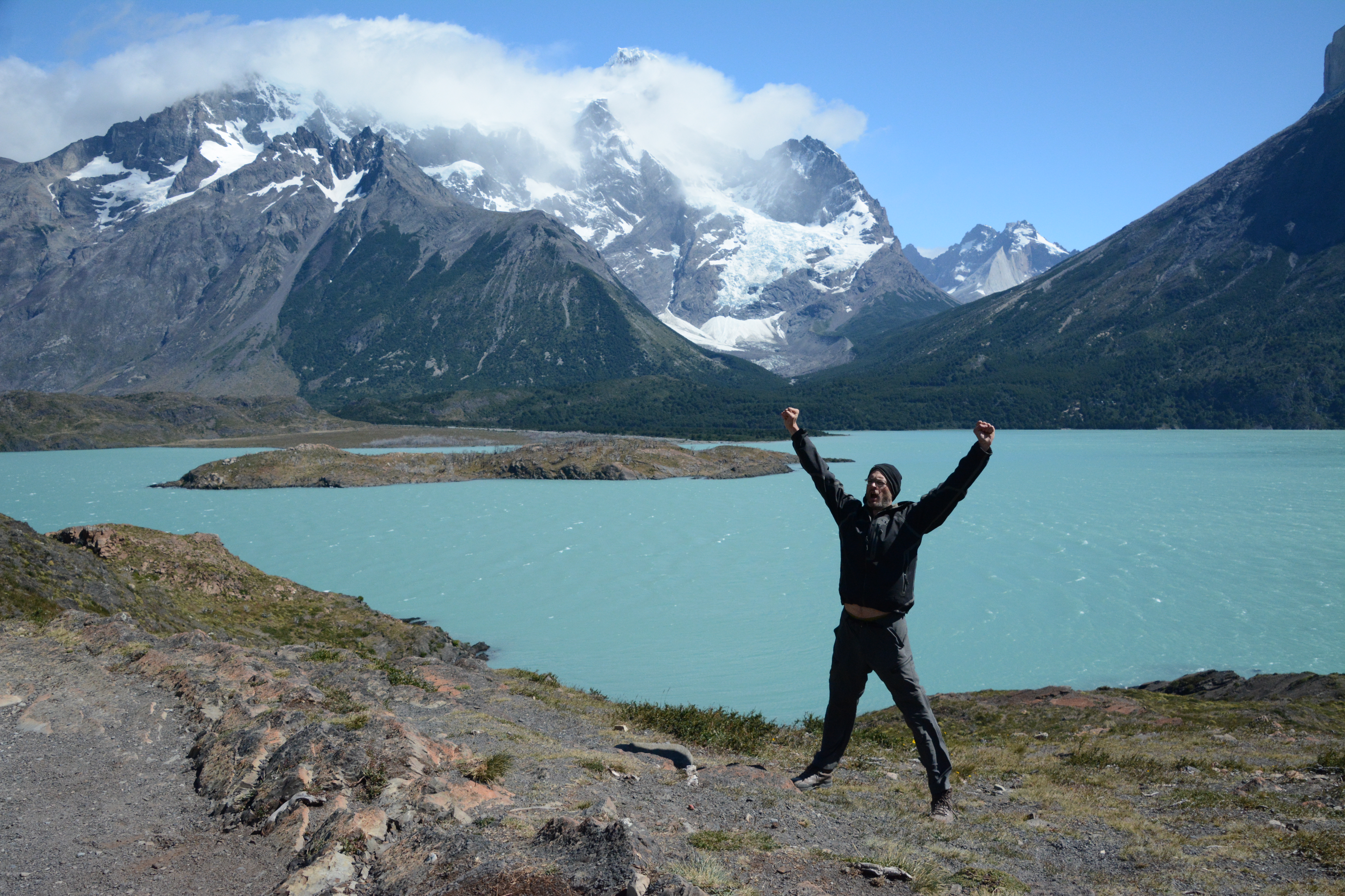
Torres del Paine
Patagonia
Chile
January 1 - 17, 2016
When Kevin brought this idea up in early 2015, I knew that I would not be able to say no.
The idea was, for the four of us (Kevin, Dan, Paul, and myself) to hike the approximately 100-mile circuit trail in Torres del Paine, a park in Chilean Patagonia. Somehow, we all managed to make it happen. We flew out of Seattle on January 1st, before dawn.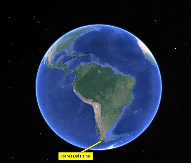
(way down there) The total transit time from Seattle to Punta Arenas was about 28 hours, with four flights and three short layovers. The Miami to Santiago flight was about 10 hours.
American Airlines (cursed be thy name) lost all four of our backpacks. That caused some stress when we arrived, as you might imagine.
Punta Arenas
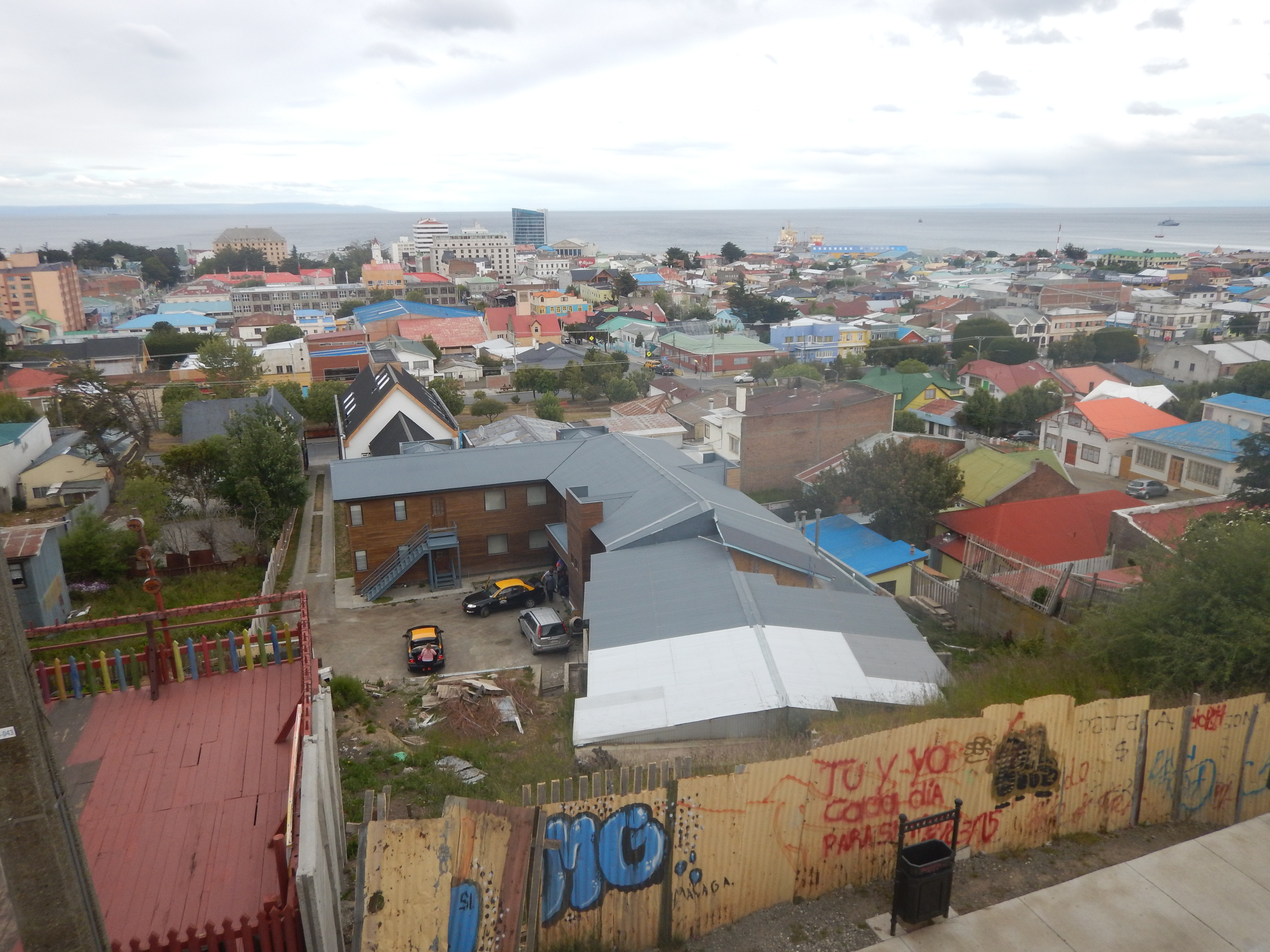 Punta Arenas is the southernmost city in the world!
(there are a couple of towns a little further south)
The city has a population of about 123,000.
This photo (above) was taken facing south, from the viewpoint near the center of town.
That's the Strait of Magellan!
Punta Arenas is the southernmost city in the world!
(there are a couple of towns a little further south)
The city has a population of about 123,000.
This photo (above) was taken facing south, from the viewpoint near the center of town.
That's the Strait of Magellan!

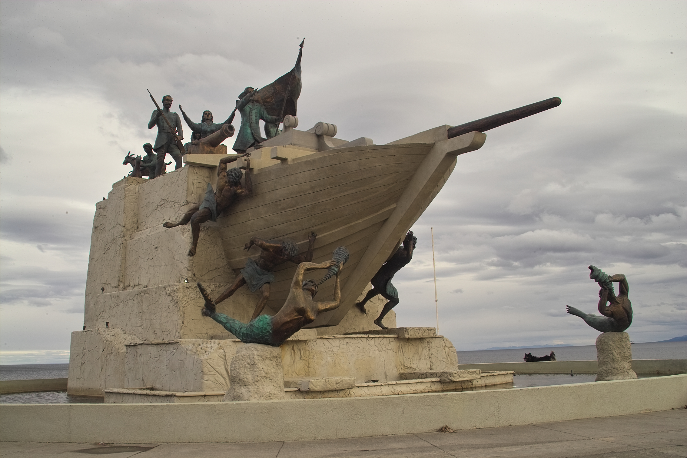 Magellan is an important part of Punta Arenas history.
Many streets, shops, businesses, etc. are named after the famous explorer.
Magellan is an important part of Punta Arenas history.
Many streets, shops, businesses, etc. are named after the famous explorer.
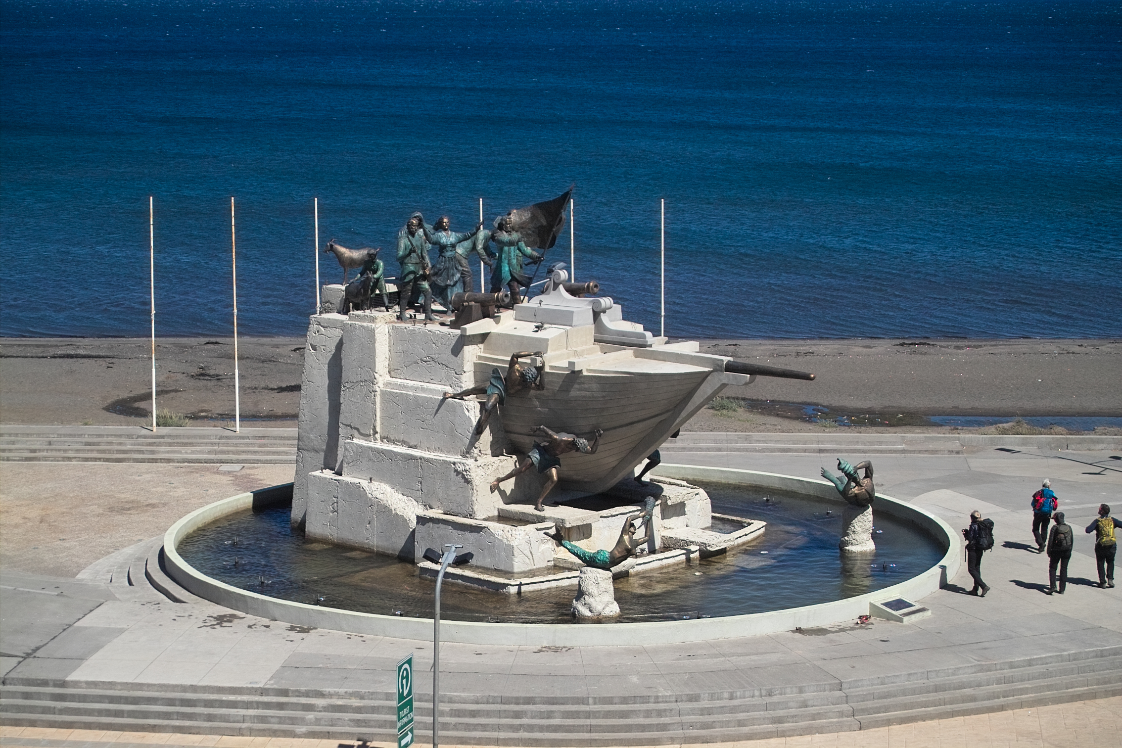 This monument to Fernando de Magallanes was recently constructed.
The monument was directly in front of the hotel we stayed at
(while we were waiting for American Airlines to find and deliver our backpacks).
This monument to Fernando de Magallanes was recently constructed.
The monument was directly in front of the hotel we stayed at
(while we were waiting for American Airlines to find and deliver our backpacks).
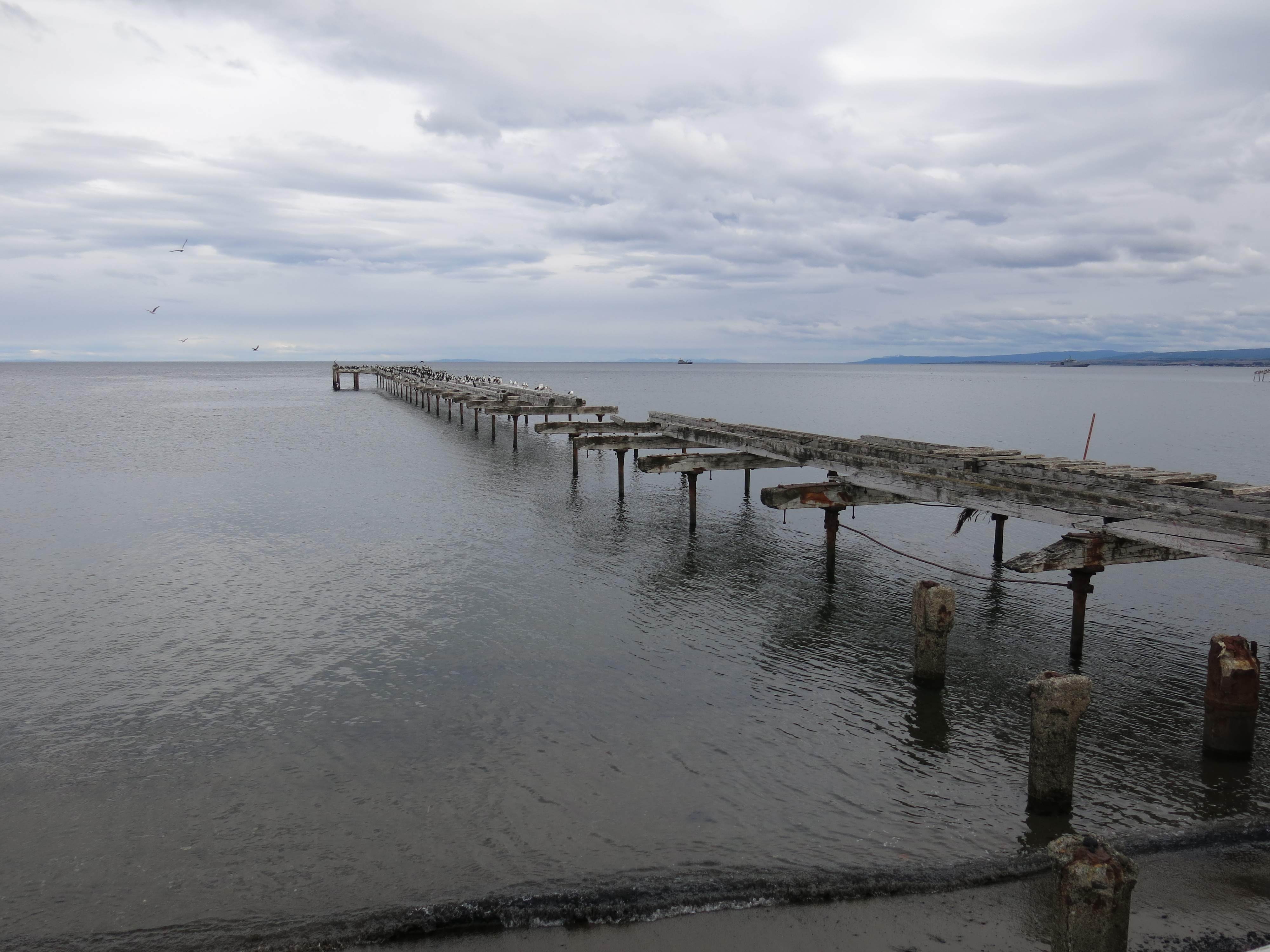
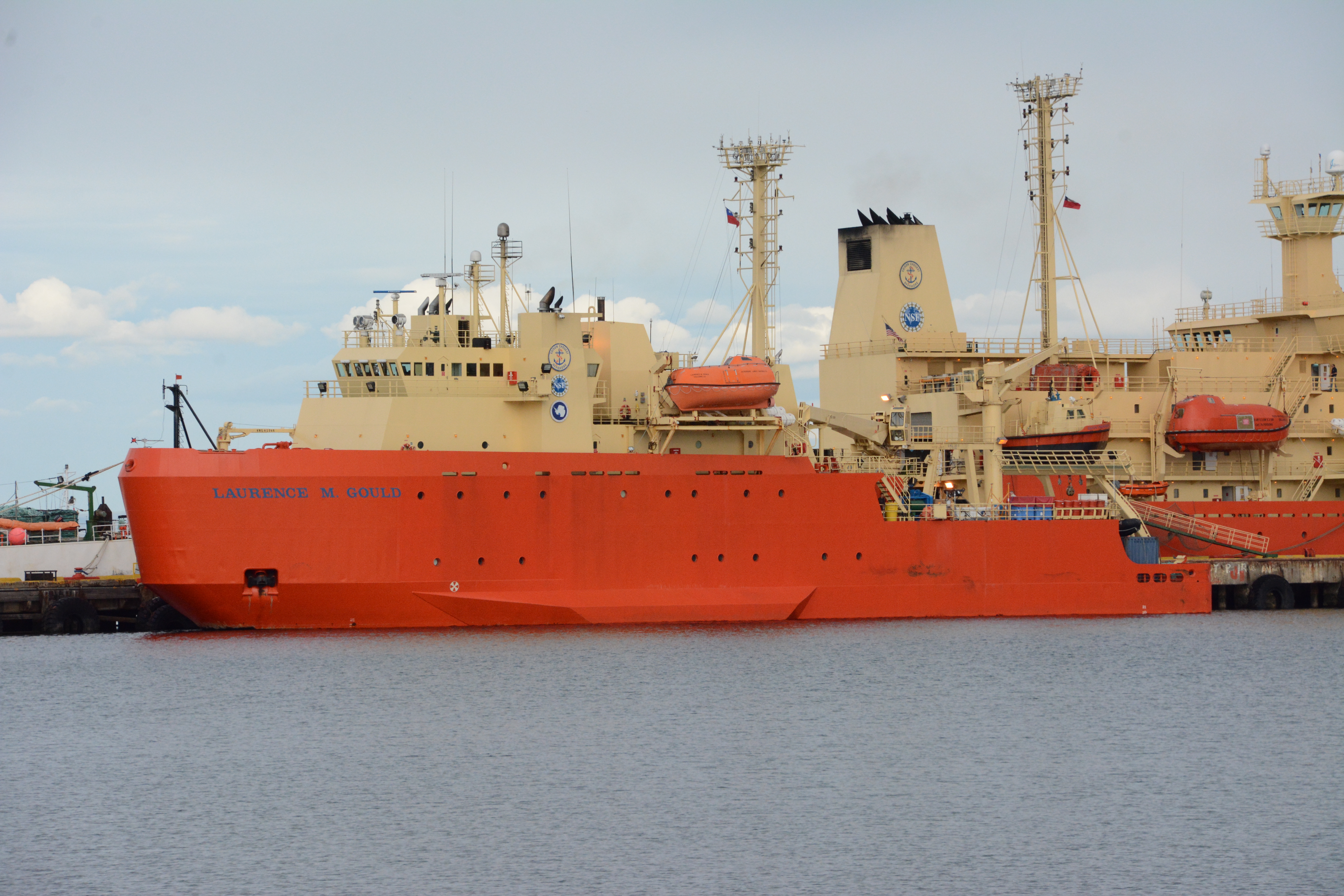 Punta Arenas is the port that the Antarctic research ships are based out of.
These two are research ships from the US.
Punta Arenas is the port that the Antarctic research ships are based out of.
These two are research ships from the US.
 Well, we have no backpacks, so that means no trek into Patagonia, and no change of clothes.
Let's go get a drink.
American Airlines was no help. Zero stars.
We couldn't even get a human being on the phone until we called Alaska Airlines and asked them to advocate for us.
Eventually we learned that the backpacks were taken off of our plane in Miami, but were on the way.
We would have to wait for about 2 days for them to arrive.
Well, we have no backpacks, so that means no trek into Patagonia, and no change of clothes.
Let's go get a drink.
American Airlines was no help. Zero stars.
We couldn't even get a human being on the phone until we called Alaska Airlines and asked them to advocate for us.
Eventually we learned that the backpacks were taken off of our plane in Miami, but were on the way.
We would have to wait for about 2 days for them to arrive.
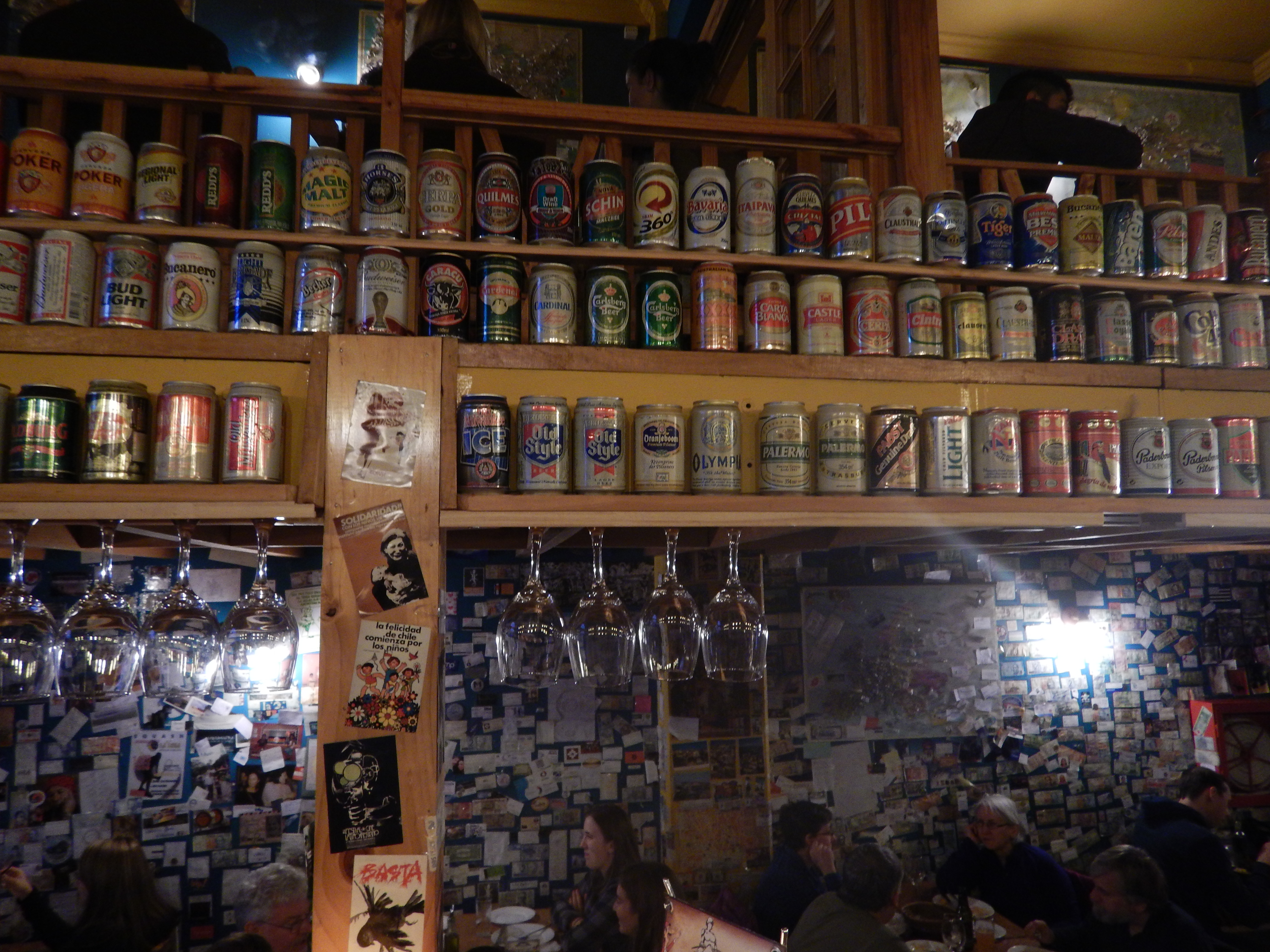 Hah! Check out that can in the center of this mighty collection!
This shows only a small subset of the beer can collection that was on display at this restaurant.
It turns out, much to my pleasant surprise, that the beer in Punta Arenas is really good!
There are at least four breweries locally, and they all make artisanal lines of beer, which are great!
I have a collection of bottle photos here. It is by no means a complete set.
Hah! Check out that can in the center of this mighty collection!
This shows only a small subset of the beer can collection that was on display at this restaurant.
It turns out, much to my pleasant surprise, that the beer in Punta Arenas is really good!
There are at least four breweries locally, and they all make artisanal lines of beer, which are great!
I have a collection of bottle photos here. It is by no means a complete set.
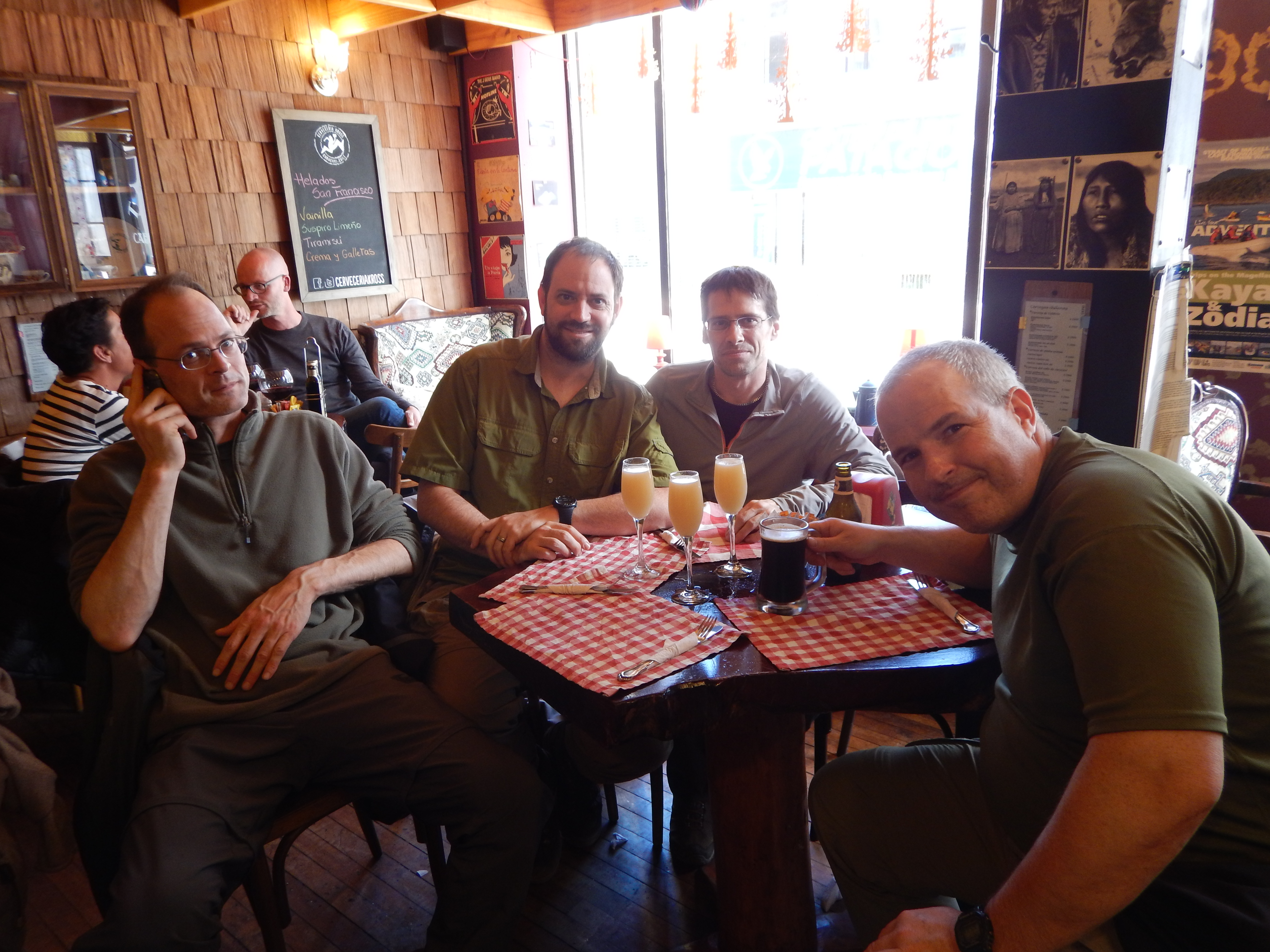 However, most of us opted for the Pisco sours.
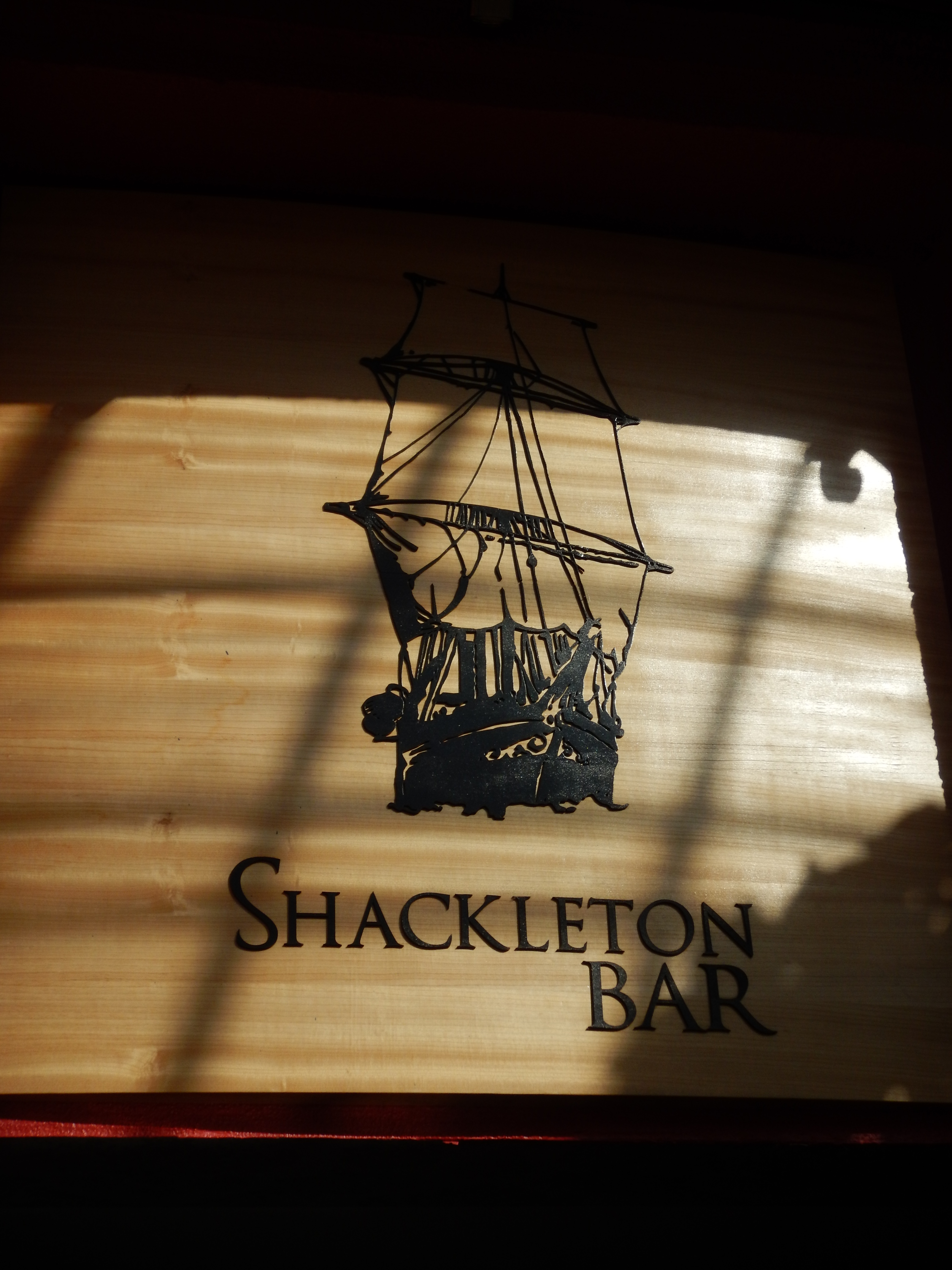 Shackleton spent time here in 1916 trying to arrange for the recovery of his men who were marooned in Antarctica.
 We spent some time here in 2016 discussing contingency plans in case our backpacks were lost forever.
What would Shackleton do?
We spent some time here in 2016 discussing contingency plans in case our backpacks were lost forever.
What would Shackleton do?
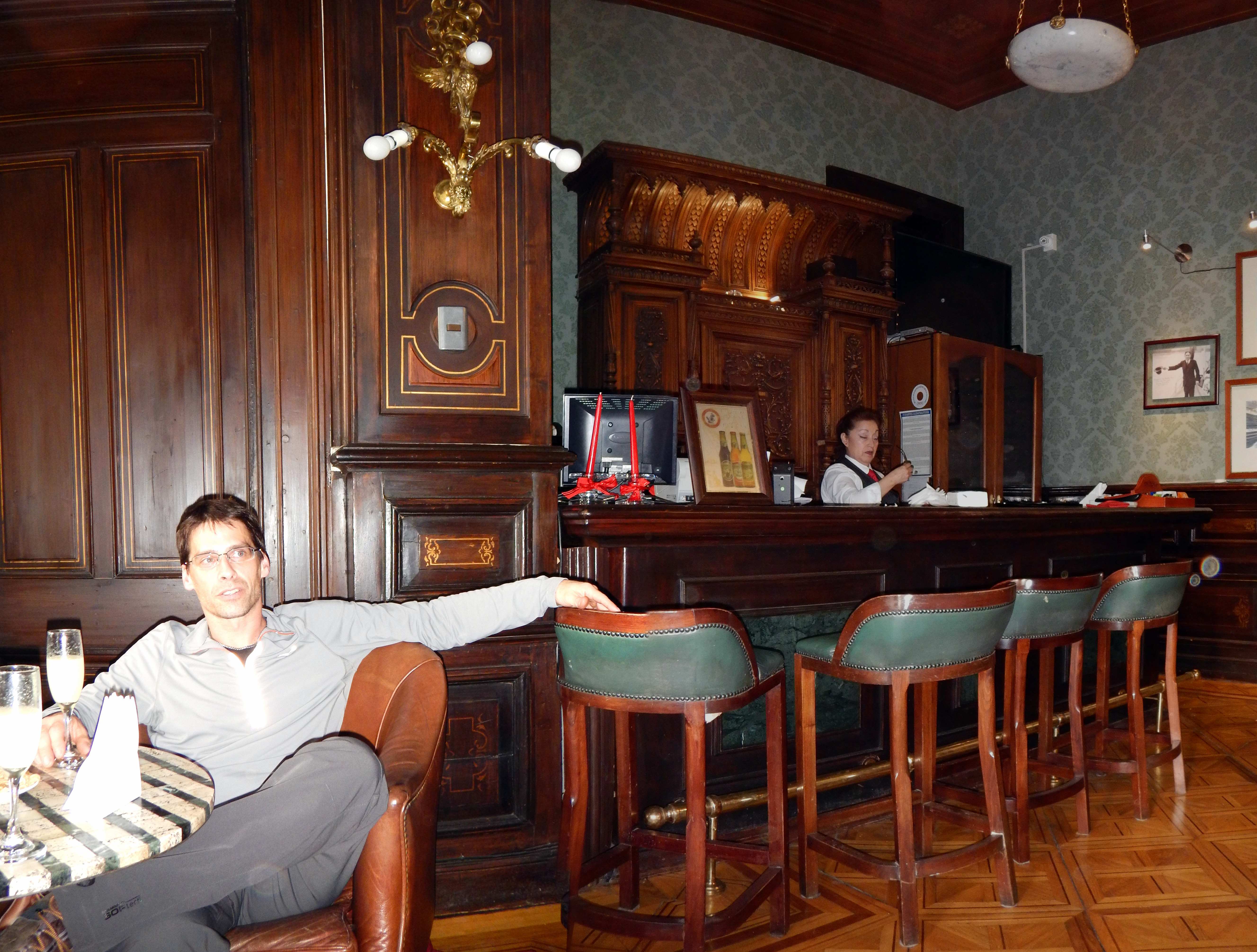 Dan, chillin' with the ghost of Shackelton.
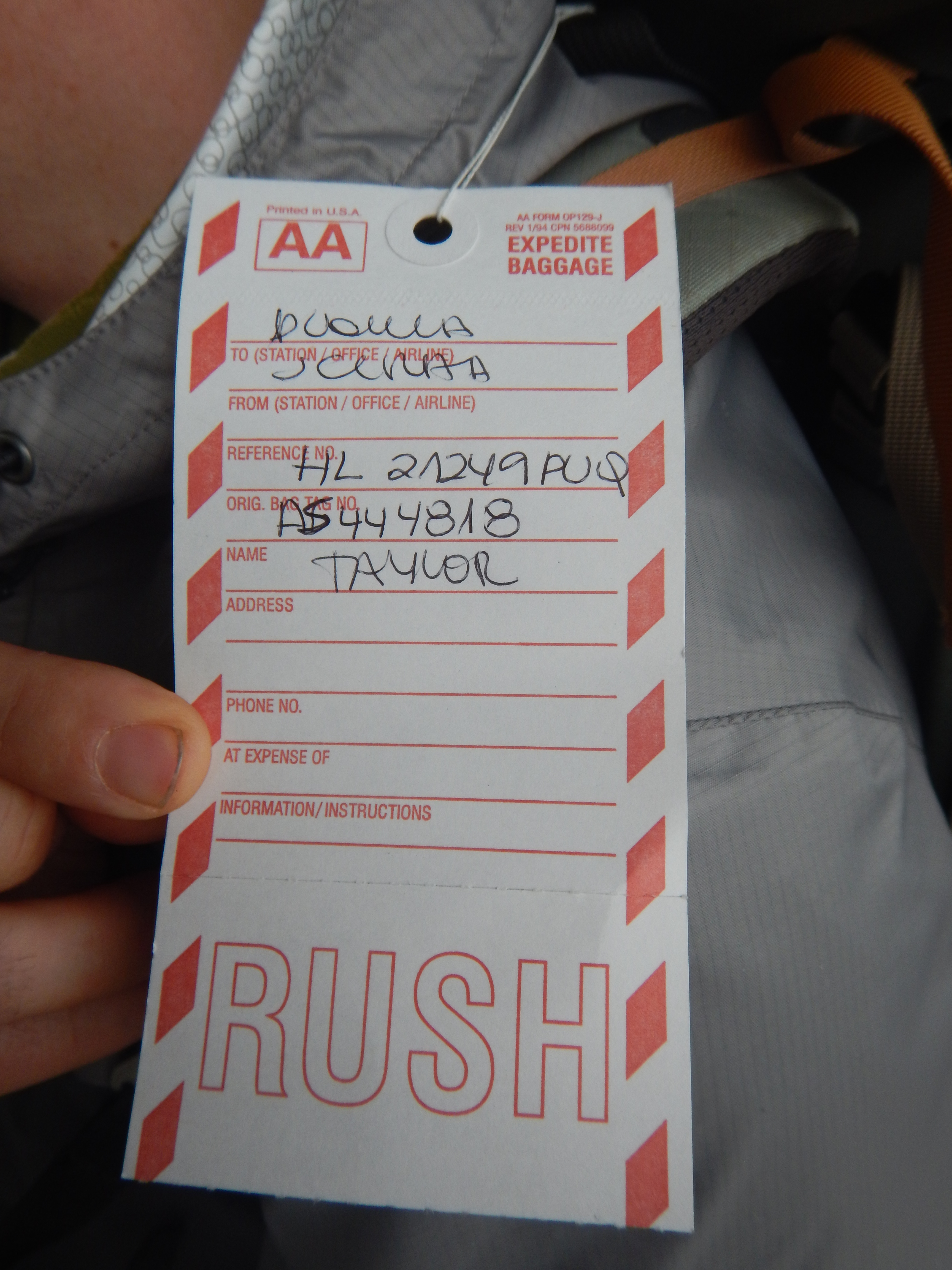 Finally, the backpacks arrived.
On my second taxi-trip to the airport that day, I showed the tattered paperwork to an airport employee.
He disappeared for awhile and eventually emerged holding one of our backpacks! Then, the other three were produced.
We rejoiced and booked the next bus (the following morning) to Torres del Paine.
Finally, the backpacks arrived.
On my second taxi-trip to the airport that day, I showed the tattered paperwork to an airport employee.
He disappeared for awhile and eventually emerged holding one of our backpacks! Then, the other three were produced.
We rejoiced and booked the next bus (the following morning) to Torres del Paine.
Torres del Paine
Day 0
Arriving at Las Torres
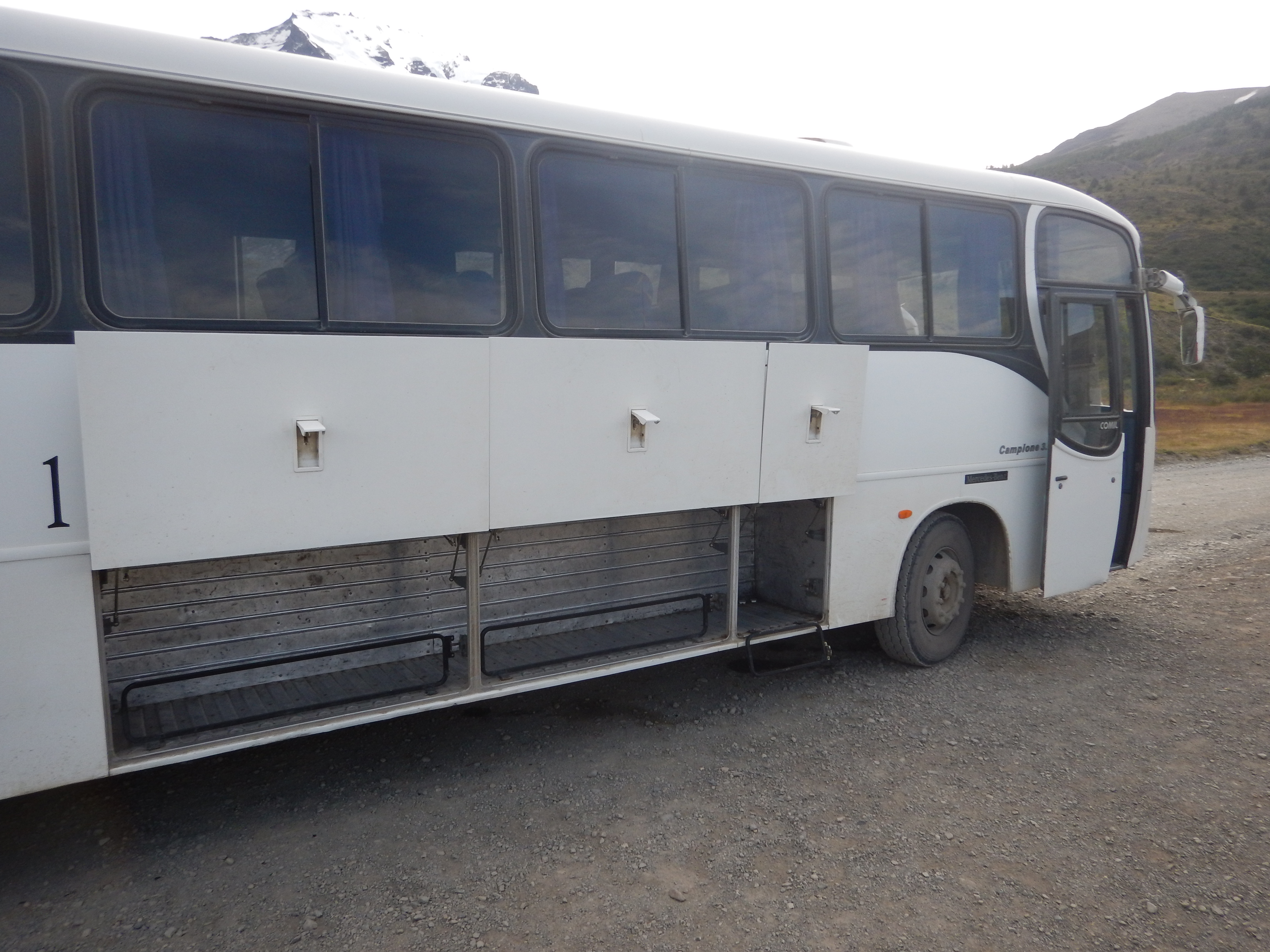 We took two buses to get to Torres del Paine.
We transferred buses in Puerto Natales. That took awhile.
We also had to register at the park entrance. That took awhile.
We took two buses to get to Torres del Paine.
We transferred buses in Puerto Natales. That took awhile.
We also had to register at the park entrance. That took awhile.
 We got super-psyched up on the bus, though.
We were finally about to hit the trail!
We got super-psyched up on the bus, though.
We were finally about to hit the trail!
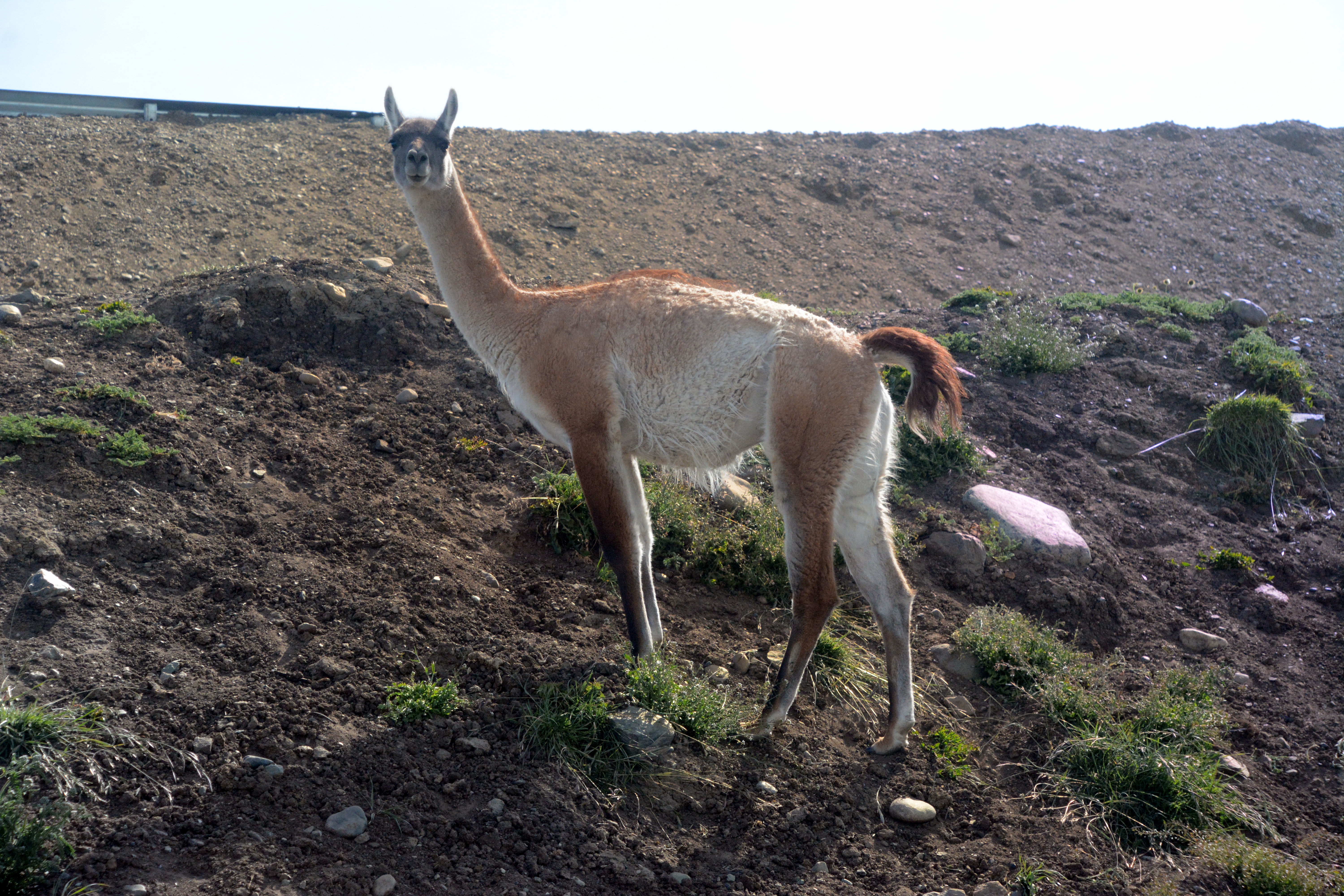
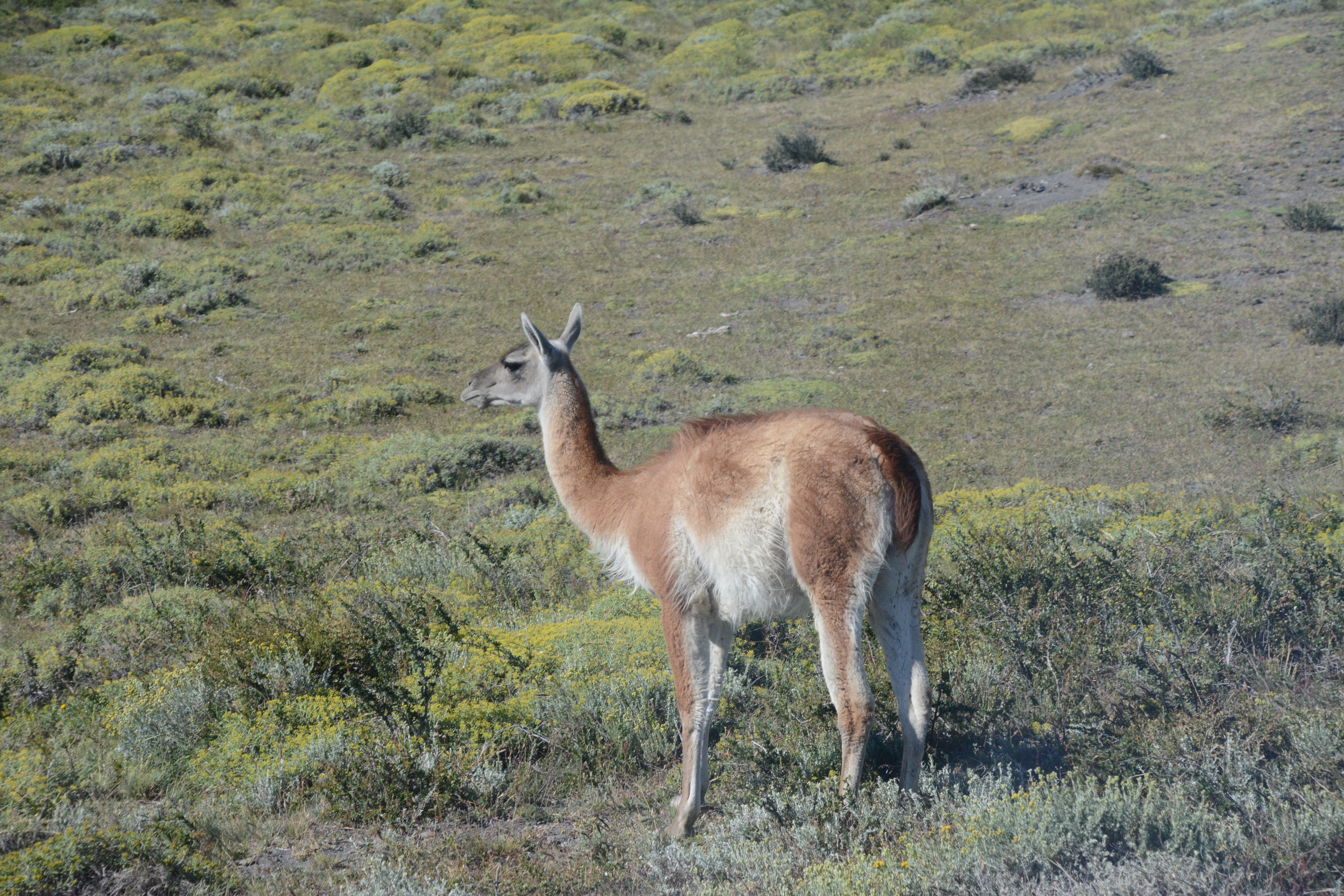 We saw lots of guanaco from the bus windows on the way in.
There were so many of them, we figured they would be everywhere.
Strangely, we didn't see guanaco again until after our hike was complete!
We saw lots of guanaco from the bus windows on the way in.
There were so many of them, we figured they would be everywhere.
Strangely, we didn't see guanaco again until after our hike was complete!
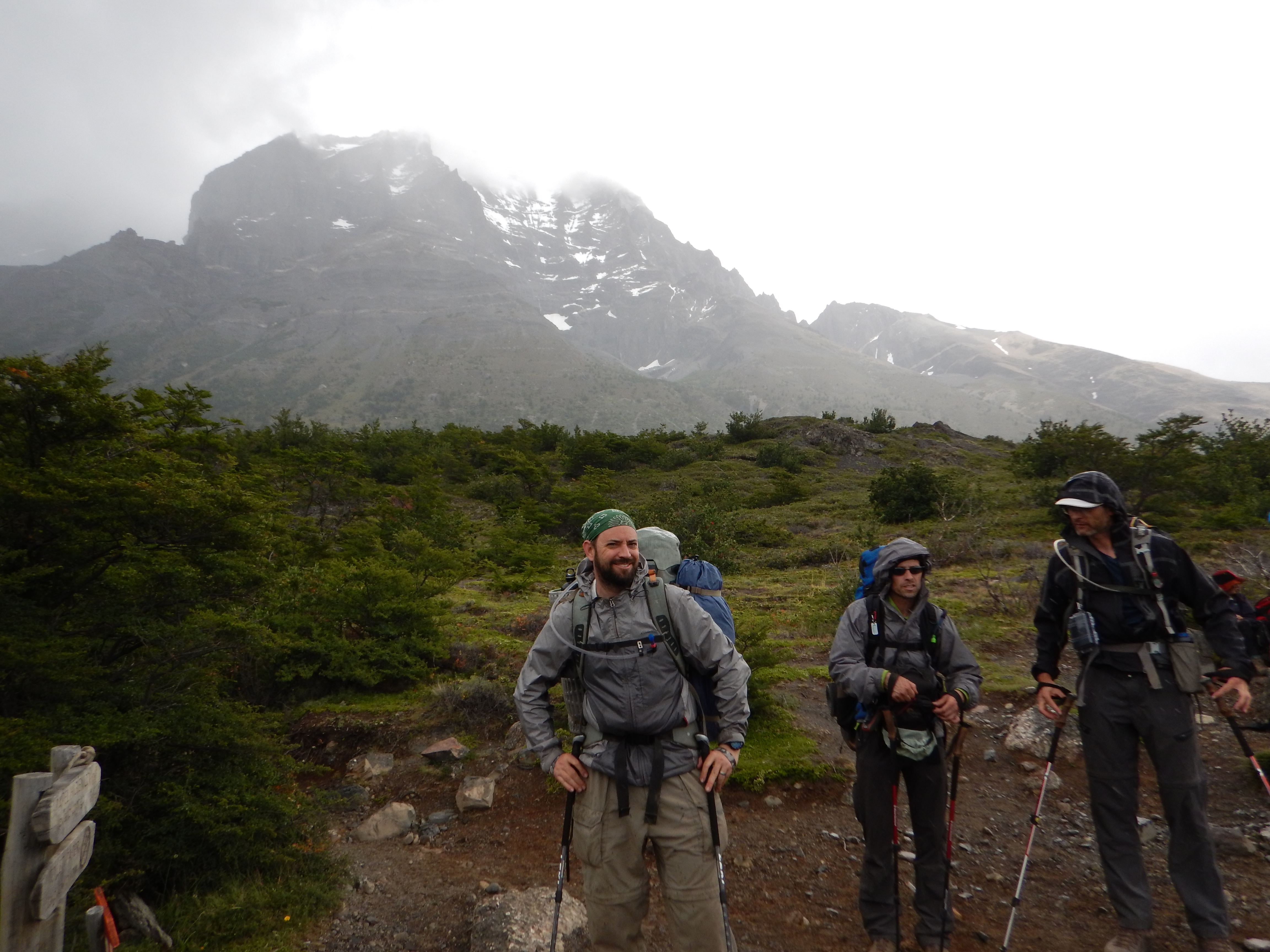
 When we finally arrived at Las Torres, approximately our trailhead, it was almost 5:00 PM.
Undaunted (or it could have been the 5 hour time change), we rapidly repacked our packs and struck out for Campamento Seron, a mere 9 km away.
When we finally arrived at Las Torres, approximately our trailhead, it was almost 5:00 PM.
Undaunted (or it could have been the 5 hour time change), we rapidly repacked our packs and struck out for Campamento Seron, a mere 9 km away.
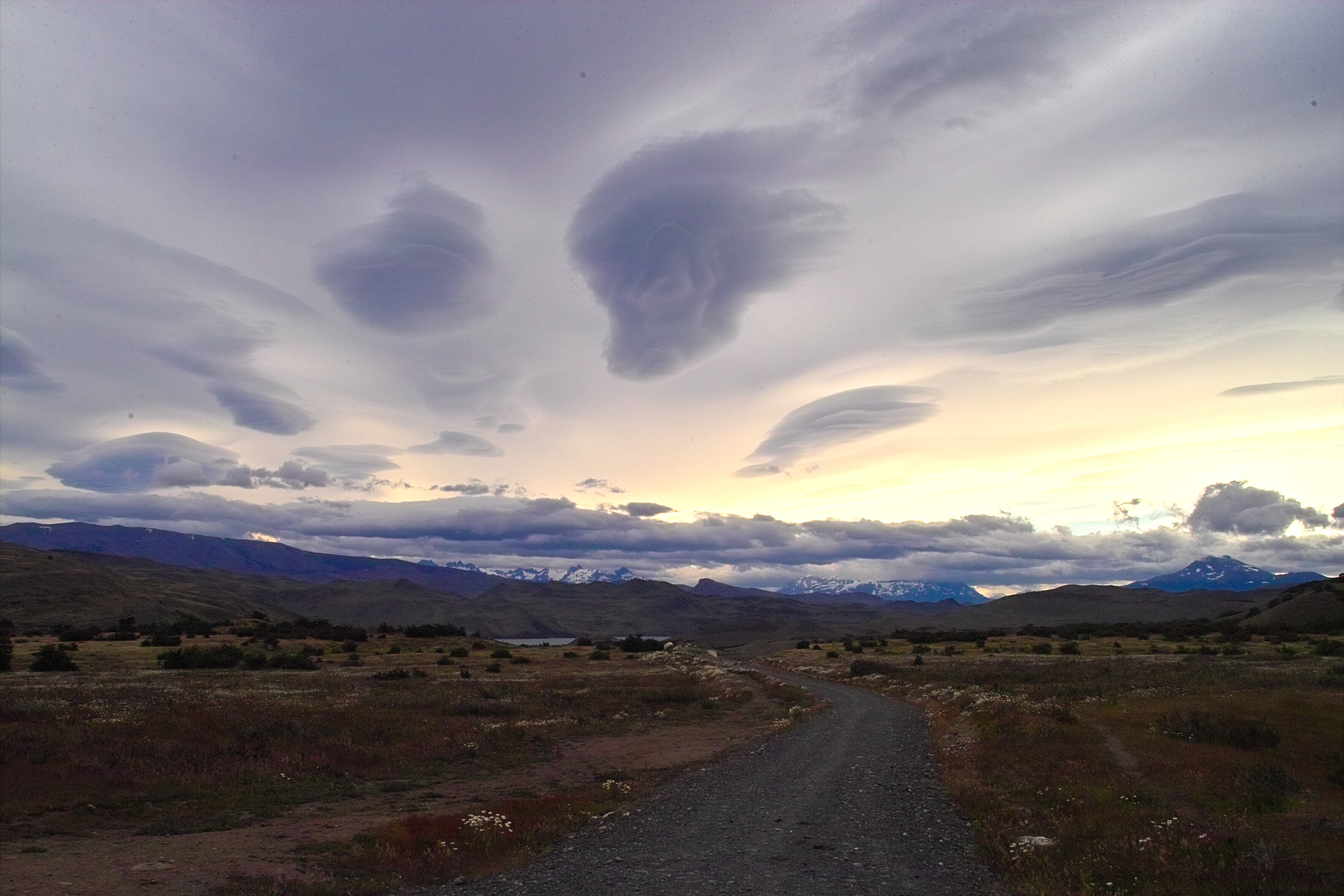
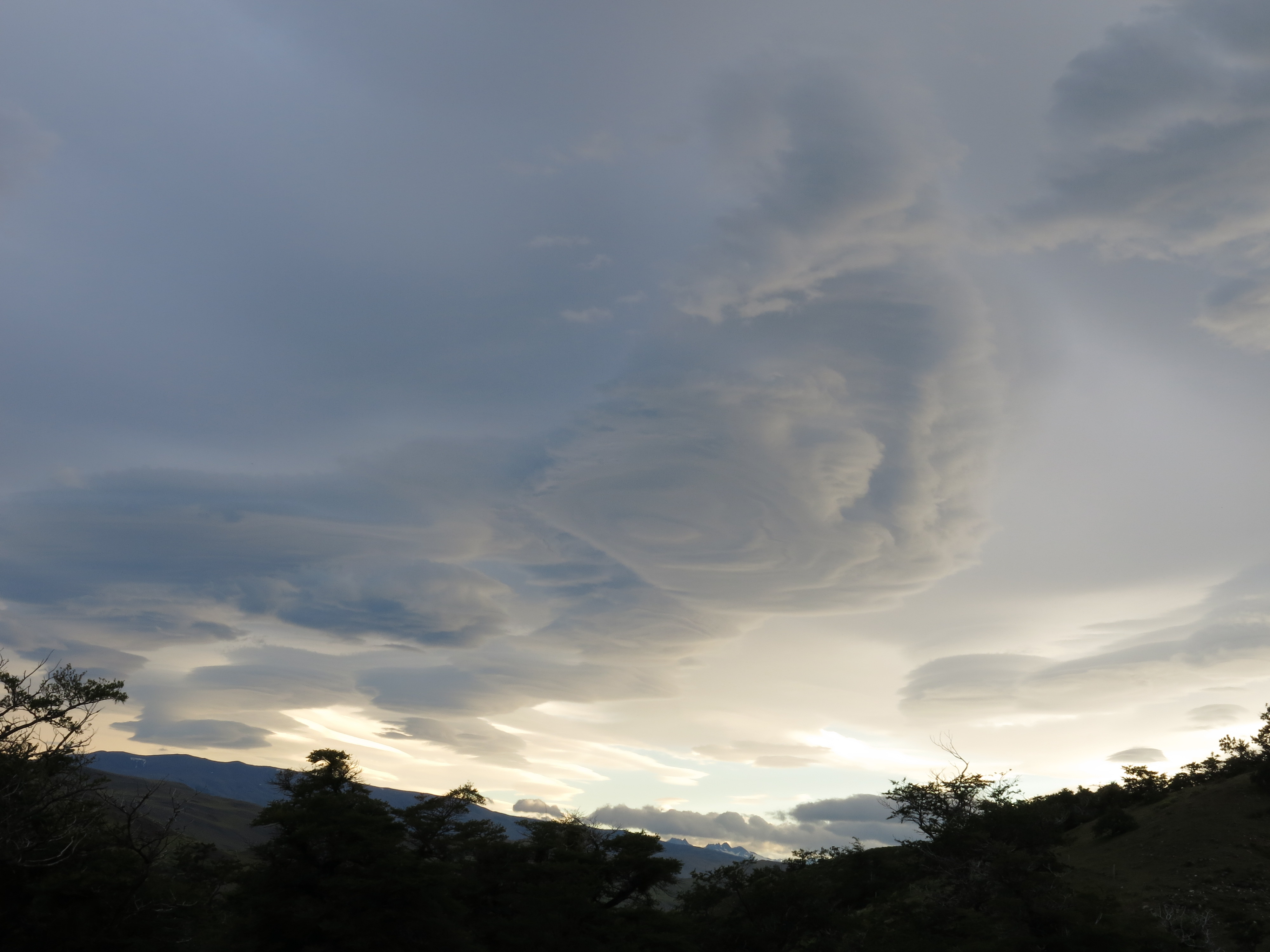
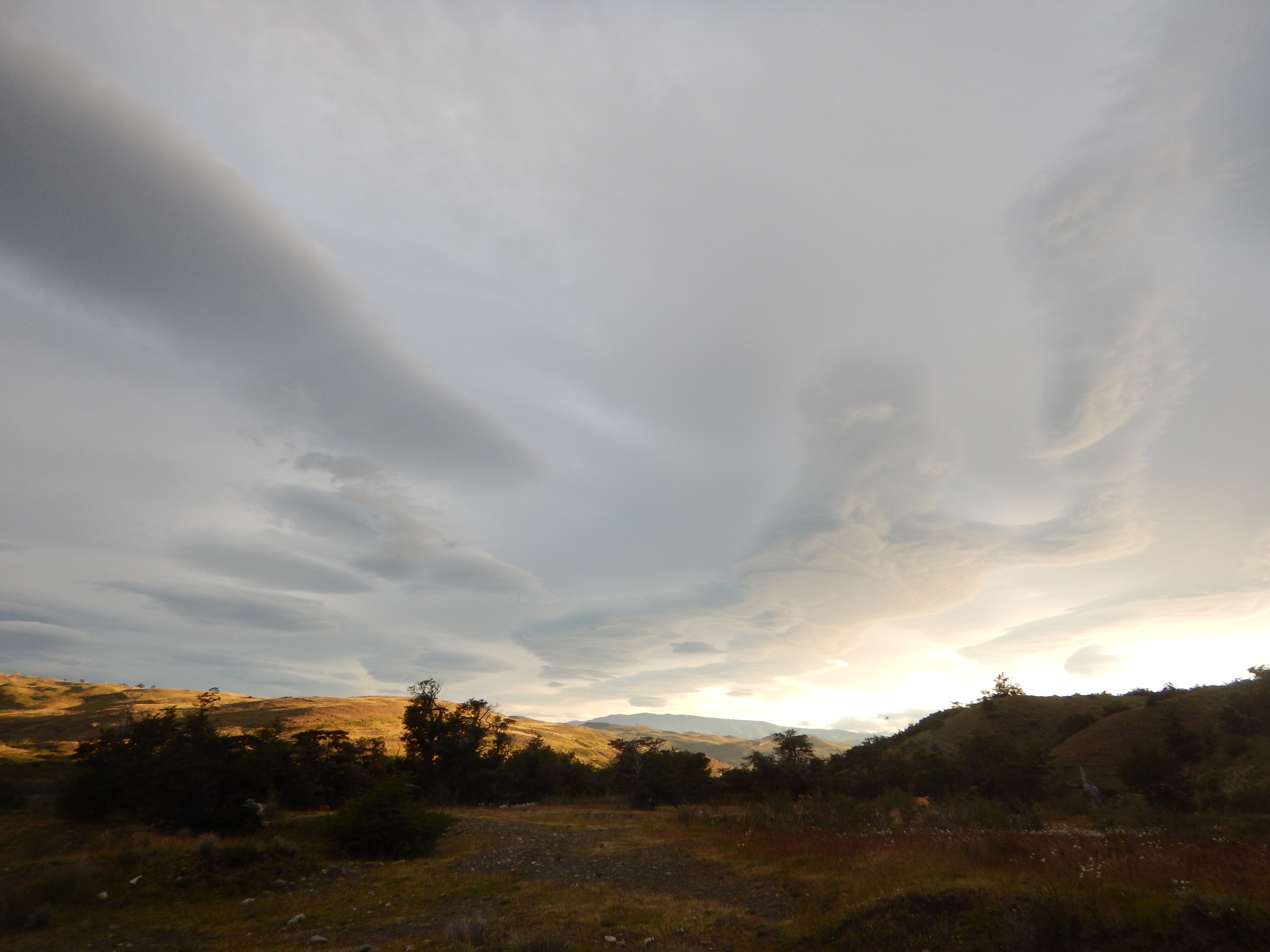 The clouds were looking a little daunting. Also, pretty strange. Foreboding, perhaps?
 It was already getting dark, windy, and cold.
After hiking less than half-a-mile, we came to our senses.
We turned around and camped at the Las Torres campground, near the trailhead.
We decided that we would make a fresh start the following day. Another day gone.
It was already getting dark, windy, and cold.
After hiking less than half-a-mile, we came to our senses.
We turned around and camped at the Las Torres campground, near the trailhead.
We decided that we would make a fresh start the following day. Another day gone.
 Ah, oh well. Let's just chill here for the night.
Las Torres has a restaurant. We can have some pisco sours and look over the maps a little more.
Ah, oh well. Let's just chill here for the night.
Las Torres has a restaurant. We can have some pisco sours and look over the maps a little more.
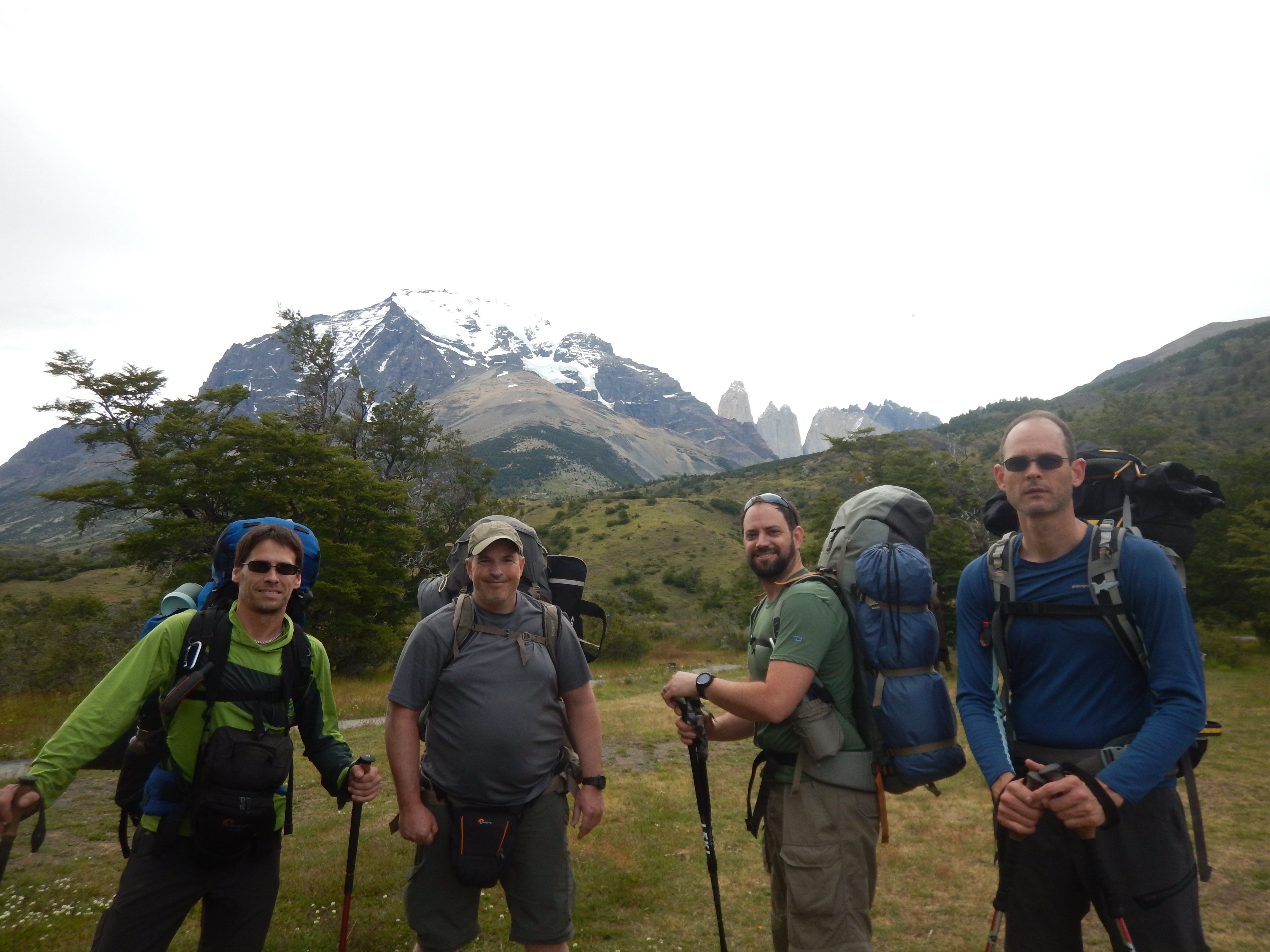
 We were at Refugio Las Torres Norte, on the right side of the map.
Our goal, was to hike the orange dashed trail counter-clockwise, all the way around the park and back to Las Torres.
We planned to hike to Campamento Seron the first day (shown on this map as 'Serron').
We were at Refugio Las Torres Norte, on the right side of the map.
Our goal, was to hike the orange dashed trail counter-clockwise, all the way around the park and back to Las Torres.
We planned to hike to Campamento Seron the first day (shown on this map as 'Serron').
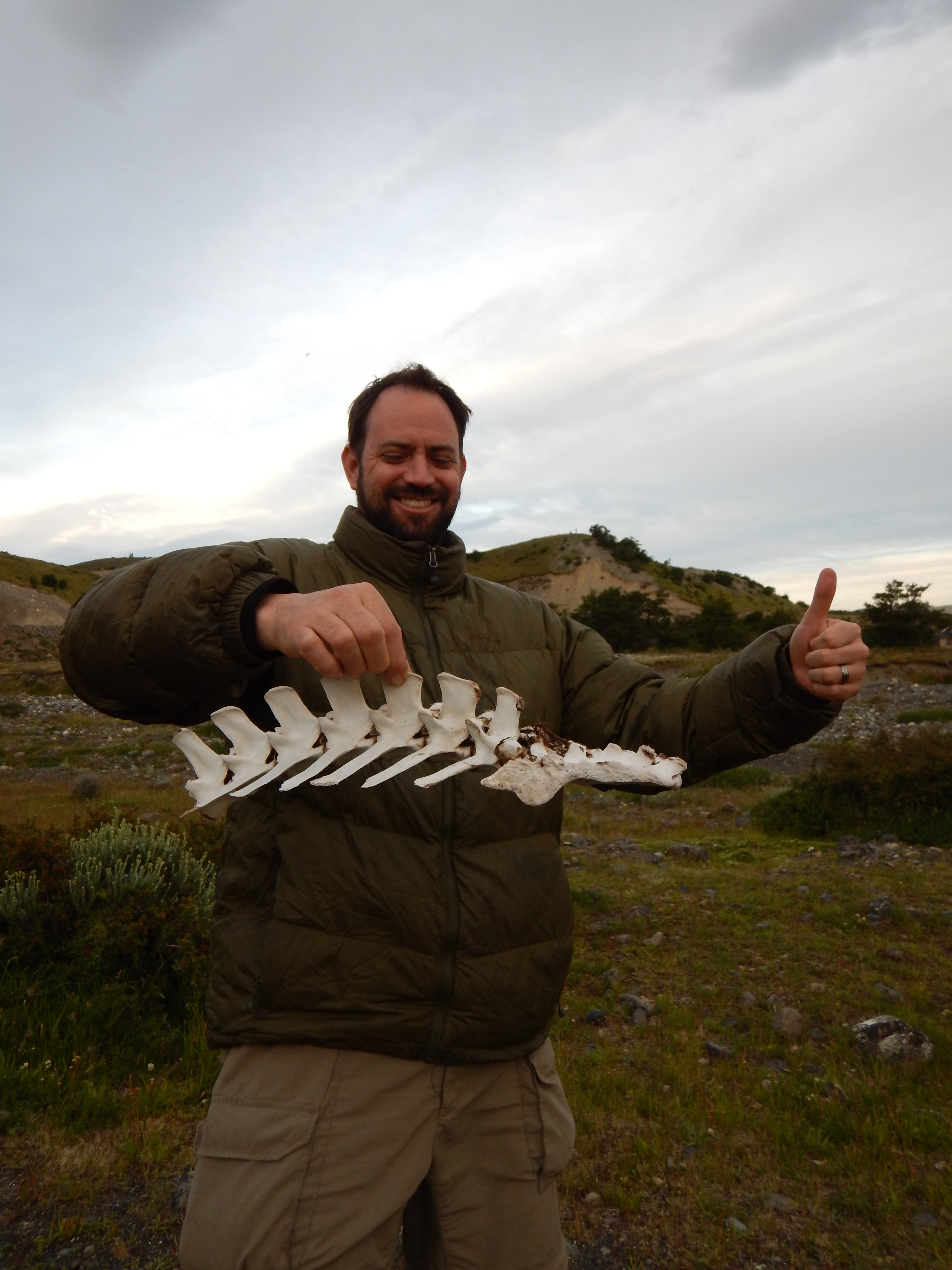 We were all glad for our decision back at camp.
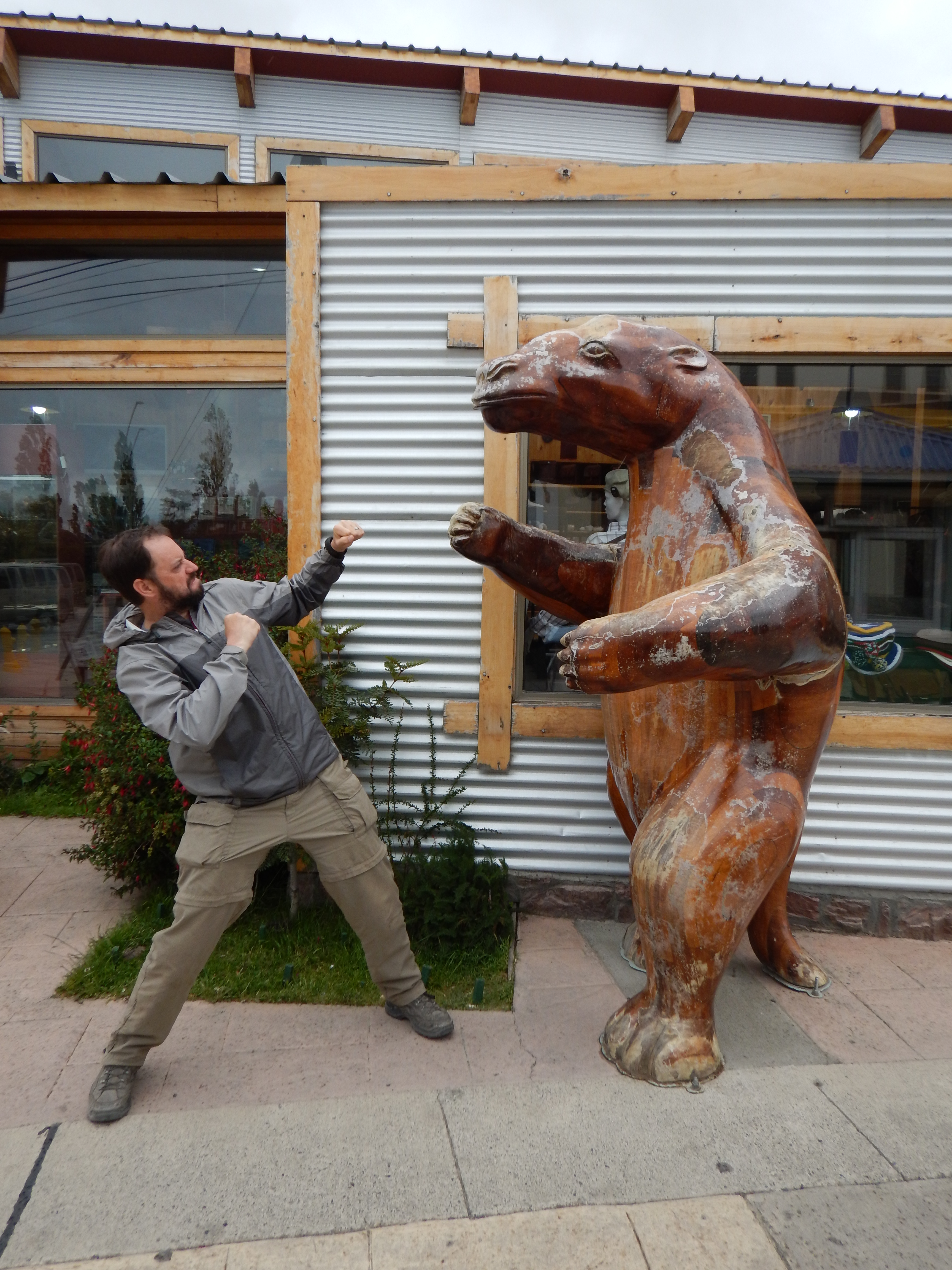
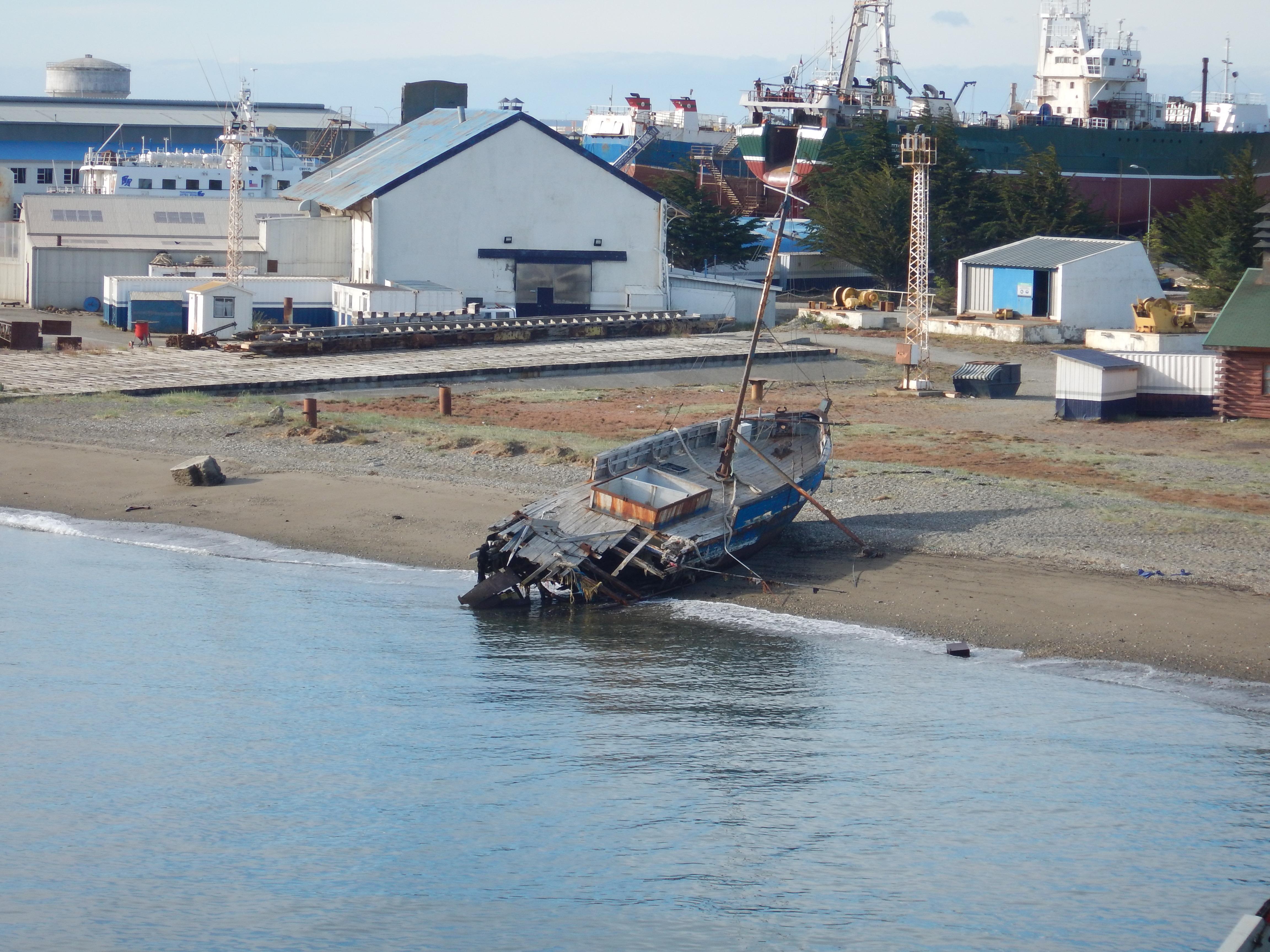
We don't want to end up like this!
We were all glad for our decision back at camp.
We don't want to end up like this!
Torres del Paine
Day 1
Las Torres to Seron - 9 km
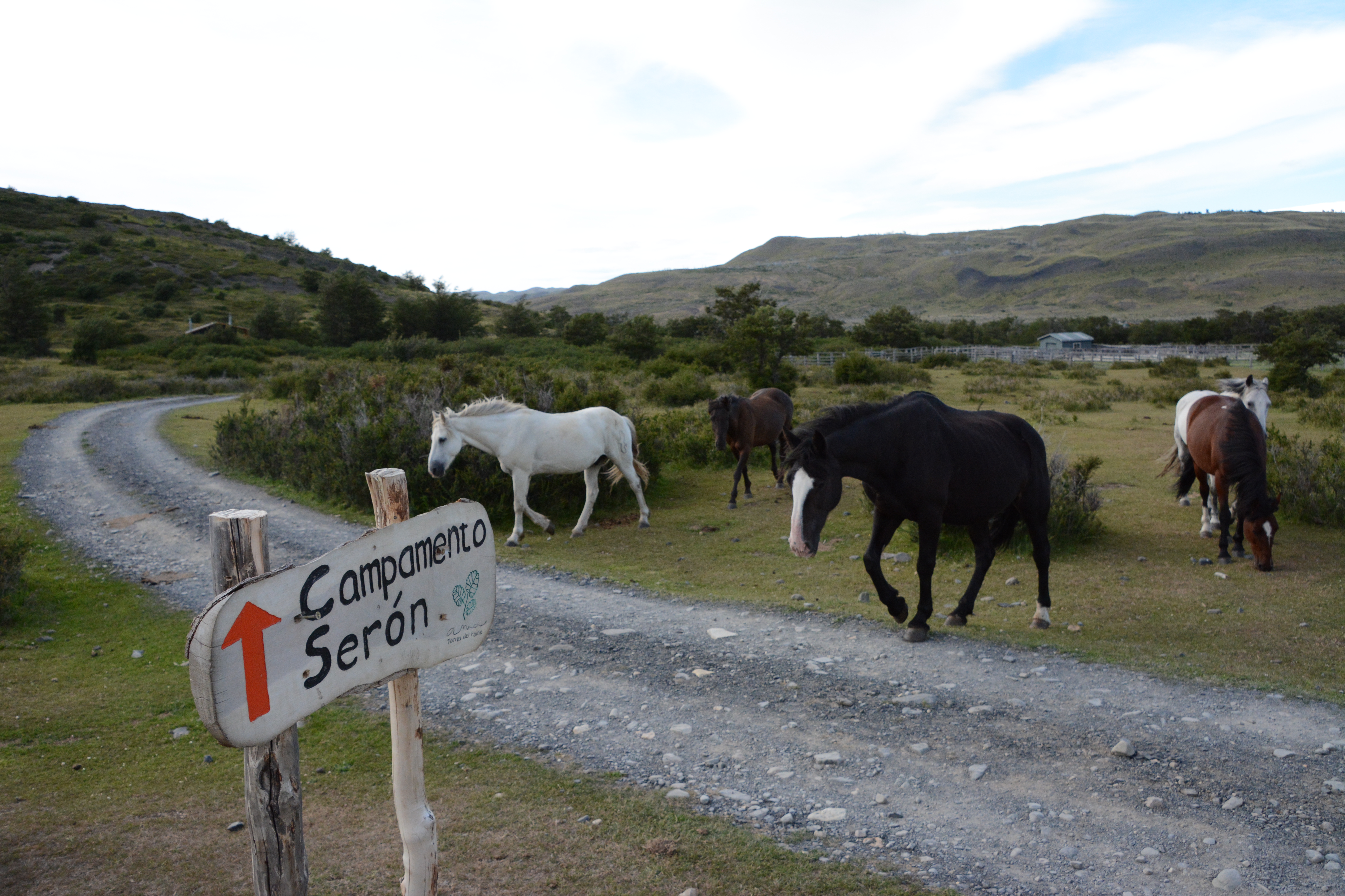 The next morning we were definitely ready to go. Enough delays! Let's hit it!
Ok, wait for the horses...
The next morning we were definitely ready to go. Enough delays! Let's hit it!
Ok, wait for the horses...
 The 'trail' started out as a dirt road.
We hammered out the half-mile of road that we had already hiked twice the prior day.
The 'trail' started out as a dirt road.
We hammered out the half-mile of road that we had already hiked twice the prior day.
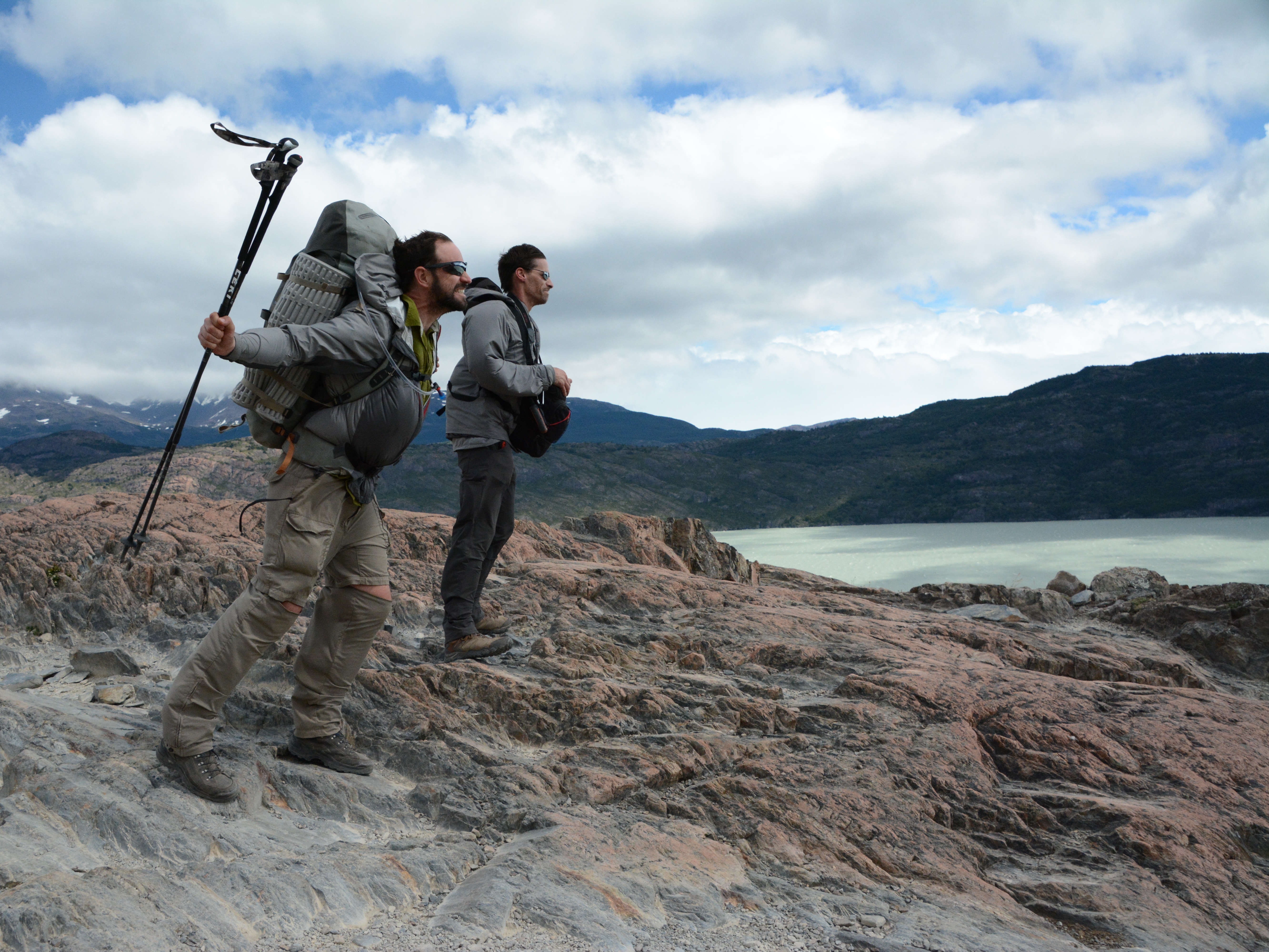
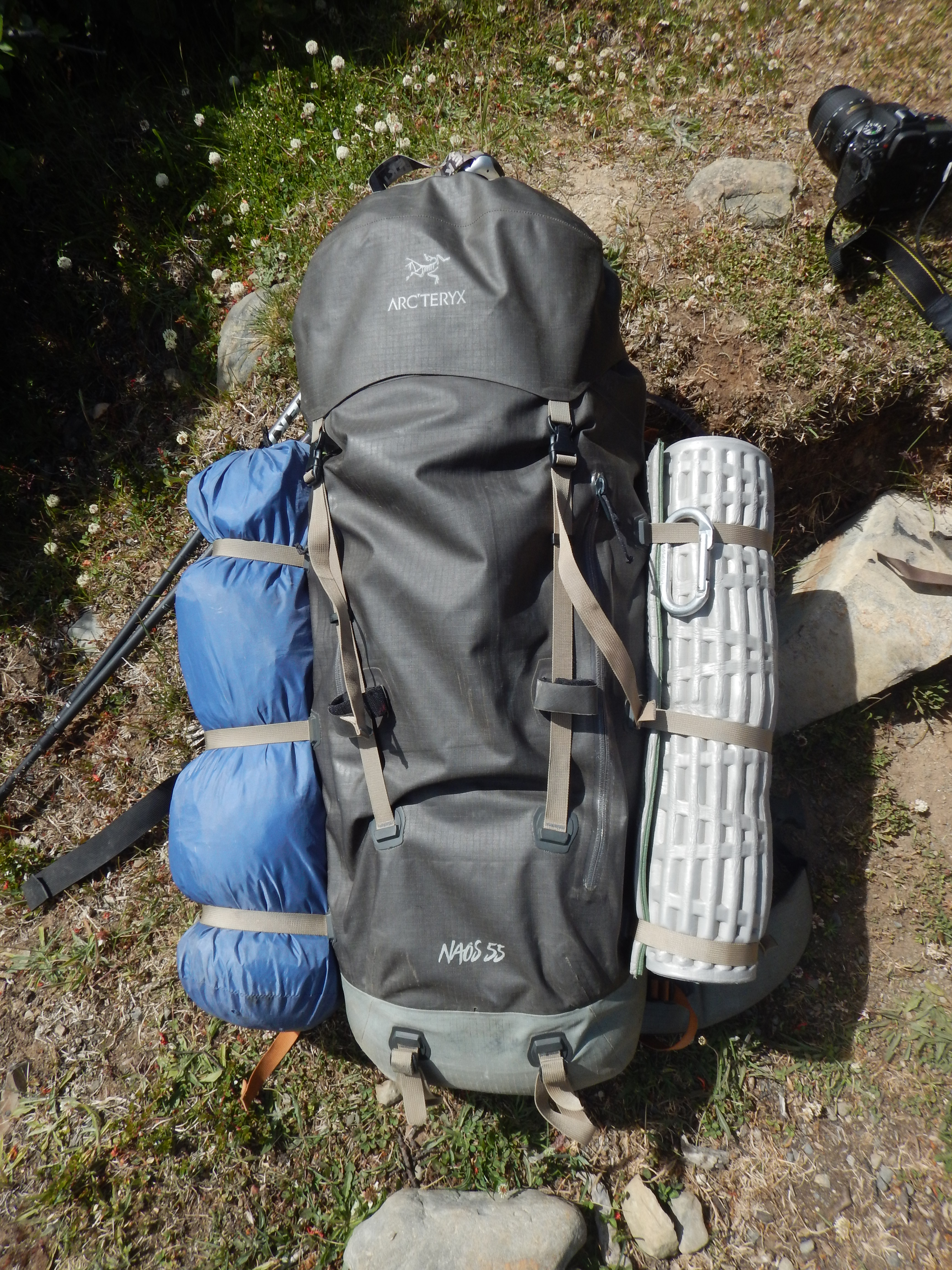 This is what my pack looked like. It was just over 40 pounds. No problem!
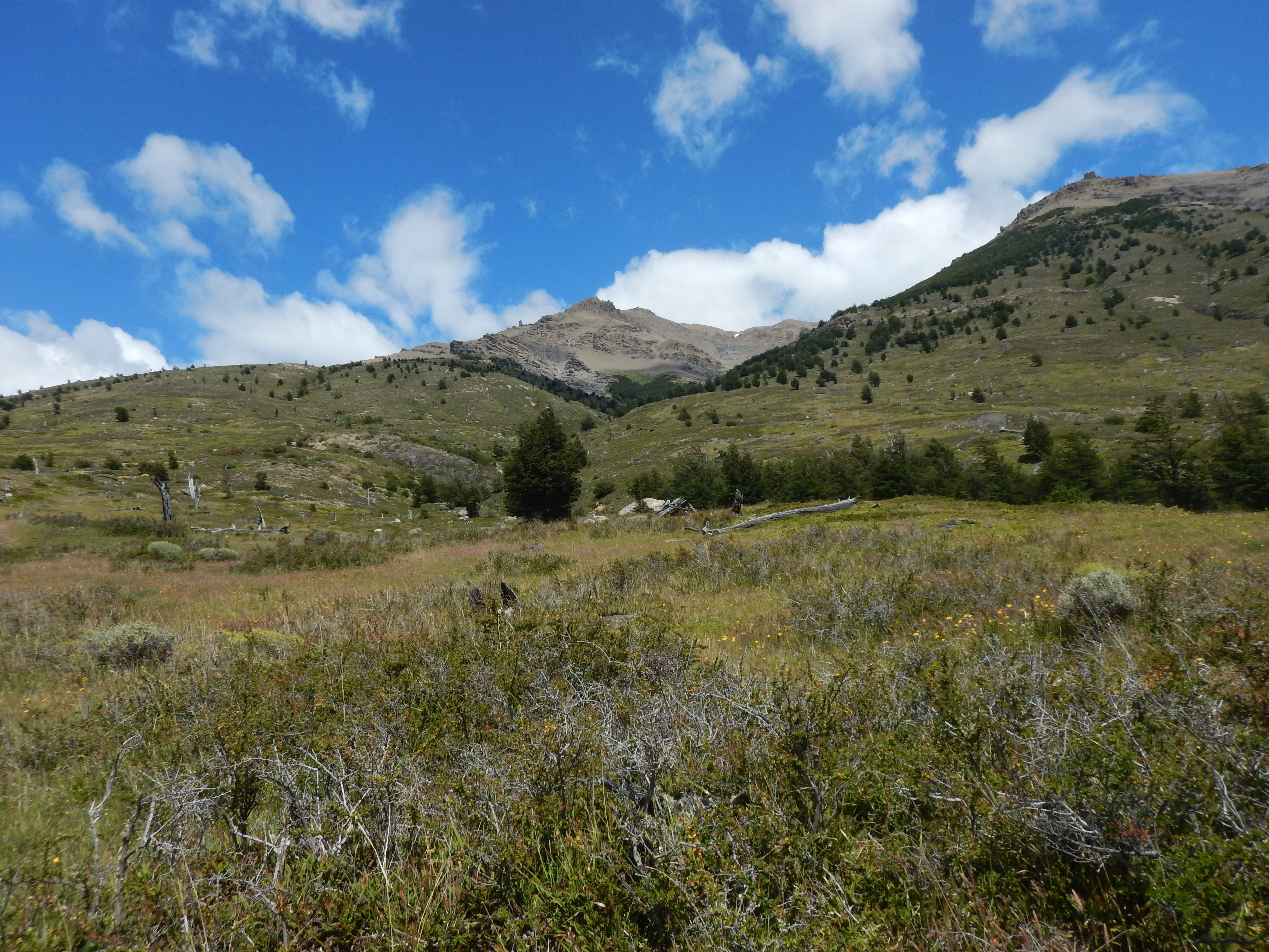
 The scenery on the hike to Seron was pleasant, but not exactly exotic.
We were reminded of Montana.
The scenery on the hike to Seron was pleasant, but not exactly exotic.
We were reminded of Montana.
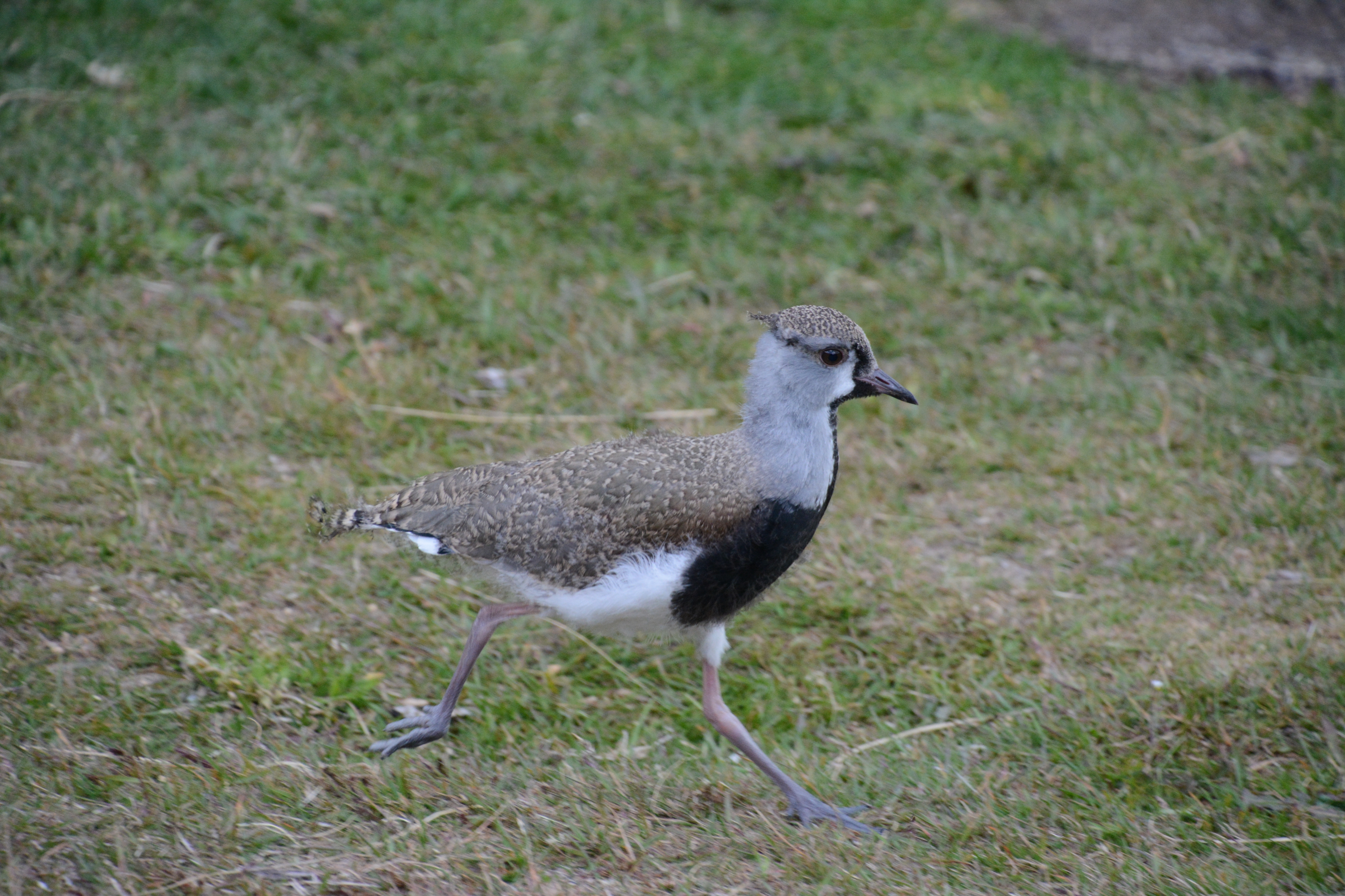
 Bird photo 1.
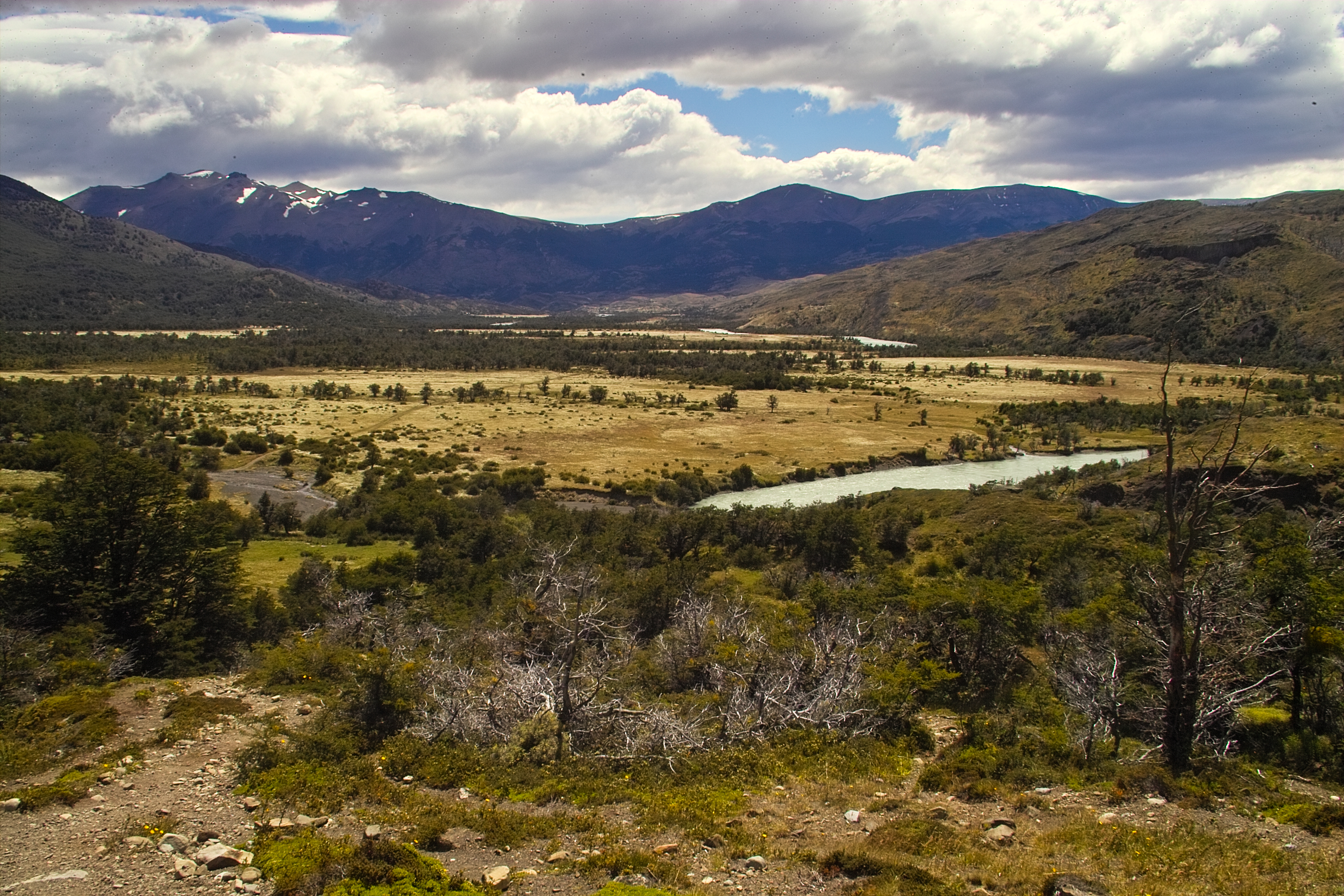
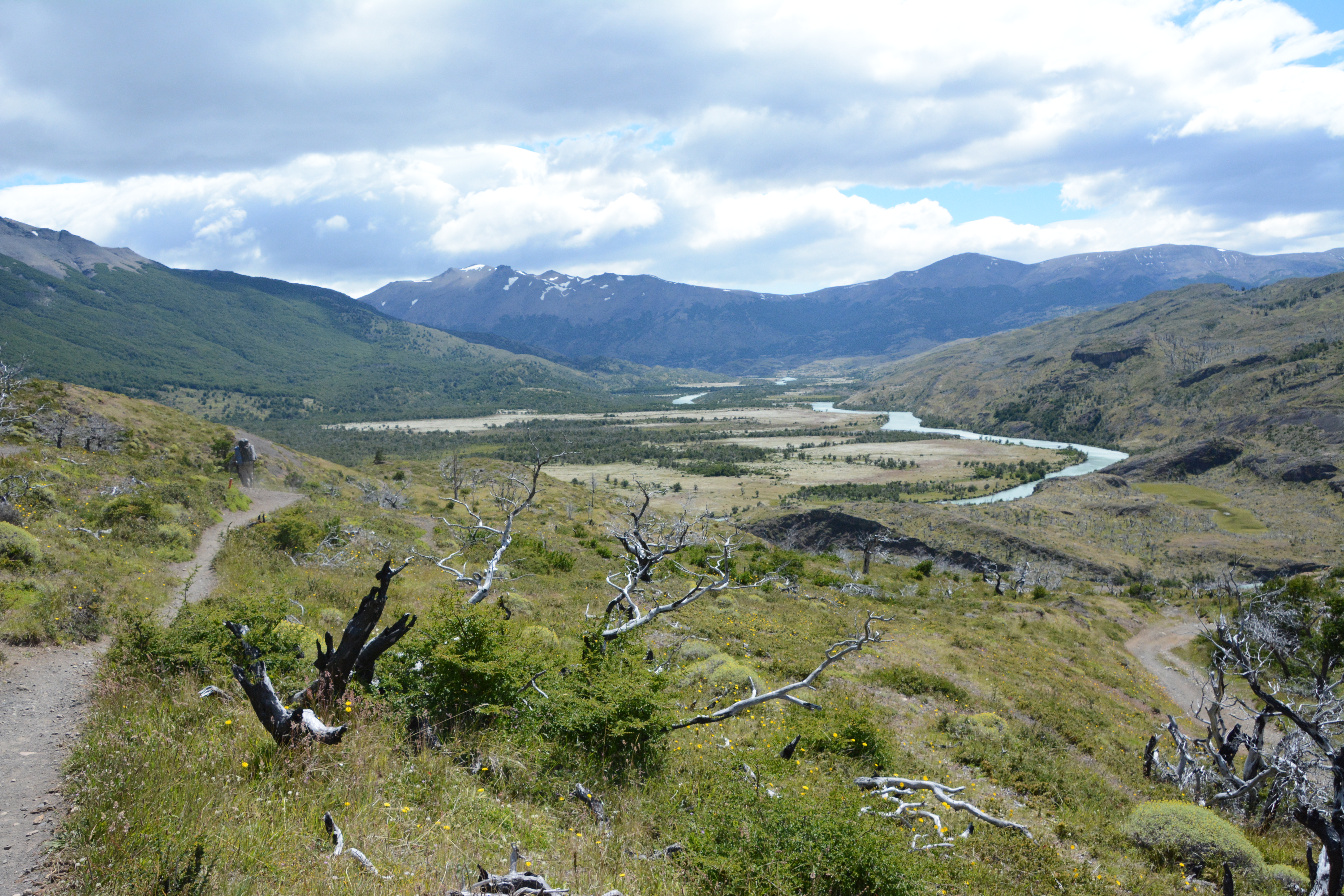 A little pass gave us a view of the winding Rio Paine and the daisy-filled plain ahead.
It also gave us our first taste of the Patagonian wind!
A little pass gave us a view of the winding Rio Paine and the daisy-filled plain ahead.
It also gave us our first taste of the Patagonian wind!
Video loading... Please be patient - or (more likely) its not working on your device
Down we go.
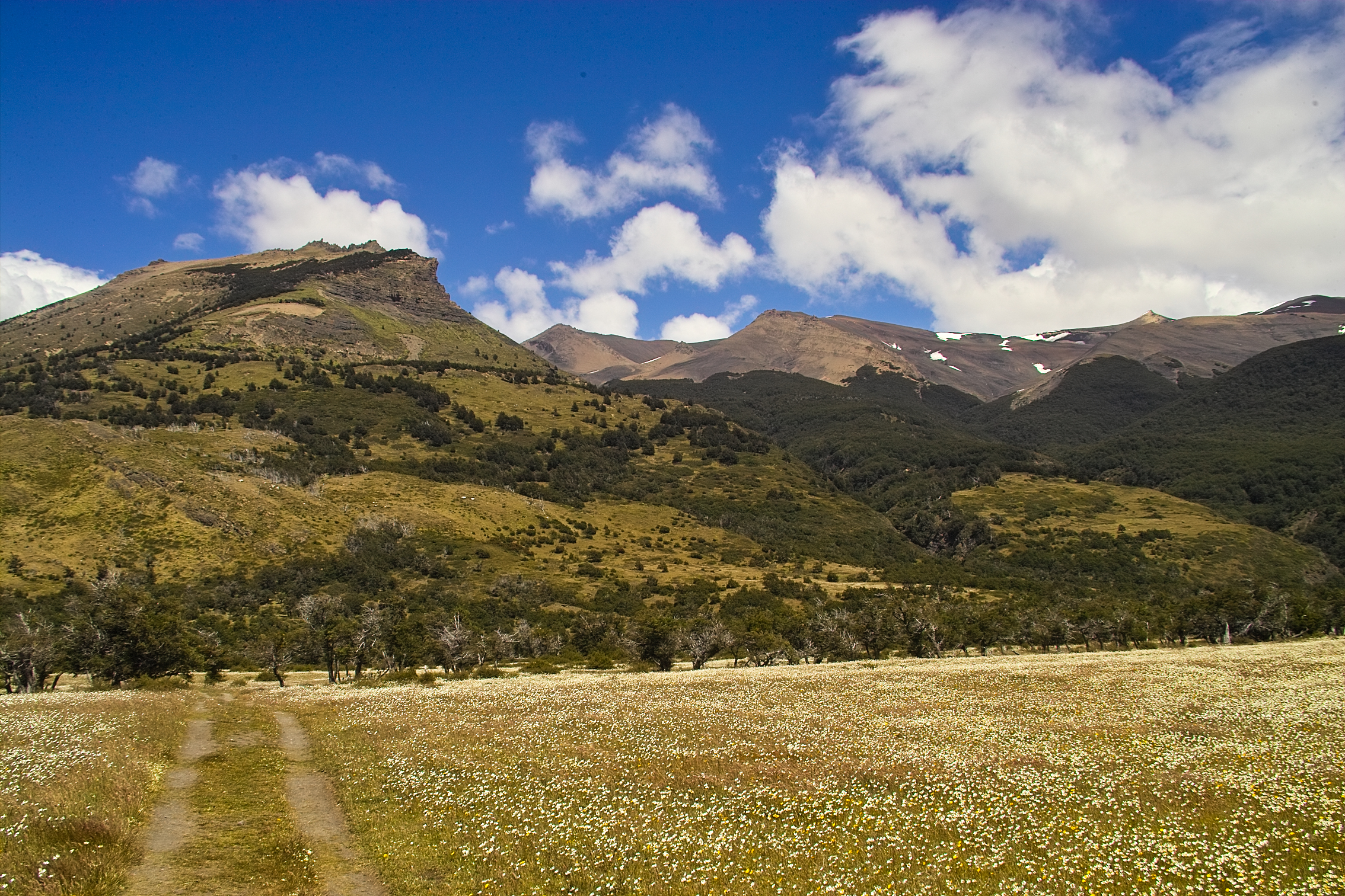
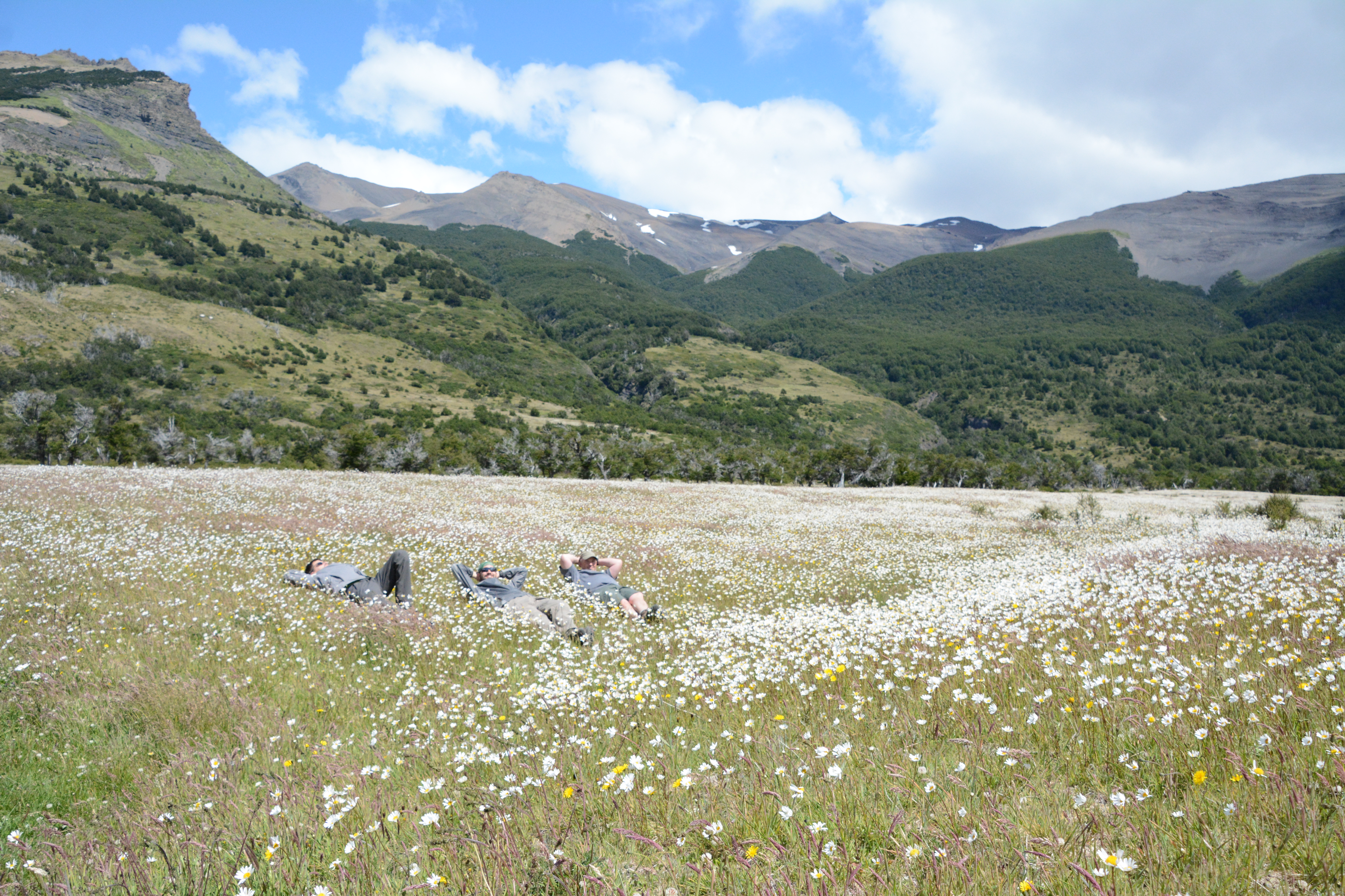
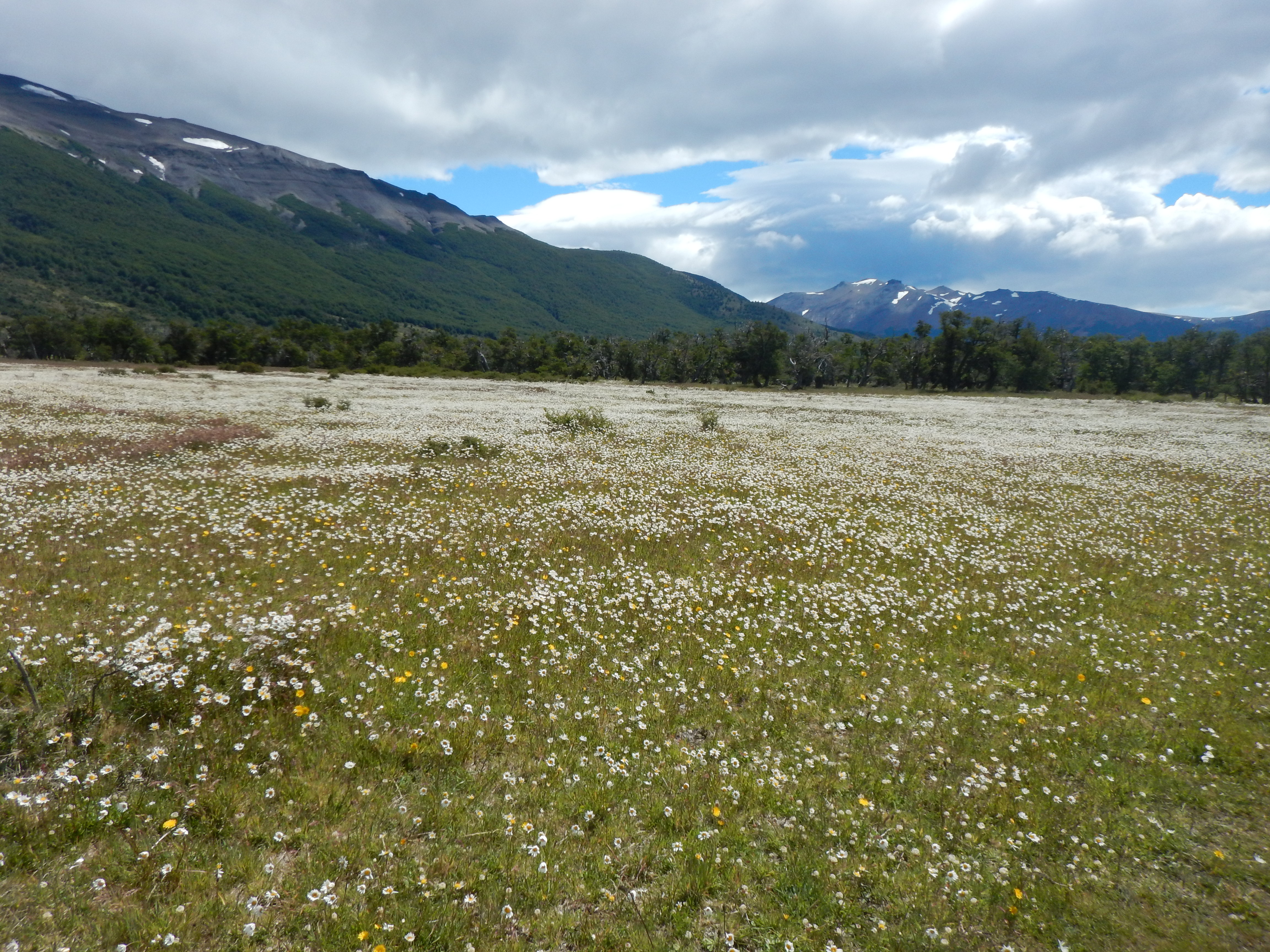 So. Many. Daisies.

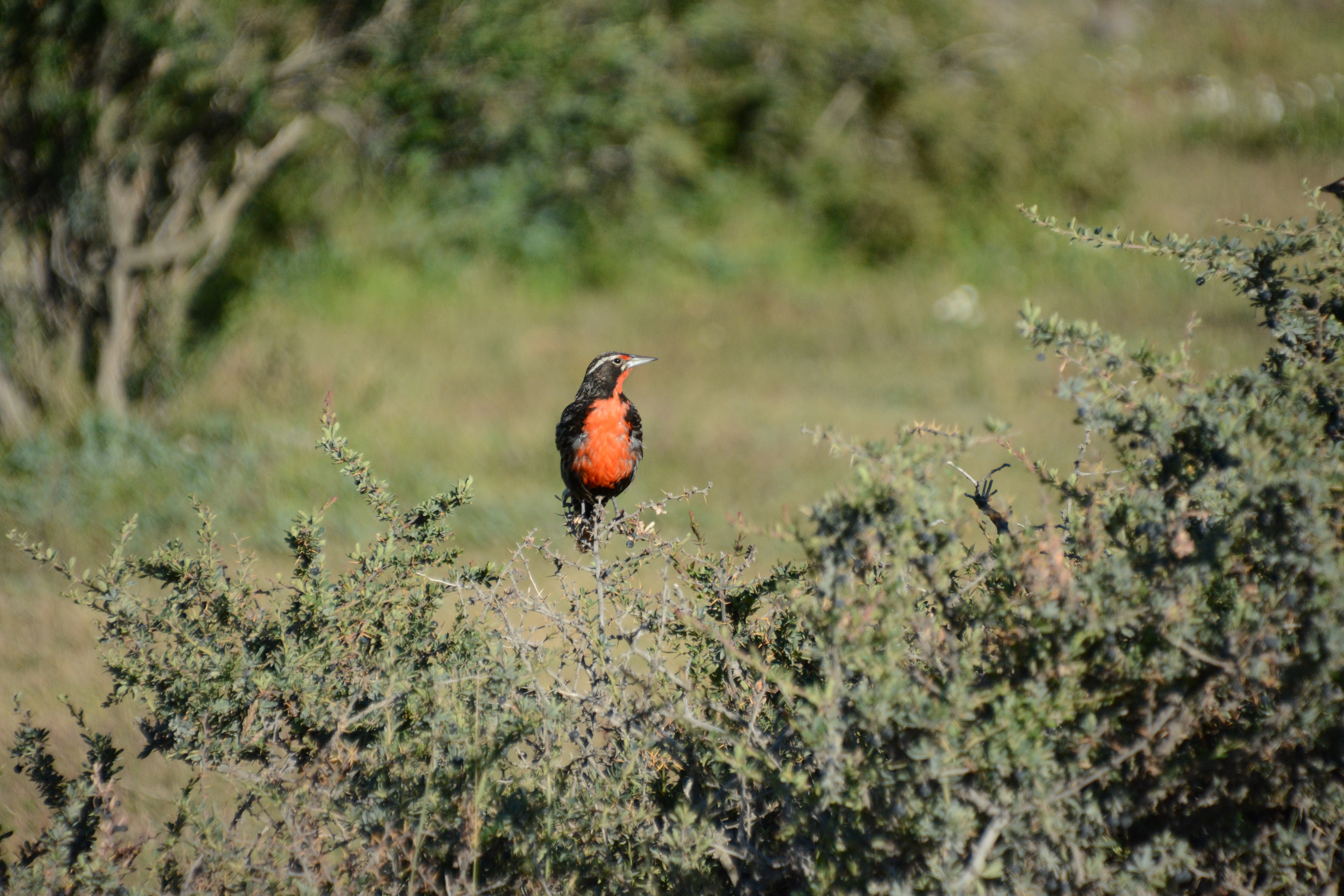
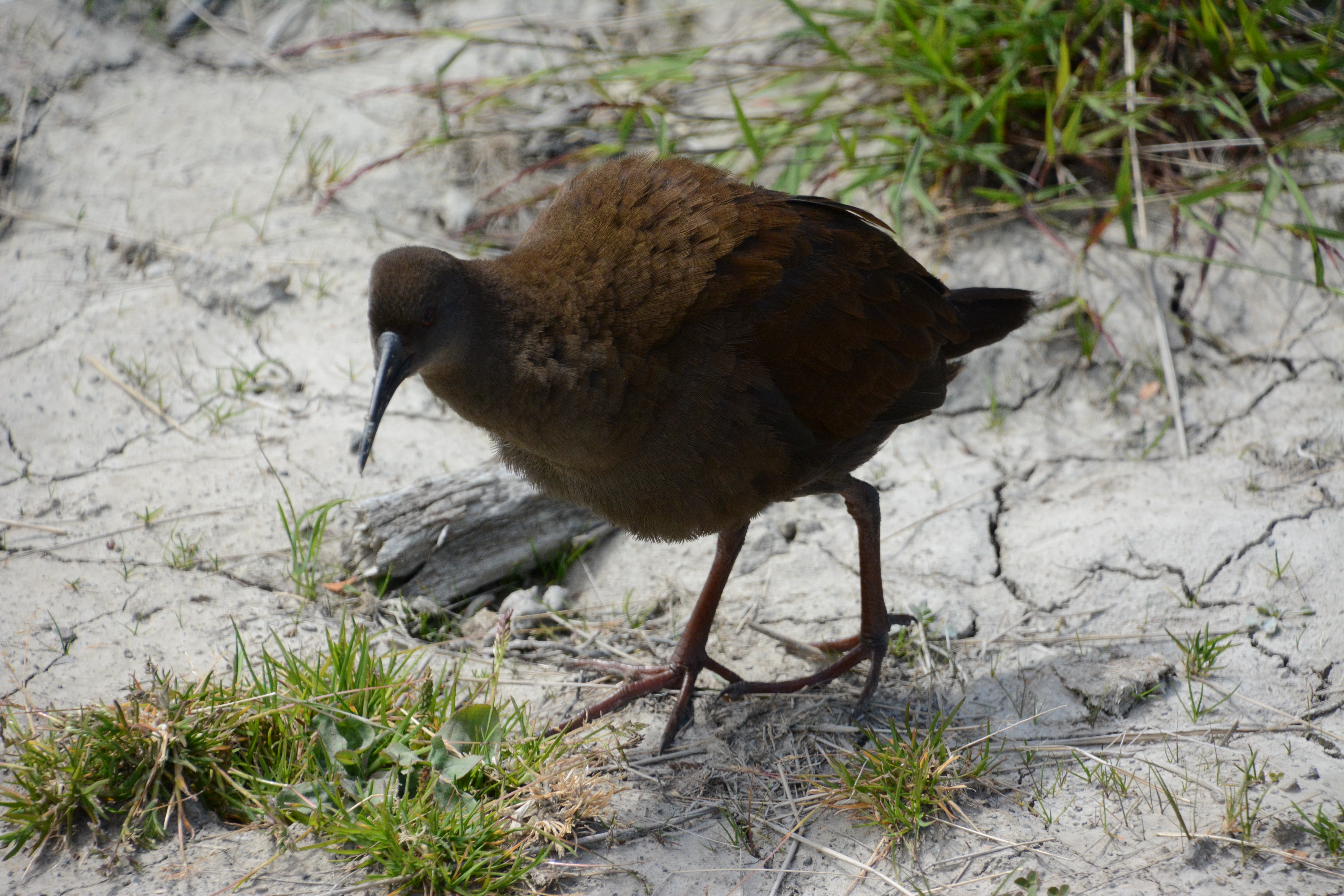 As promised, your second of many bird photos.
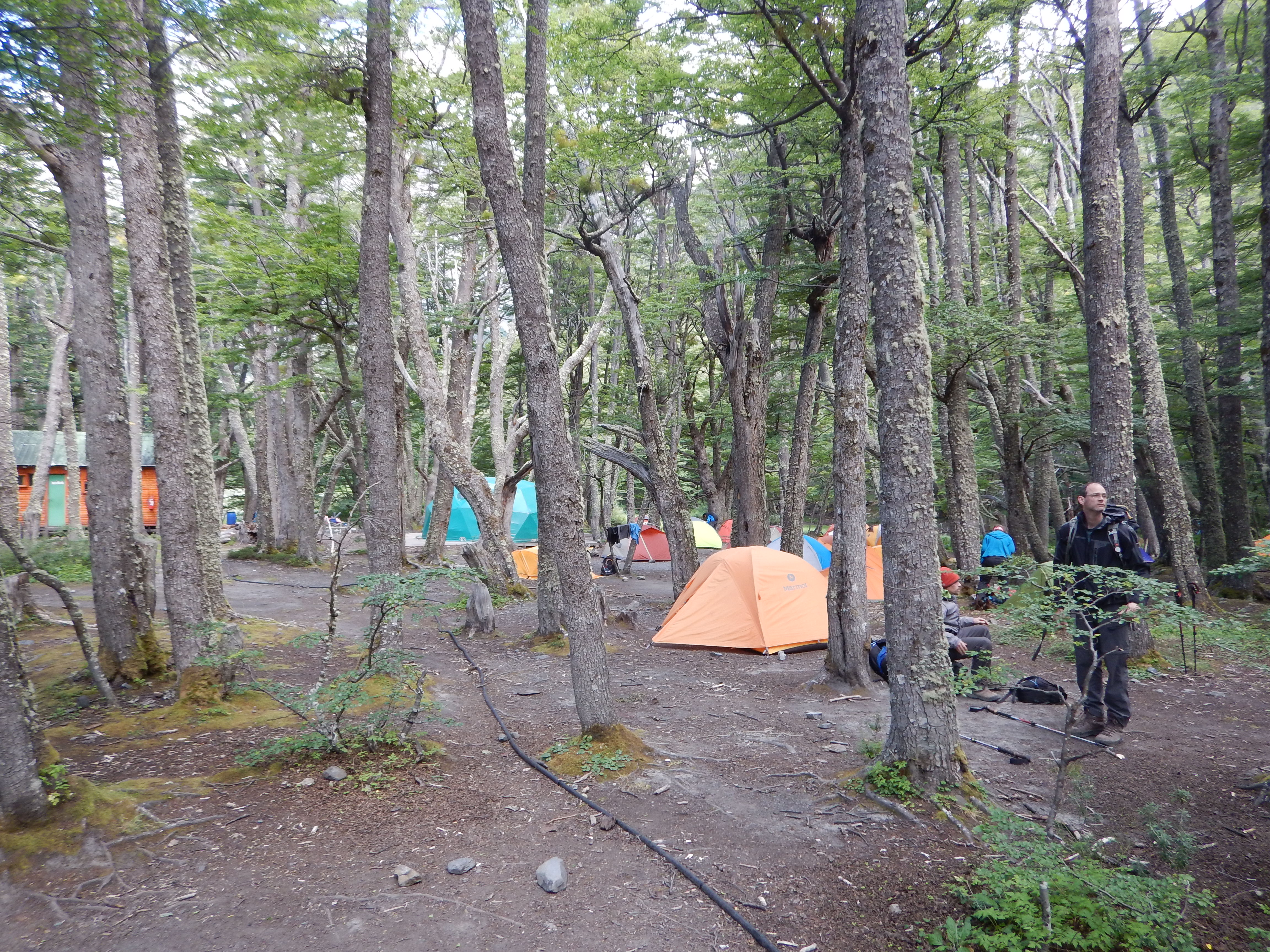
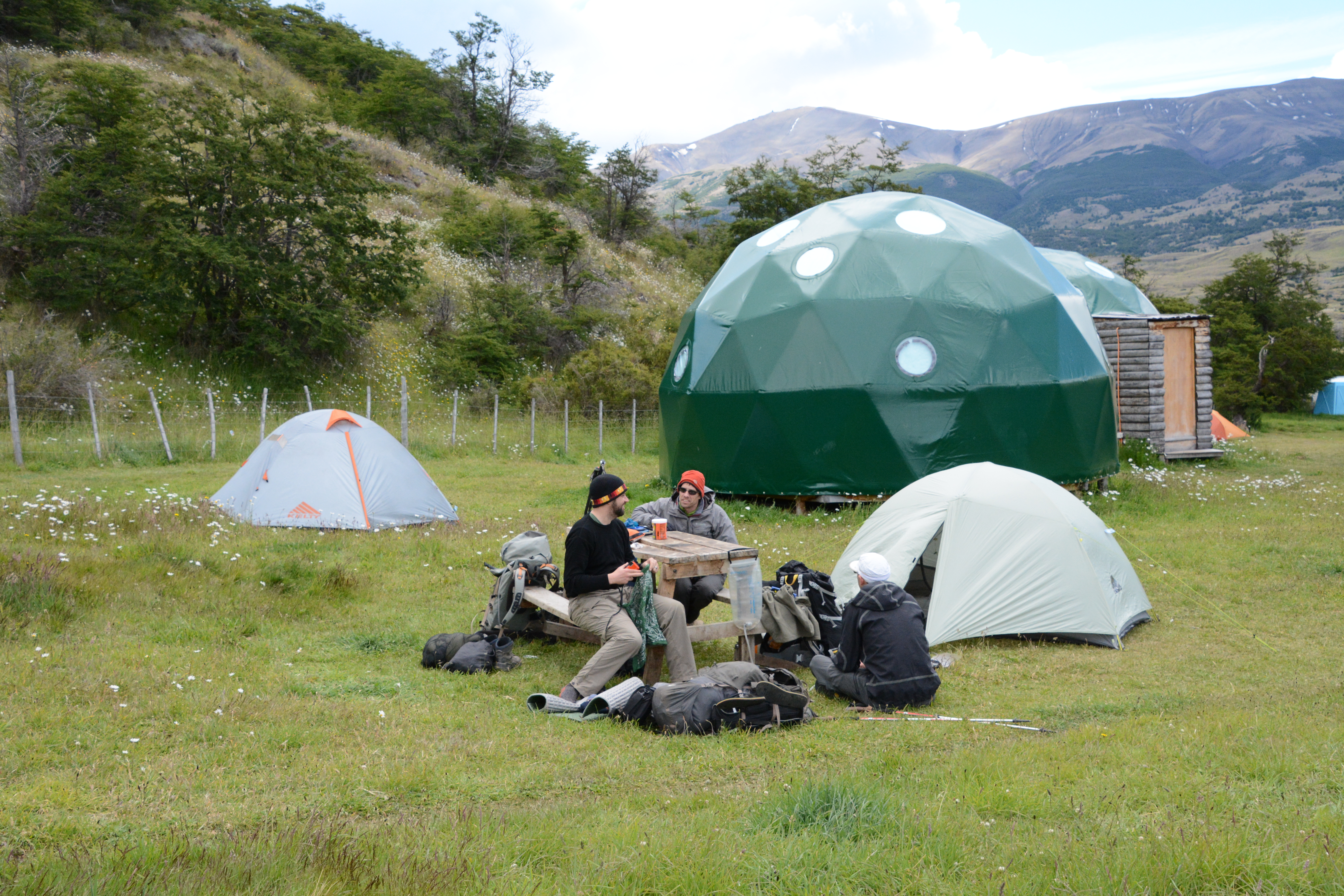 We made it to Seron by mid-afternoon.
As you can see, this is not a wilderness.
That green dome had beds in it, for rent, we assumed. Those are our tents.
We discovered that the picnic tables topple over if they are not balanced evenly by people.
That made for some fun trust-building exercises.
So, one day down.
Not much in the way of scenery that one would fly 28 hours to see, but hey, we are out on the trail and presumably, more exotic scenery lies ahead!
Tomorrow we hike to Dickson.
We made it to Seron by mid-afternoon.
As you can see, this is not a wilderness.
That green dome had beds in it, for rent, we assumed. Those are our tents.
We discovered that the picnic tables topple over if they are not balanced evenly by people.
That made for some fun trust-building exercises.
So, one day down.
Not much in the way of scenery that one would fly 28 hours to see, but hey, we are out on the trail and presumably, more exotic scenery lies ahead!
Tomorrow we hike to Dickson.
Torres del Paine
Day 2
Seron to Dickson- 19 km
 The day began hiking along the Rio Paine, gradually climbing up to a pass near Lago Paine.
We took it at a leisurely pace, checking out birds and plants along the way.
The day began hiking along the Rio Paine, gradually climbing up to a pass near Lago Paine.
We took it at a leisurely pace, checking out birds and plants along the way.
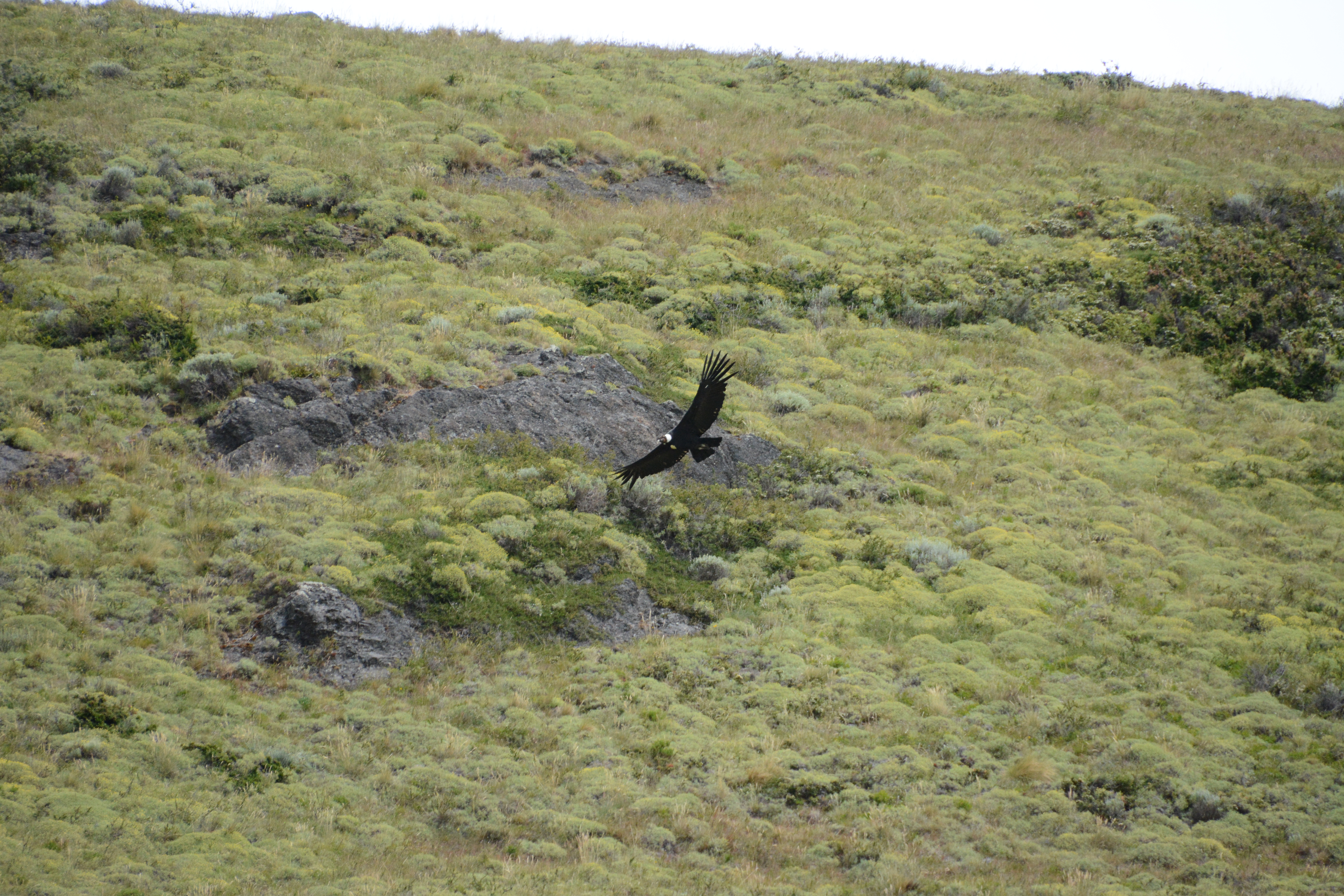
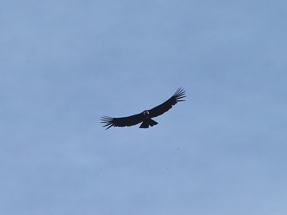 Condor!
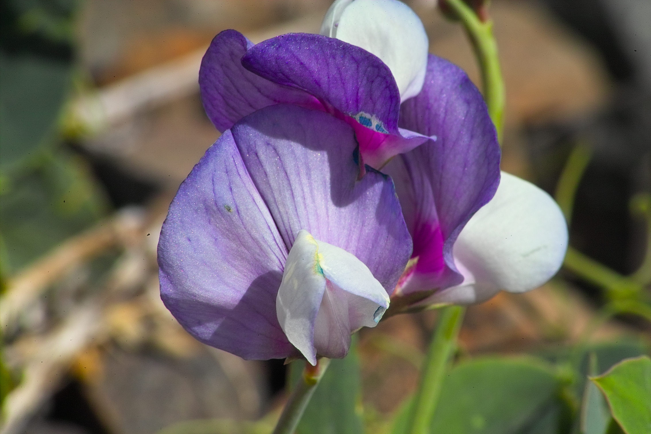
 A wild orchid.
 Tiny flowers.
 Up to the pass.
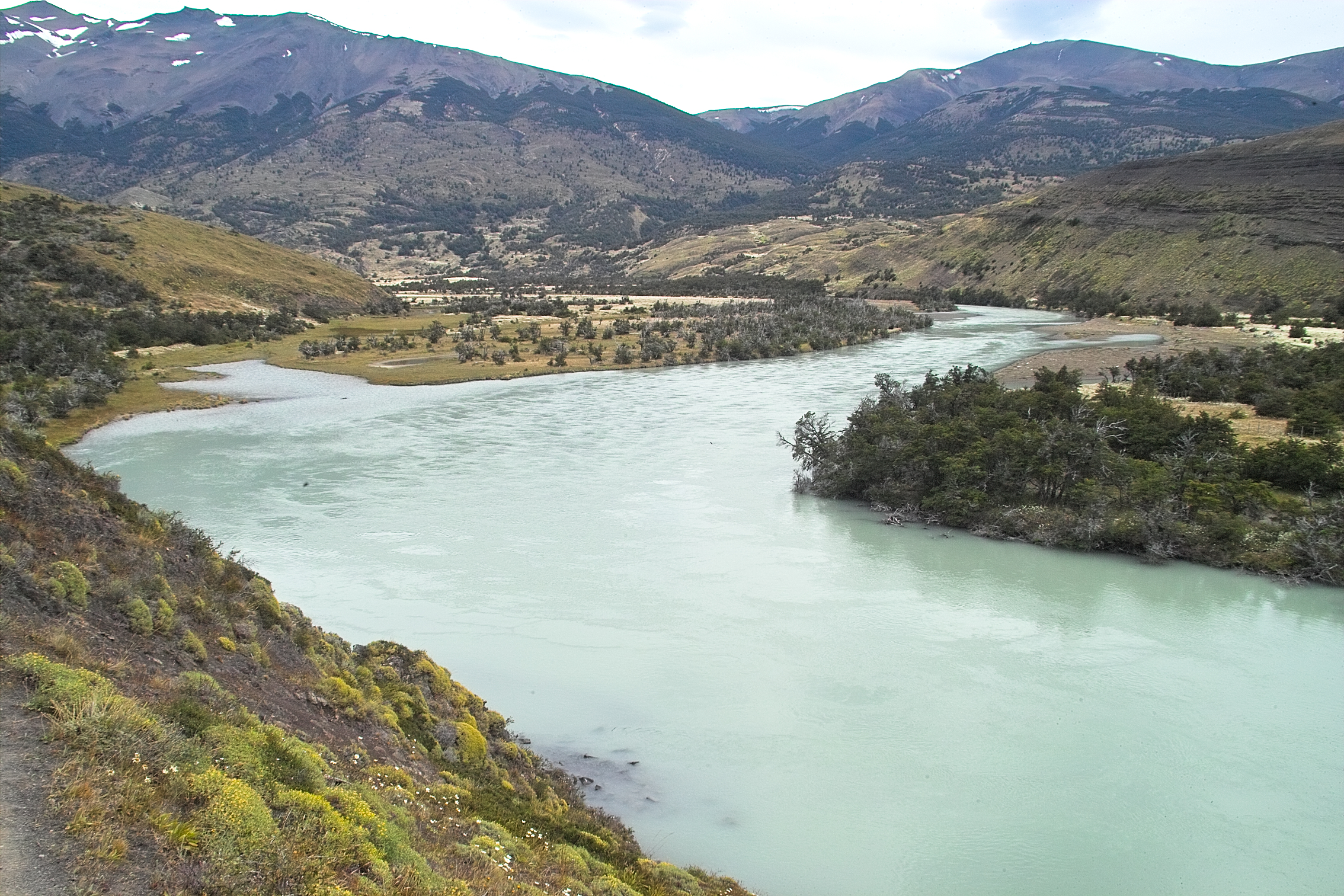
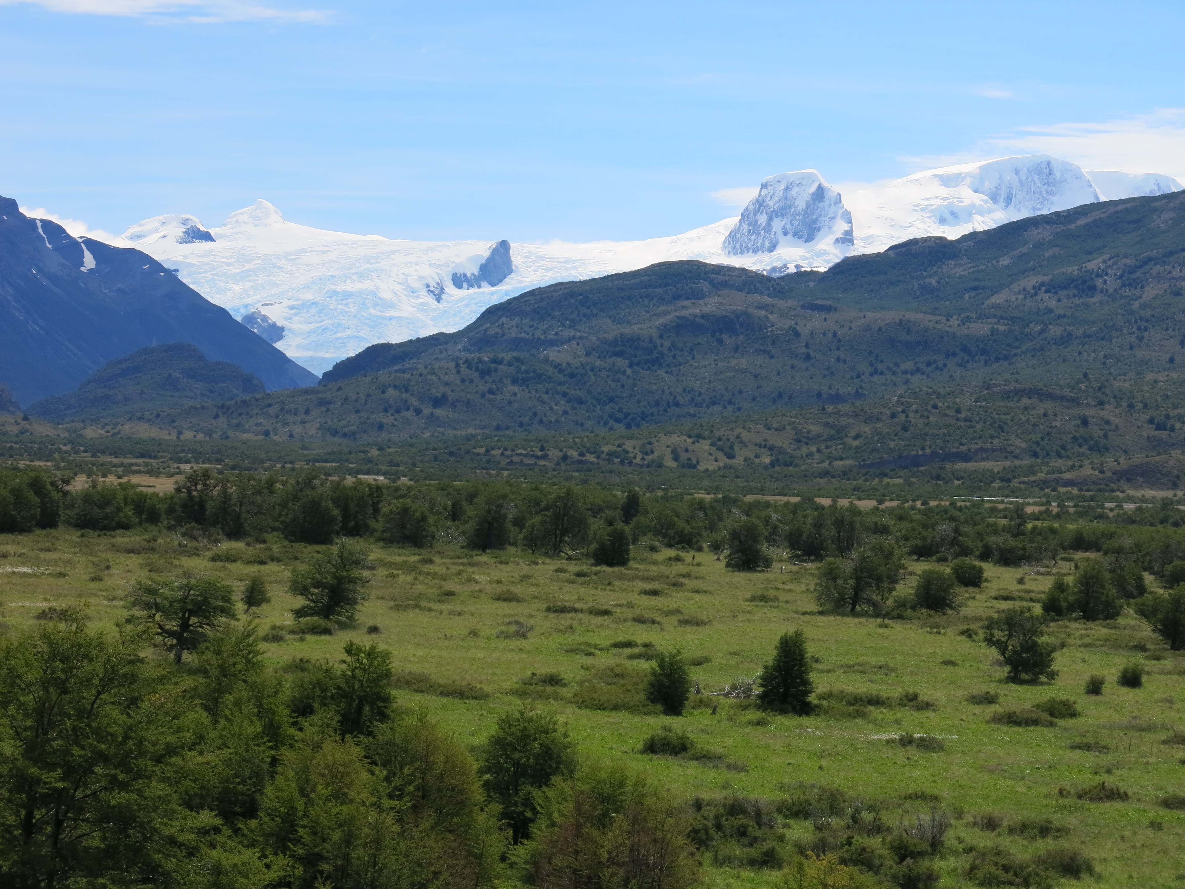
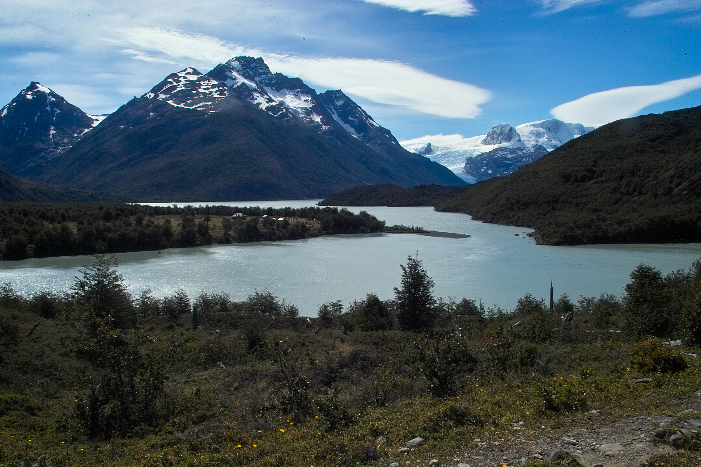
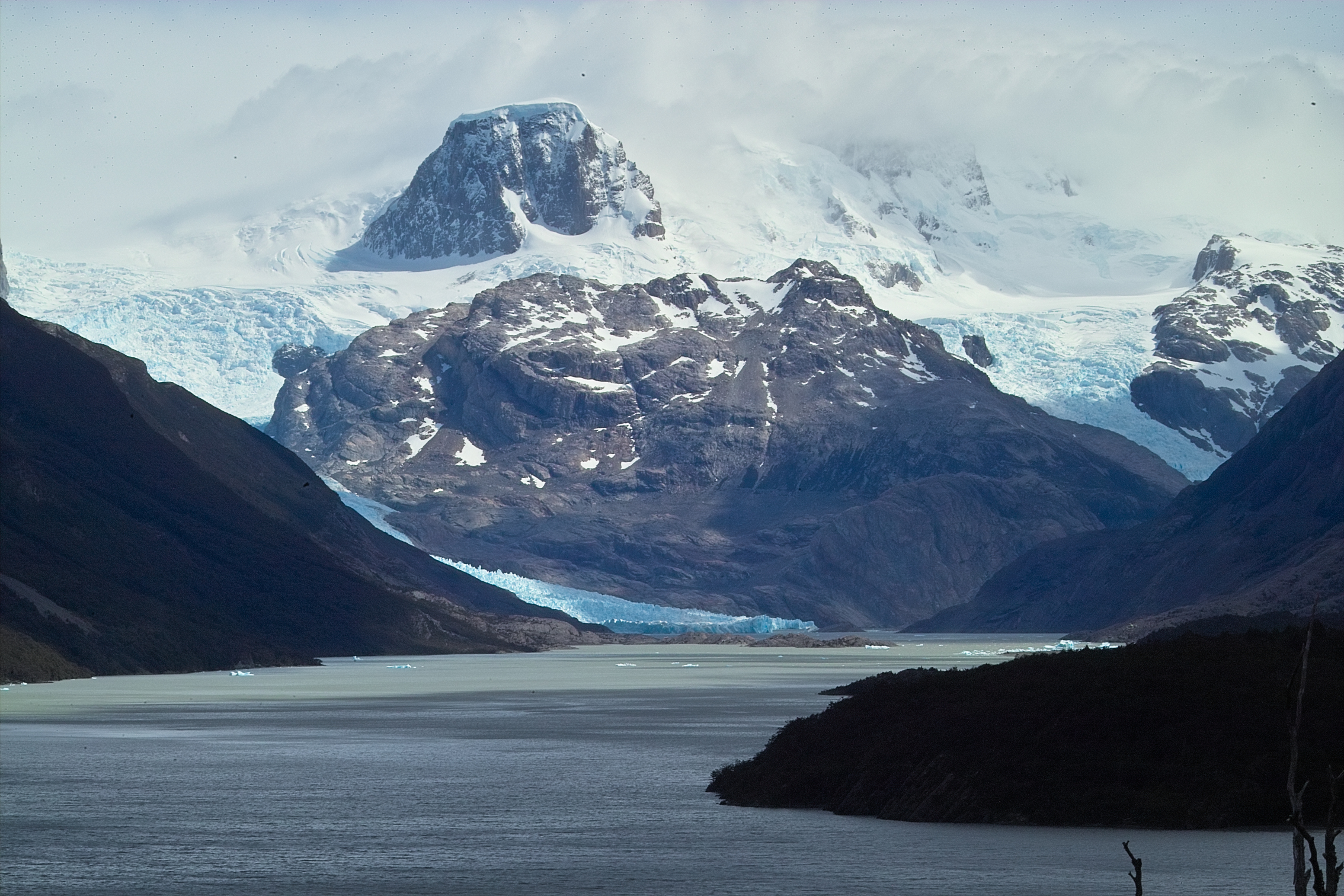
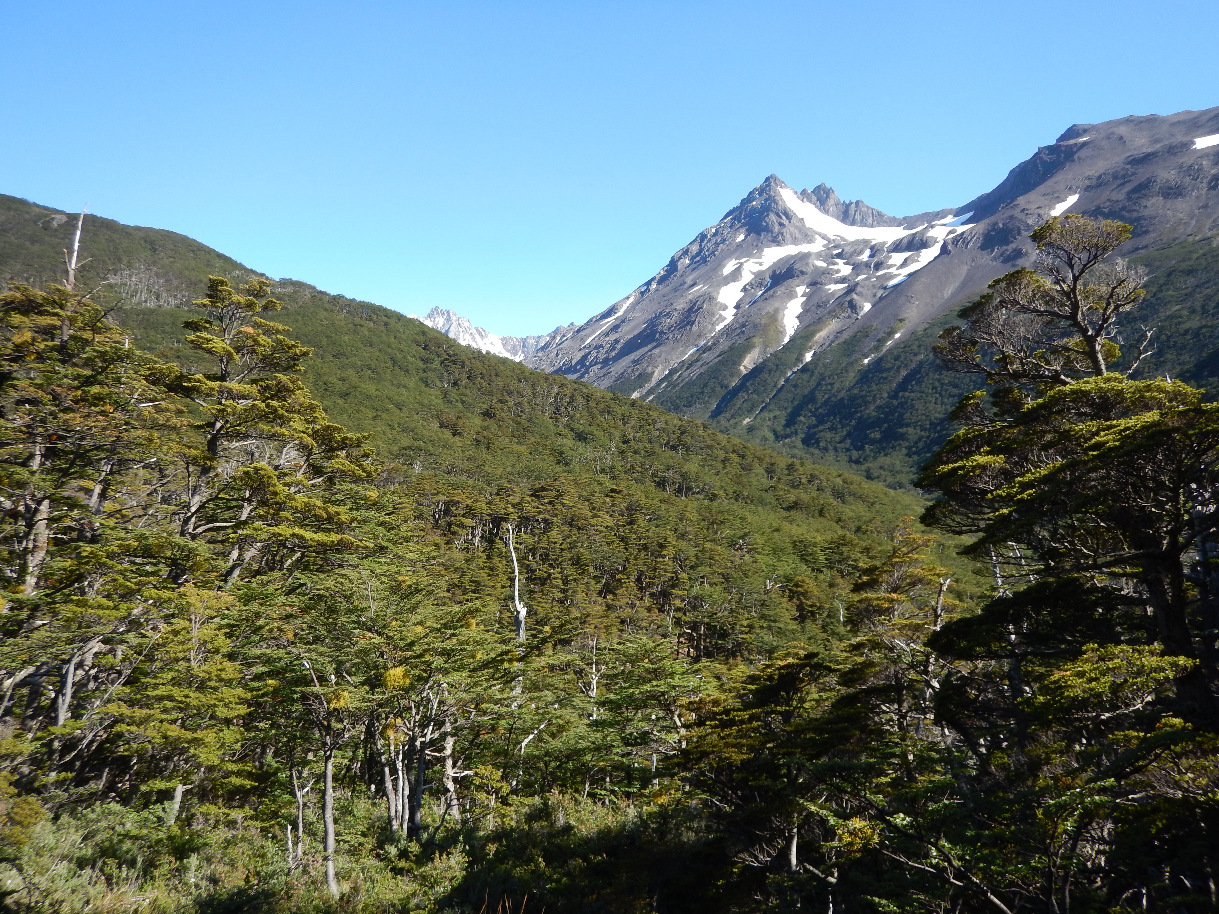
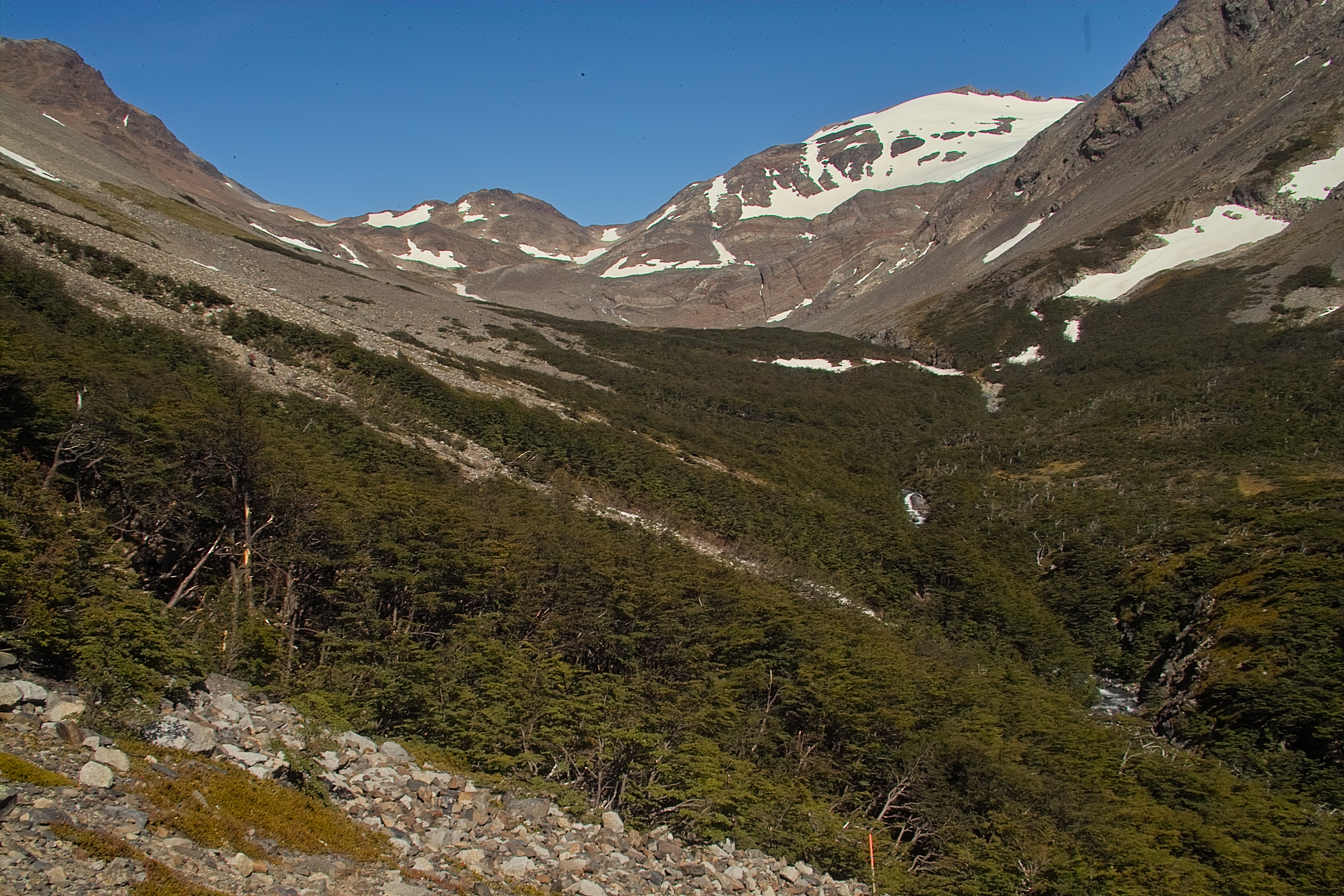
 We reached the pass and looked to the west, toward Dickson.
Dickson is at the far end of the valley shown above, where the river comes out of those hills.
The hike along the lake had a lot of ups and downs, then it was pretty much flat the rest of the way.
19 km felt like a long way.
We reached the pass and looked to the west, toward Dickson.
Dickson is at the far end of the valley shown above, where the river comes out of those hills.
The hike along the lake had a lot of ups and downs, then it was pretty much flat the rest of the way.
19 km felt like a long way.
 These were strange.
At first, I thought they were boulders covered in moss.
These were strange.
At first, I thought they were boulders covered in moss.
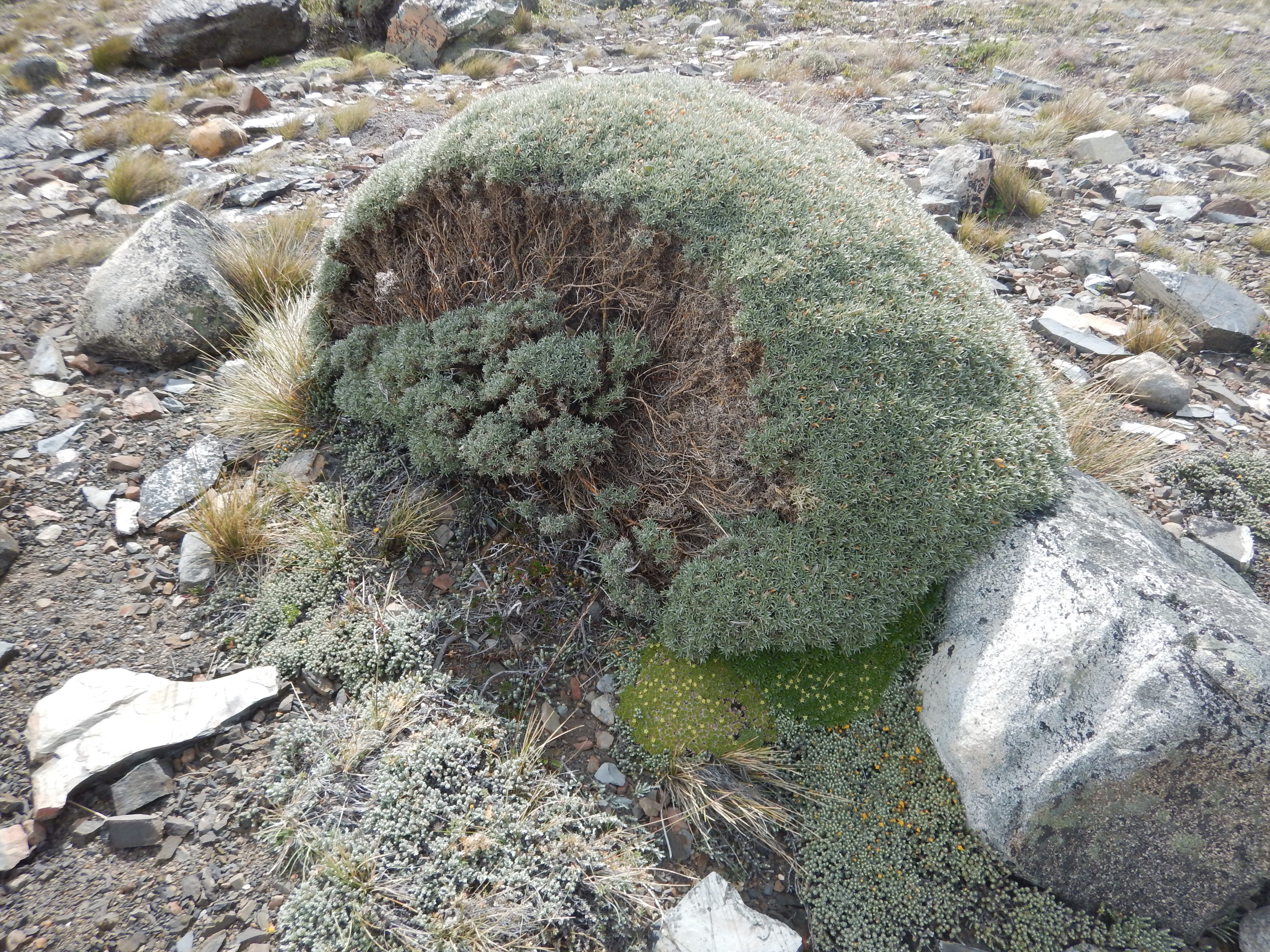 Nope, plant all the way through.
 bird
bird
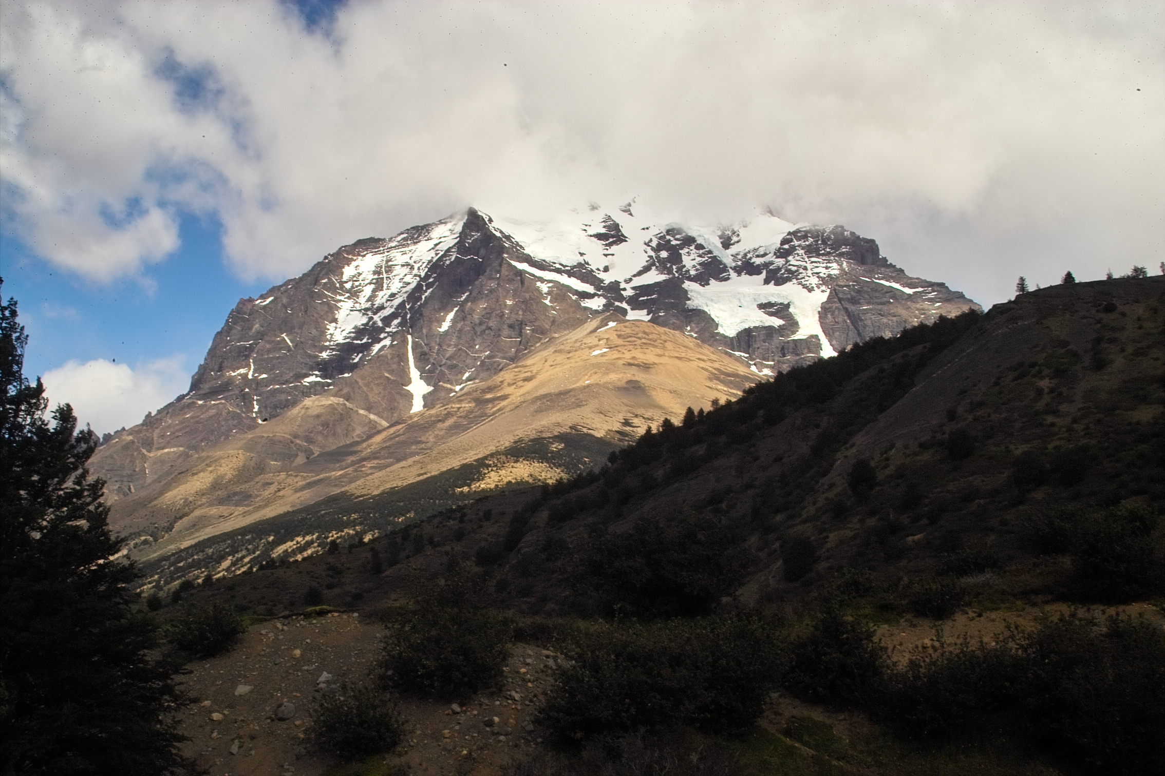
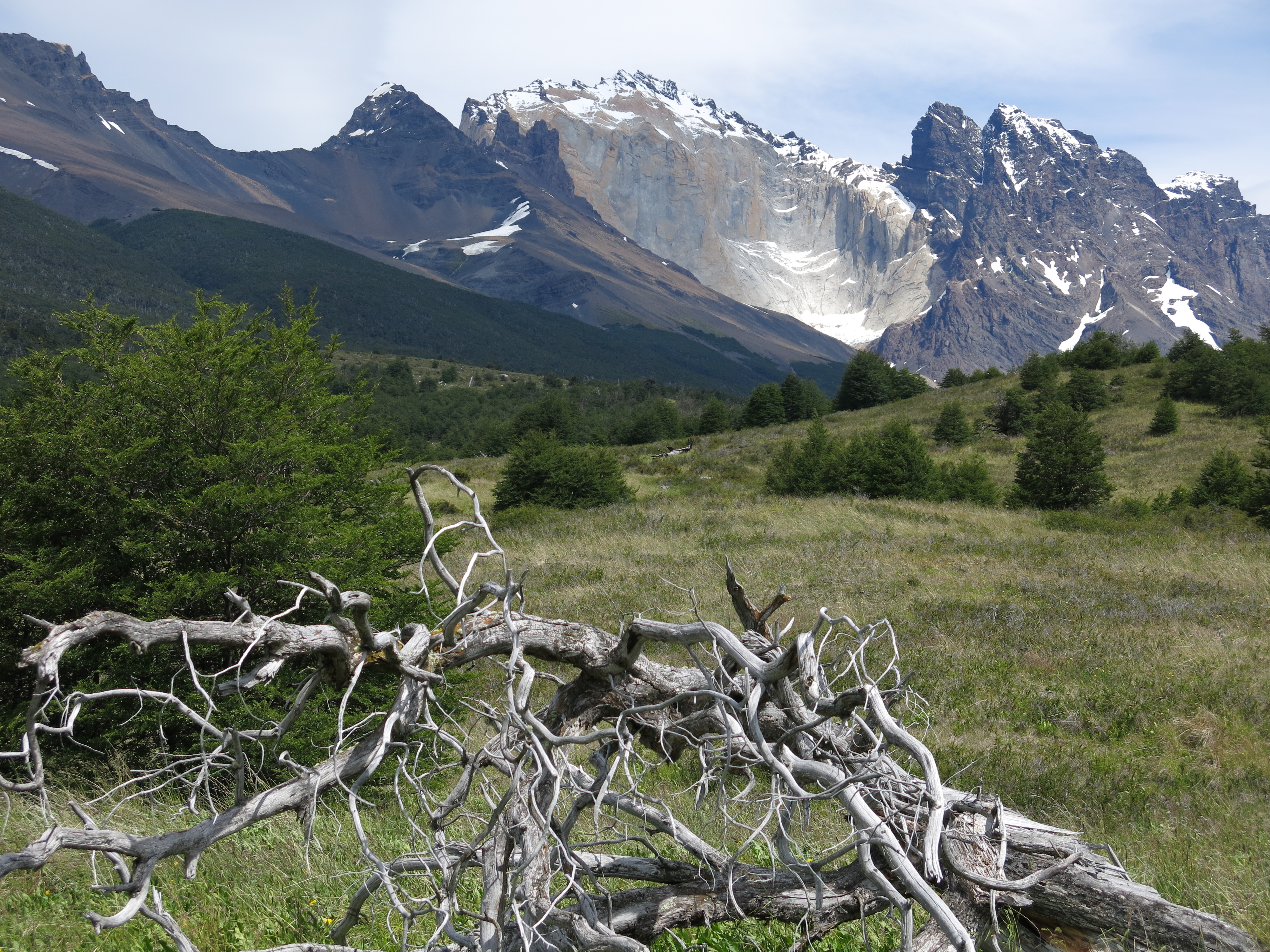
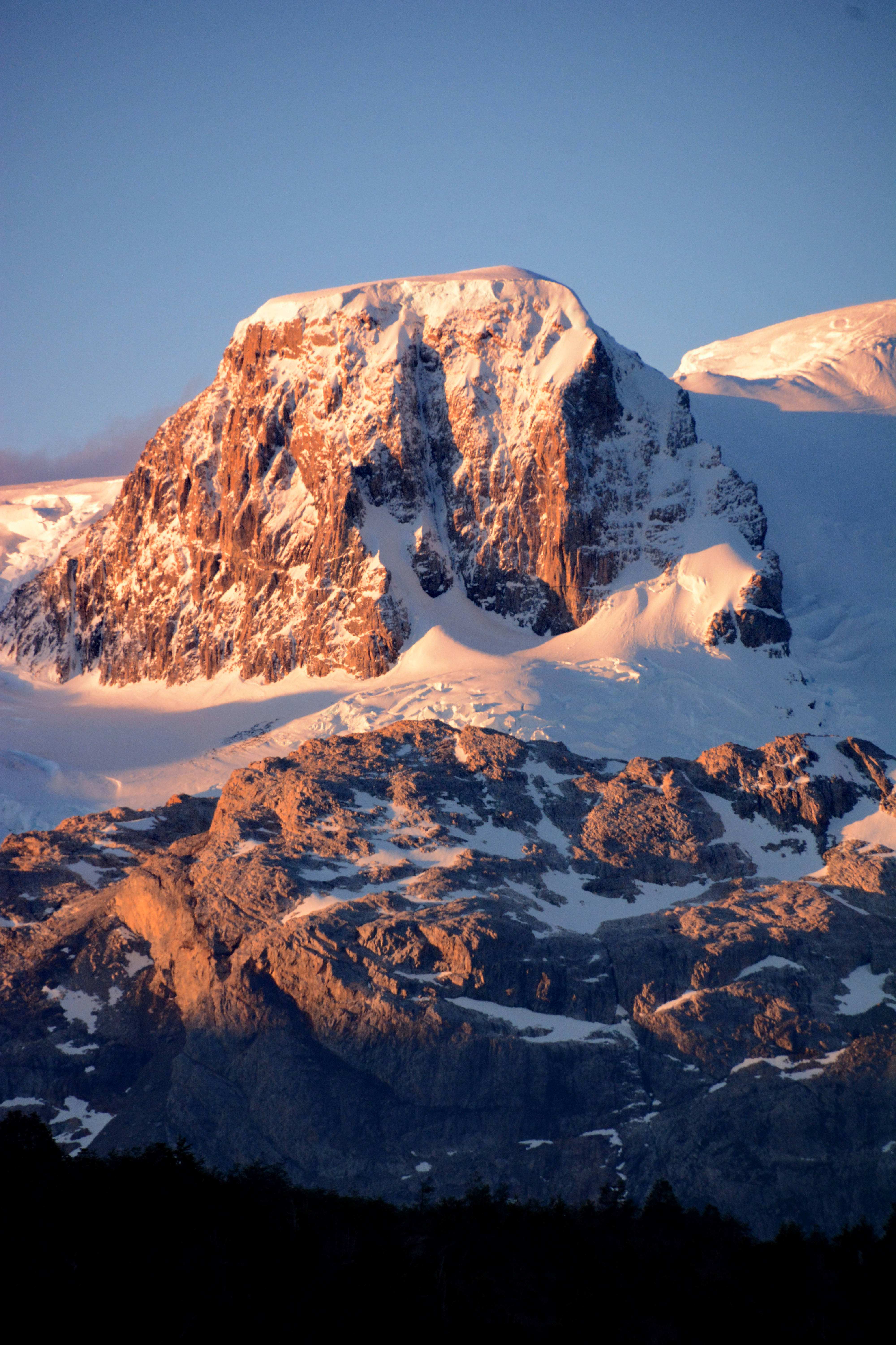
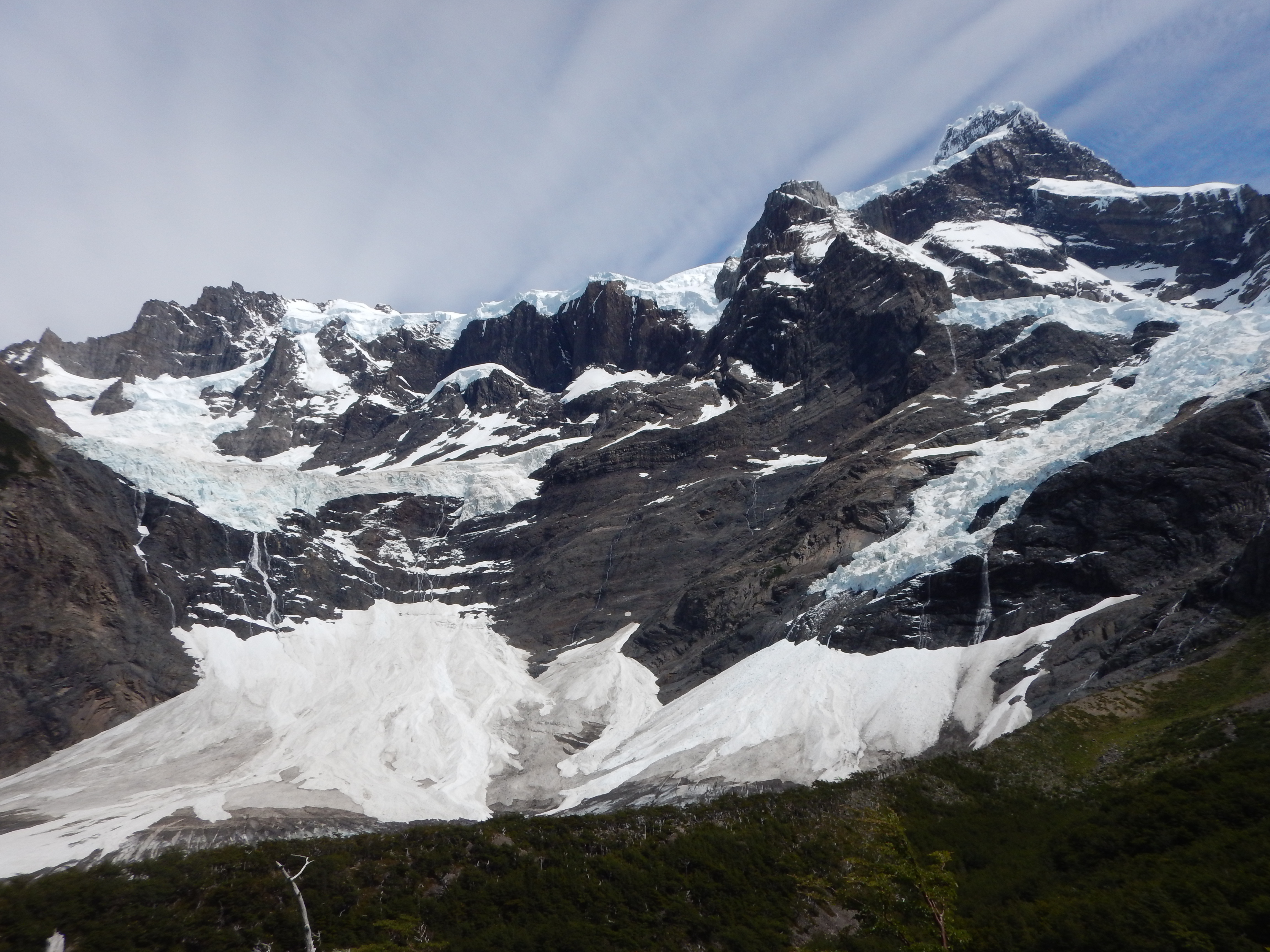
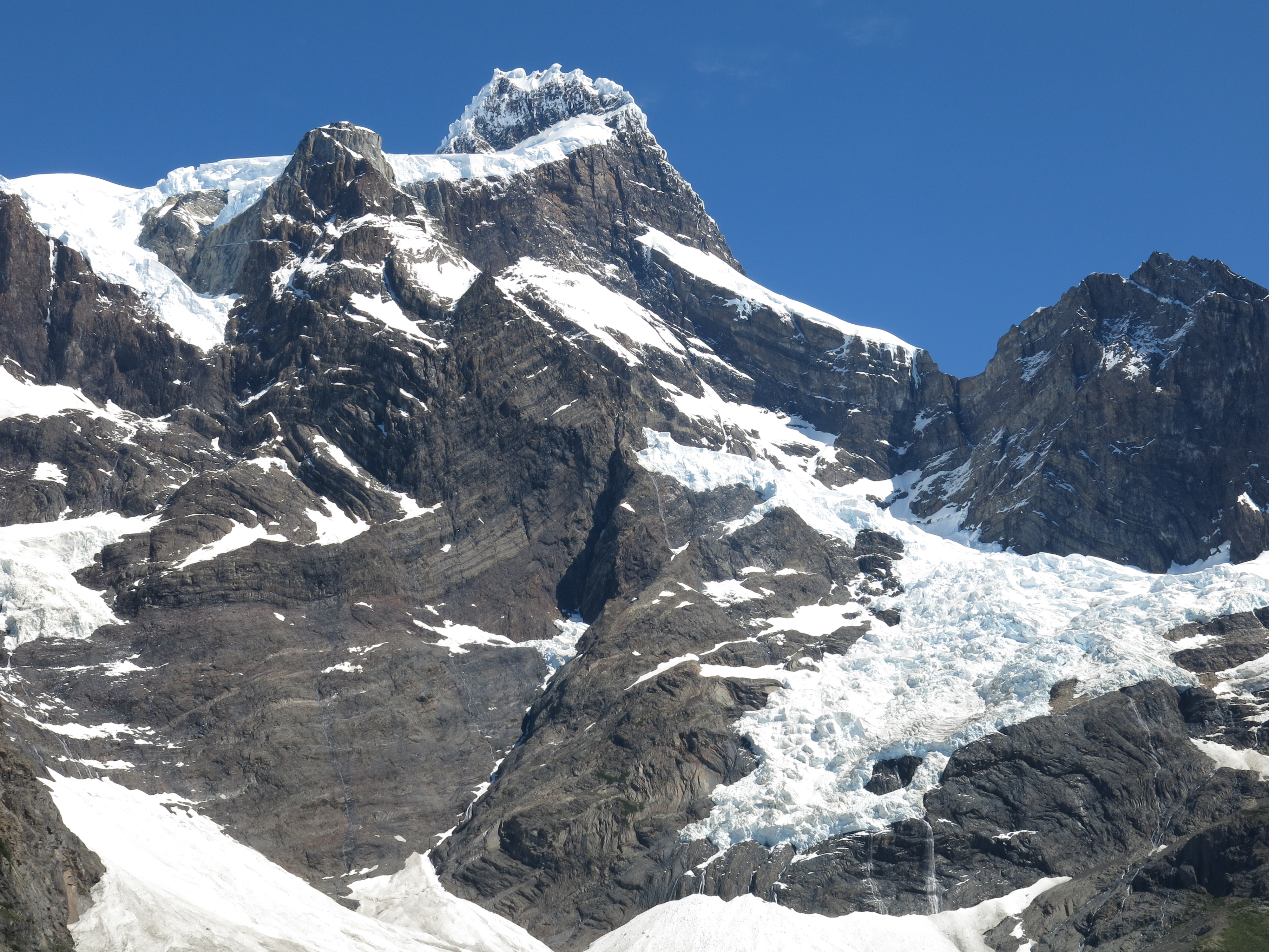
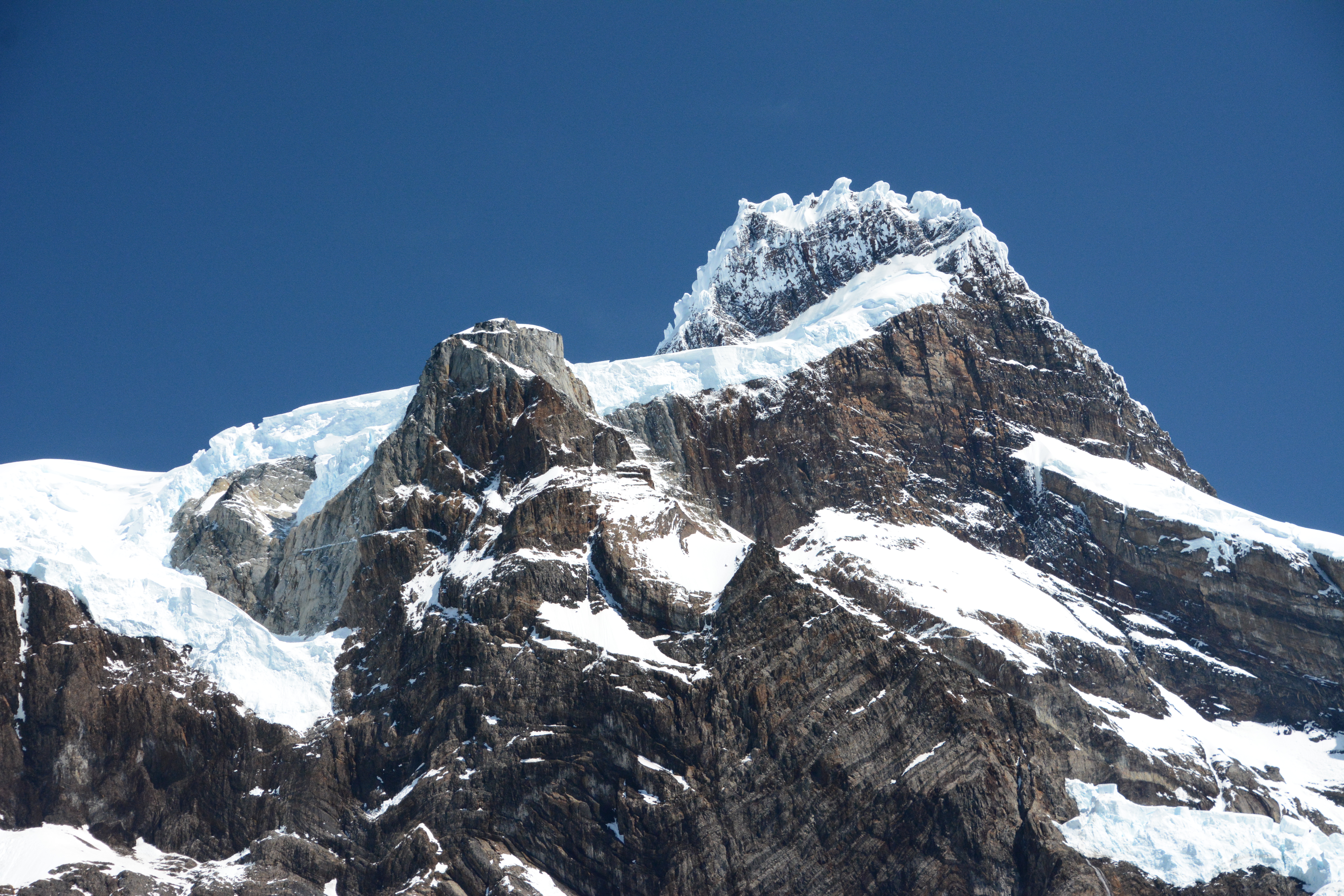
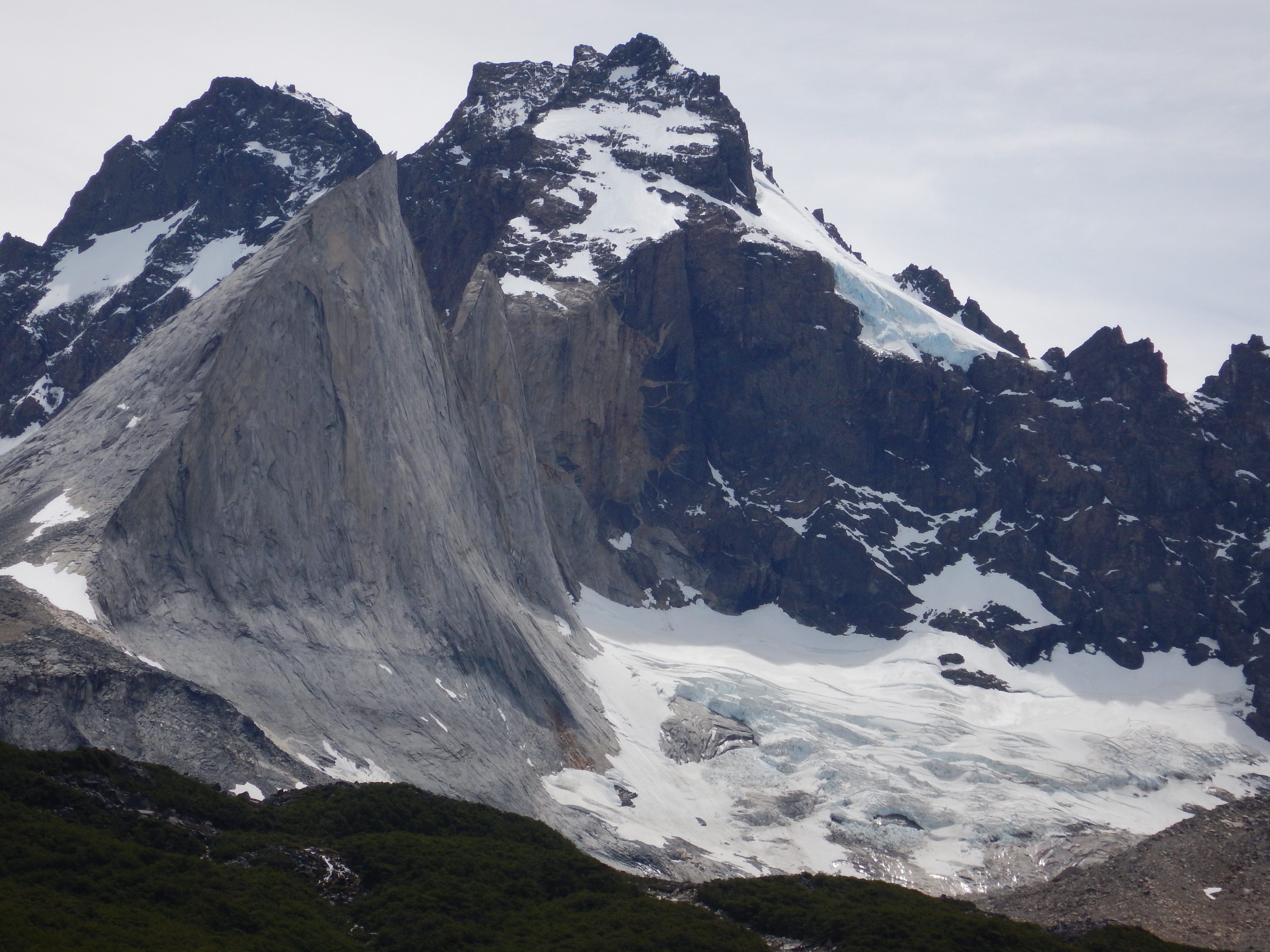
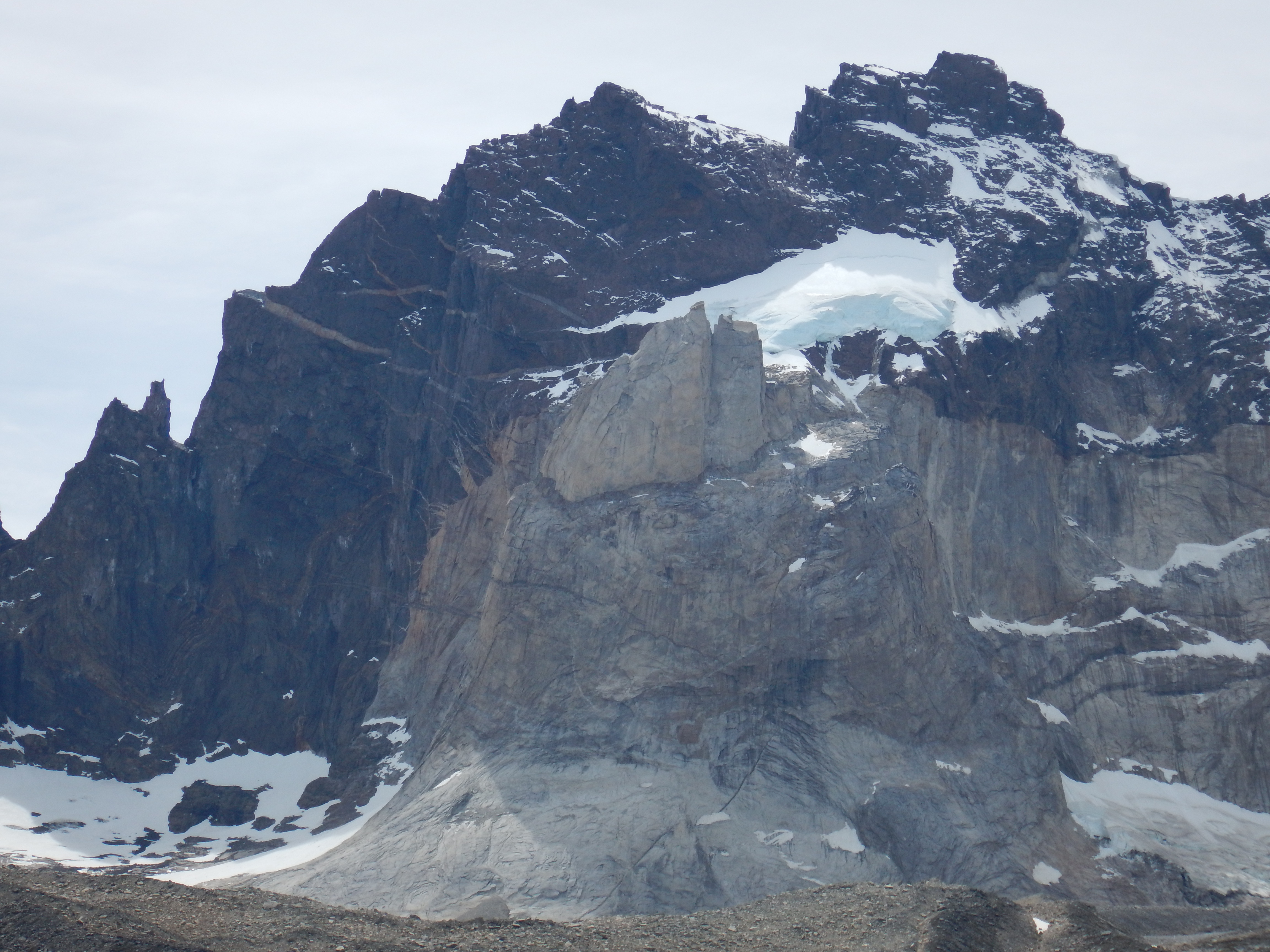
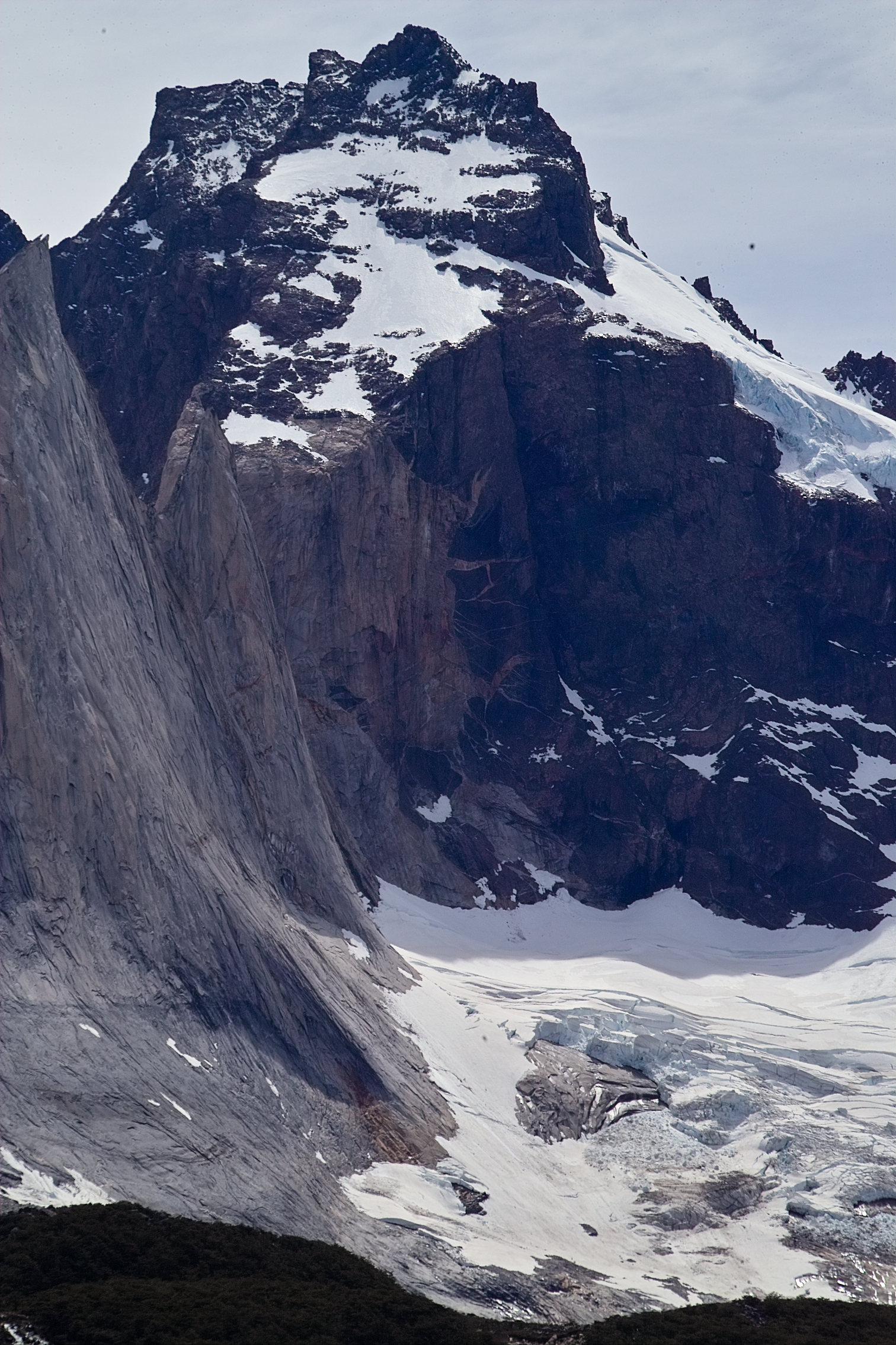
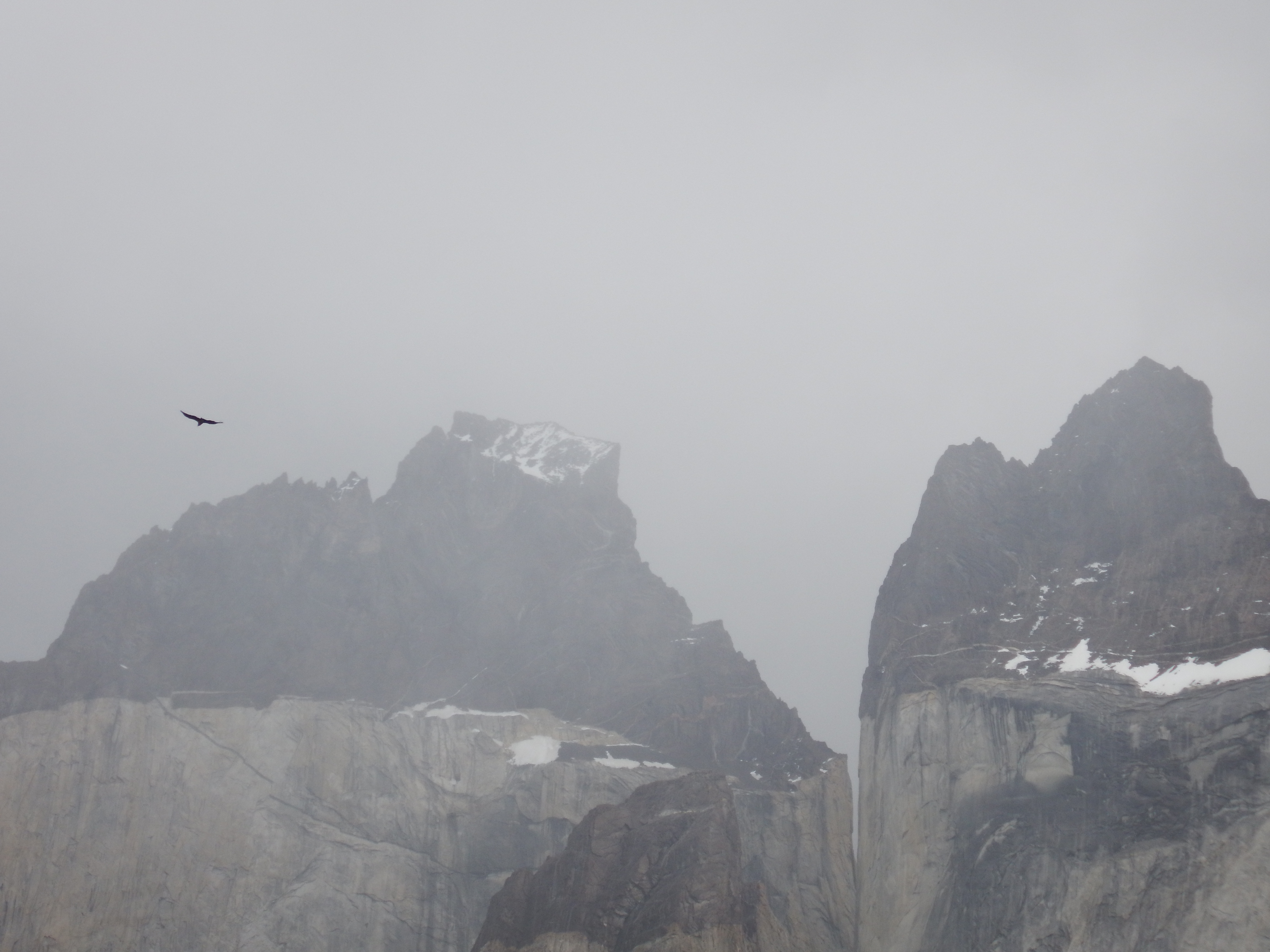
 Those mountains in the background are fearsome!
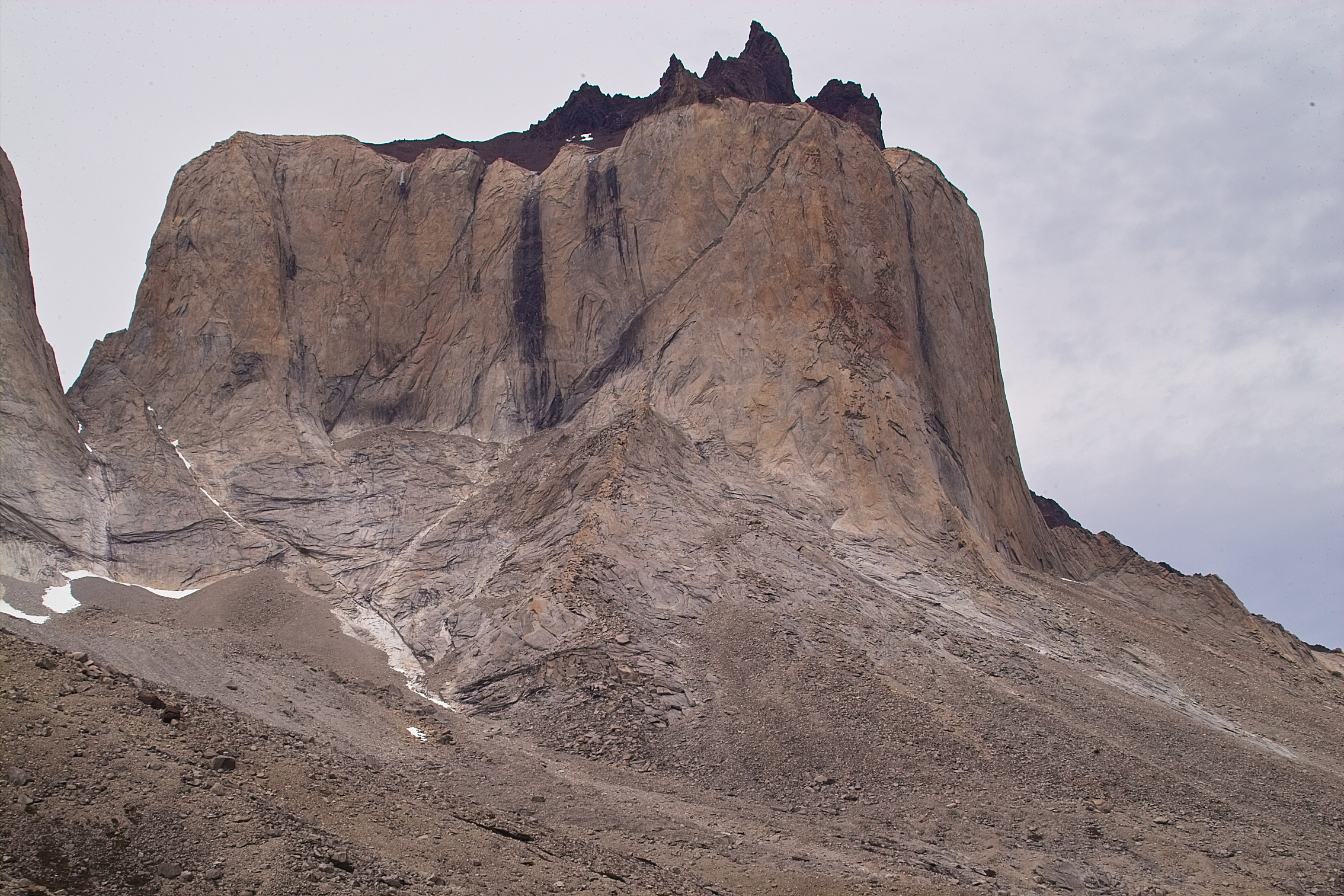
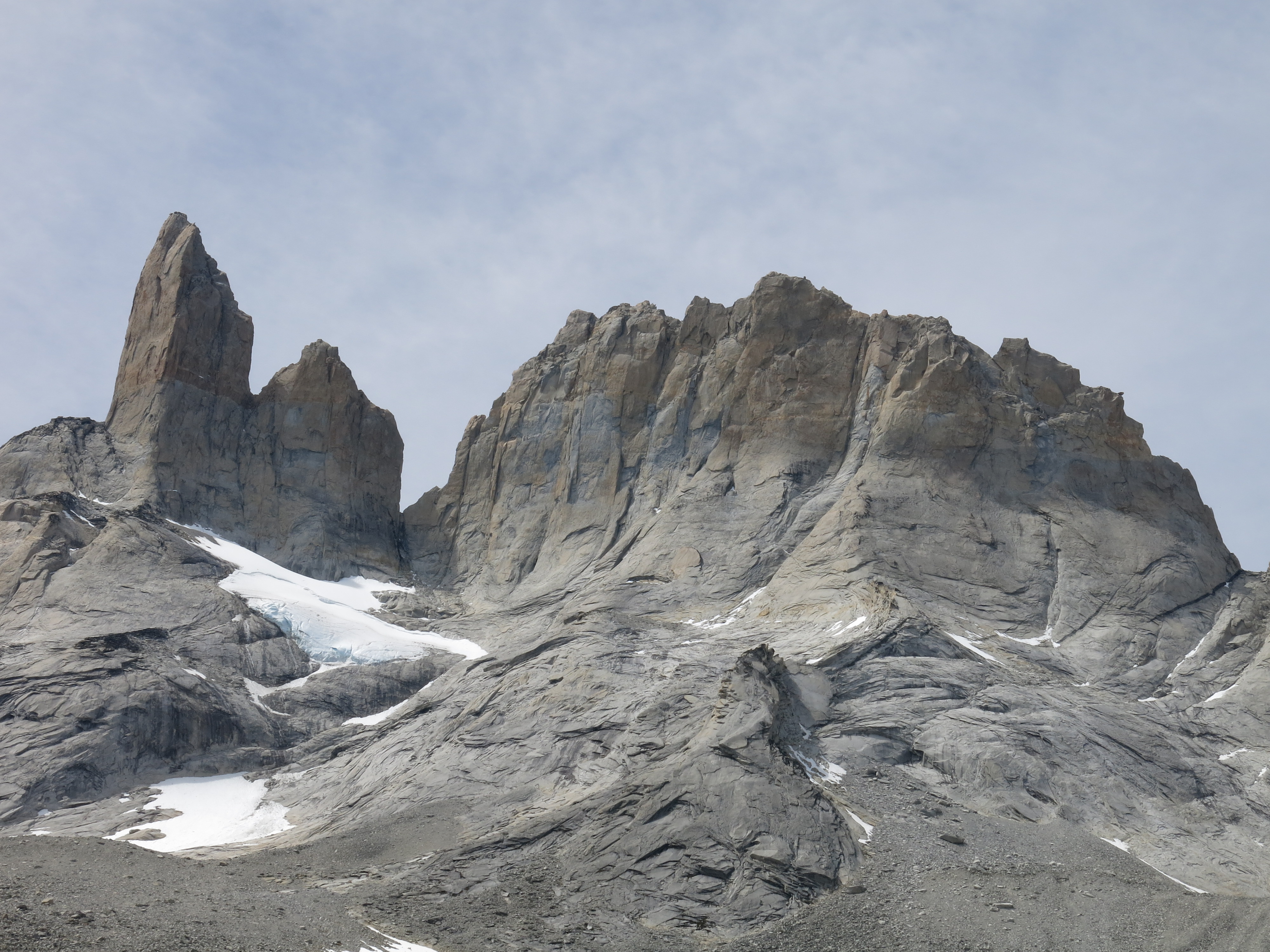
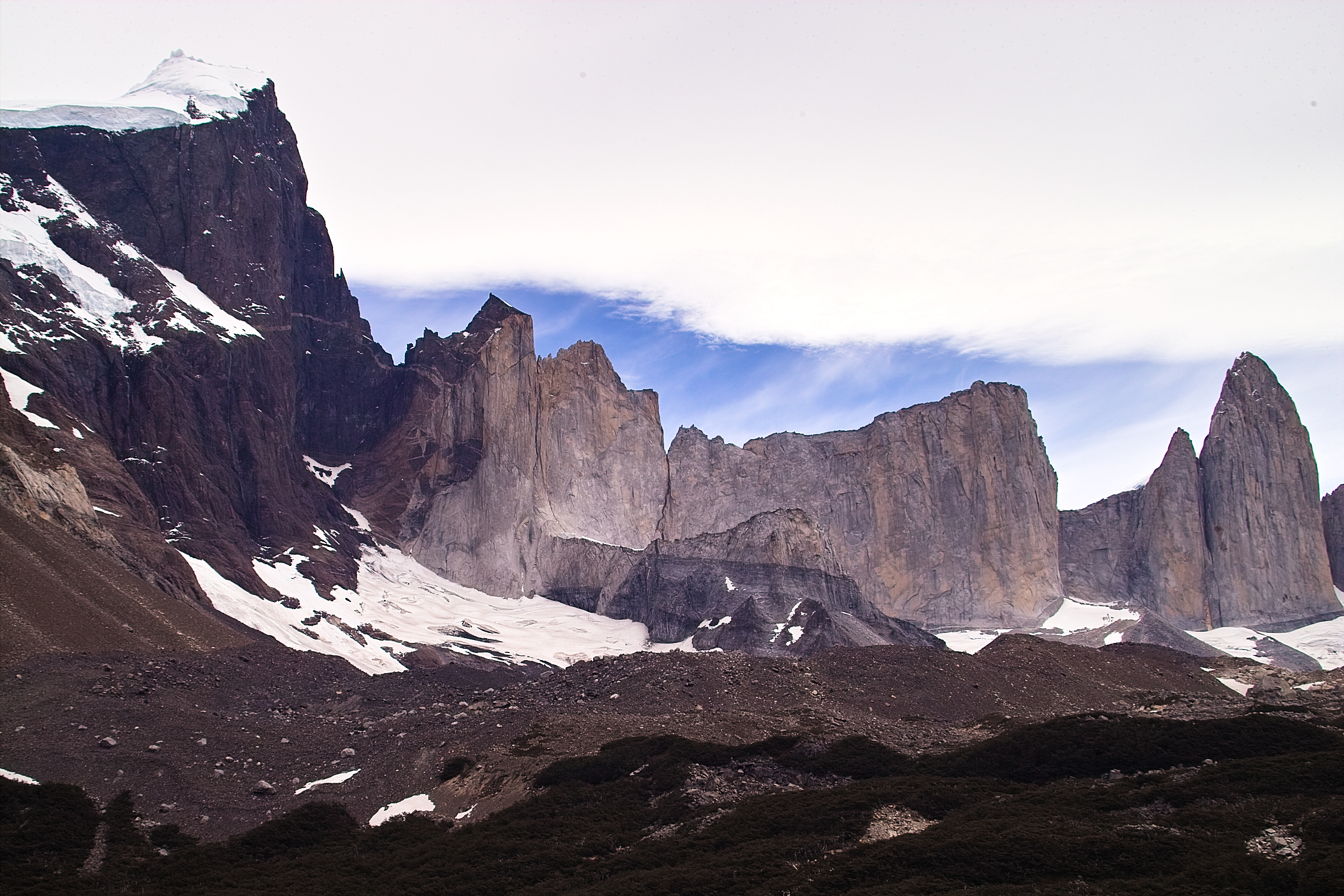
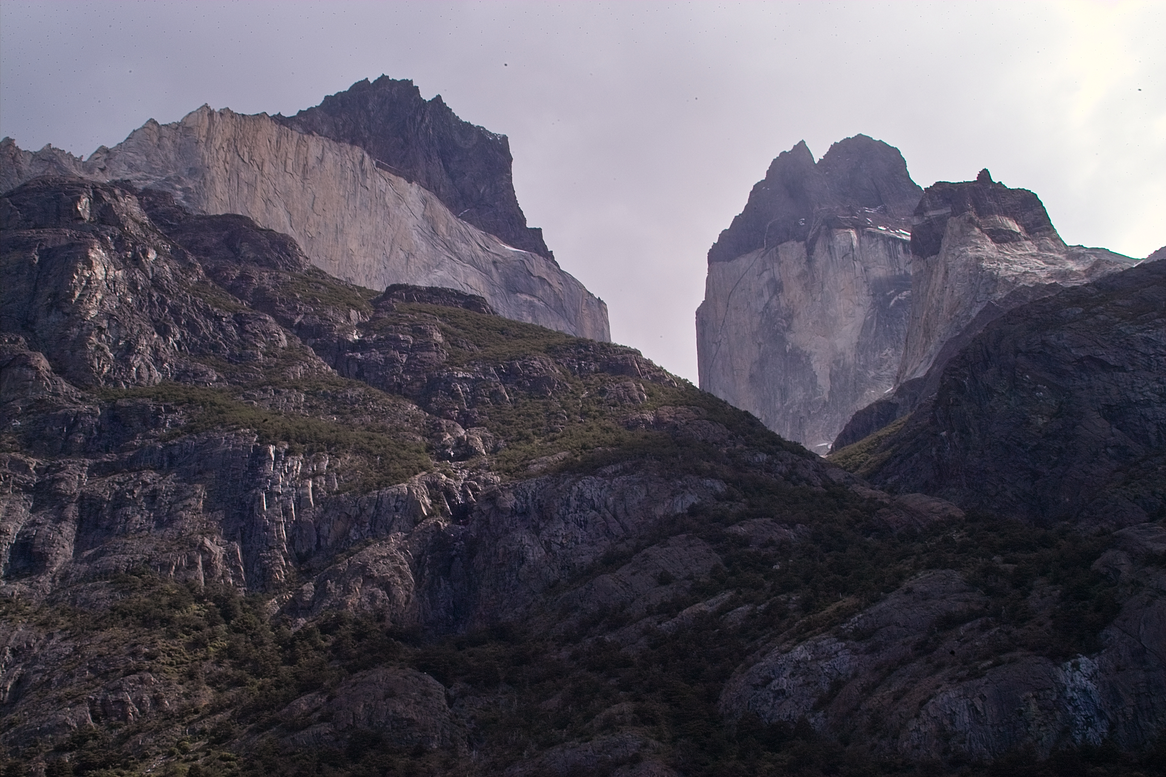
 Our first glimpse of the almighty granite.
 bird
bird
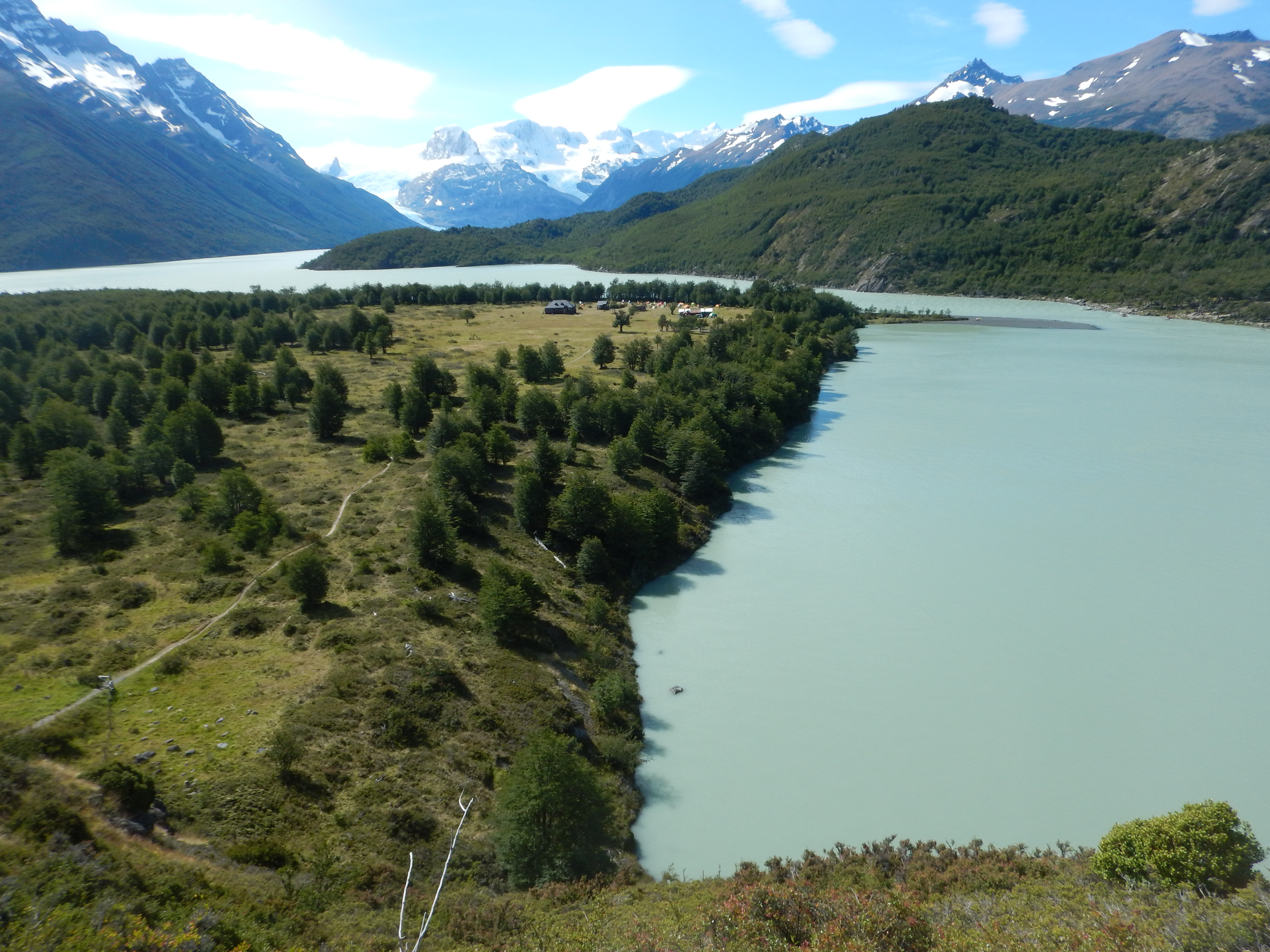
 After what seemed like a really long day, we finally laid eyes on Dickson.
What a beautiful place for a campground!
After what seemed like a really long day, we finally laid eyes on Dickson.
What a beautiful place for a campground!
 Those mountains on the far side of Lago Dickson lie on the Chile - Argentina border.

 We dropped down the steep trail and hauled ourselves over the last few hundred yards into camp.
A ranger greeted us and asked if anyone wanted a shower or a beer. "Yeah!"
This place was alright.
We dropped down the steep trail and hauled ourselves over the last few hundred yards into camp.
A ranger greeted us and asked if anyone wanted a shower or a beer. "Yeah!"
This place was alright.
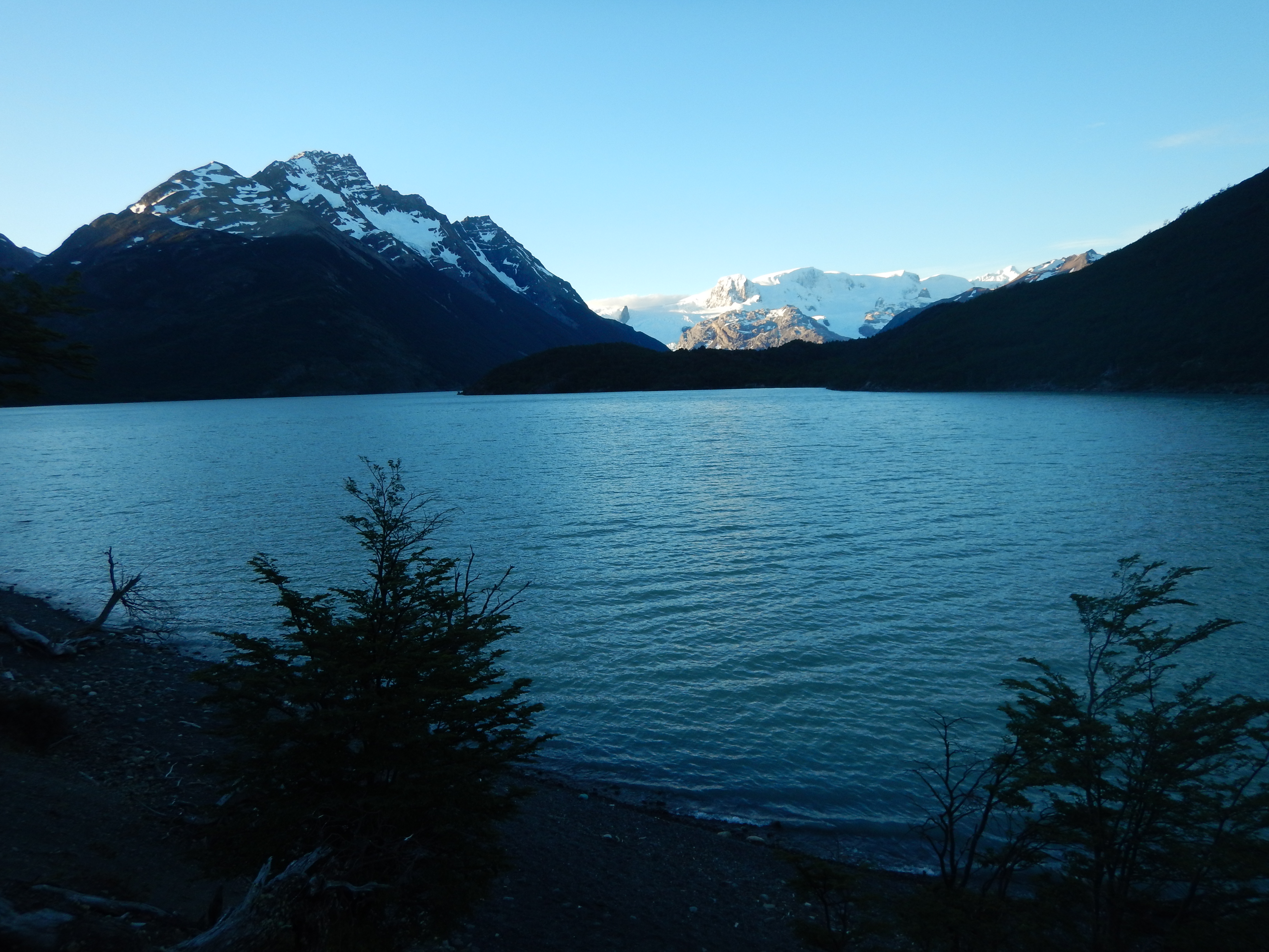 After some grub, we walked down to the shore of Lago Dickson in time for the sunset.
 Alpenglow. Ah...
Well, that's another day down. Tomorrow we start to climb, up to Camp Perro!
Alpenglow. Ah...
Well, that's another day down. Tomorrow we start to climb, up to Camp Perro!
Torres del Paine
Day 3
Dickson to Los Perros - 9 km
 The day was cold and cloudy. The wind was mild at first, but gradually picked up over the course of the day.
We hiked up a steep and muddy trail into the mountains above Dickson, glancing back from time to time at those mountains on the Argentinian border.
The day was cold and cloudy. The wind was mild at first, but gradually picked up over the course of the day.
We hiked up a steep and muddy trail into the mountains above Dickson, glancing back from time to time at those mountains on the Argentinian border.
 After gaining considerable elevation, we got this nice view, looking back toward Dickson.
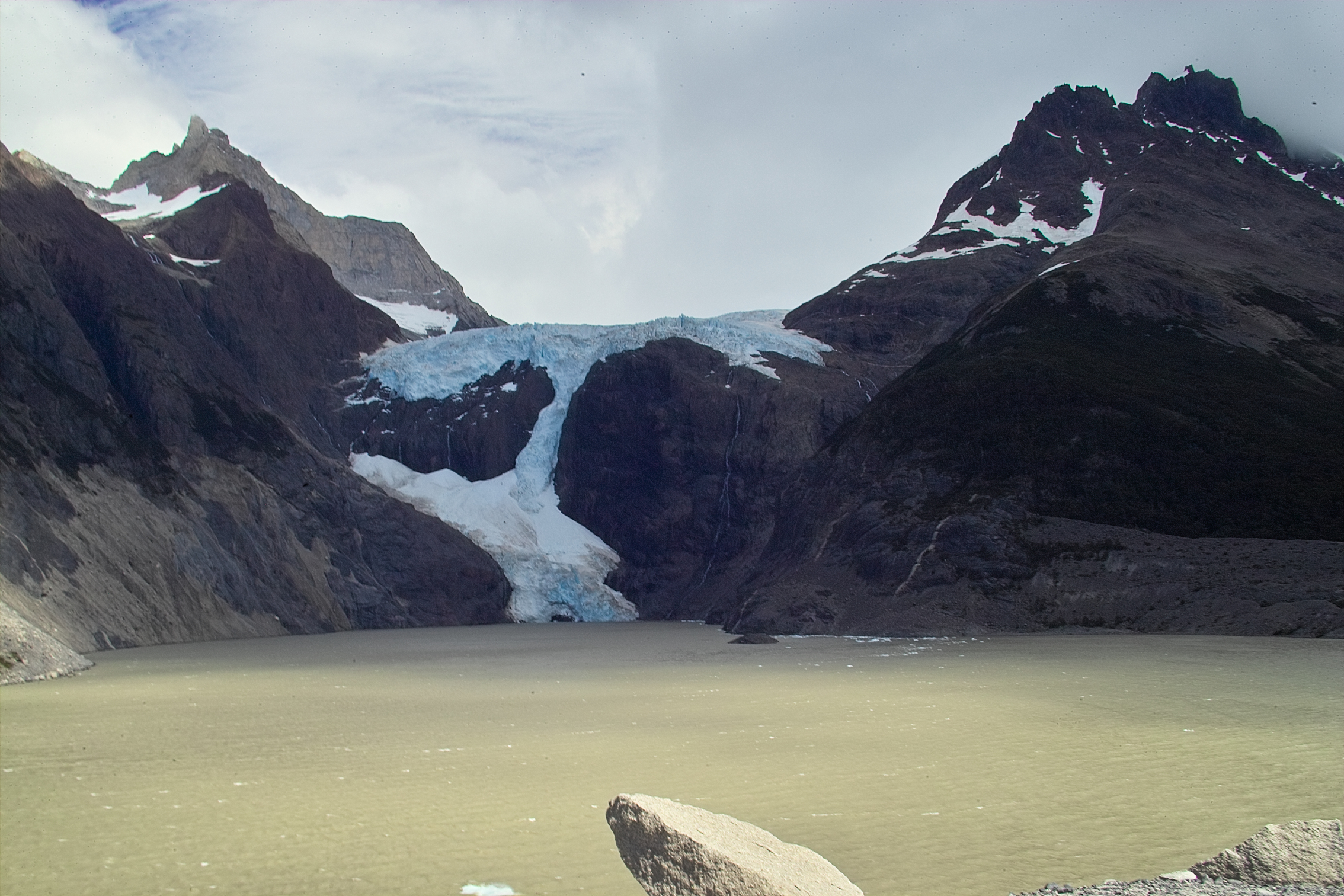
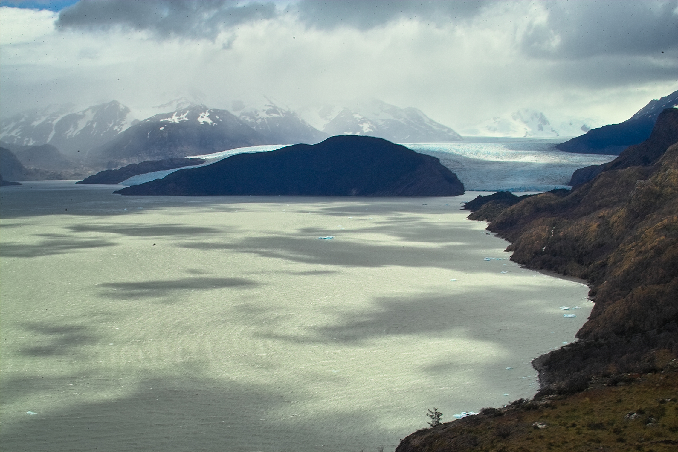
 We got our first view of a glacier terminating in water.
Then we dropped back down into the trees.
We got our first view of a glacier terminating in water.
Then we dropped back down into the trees.
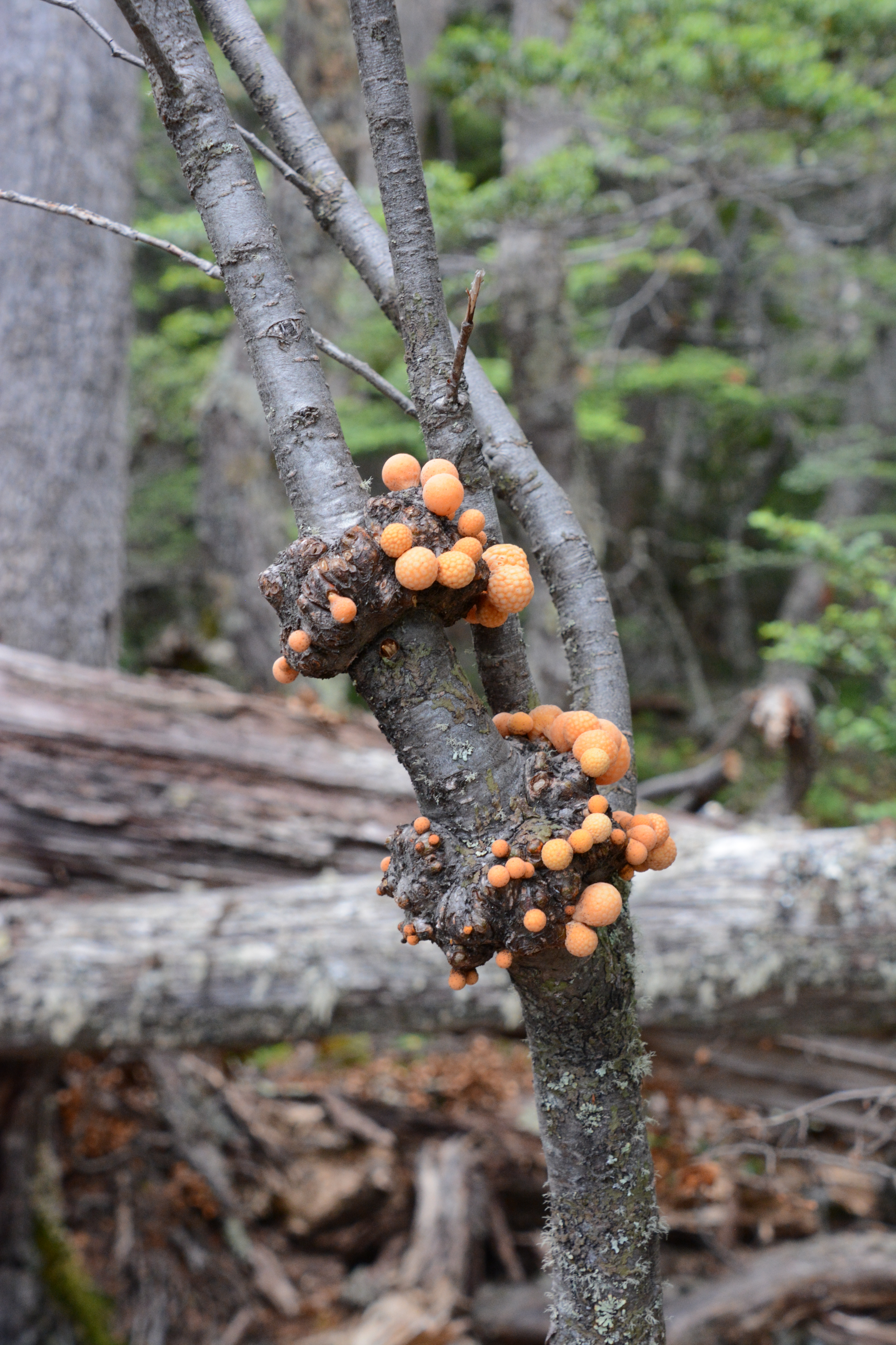 What the heck are these?
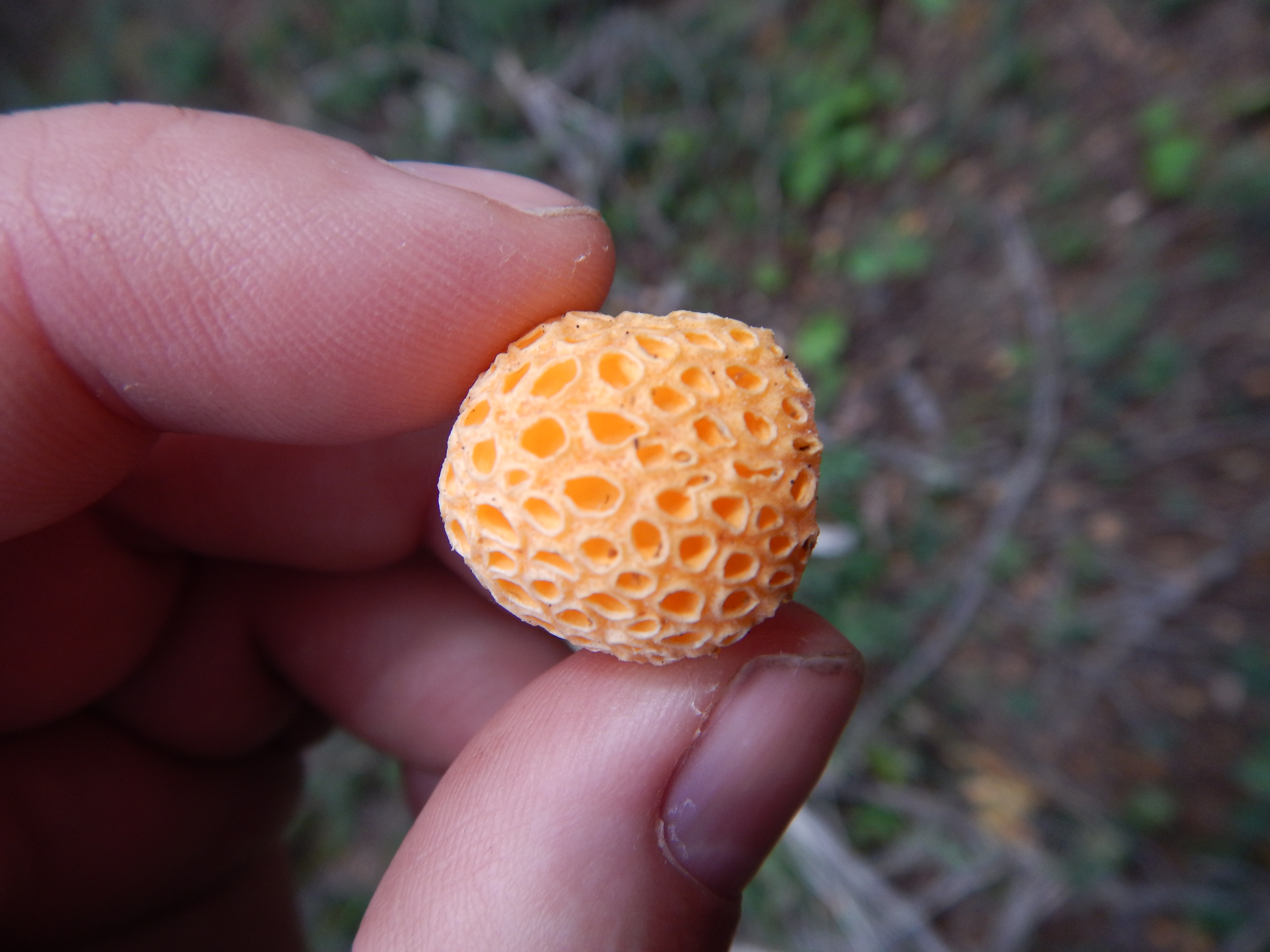 Anyone?
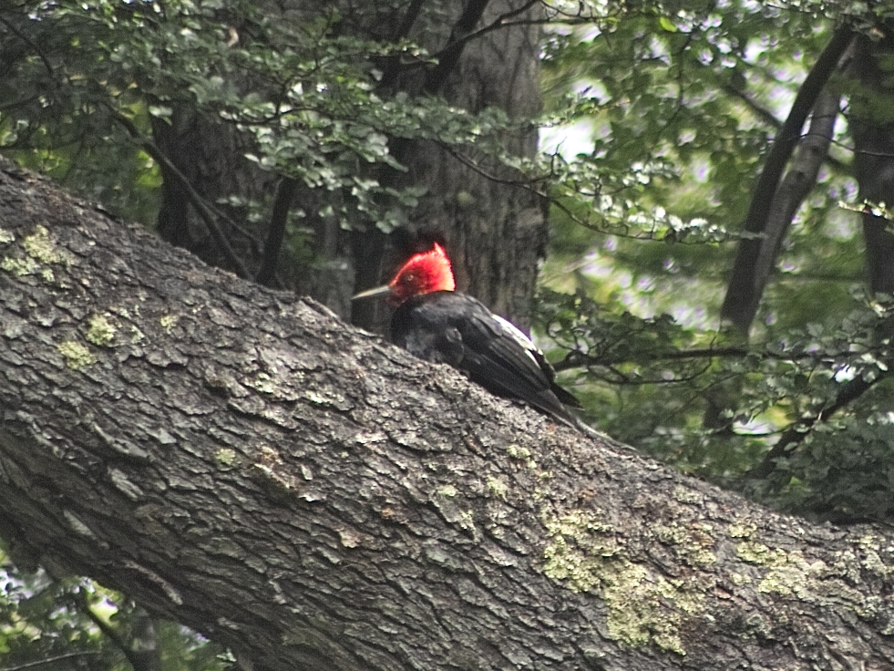 That's the Magellanic woodpecker.
I have been told that this is a pretty rare bird and that we were fortunate to see it.
That's the Magellanic woodpecker.
I have been told that this is a pretty rare bird and that we were fortunate to see it.
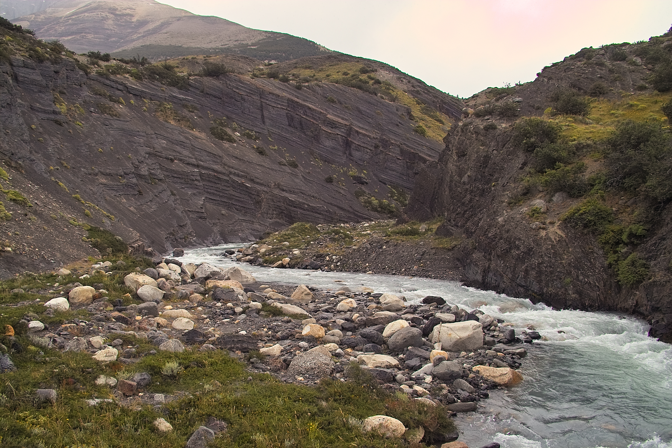
 Toward the end of the day, we climbed out of the forest and into a more barren and harsh landscape.
The trail brought us to the edge of this small lake, with the Los Perros Glacier above.
Oh, and it was windy as hell!
Standing at the shore of this lake, it was a struggle just to remain upright.
Toward the end of the day, we climbed out of the forest and into a more barren and harsh landscape.
The trail brought us to the edge of this small lake, with the Los Perros Glacier above.
Oh, and it was windy as hell!
Standing at the shore of this lake, it was a struggle just to remain upright.
Video loading... Please be patient - or (more likely) its not working on your device
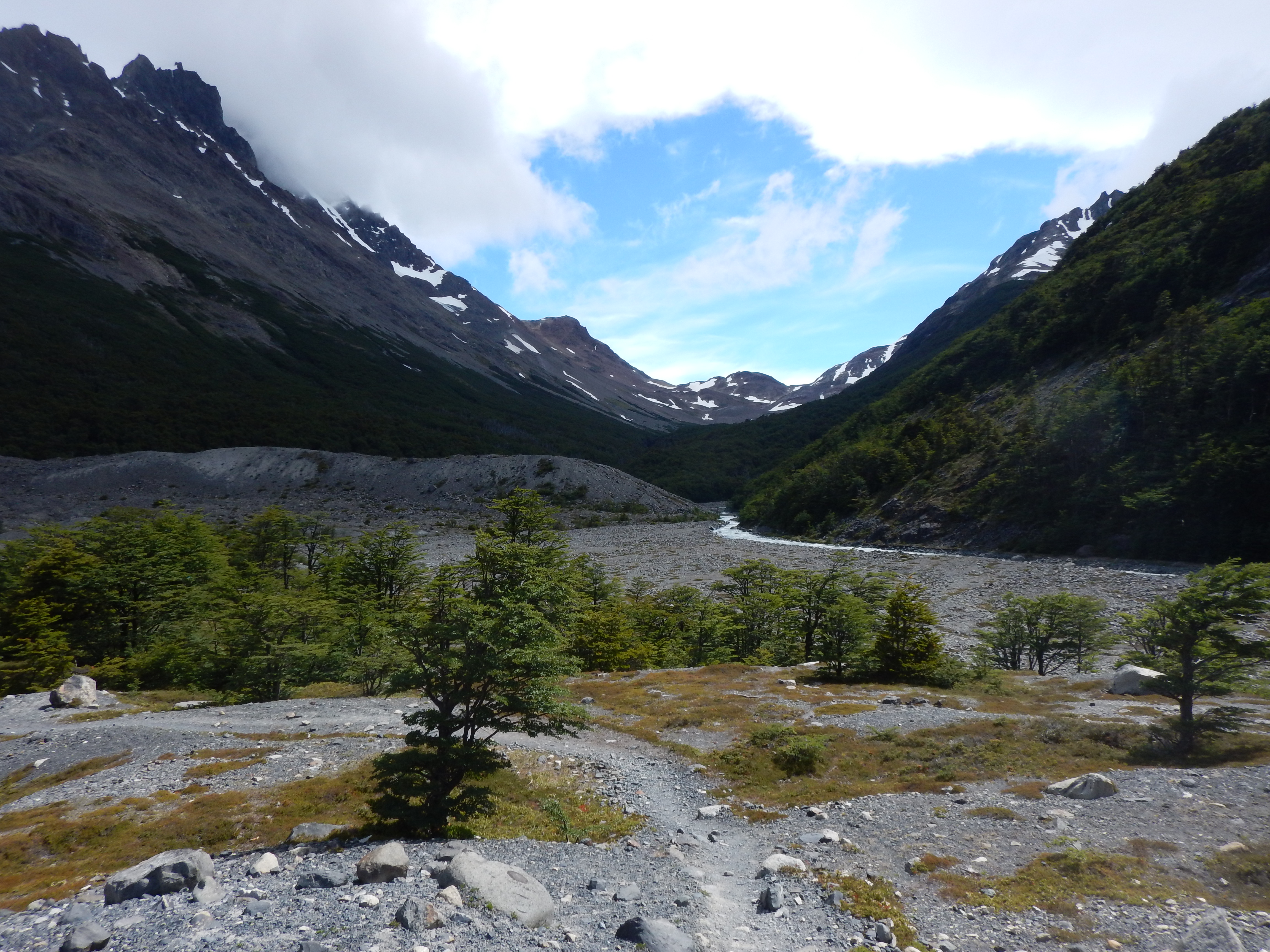 From there, it was less than an hour through the gravelly glacial valley to Los Perros,
 ...which consisted of a cluster of tents in the trees, a primitive bathroom, and a cooking shelter.
We were very happy for the trees, as they cut the wind fairly well.
We set up camp, nervously watching the limbs swaying violently in the maelstrom above our tent.
Ok, that's another day down. Tomorrow is a big day!
Tomorrow, we'll climb over John Gardner Pass, see part of the Southern Patagonian Ice Field, and hike down to Camp Paso!
...which consisted of a cluster of tents in the trees, a primitive bathroom, and a cooking shelter.
We were very happy for the trees, as they cut the wind fairly well.
We set up camp, nervously watching the limbs swaying violently in the maelstrom above our tent.
Ok, that's another day down. Tomorrow is a big day!
Tomorrow, we'll climb over John Gardner Pass, see part of the Southern Patagonian Ice Field, and hike down to Camp Paso!
Torres del Paine
Day 4
Los Perros to Paso - 12 km
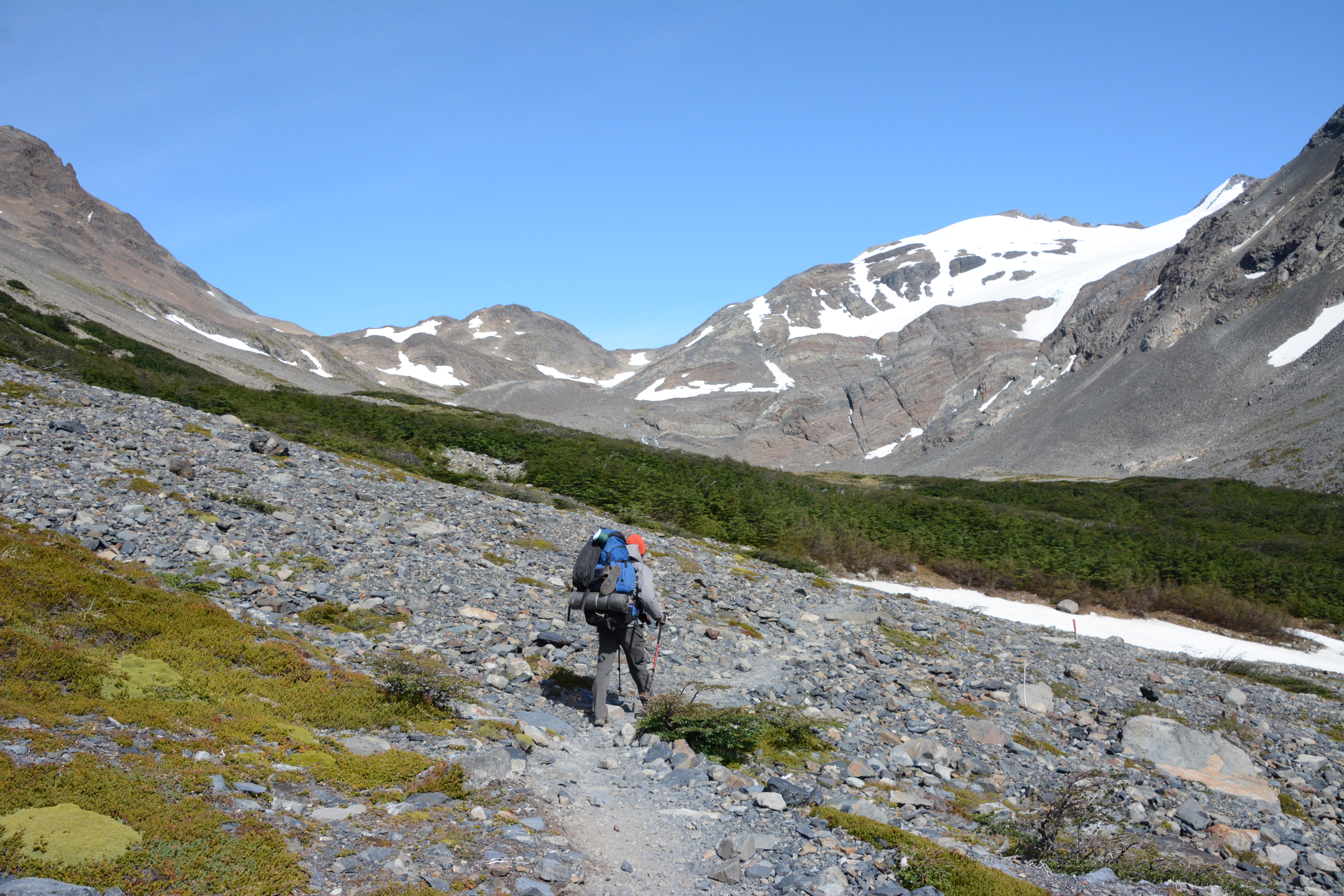
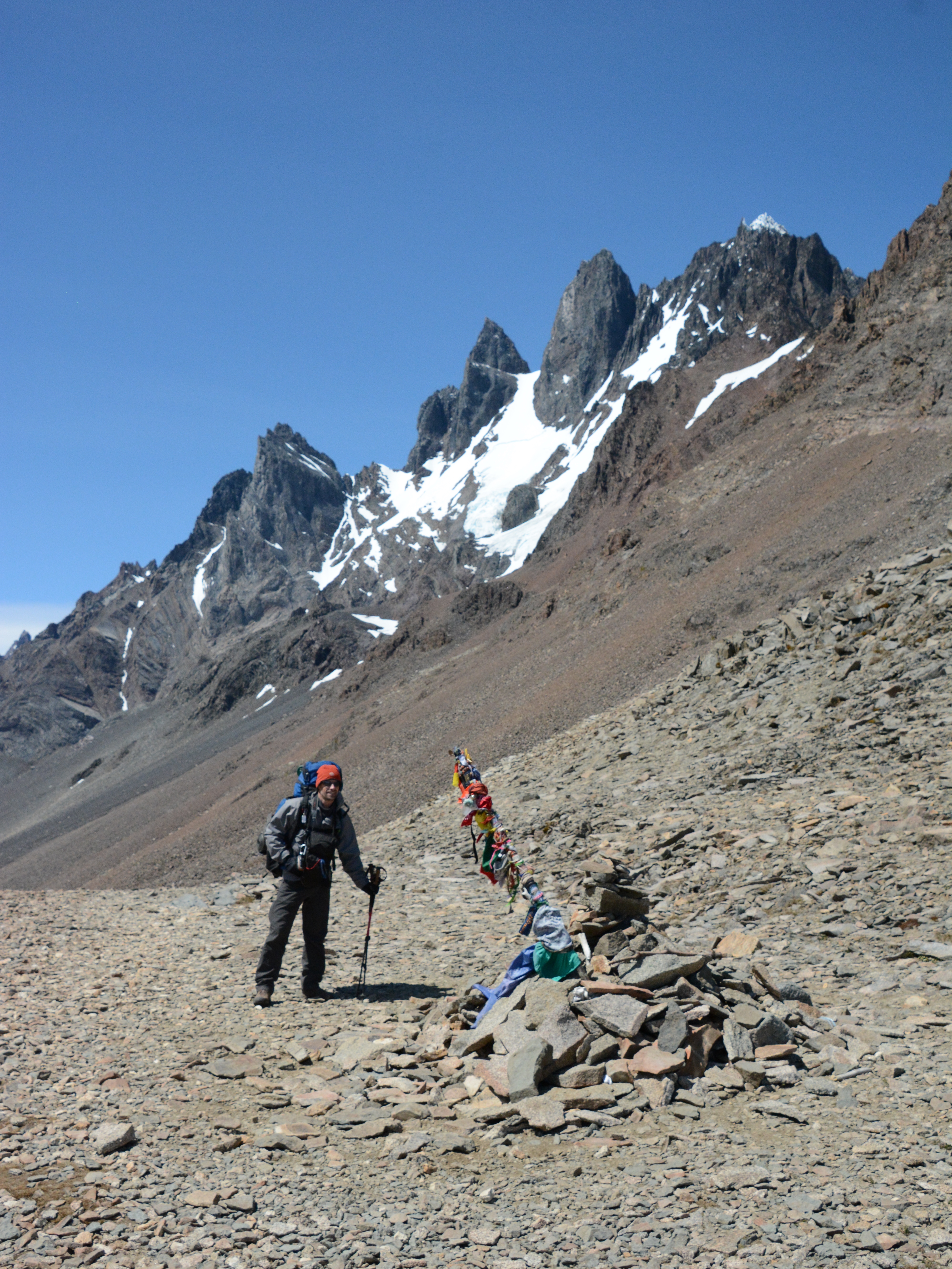
 The next morning, we began the climb up to John Gardner Pass.
We were very fortunate with the weather. It was a beautiful day. The wind even calmed down some.
Of all the days on this trek, this was the one where good clear weather was the most important.
If conditions are bad, the rangers will close this section of the trail, due to the extreme winds.
Also, we were really hoping to get a good view of the Grey Glacier (part of the Southern Patagonian Icefield) from the pass.
We really lucked out.
The trail took us out of the trees and into a broad windswept talus field.
The next morning, we began the climb up to John Gardner Pass.
We were very fortunate with the weather. It was a beautiful day. The wind even calmed down some.
Of all the days on this trek, this was the one where good clear weather was the most important.
If conditions are bad, the rangers will close this section of the trail, due to the extreme winds.
Also, we were really hoping to get a good view of the Grey Glacier (part of the Southern Patagonian Icefield) from the pass.
We really lucked out.
The trail took us out of the trees and into a broad windswept talus field.
 And back into the trees...
 And back out again.
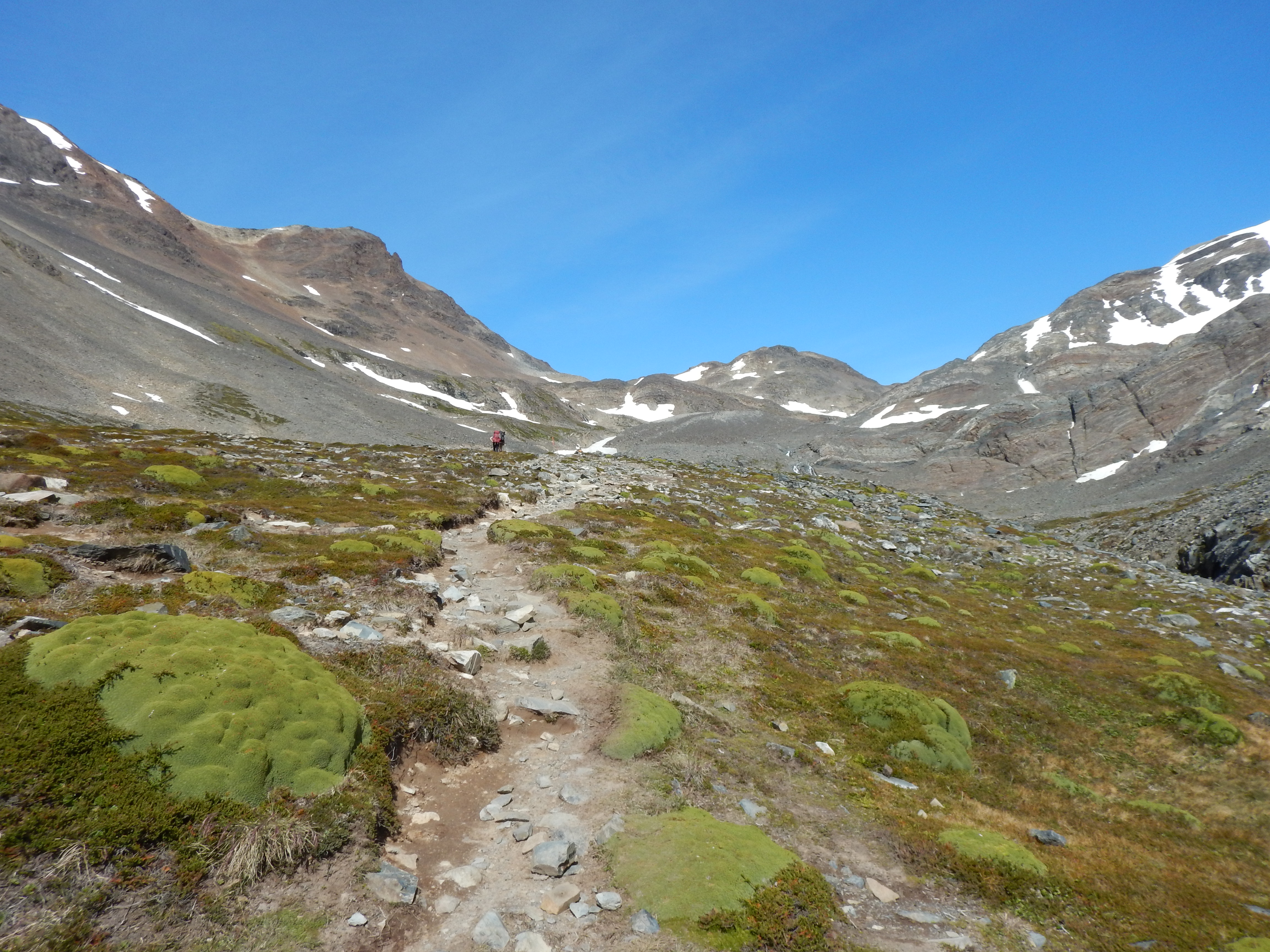 Up, up, up.
 Views to the left (above and below)
 Views to the right (above).
It's starting to feel like we're in the alpine.
Views to the right (above).
It's starting to feel like we're in the alpine.
 We are close now. That's it, on the horizon, over on the left (above).
John Gardner Pass
 That's the Grey Glacier down below, straight ahead.
Video loading... Please be patient - or (more likely) its not working on your device

 There's stuff growing up here!

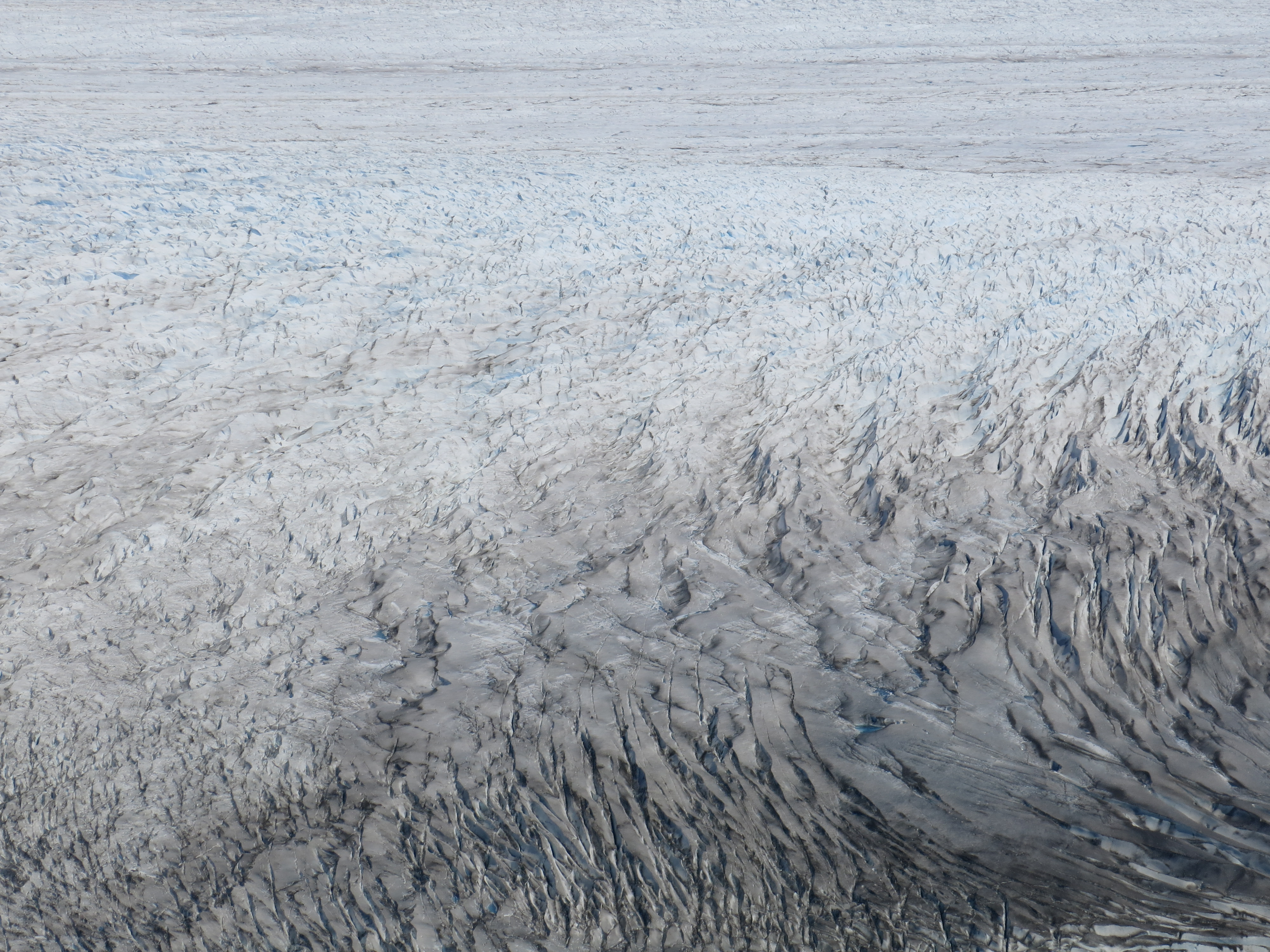
 (Above) That leads up to the rest of the mighty Southern Patagonian Ice Field.
The Southern Patagonian Ice Field is the third largest ice field on earth, after Antarctica and Greenland.
We are looking at the Grey Glacier, which is one of the Southern Patagonian Ice Field's terminal lobes.
(Above) That leads up to the rest of the mighty Southern Patagonian Ice Field.
The Southern Patagonian Ice Field is the third largest ice field on earth, after Antarctica and Greenland.
We are looking at the Grey Glacier, which is one of the Southern Patagonian Ice Field's terminal lobes.
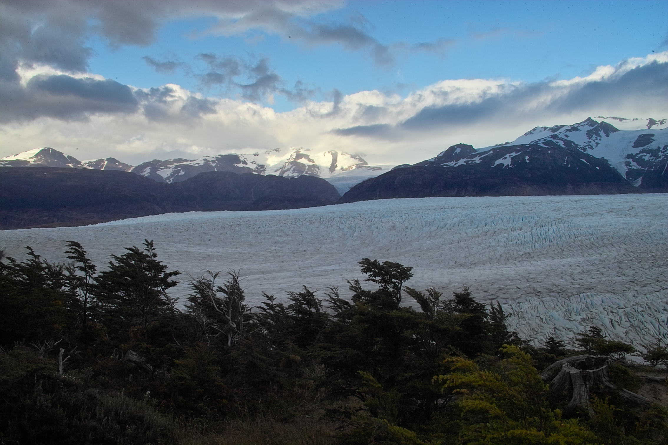
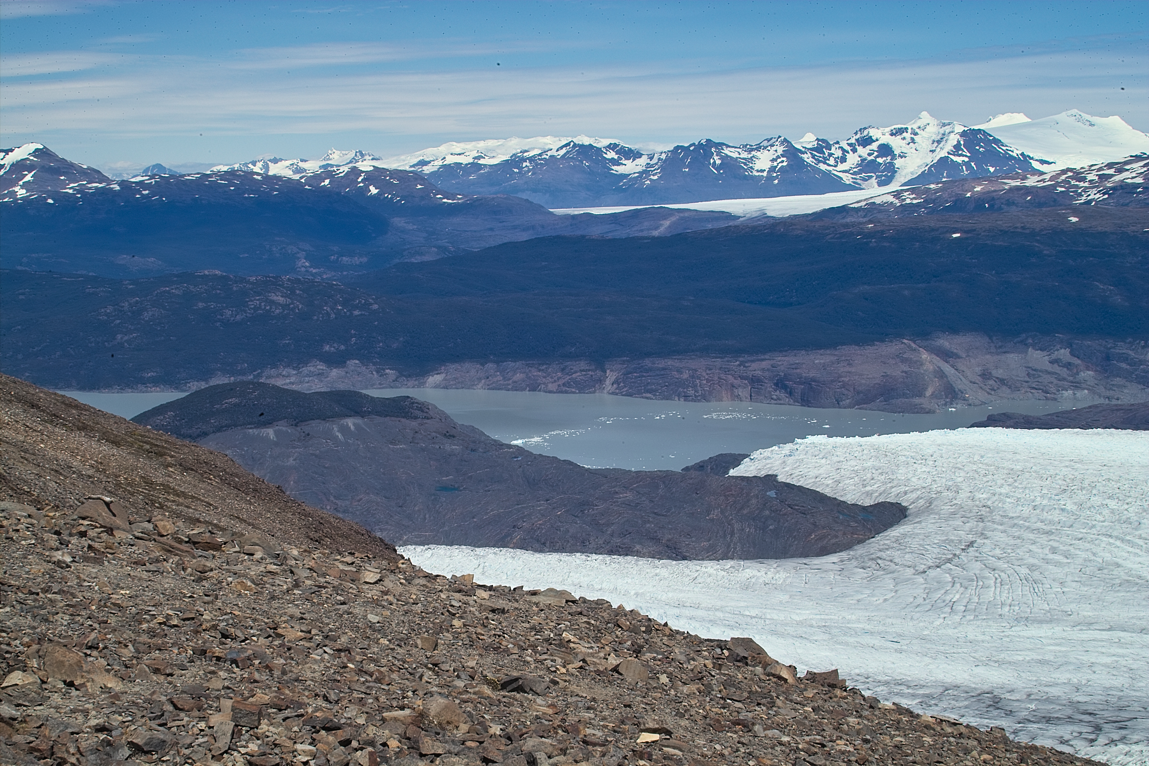 The Grey Glacier terminates into Lago Grey. Icebergs drift slowly away from the glacier.
John Gardner Pass is at about elevation 4660 feet.
Lago Grey is at about elevation 1500 feet.
That's the direction we're headed. We'll get to Lago Grey tomorrow.
The Grey Glacier terminates into Lago Grey. Icebergs drift slowly away from the glacier.
John Gardner Pass is at about elevation 4660 feet.
Lago Grey is at about elevation 1500 feet.
That's the direction we're headed. We'll get to Lago Grey tomorrow.
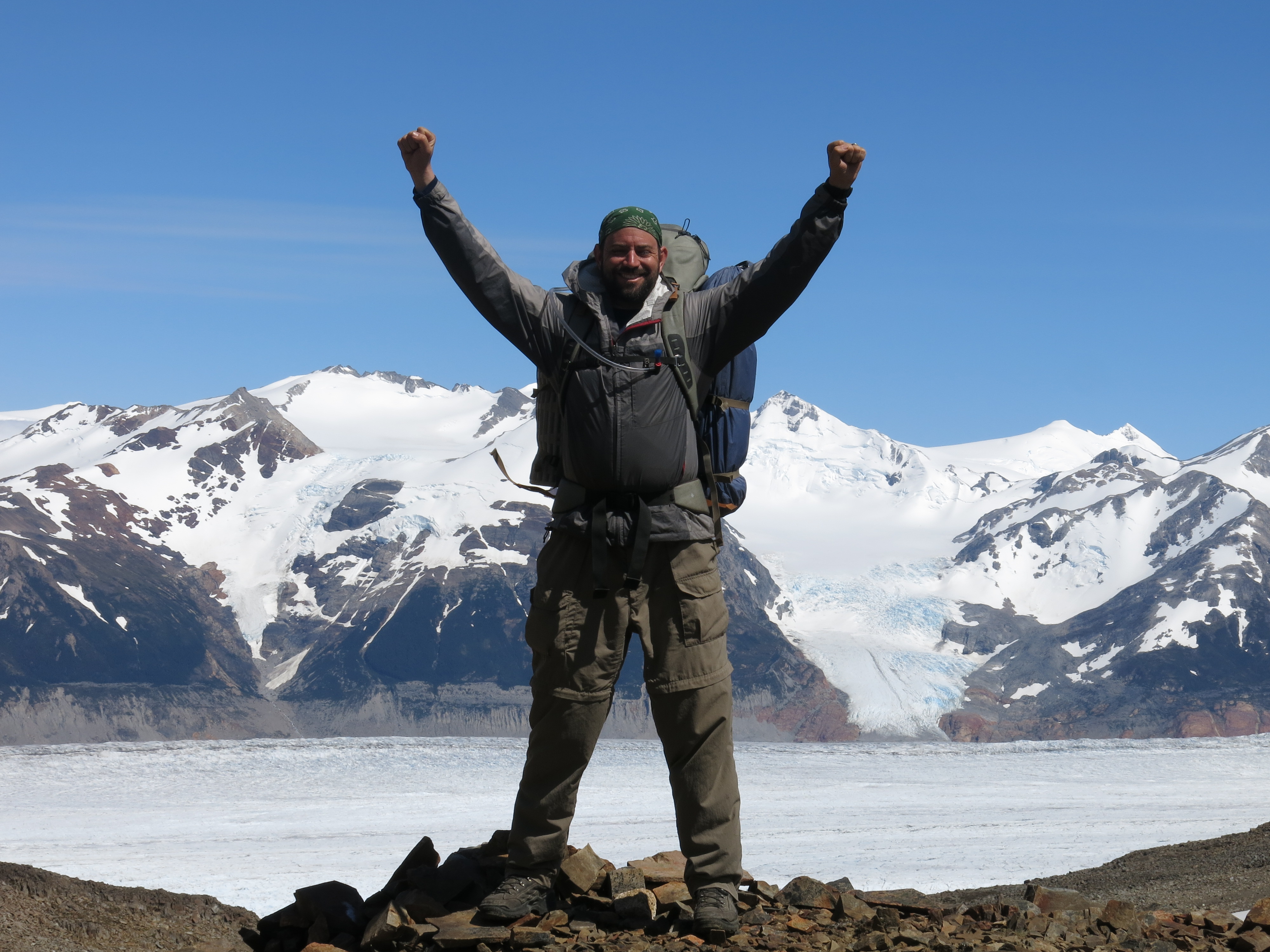
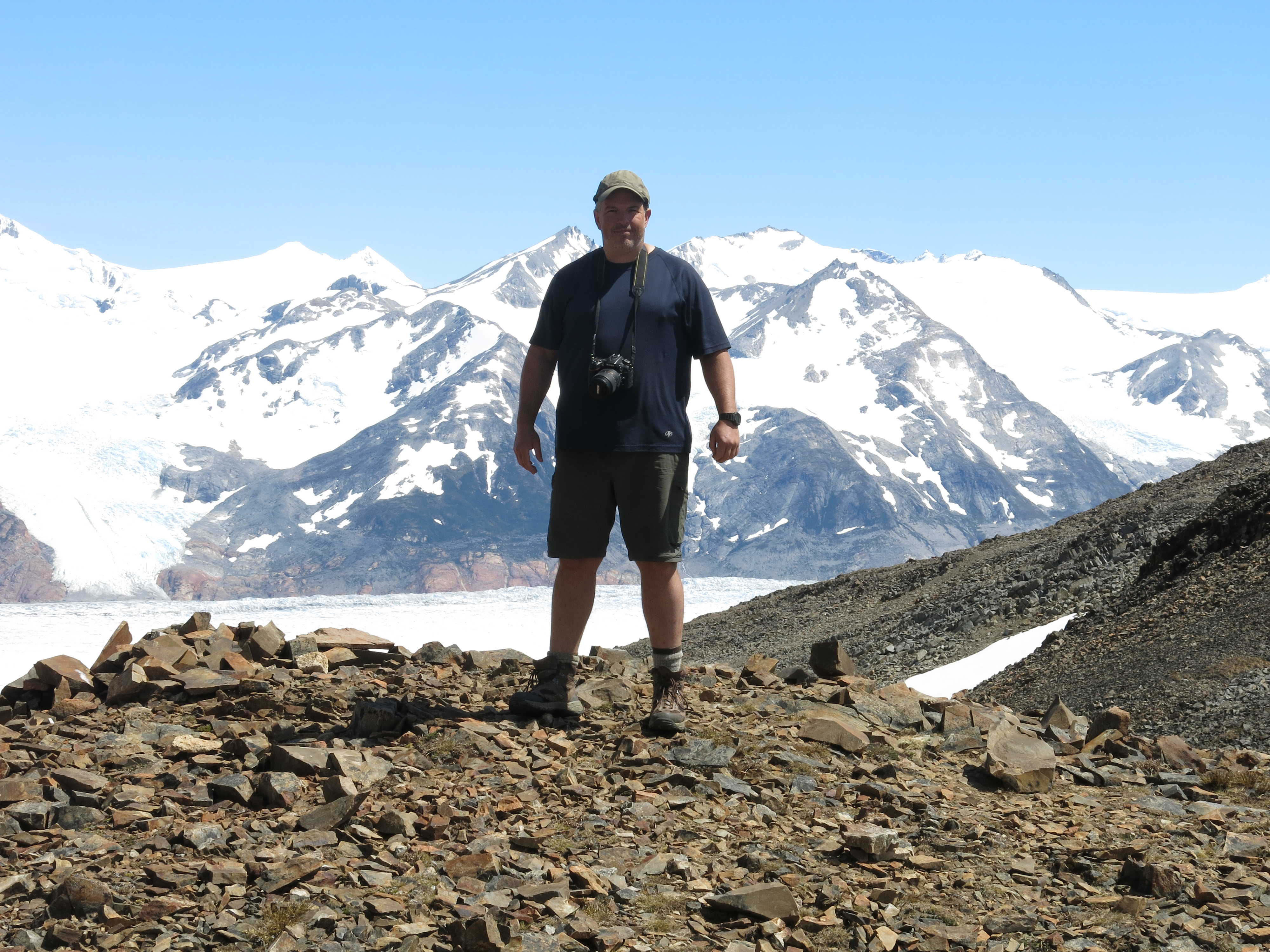
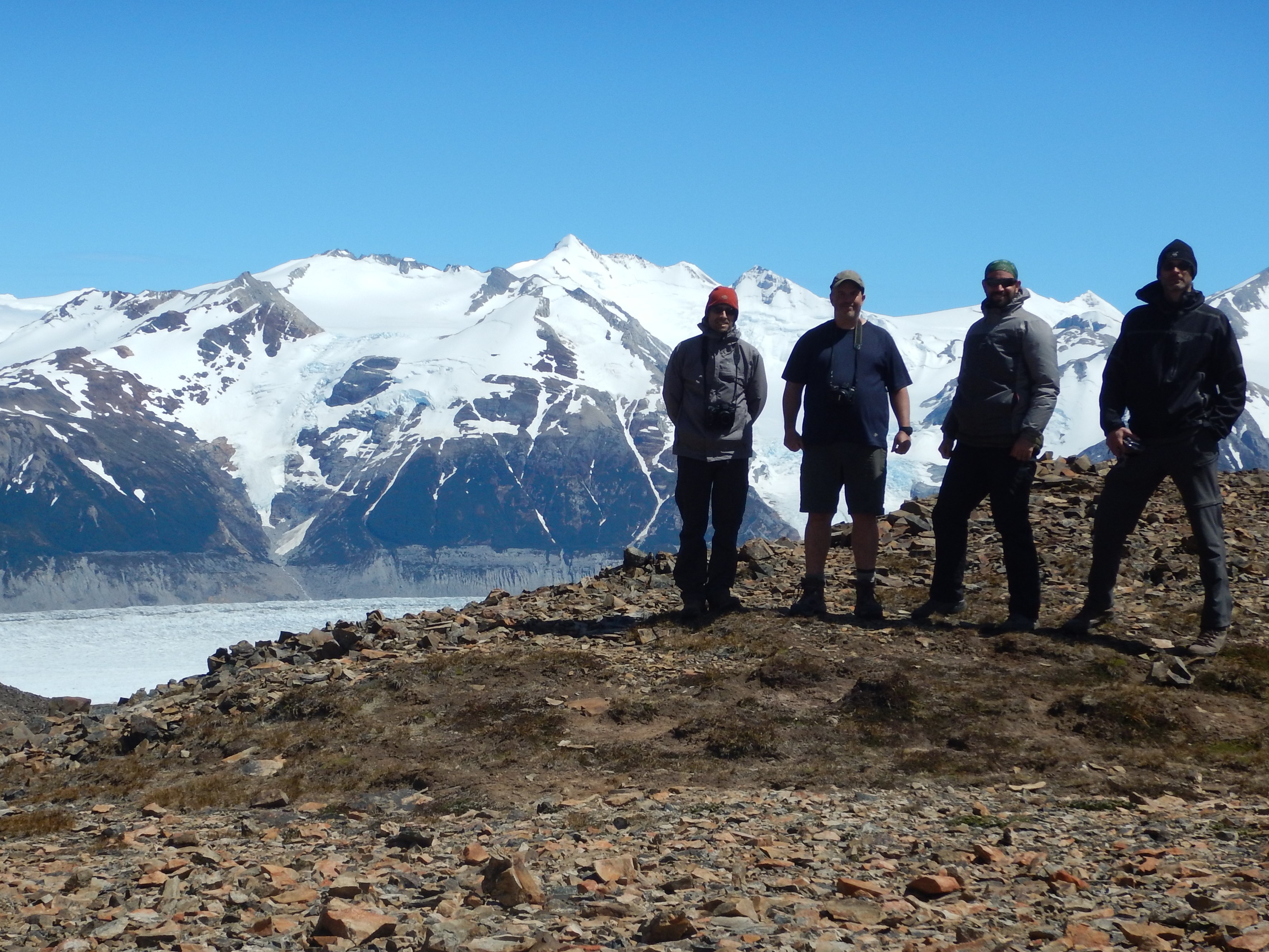
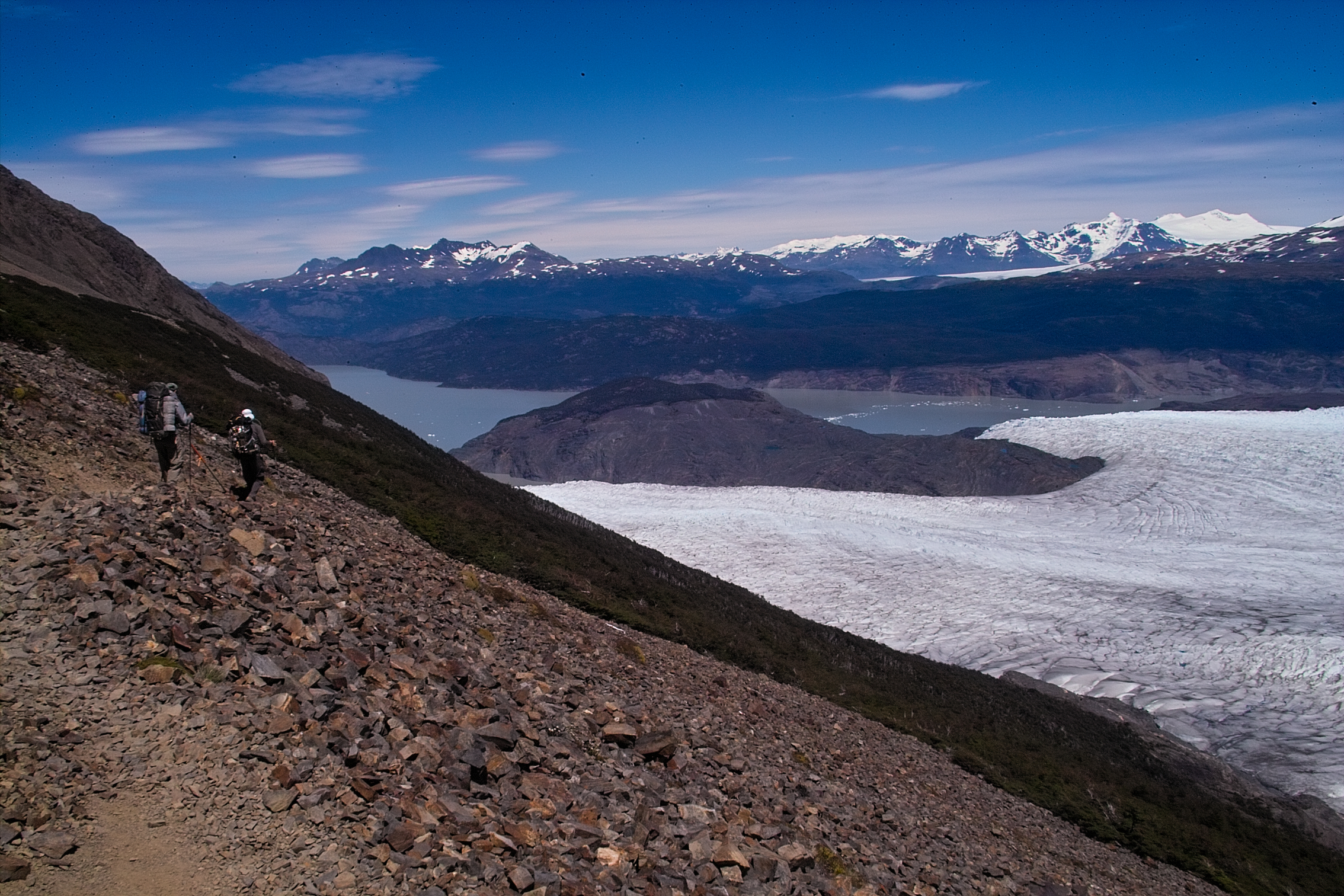 Let's go!
Wait!
We climbed about 2500 feet from Los Perros to get here.
This is our high point. Lets get some summit shots!
Let's go!
Wait!
We climbed about 2500 feet from Los Perros to get here.
This is our high point. Lets get some summit shots!

 It's weird seeing a glacier below the trees!
 The trail down was very steep, like something you would find in the Olympics.
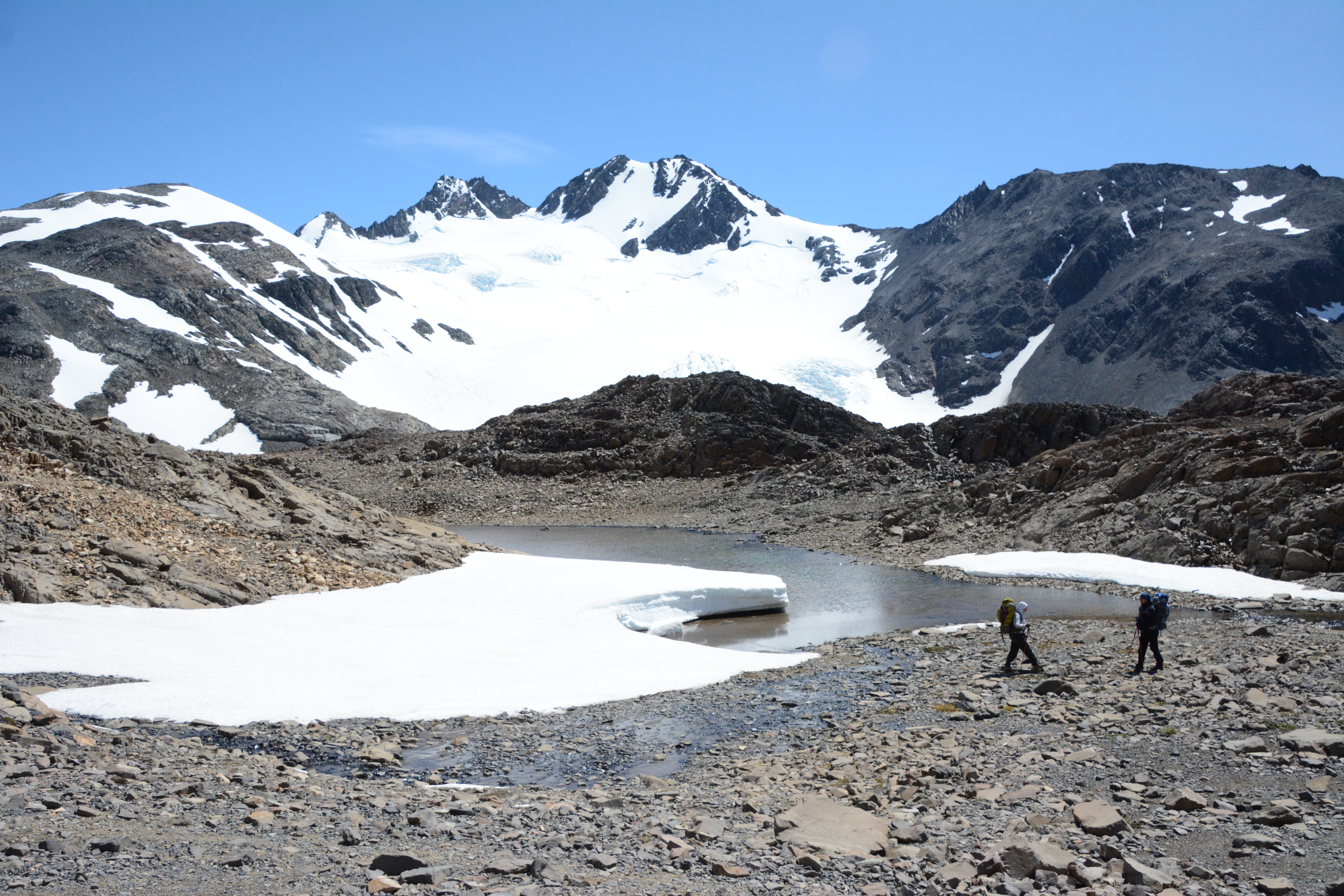
 Eventually we made it to Los Perros, a small campground perched on a ledge above the Grey Glacier.
Well, that was a hell of a day.
Tomorrow we'll stroll back down to the lowlands, all the way down to Paine Grande.
Eventually we made it to Los Perros, a small campground perched on a ledge above the Grey Glacier.
Well, that was a hell of a day.
Tomorrow we'll stroll back down to the lowlands, all the way down to Paine Grande.
Torres del Paine
Day 5
Paso to Paine Grande - 21 km
 The day was kind of dreary and cold. From what I understand, that's fairly pleasant for Patagonia.
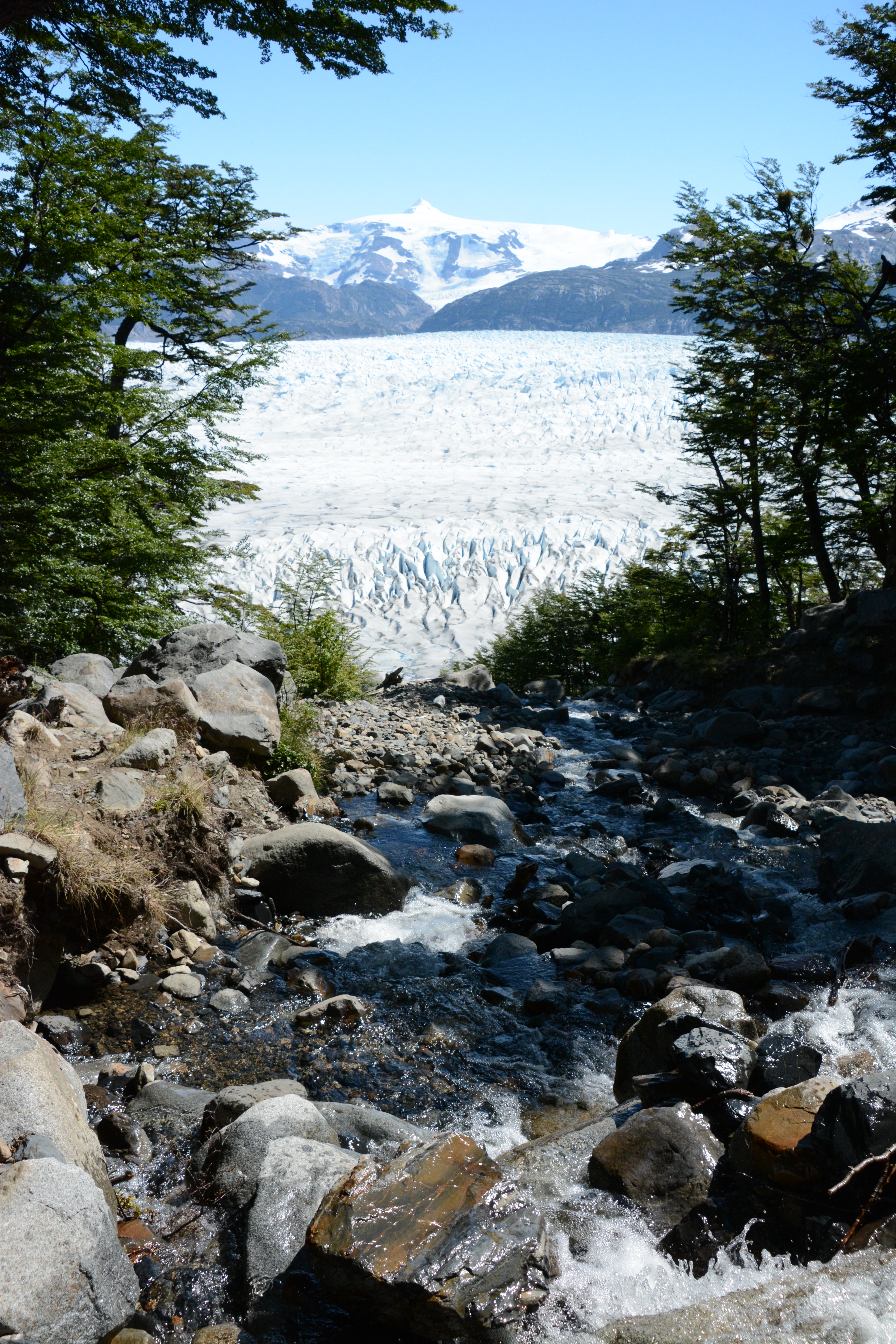
The plan for today: hike down the trail to near the terminus of the Grey Glacier, on Lago Grey.
There is a large campground, Refugio Grey, there. We'll get some lunch at Refugio Grey.
Then, its a long push to the far end of the lake, where we'll camp at Paine Grande.
This is going to be a long day, but don't worry, because the next day will be even longer!
The day was kind of dreary and cold. From what I understand, that's fairly pleasant for Patagonia.
The plan for today: hike down the trail to near the terminus of the Grey Glacier, on Lago Grey.
There is a large campground, Refugio Grey, there. We'll get some lunch at Refugio Grey.
Then, its a long push to the far end of the lake, where we'll camp at Paine Grande.
This is going to be a long day, but don't worry, because the next day will be even longer!
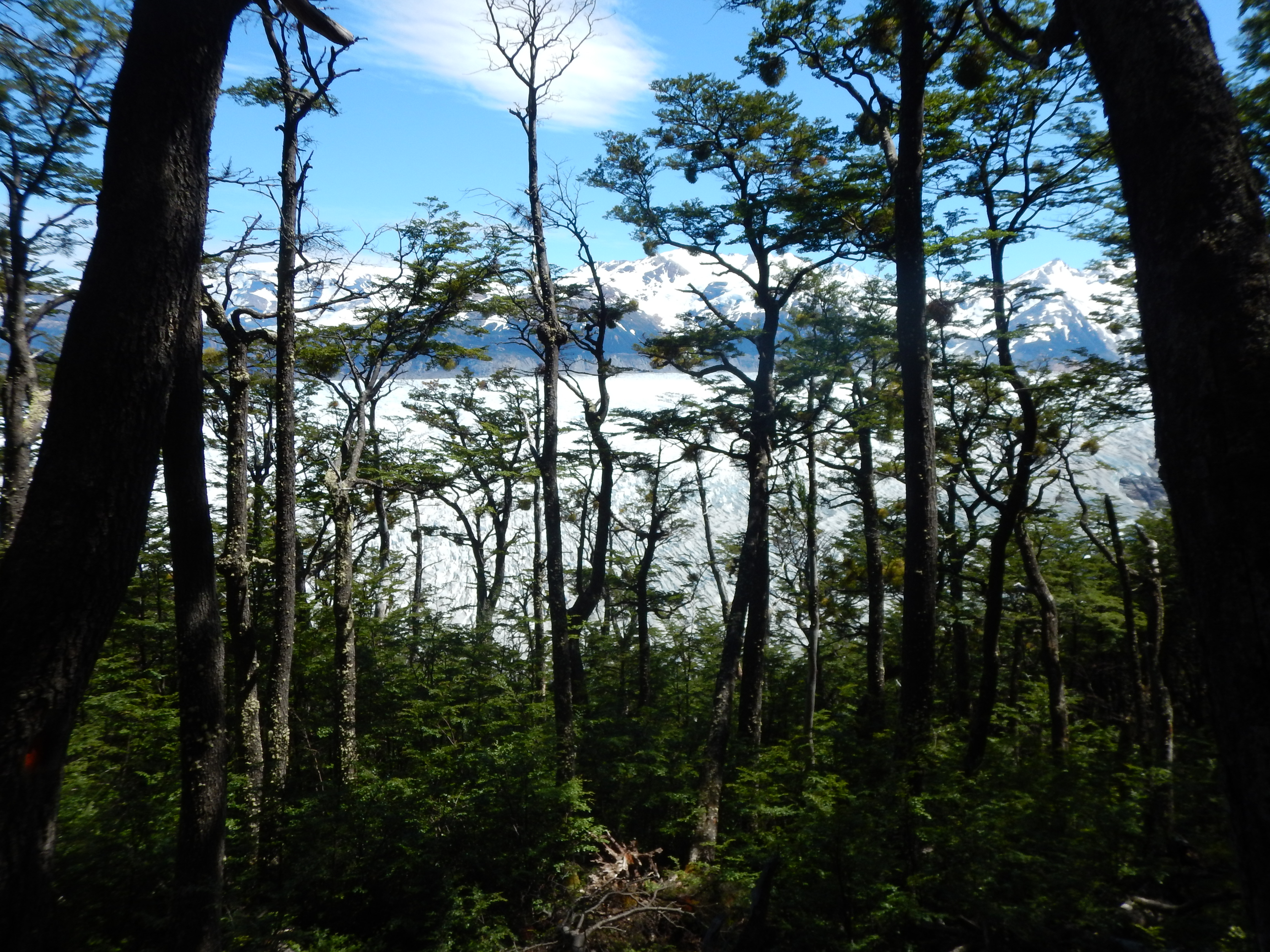
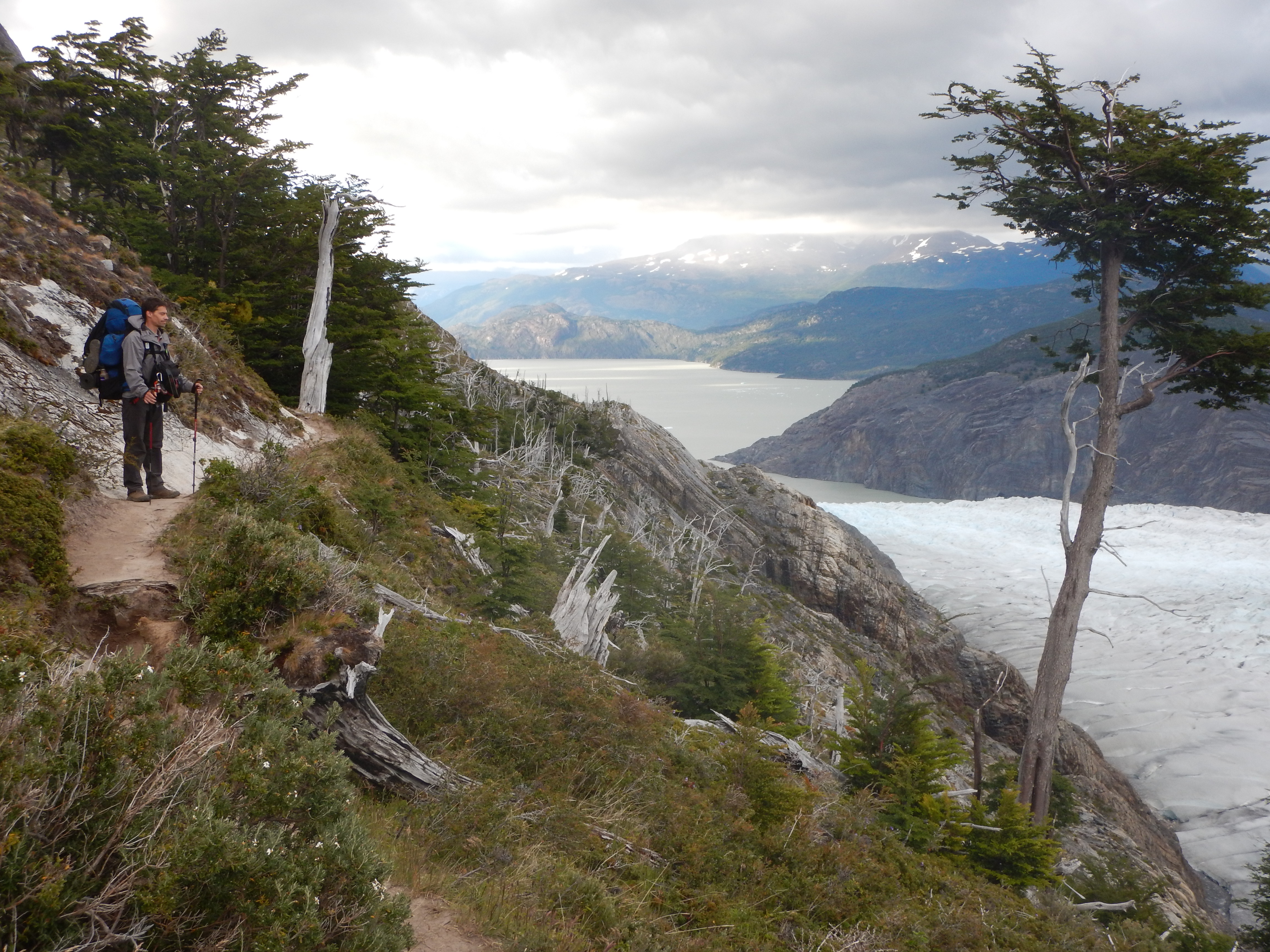
 The trail was quite rough, with lots of elevation gains and losses.
There was some light scrambling required across boulder-strewn channels.
The trail was quite rough, with lots of elevation gains and losses.
There was some light scrambling required across boulder-strewn channels.
 The view upslope.
 The view up the Grey Glacier toward the Southern Patagonian Ice Field.
 Finally, we were at the terminus, but still well above the lake.
 We could see the 'catamaran', a tour boat, bringing tourists over to the glacier for ice hiking.
Check out the folding in that rock!
We could see the 'catamaran', a tour boat, bringing tourists over to the glacier for ice hiking.
Check out the folding in that rock!
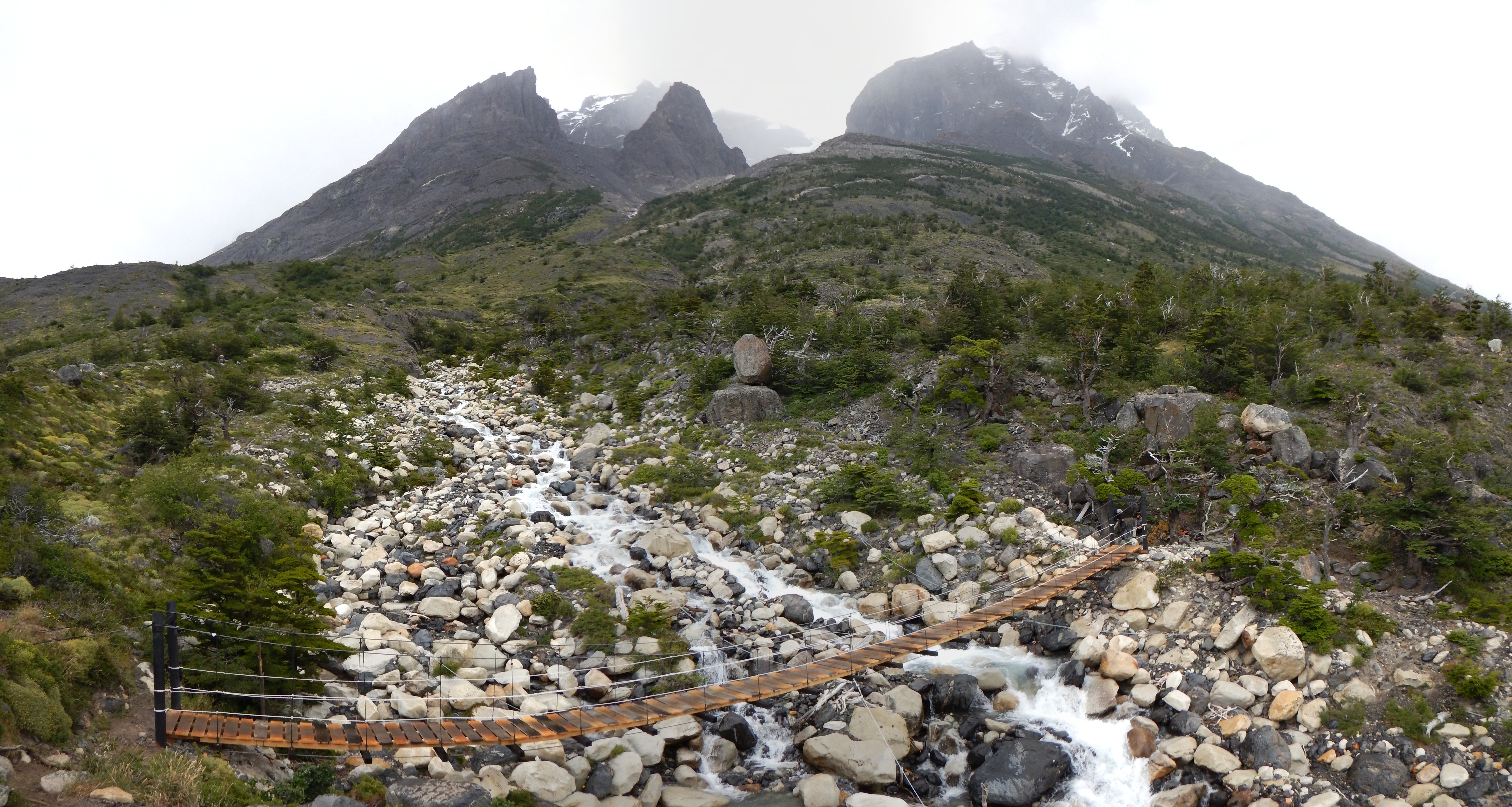
 There were two recently constructed suspension bridges.
It was pleasure to cross high over those rugged stream channels.
There were two recently constructed suspension bridges.
It was pleasure to cross high over those rugged stream channels.
 ...and maybe a little spooky.
 After the bridges, the trail evened out a little and dropped down to Refugio Grey.
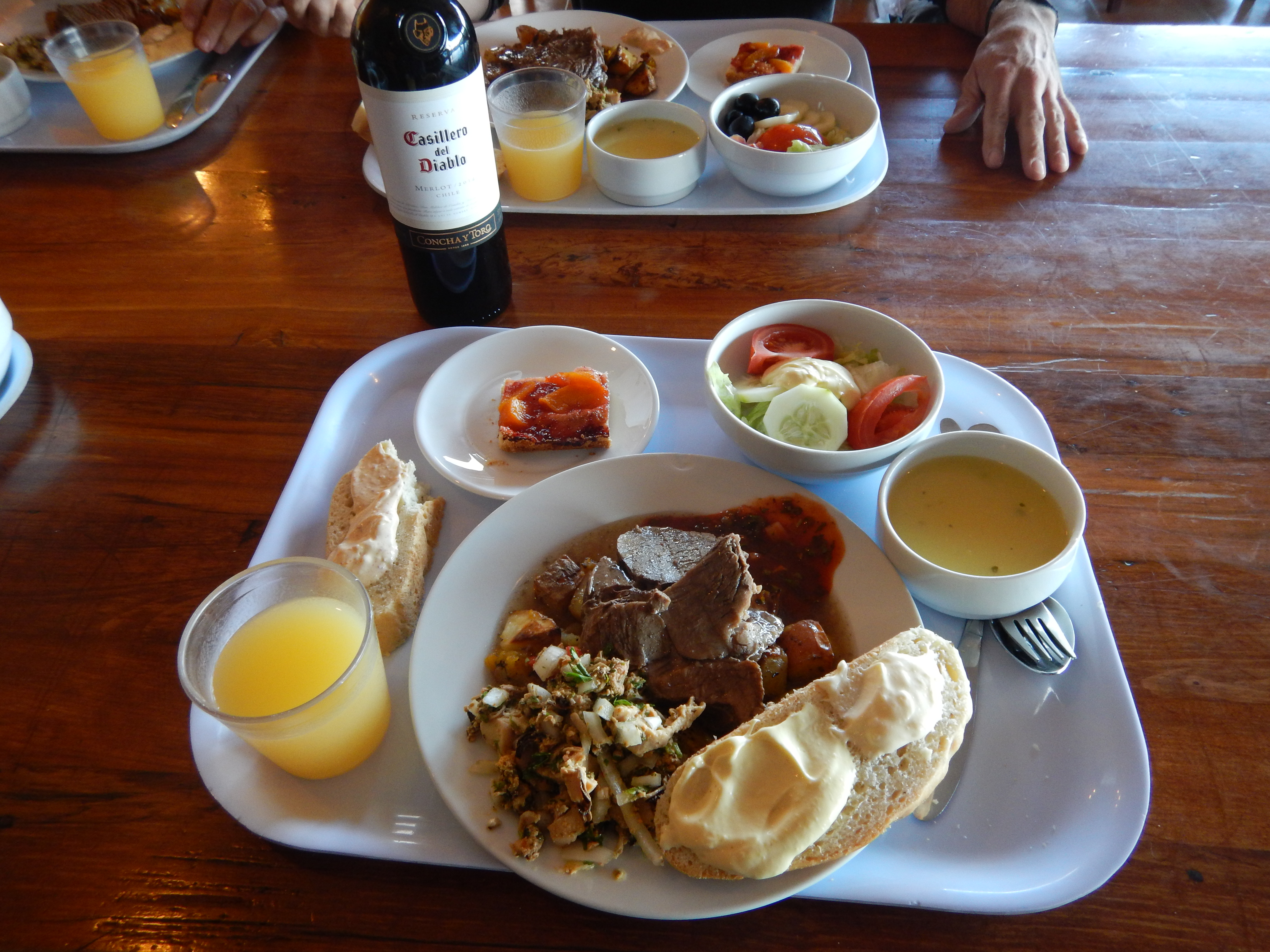
 ...where we got ourselves some beers and a hot lunch.
That felt good.
...where we got ourselves some beers and a hot lunch.
That felt good.
 As we were leaving to get back on the trail... bird photos.
 Some kinda chicken?
 Back on the trail.
The terminus of Glacier Grey (and the Southern Patagonian Ice Field) began to drop away behind us as the day went on.
Back on the trail.
The terminus of Glacier Grey (and the Southern Patagonian Ice Field) began to drop away behind us as the day went on.
 ...and on.
Video loading... Please be patient - or (more likely) its not working on your device


 As we hiked onward, we began to round the corner to the south side of the range.
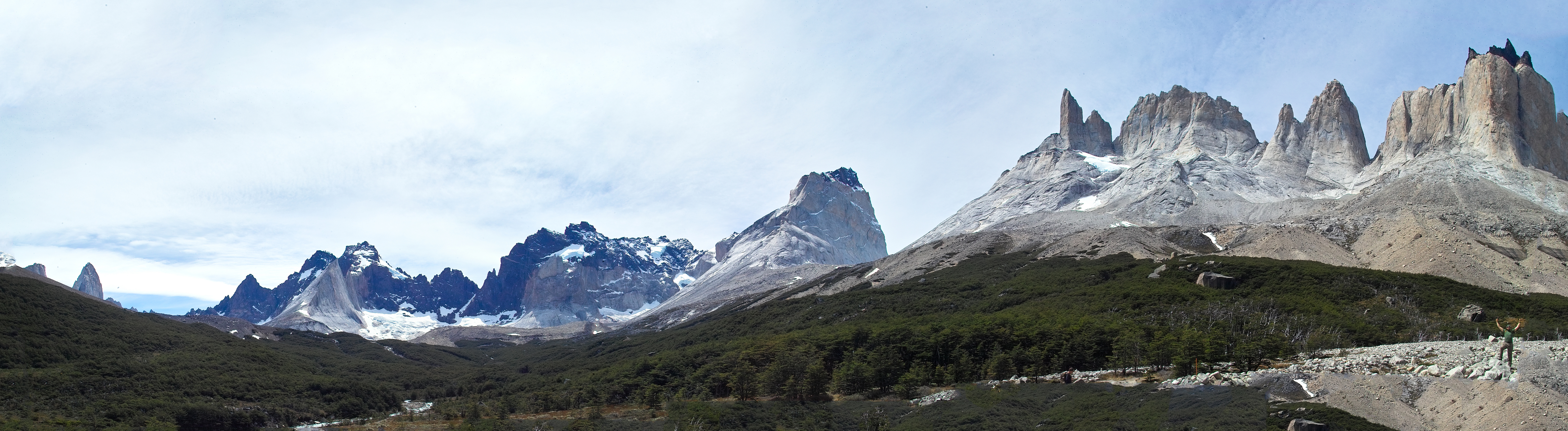
The south side is much more popular, largely due to the easy access to great views of the dramatic granite horns, the 'Torres'.
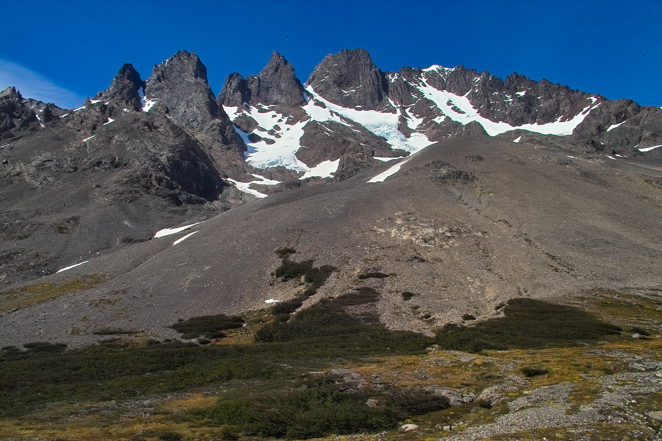
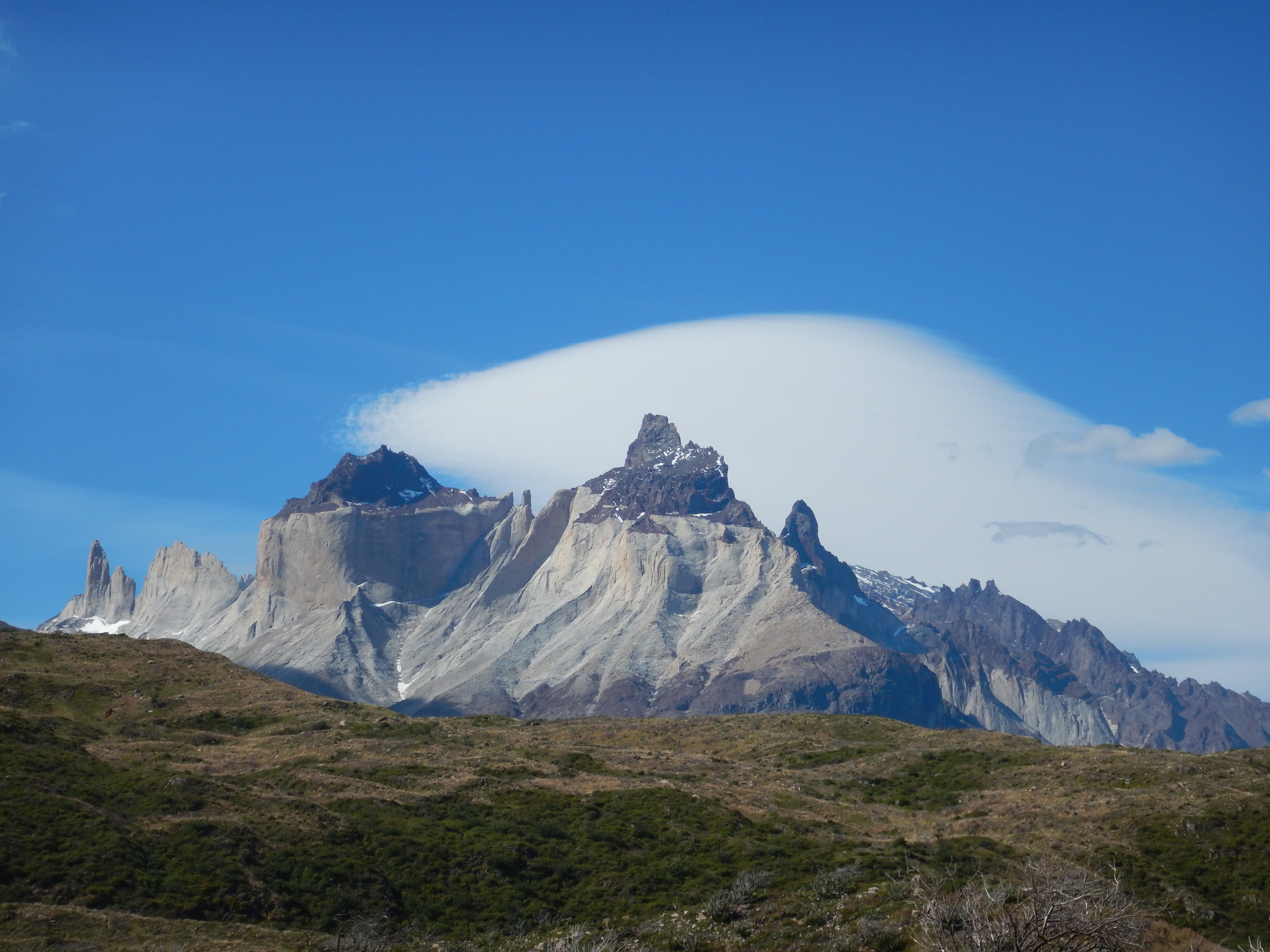
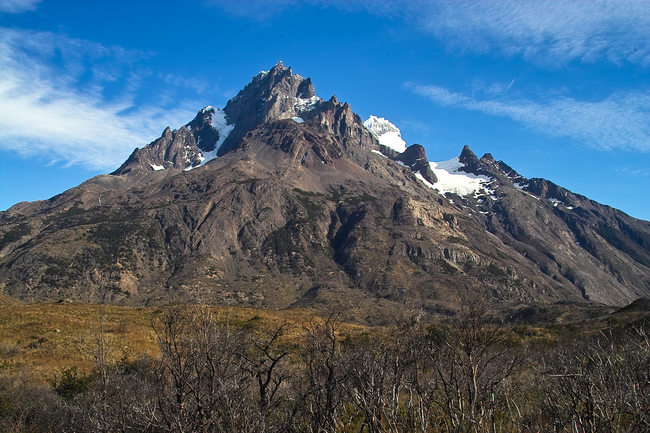
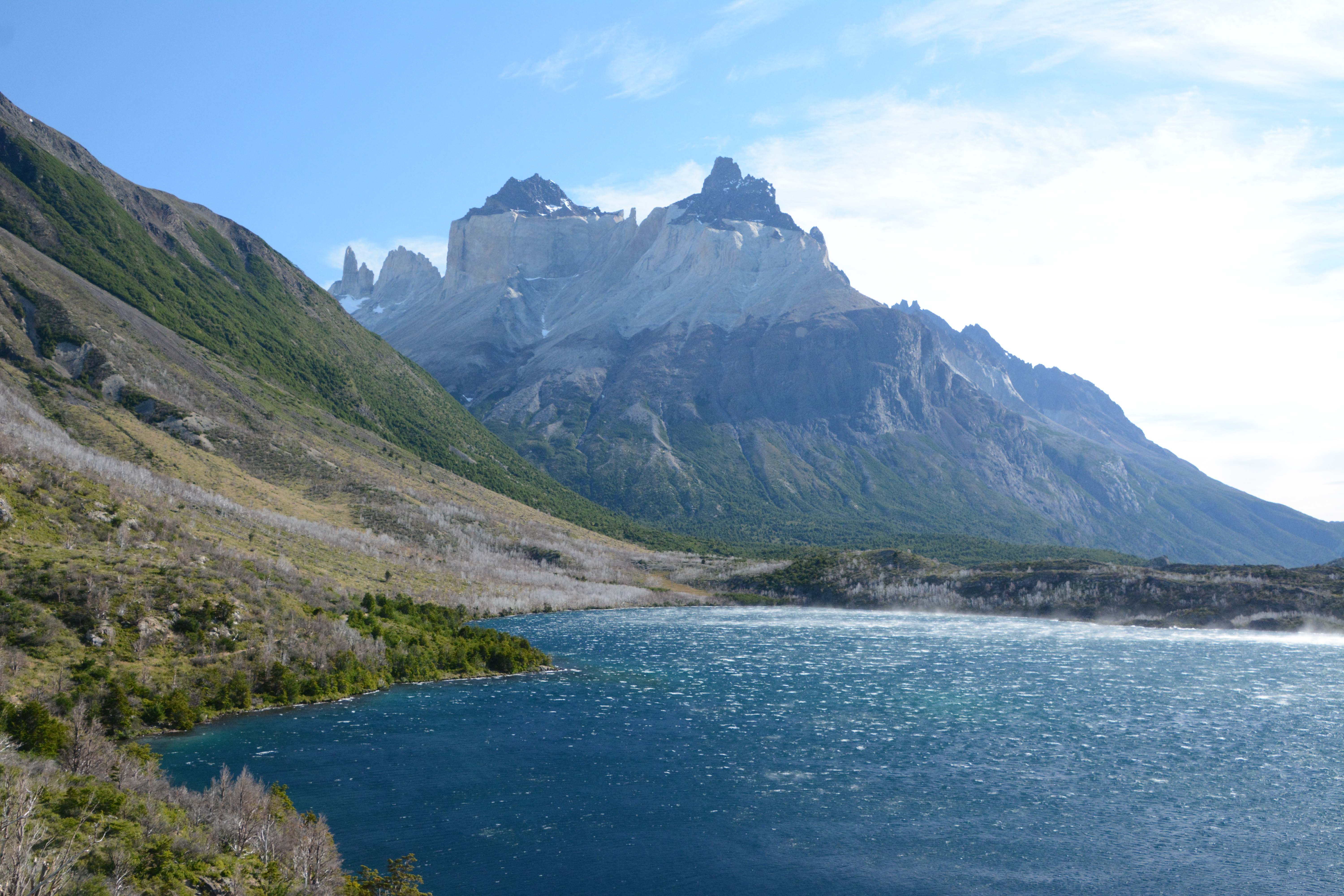
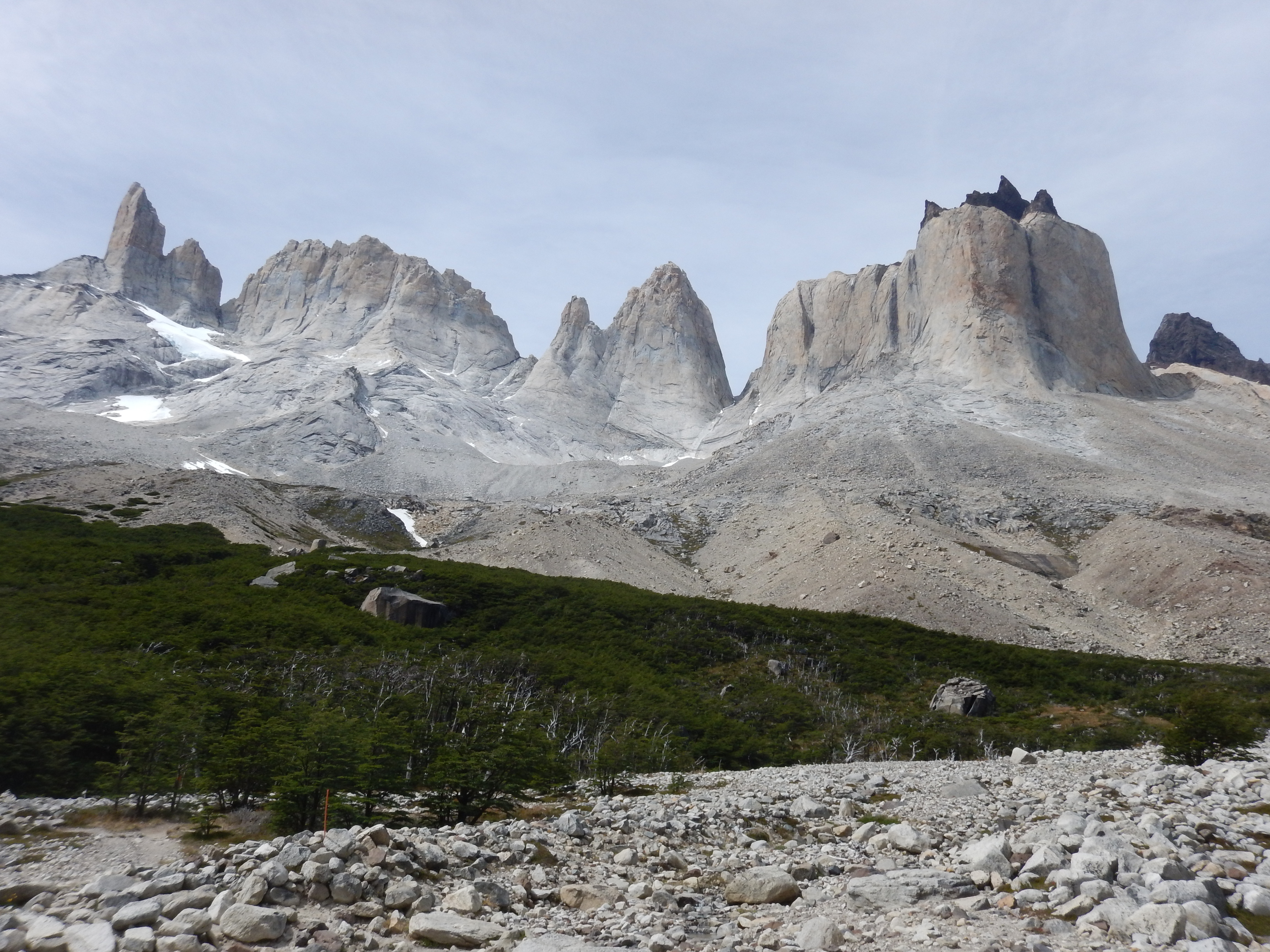
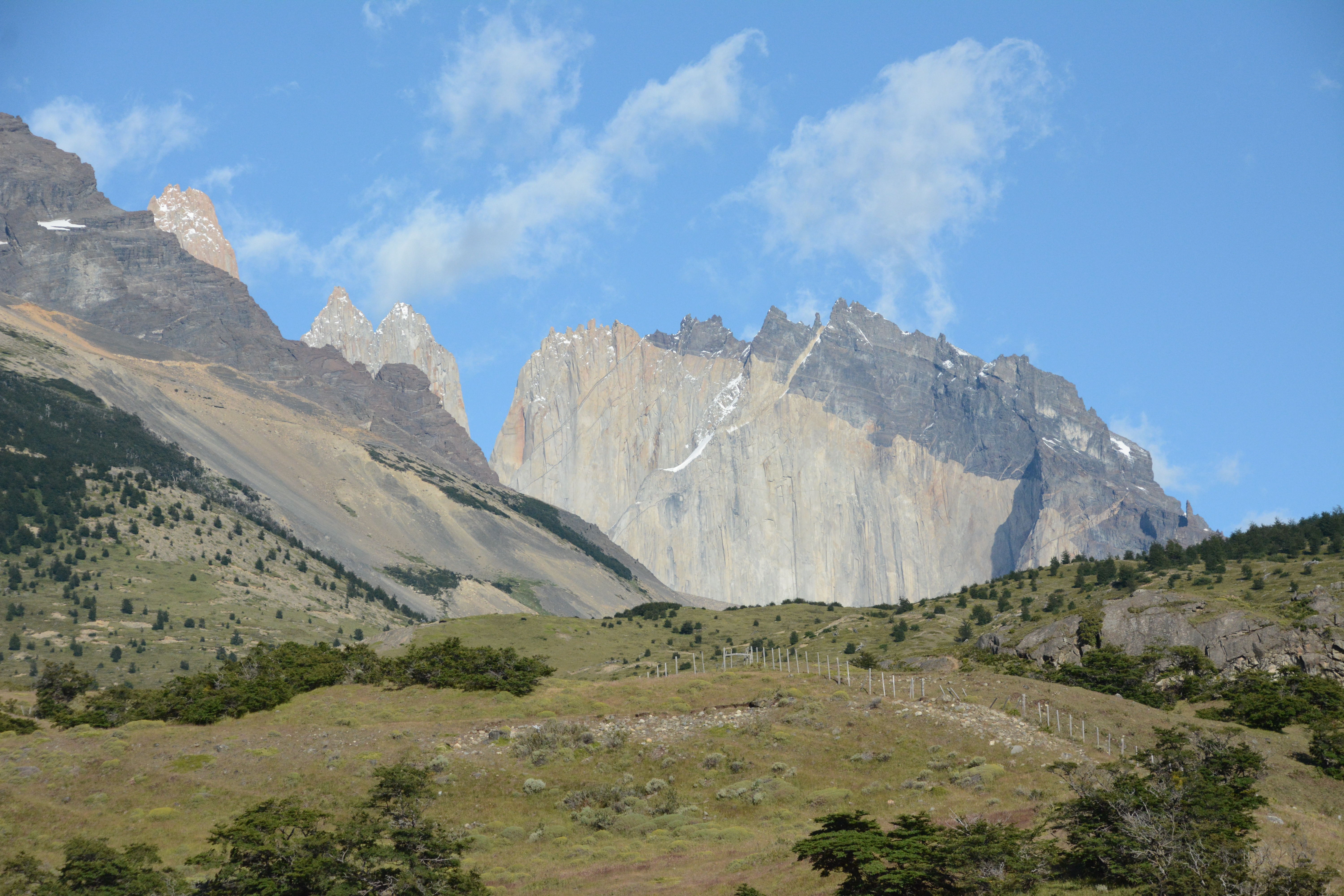
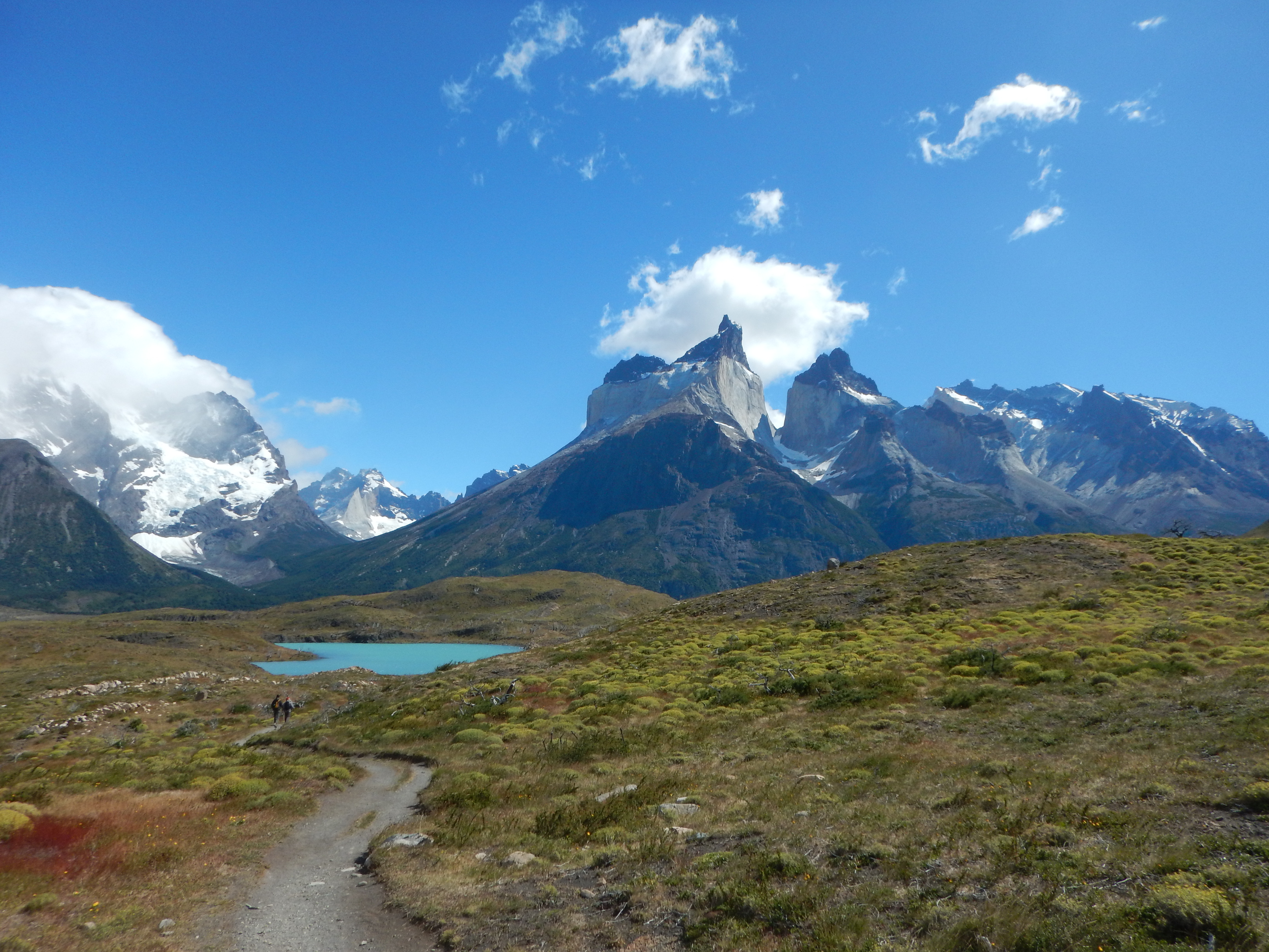
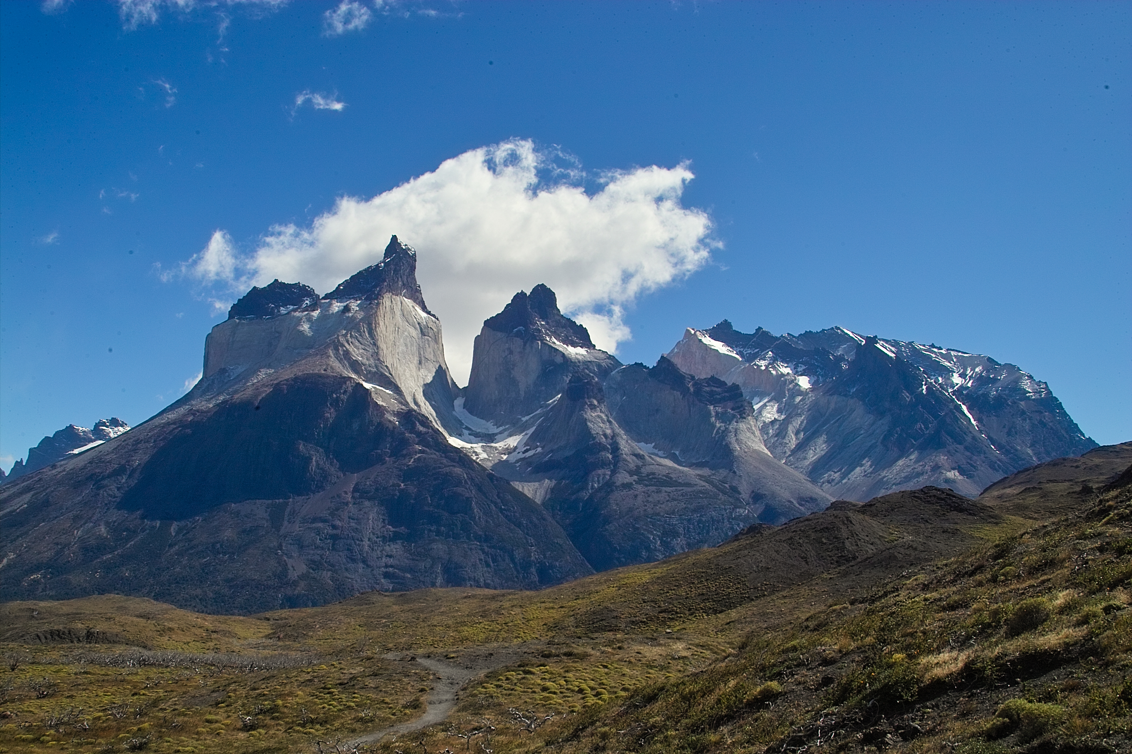
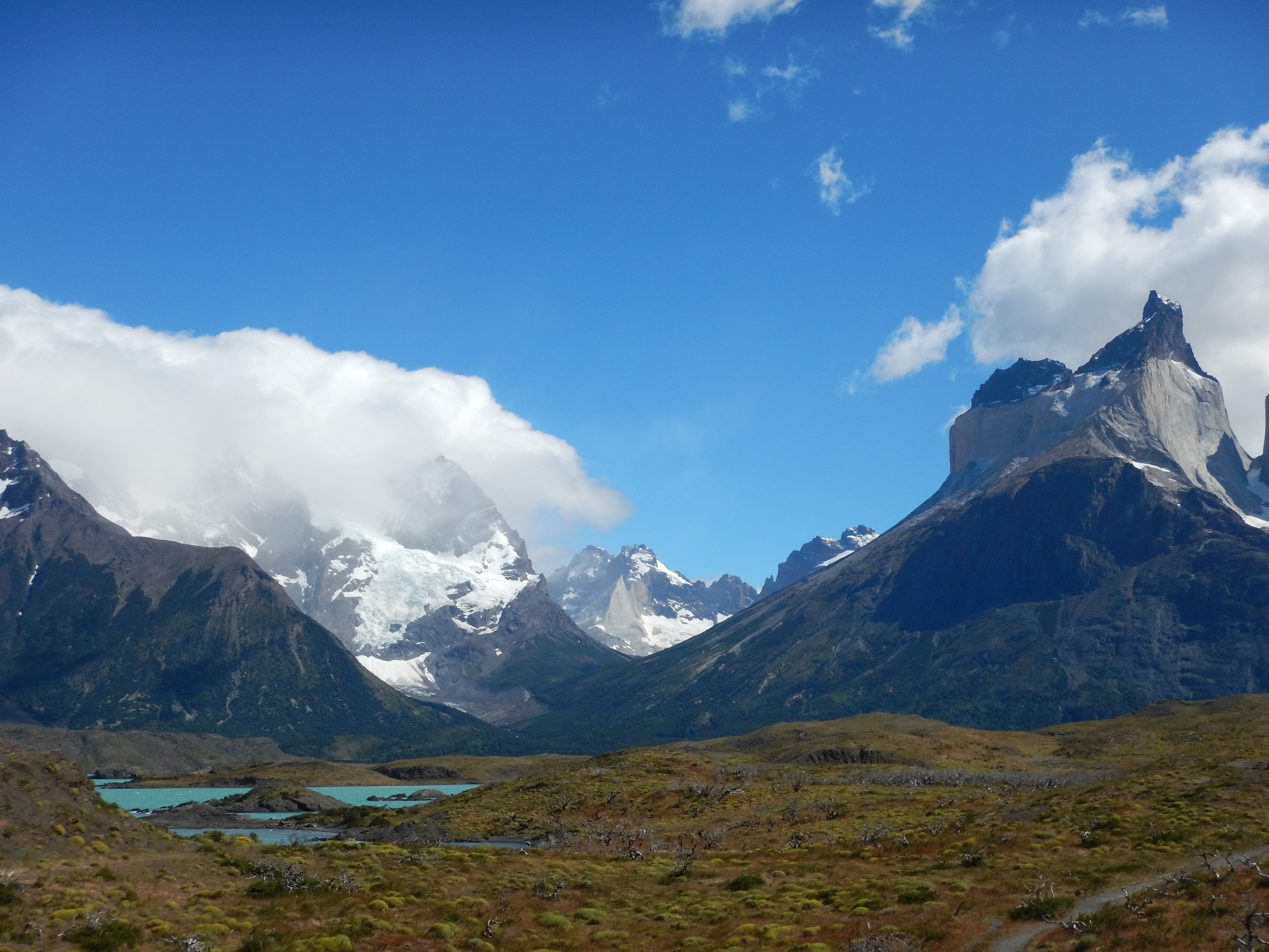
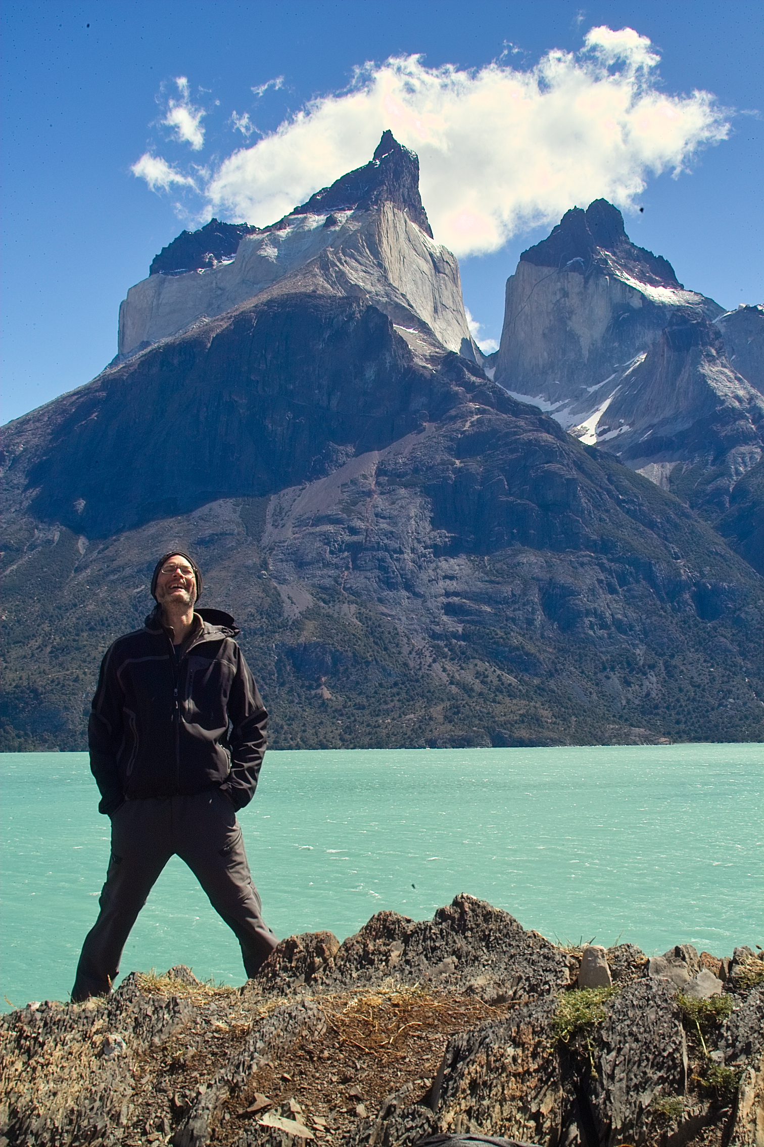
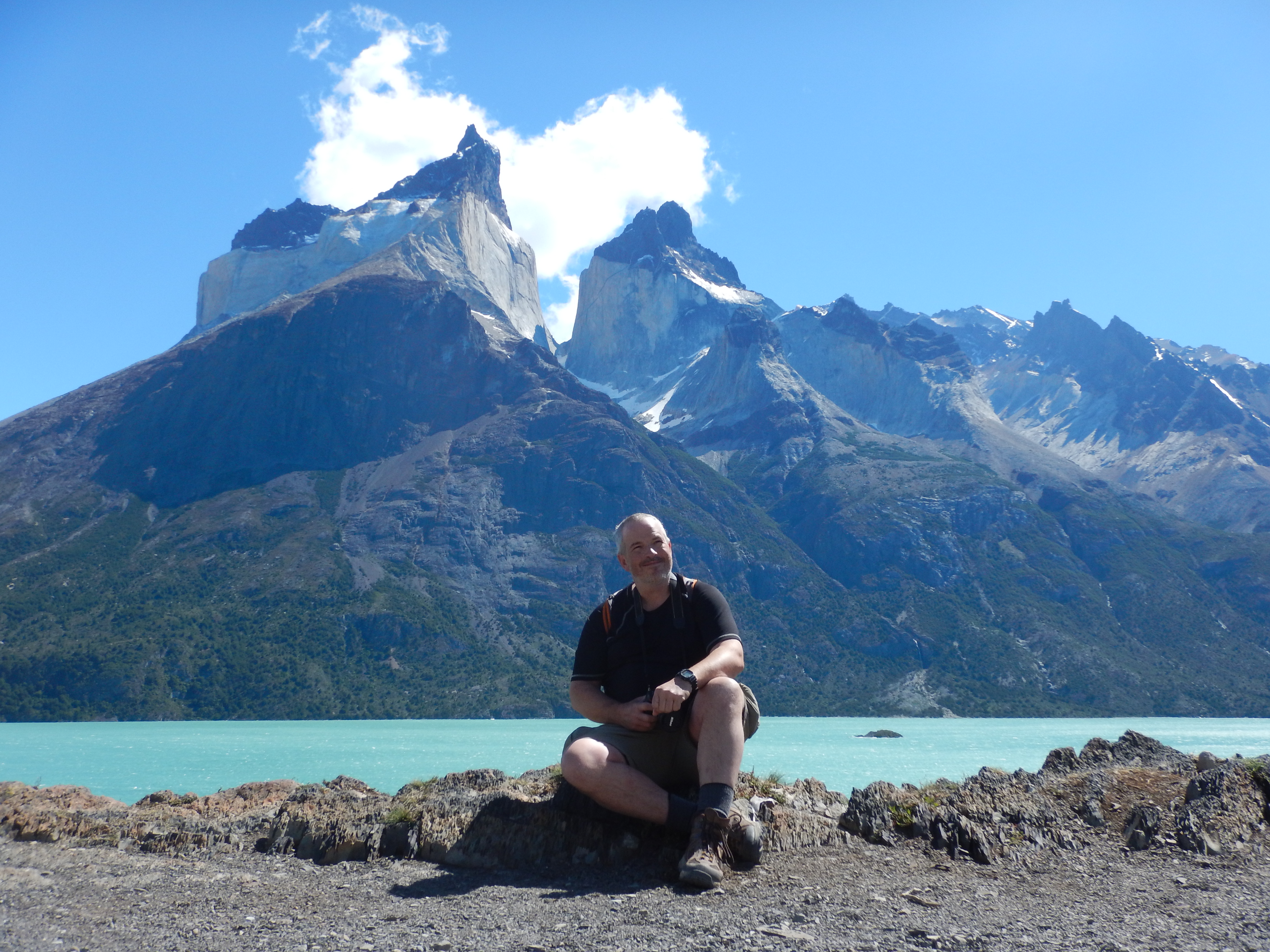
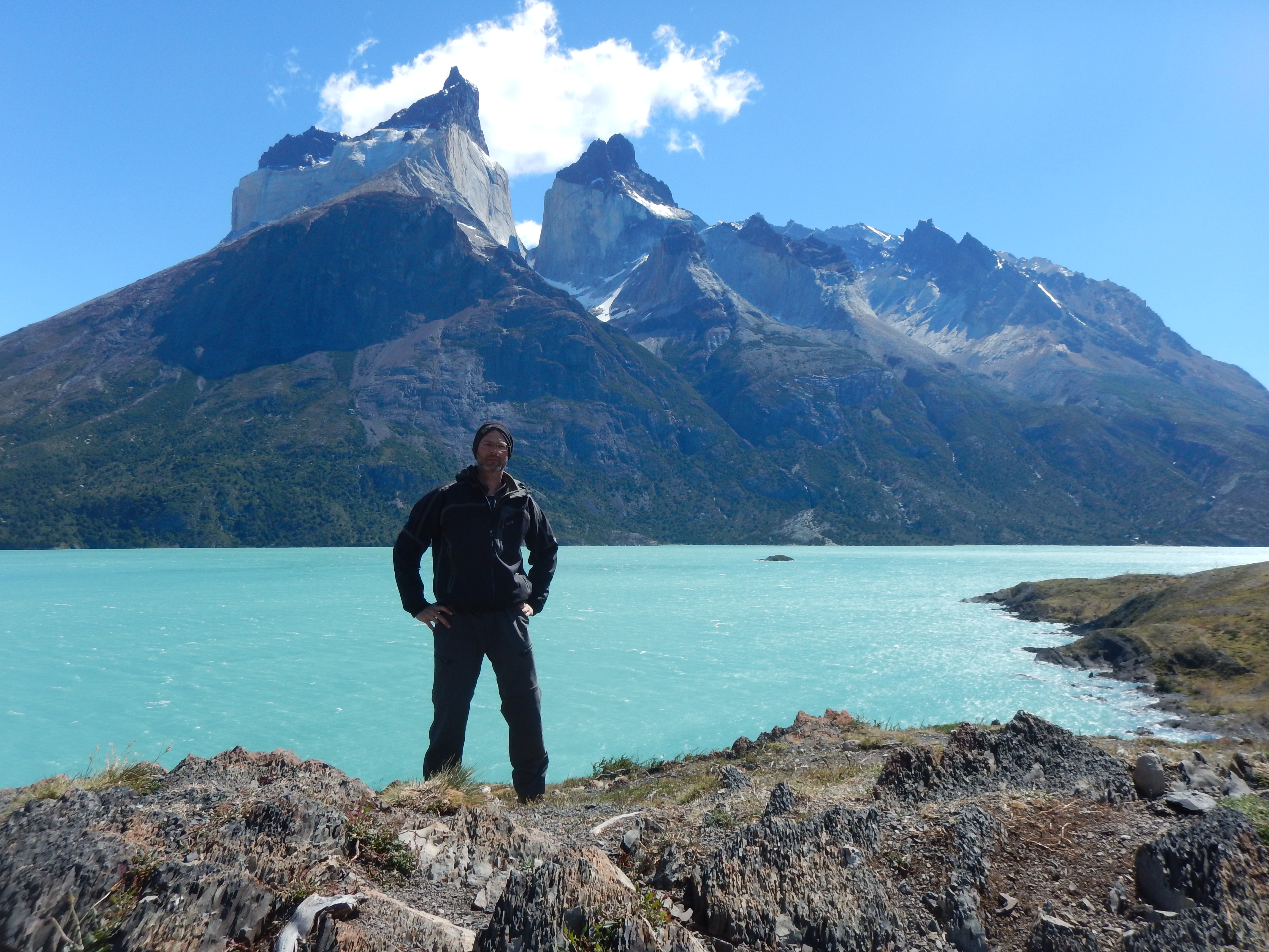
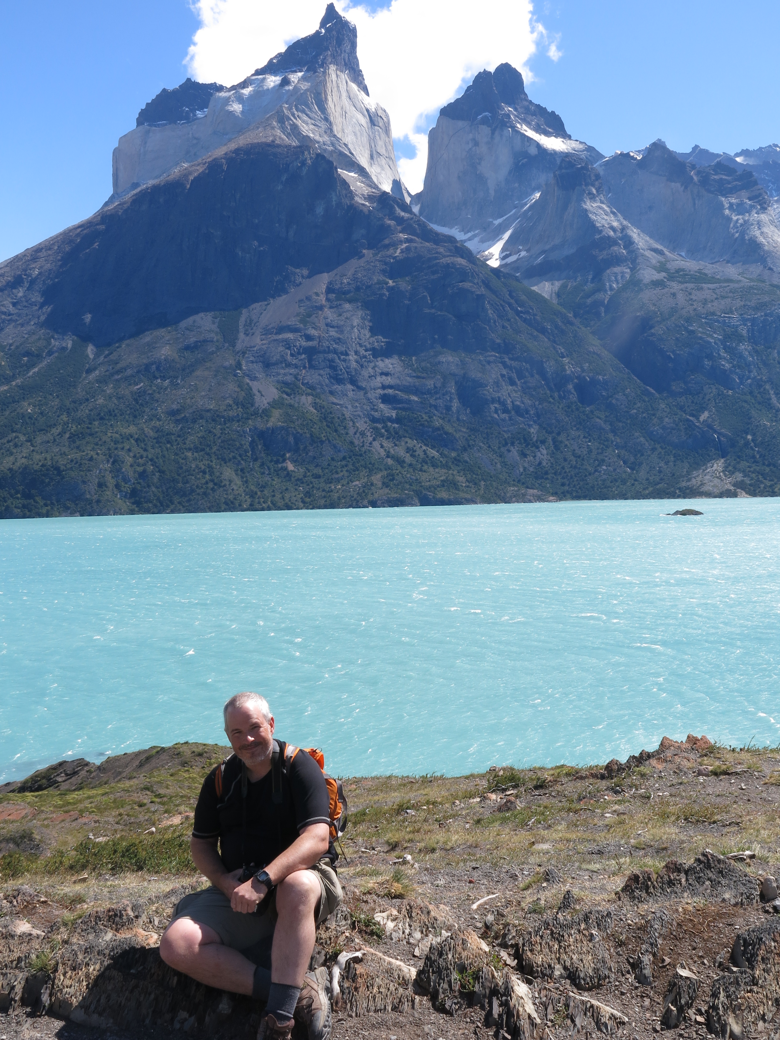
We got our first glimpses of the Torres. That's Cuernos del Paine.
As we hiked onward, we began to round the corner to the south side of the range.
The south side is much more popular, largely due to the easy access to great views of the dramatic granite horns, the 'Torres'.
We got our first glimpses of the Torres. That's Cuernos del Paine.
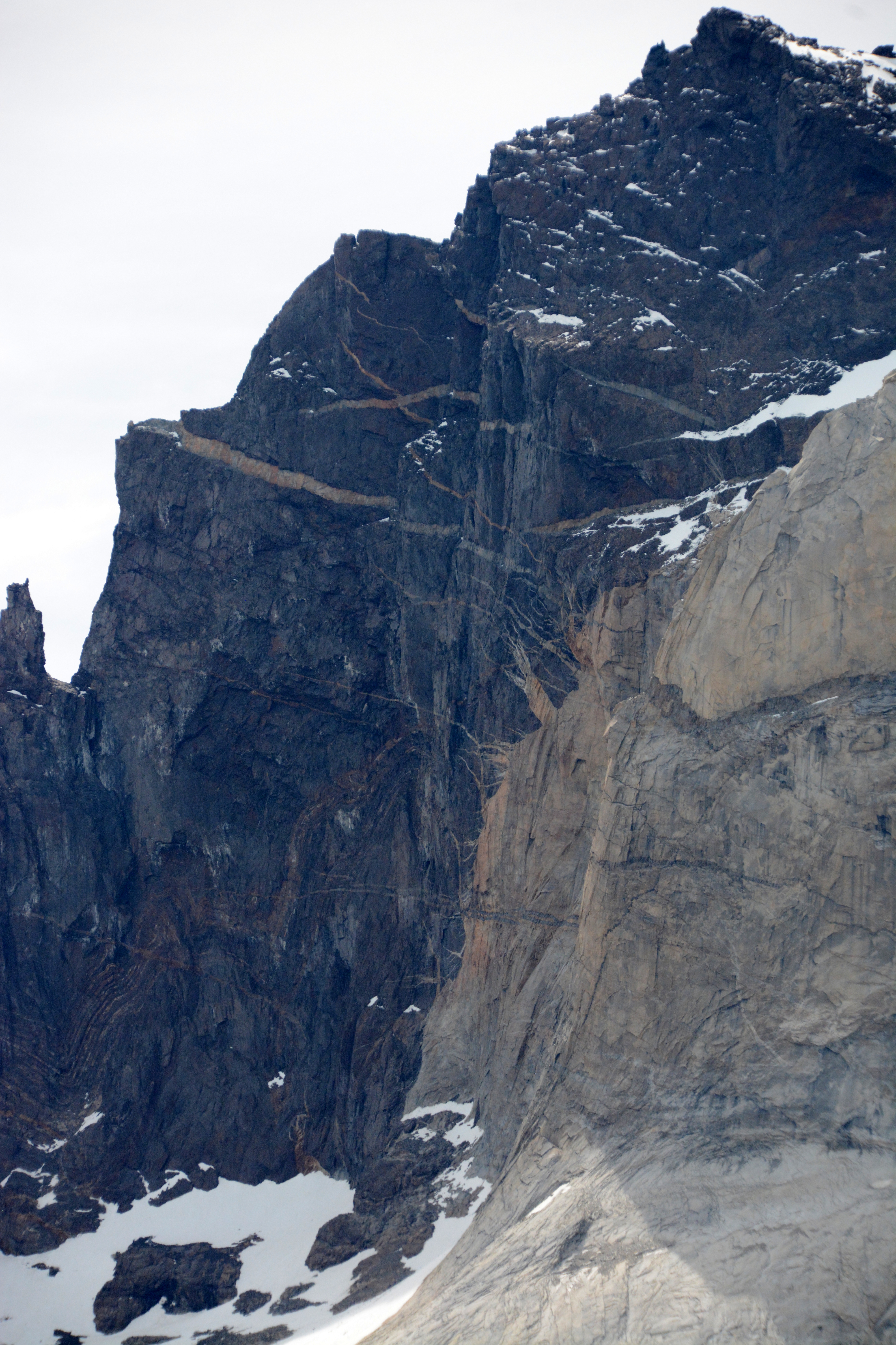
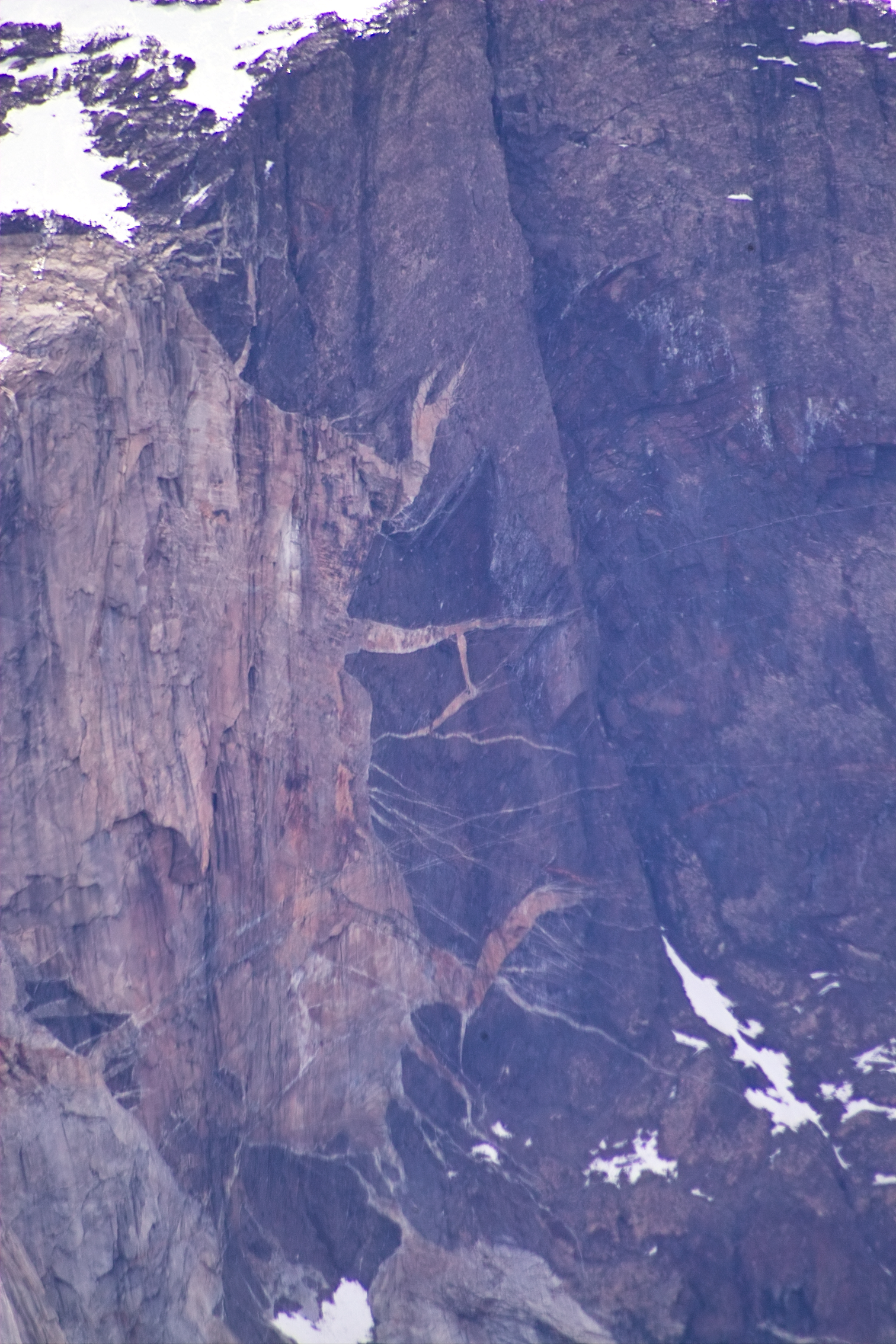
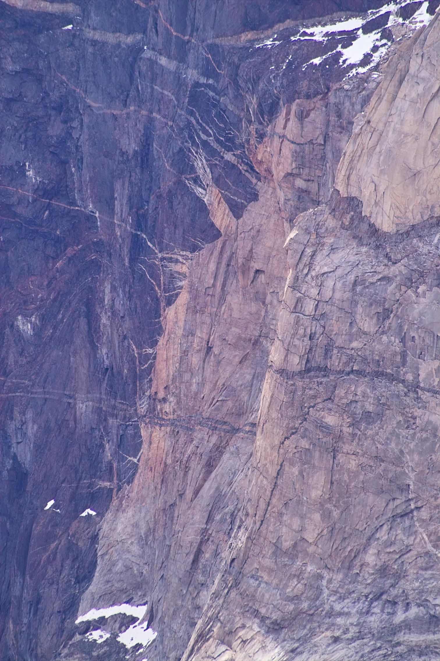
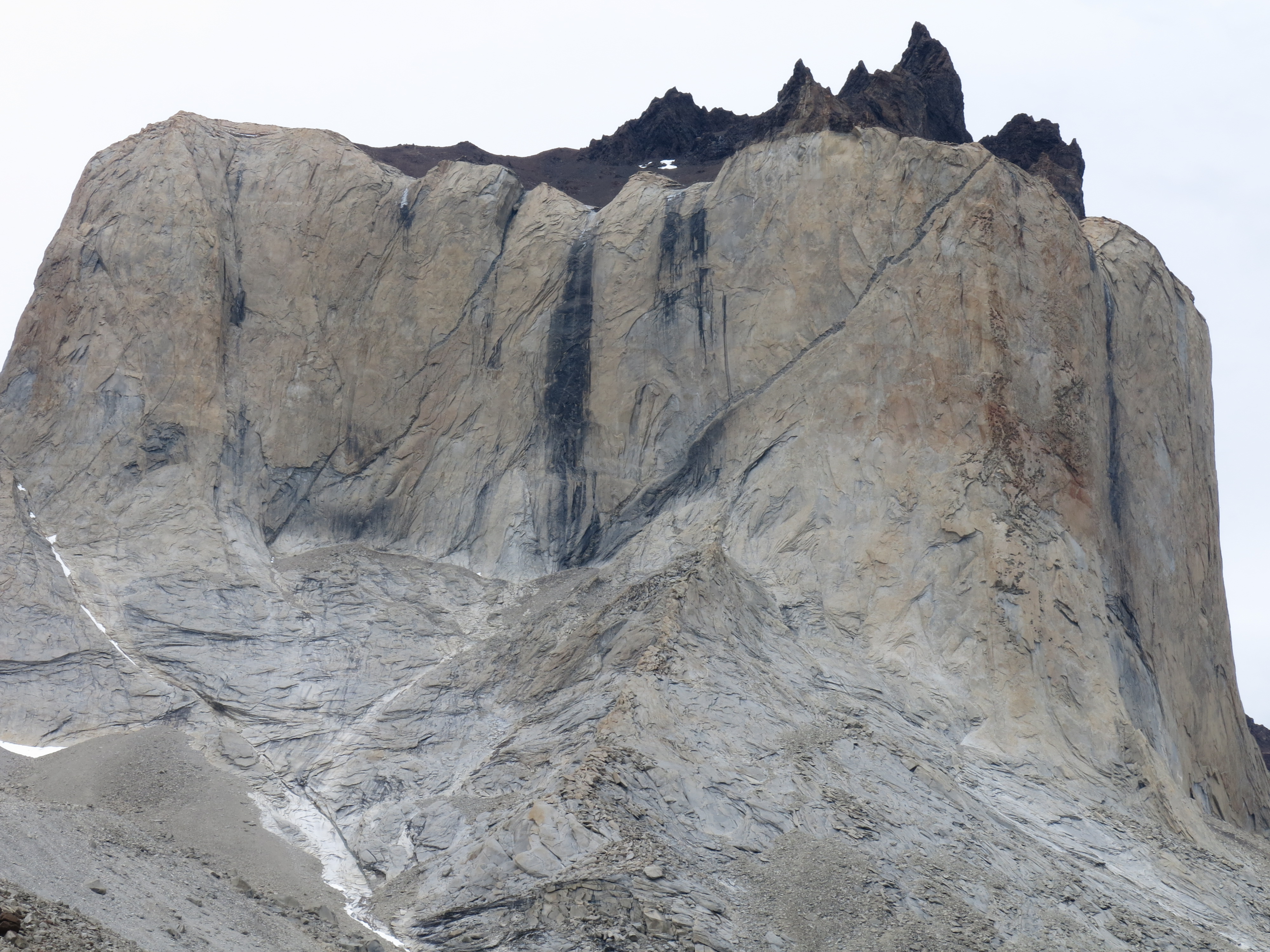
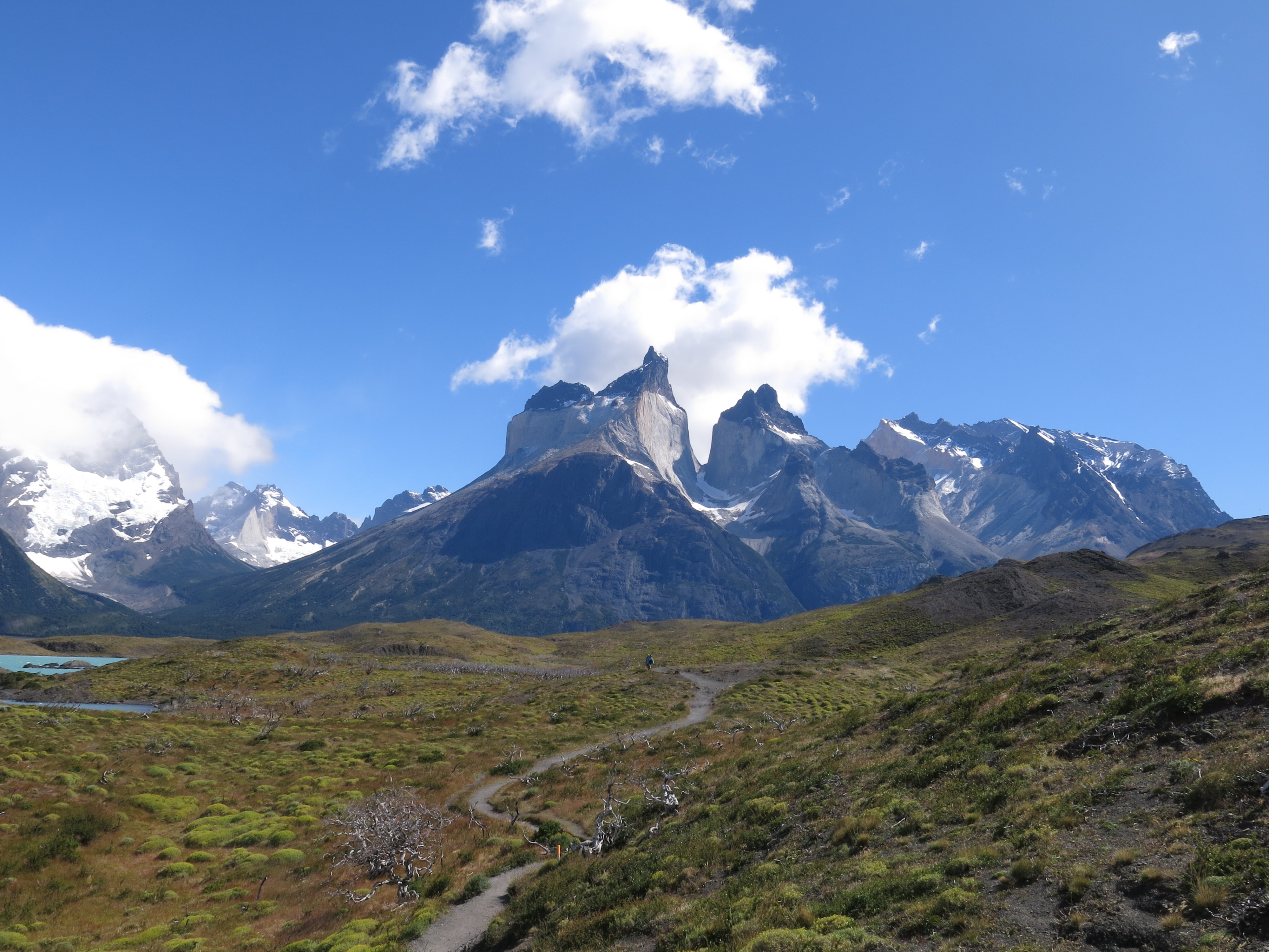
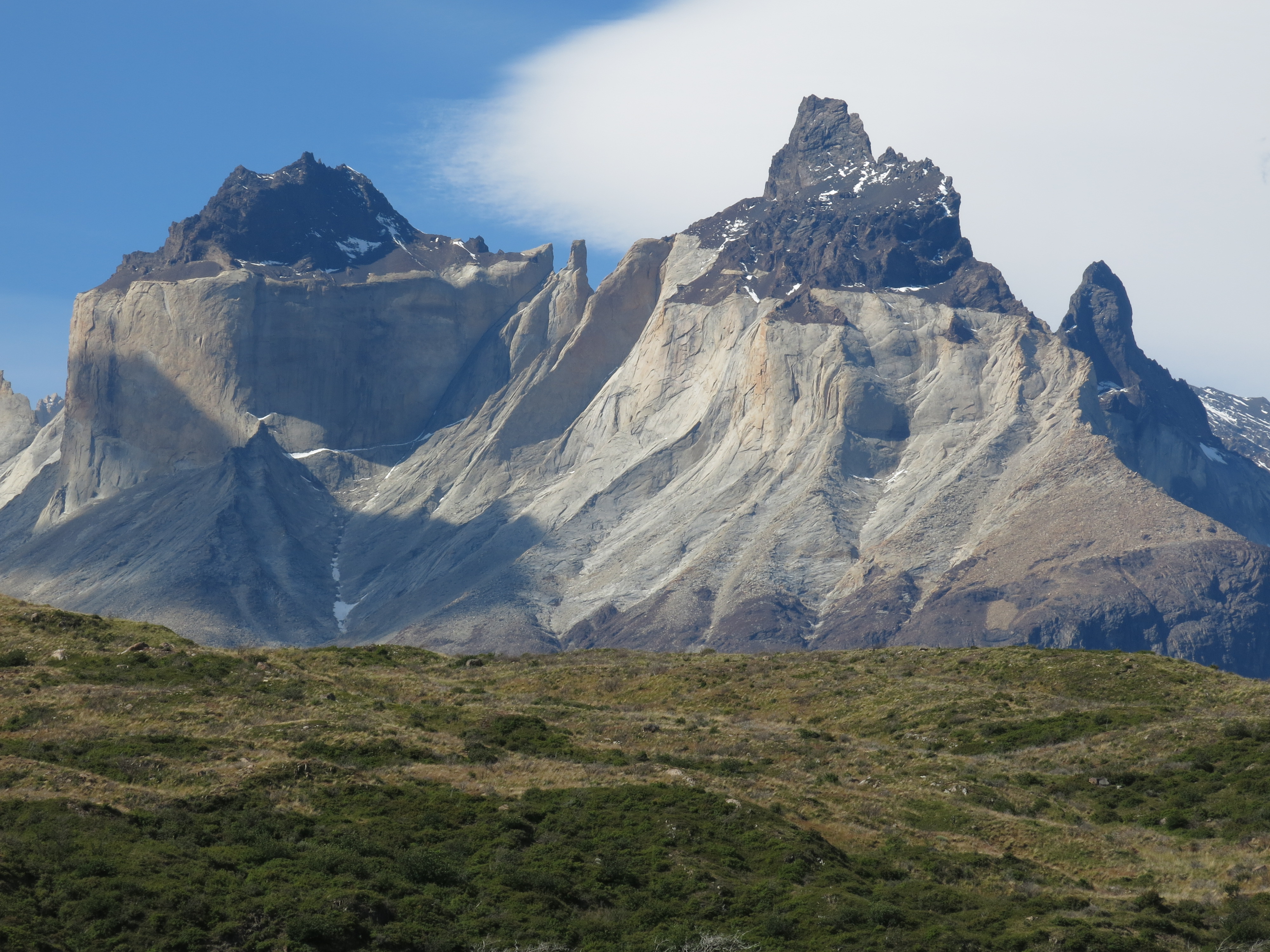 That white rock is granite (Miocene).
The granite intruded into the black marine sedimentary rock (Cretaceous) that is above and below the granite.
Glaciation (Pleistocene) carved the steep mountainsides.
Granite will stand up like that for millennia, forming soaring cliffs and dramatic mountainscapes.
That's one of the reasons we like granite.
That white rock is granite (Miocene).
The granite intruded into the black marine sedimentary rock (Cretaceous) that is above and below the granite.
Glaciation (Pleistocene) carved the steep mountainsides.
Granite will stand up like that for millennia, forming soaring cliffs and dramatic mountainscapes.
That's one of the reasons we like granite.
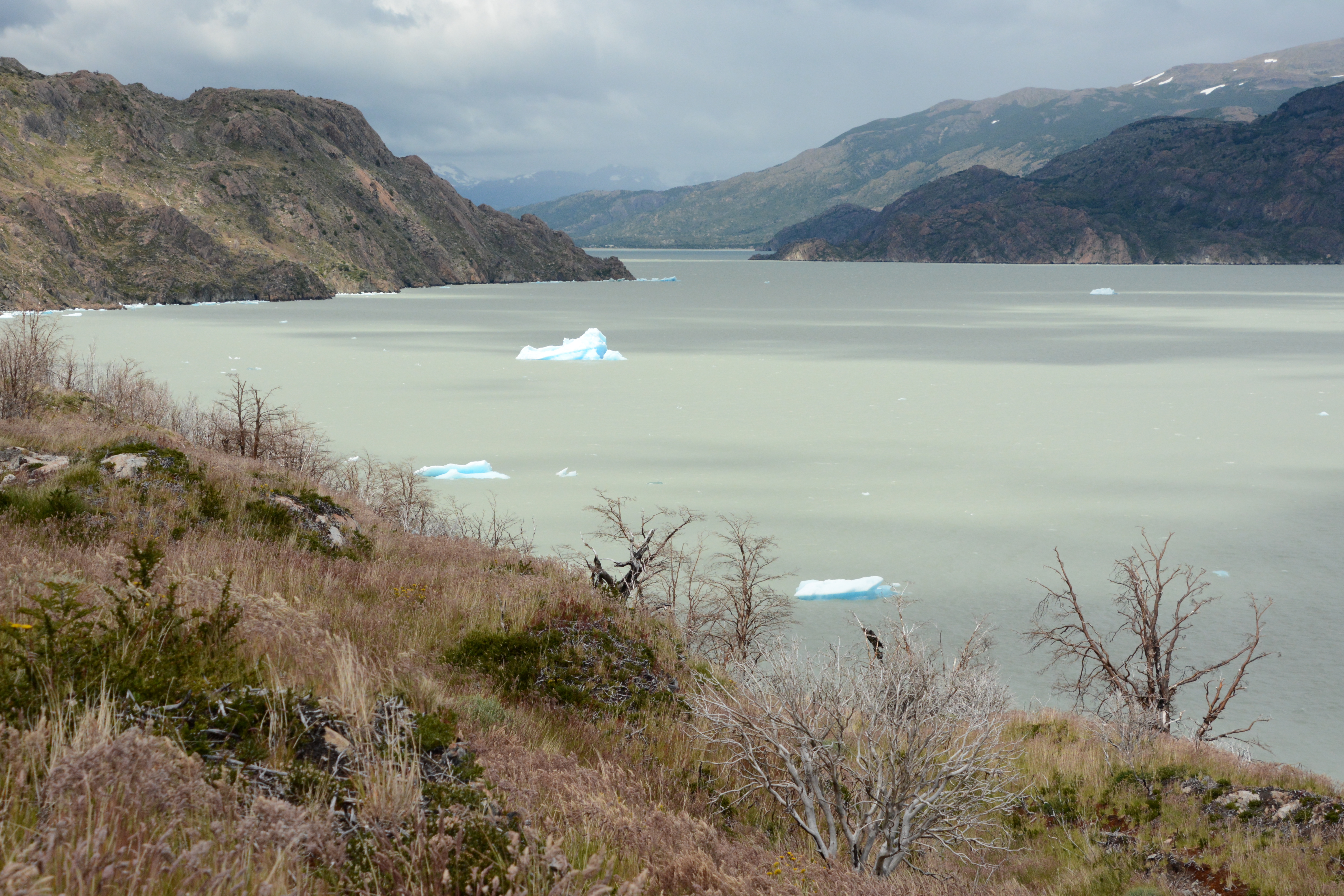 The icebergs on the lake indicated that swimming, if attempted, would be fairly brisk.
 Finally, as the afternoon was beginning to feel like evening, and our feet were beginning to feel like numbed stumps,
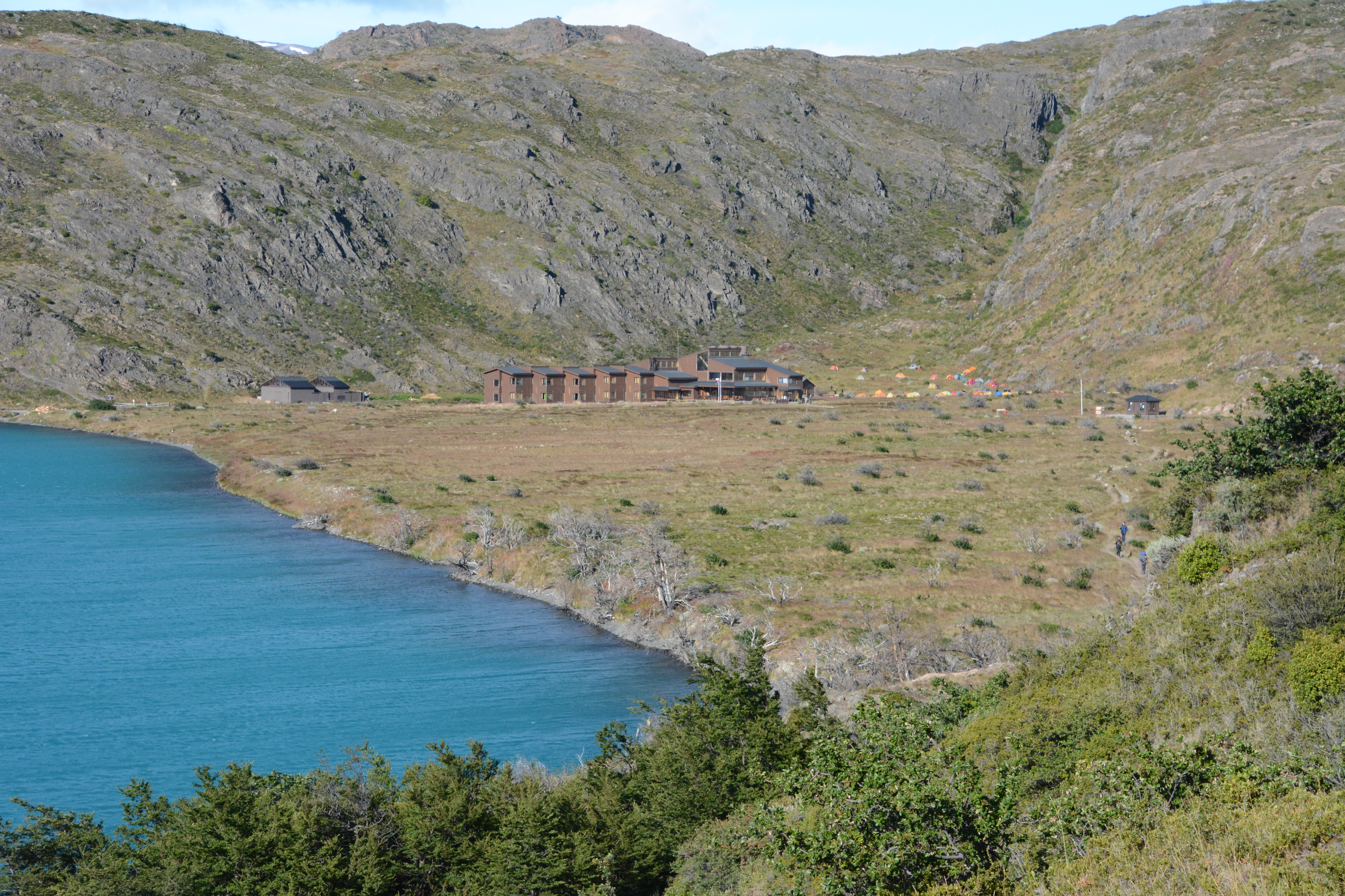
Paine Grande, another one of the park's larger establishments, came into view.
Finally, as the afternoon was beginning to feel like evening, and our feet were beginning to feel like numbed stumps,
Paine Grande, another one of the park's larger establishments, came into view.
 This place is known locally as the 'tent graveyard'. The wind was whipping through there, fiercely.
Tents were buckling and flapping around. We saw at least one tent meet its end in the Patagonian wind.
This place is known locally as the 'tent graveyard'. The wind was whipping through there, fiercely.
Tents were buckling and flapping around. We saw at least one tent meet its end in the Patagonian wind.

 Two meals (that I don't boil in a bag) in one day?
Aw yeah.
Now, so long as our tent doesn't blow away, we can crash out and get some rest for tomorrow.
Tomorrow is going to be another long day. See that beautiful granite up there?
Yeah, that's where we're going. The Valle Frances!
Two meals (that I don't boil in a bag) in one day?
Aw yeah.
Now, so long as our tent doesn't blow away, we can crash out and get some rest for tomorrow.
Tomorrow is going to be another long day. See that beautiful granite up there?
Yeah, that's where we're going. The Valle Frances!
Torres del Paine
Day 6
Paine Grande to Frances - 21 km
 We woke up to a beautiful sunny day! Wow! What fortune!
This was our day to hike up the Valle Frances and see the Torres up close.
The blue sky was a welcome sight.
We woke up to a beautiful sunny day! Wow! What fortune!
This was our day to hike up the Valle Frances and see the Torres up close.
The blue sky was a welcome sight.
 We hit the trail.
Those mountains are Punta Bariloche (left) and Cuernos del Paine (right).
We hit the trail.
Those mountains are Punta Bariloche (left) and Cuernos del Paine (right).
 We hiked along Lago Skottsberg for a few miles toward Campamento Italiano and the Valle Frances.
The wind was ever-present, loud and blasting hard.
We hiked along Lago Skottsberg for a few miles toward Campamento Italiano and the Valle Frances.
The wind was ever-present, loud and blasting hard.
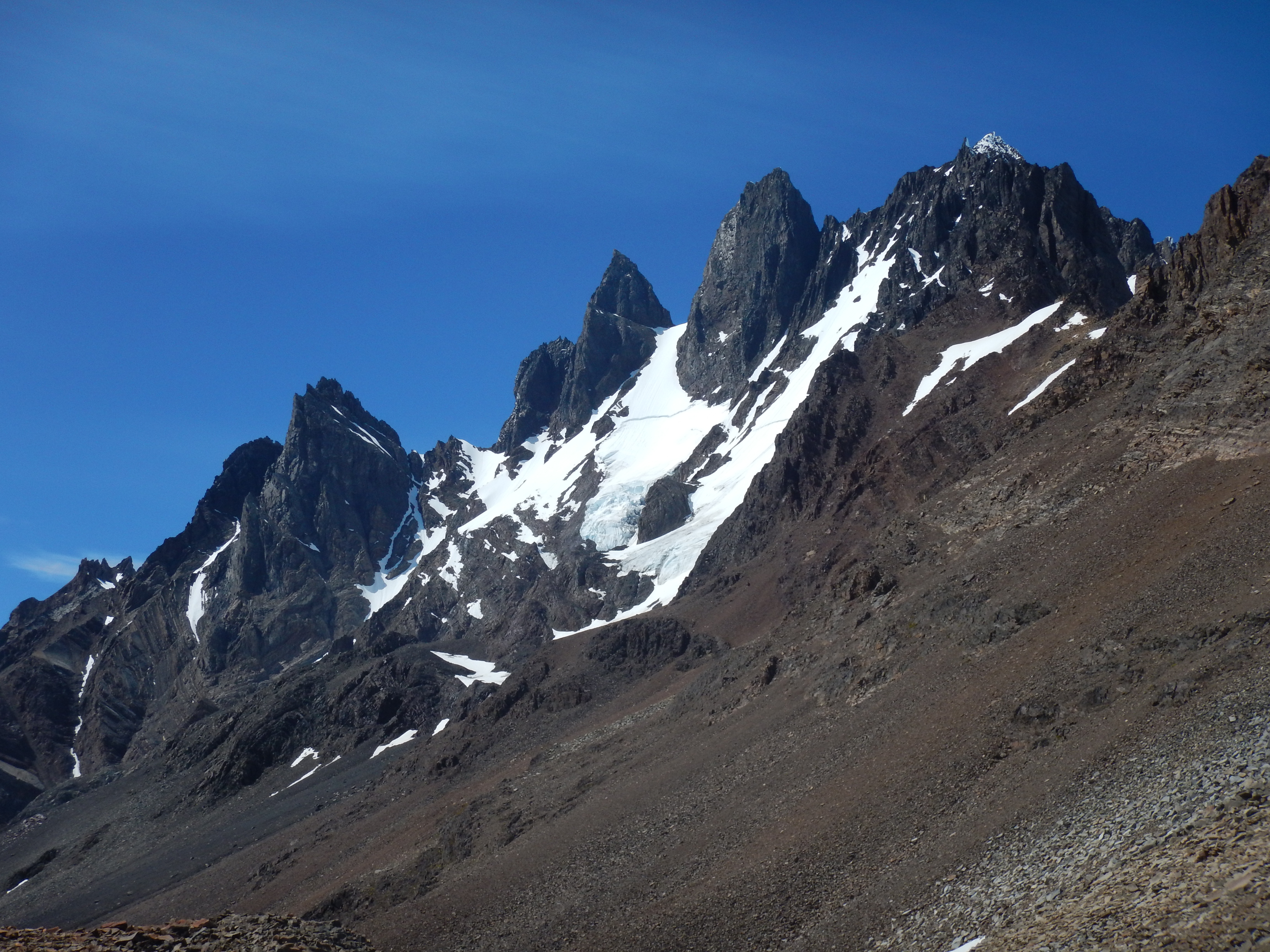
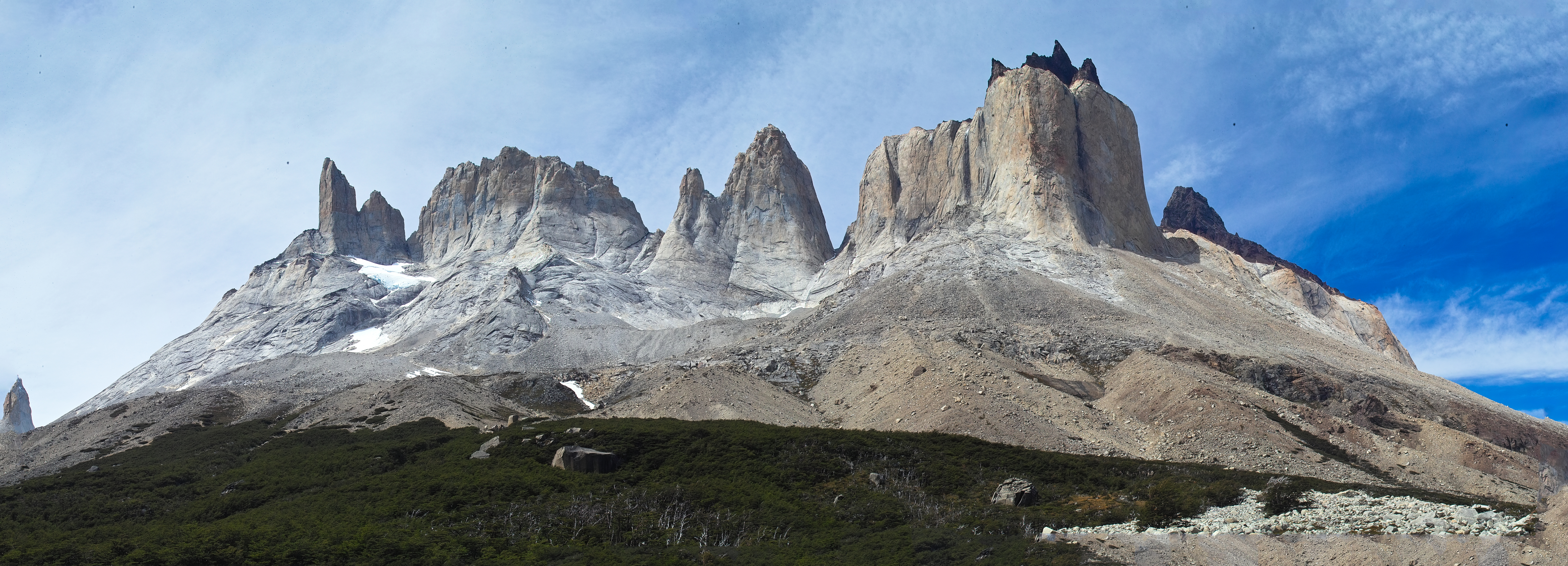
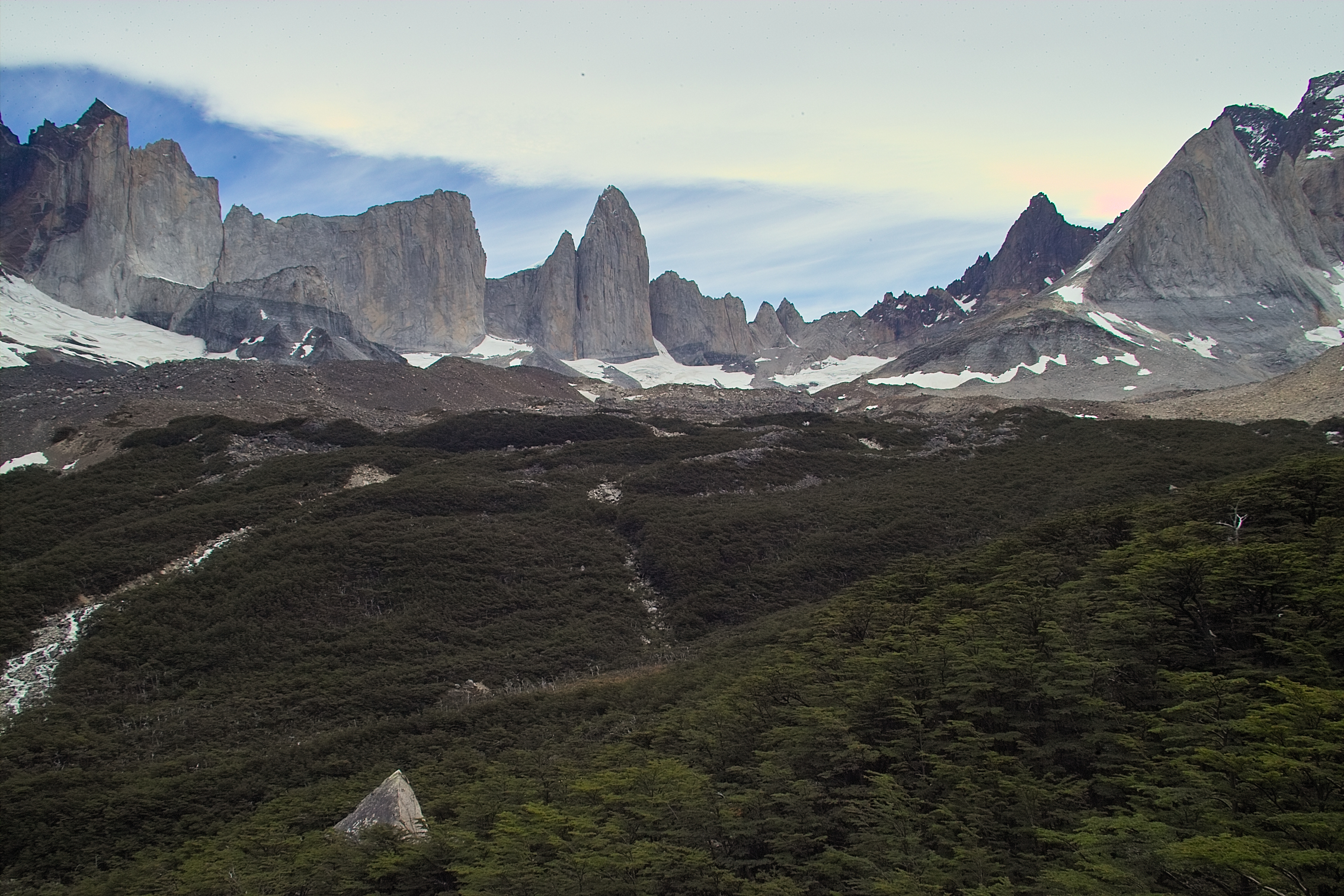
 We were gazing up at the huge granite cliffs of the Torres the whole way.
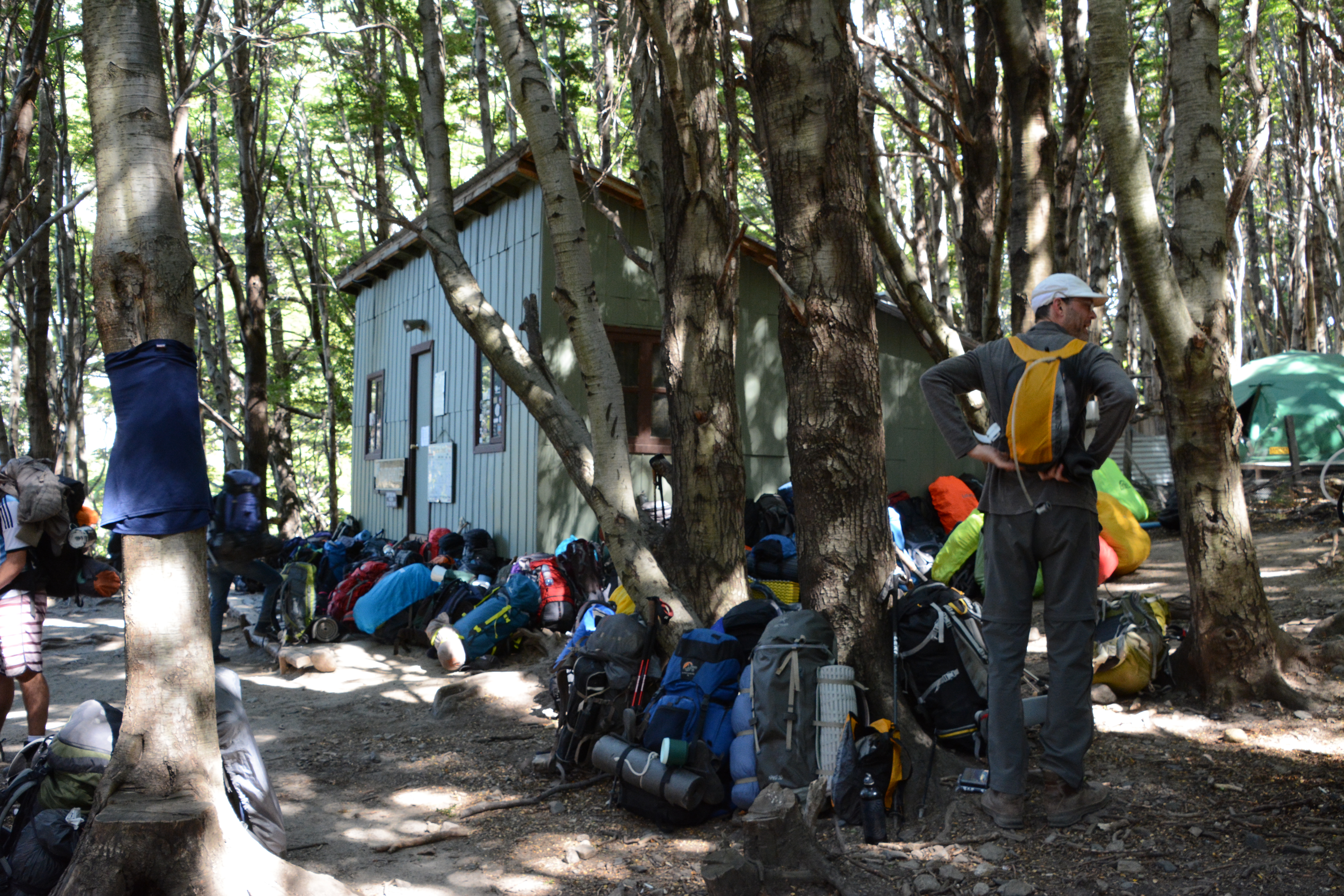 Campamento Italiano, a resting place for backpacks.
There were no campsites available at Italiano. The place was packed with people.
We dropped our packs here and began our hike up the Valle Frances to Camp Britanico.
The plan was to hike up to Camp Britanico, and then back down to Camp Italiano.
Then, we'd heft those packs again, and continue down the trail to Campamento Frances, where we could hopefully camp.
Campamento Italiano, a resting place for backpacks.
There were no campsites available at Italiano. The place was packed with people.
We dropped our packs here and began our hike up the Valle Frances to Camp Britanico.
The plan was to hike up to Camp Britanico, and then back down to Camp Italiano.
Then, we'd heft those packs again, and continue down the trail to Campamento Frances, where we could hopefully camp.
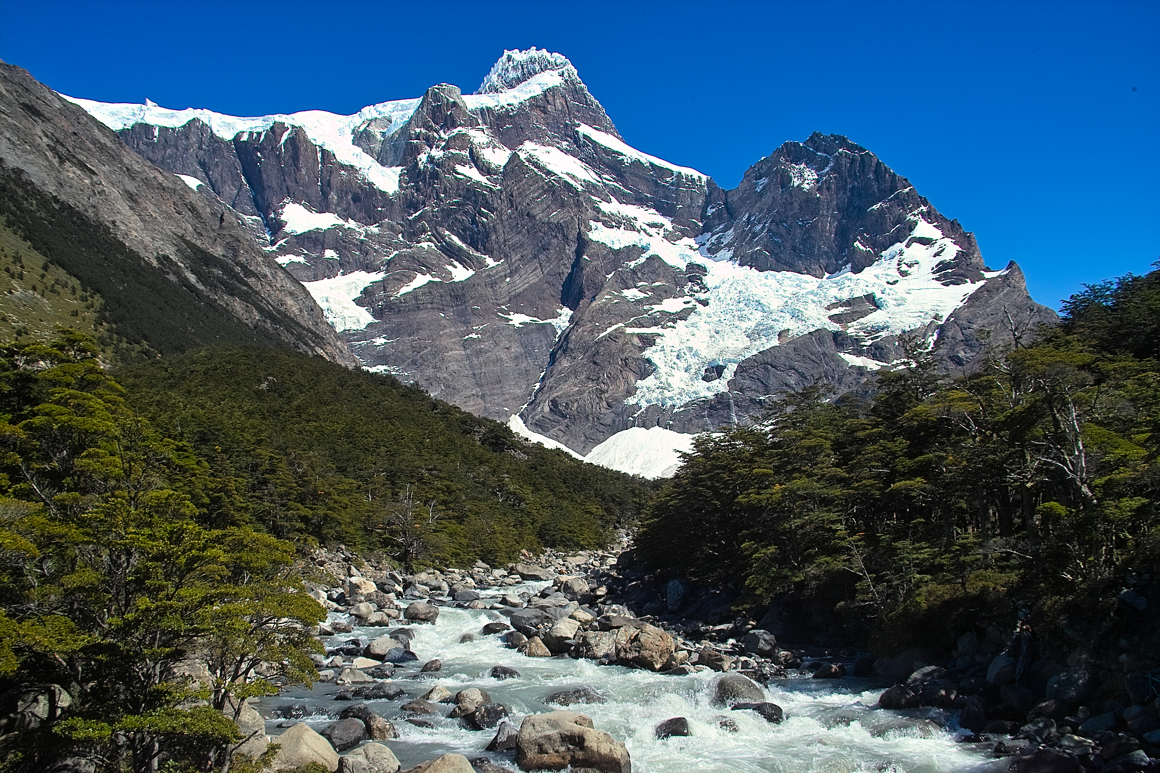 Unburdened, we skipped and hopped up the trail toward the spectacular Frances Glacier.
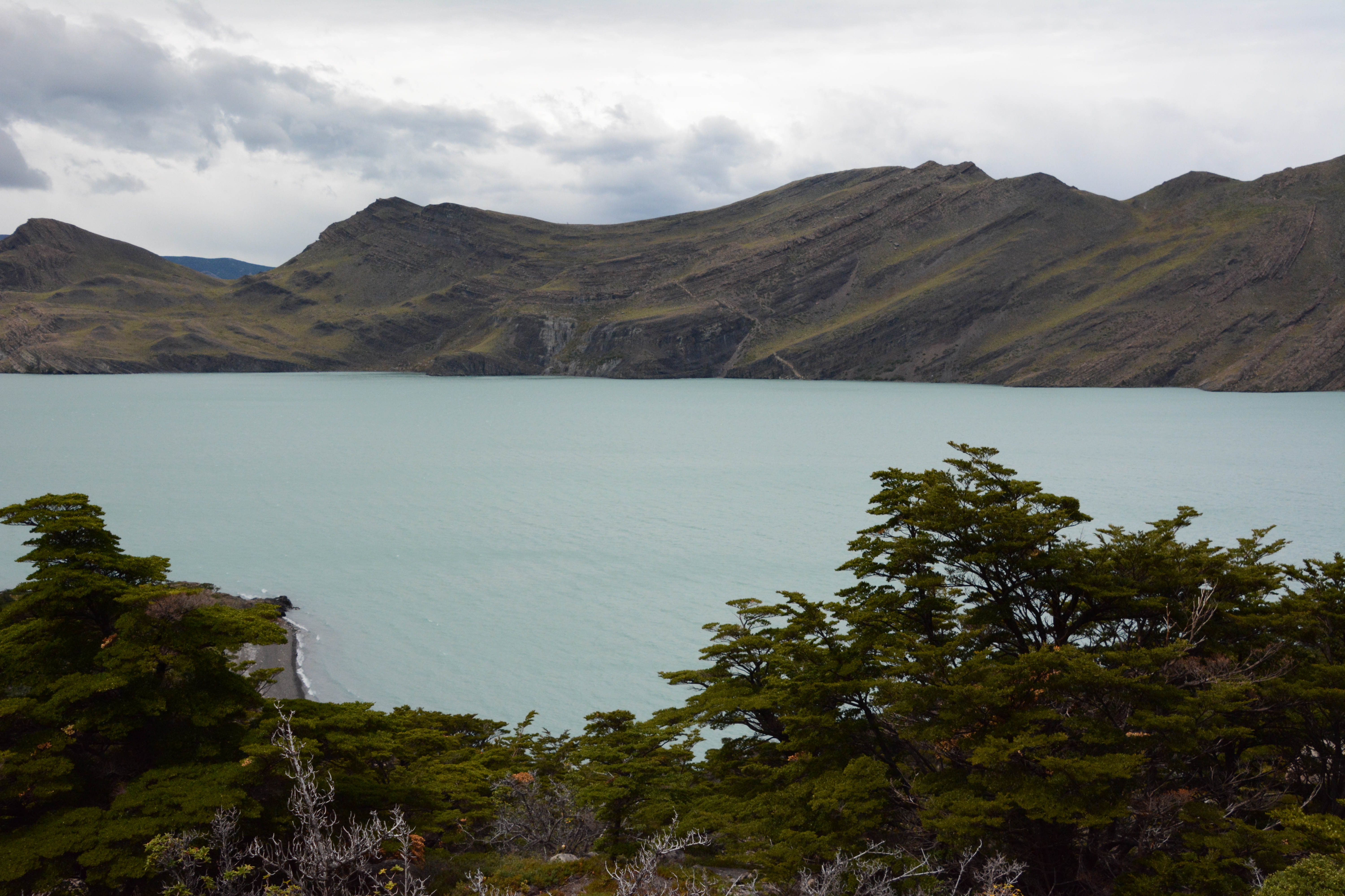
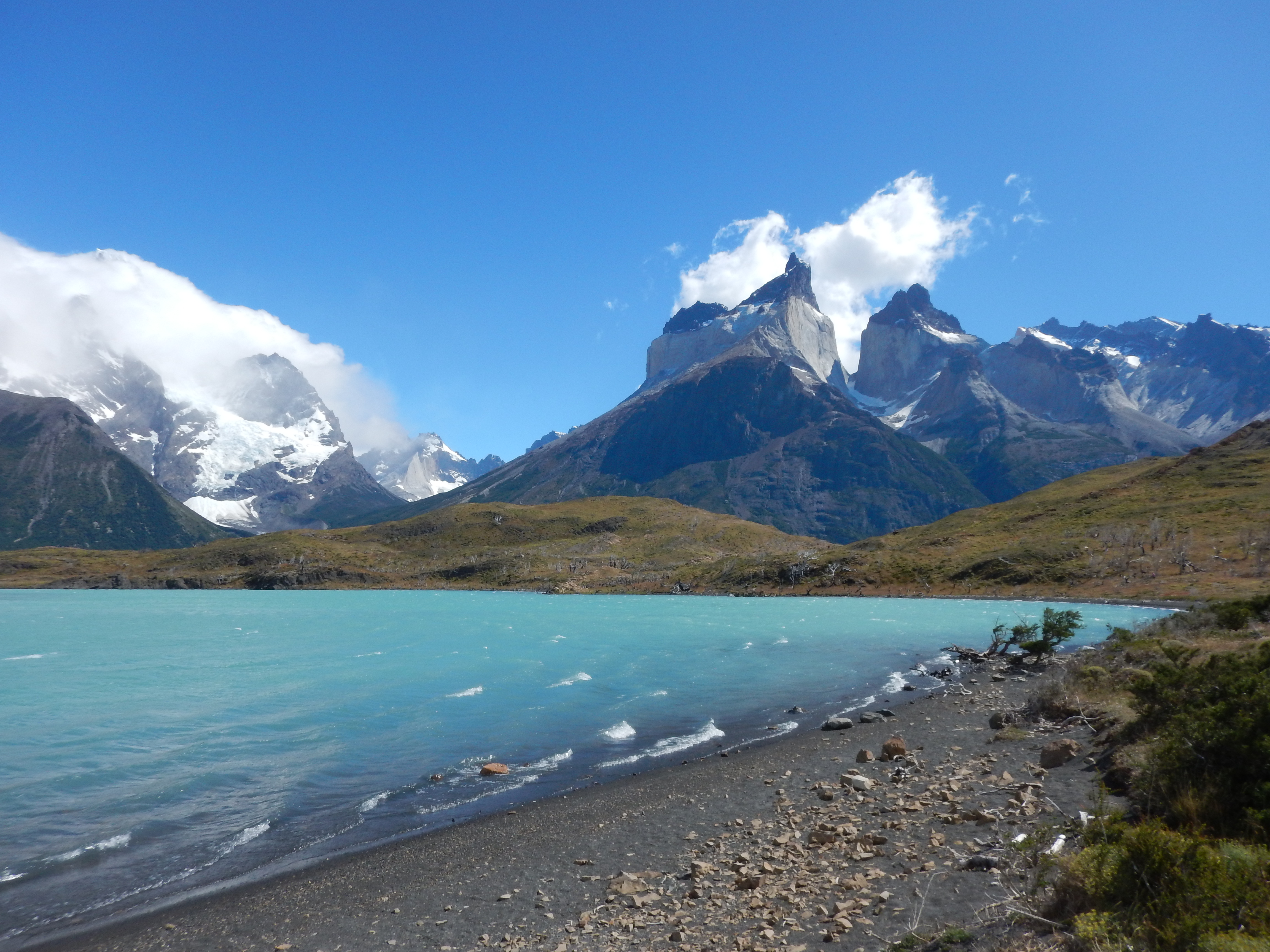
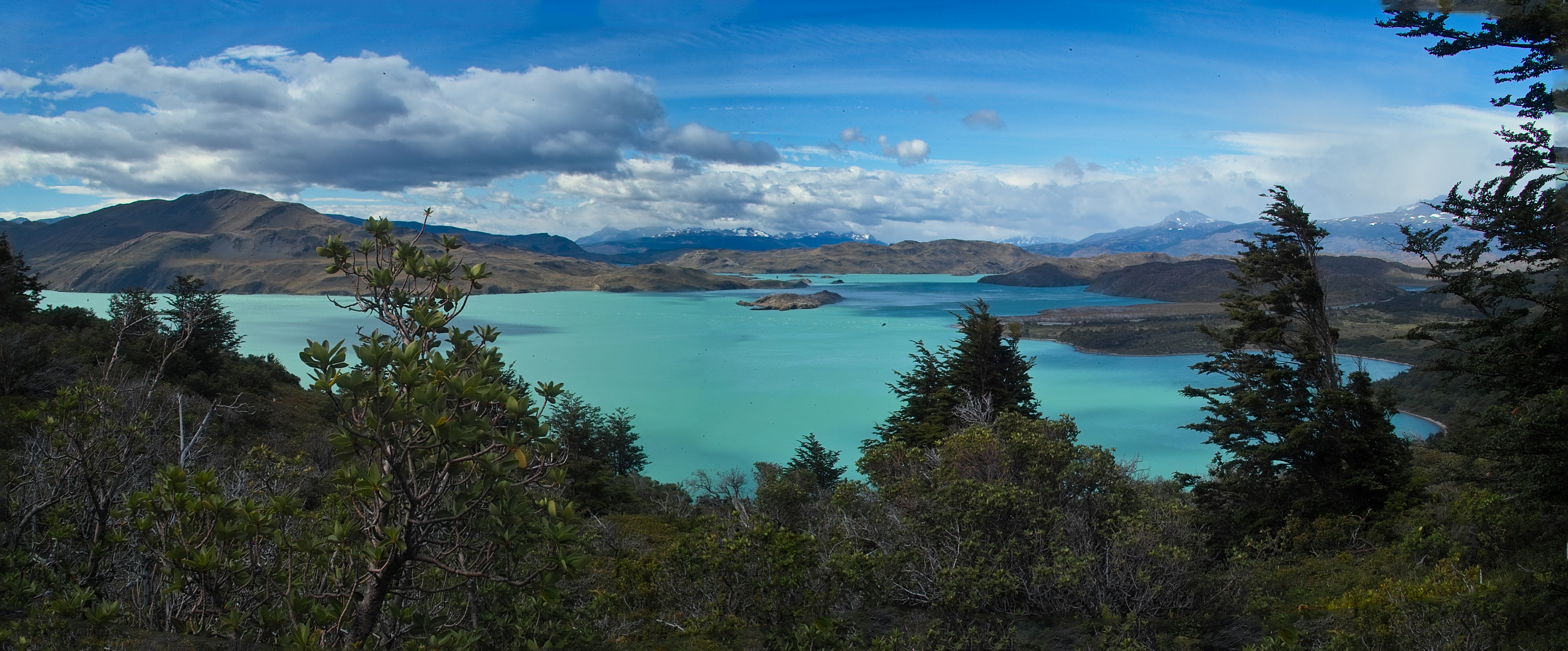 Behind us, we could see the huge lakes, turquoise from glacial sediment.
 There was a mirador (viewpoint) part-way up the trail, across from the Frances Glacier.
 We hung out there for a while, listening to the occasional rumbling of ice falling from the glacier.
Video loading... Please be patient - or (more likely) its not working on your device
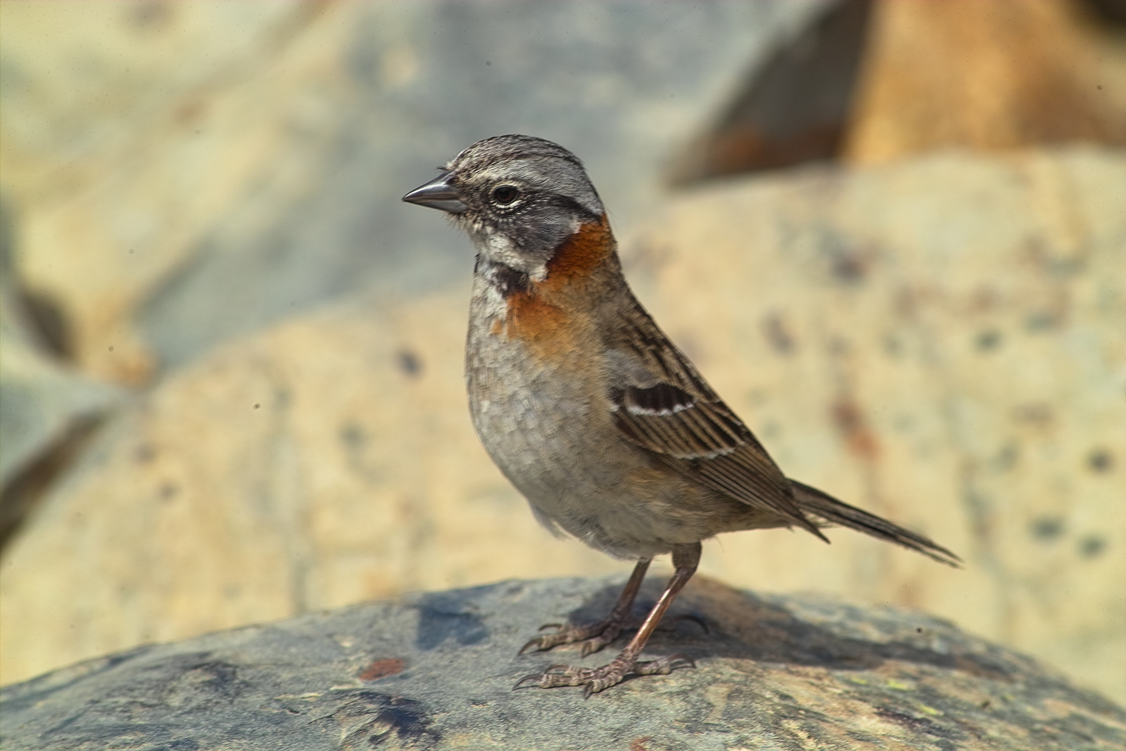 Hey look, a bird!
(Rufous-Collared Sparrow)
Hey look, a bird!
(Rufous-Collared Sparrow)
 Now back to this.
Ahhhh....
Now back to this.
Ahhhh....
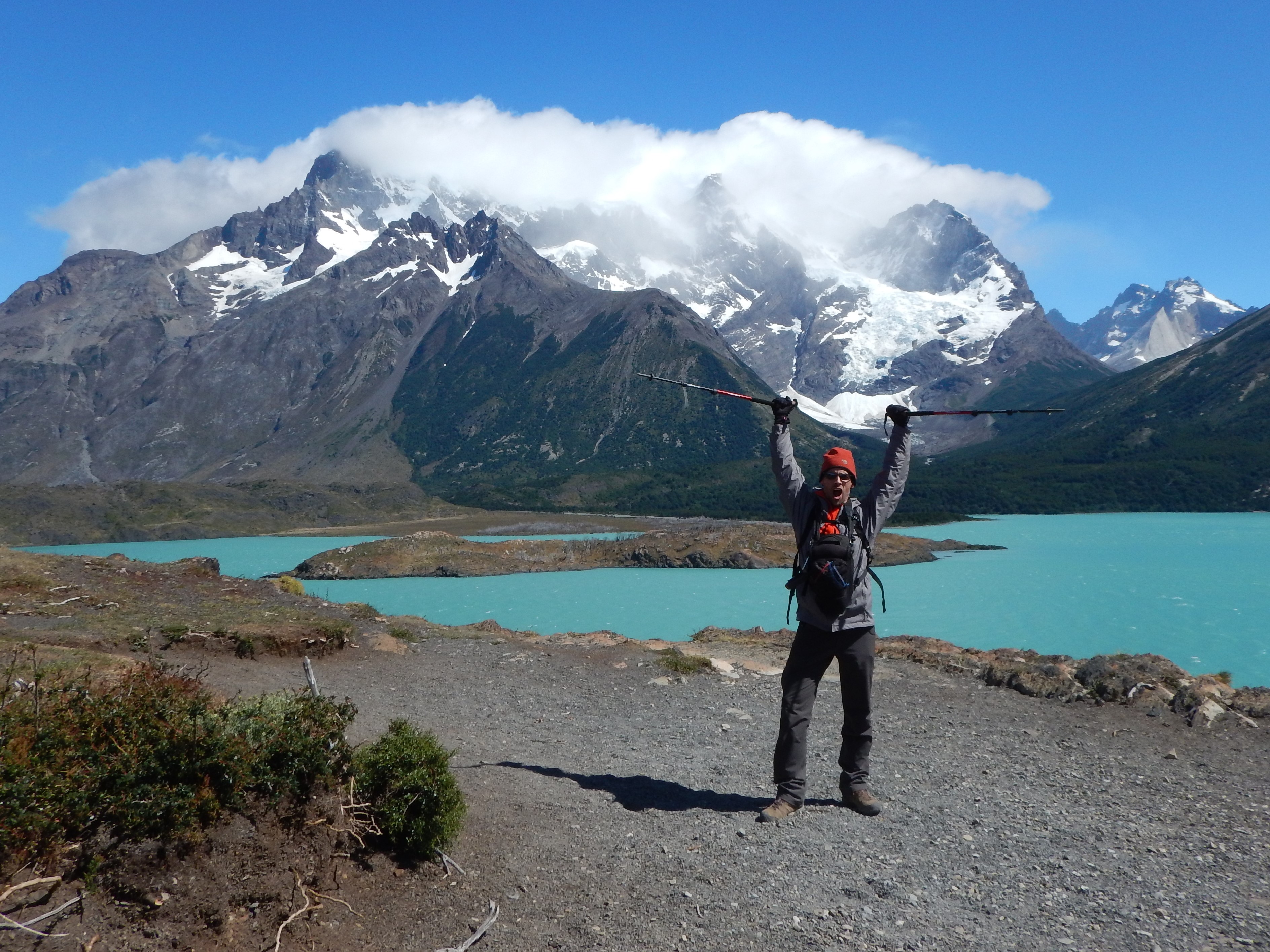
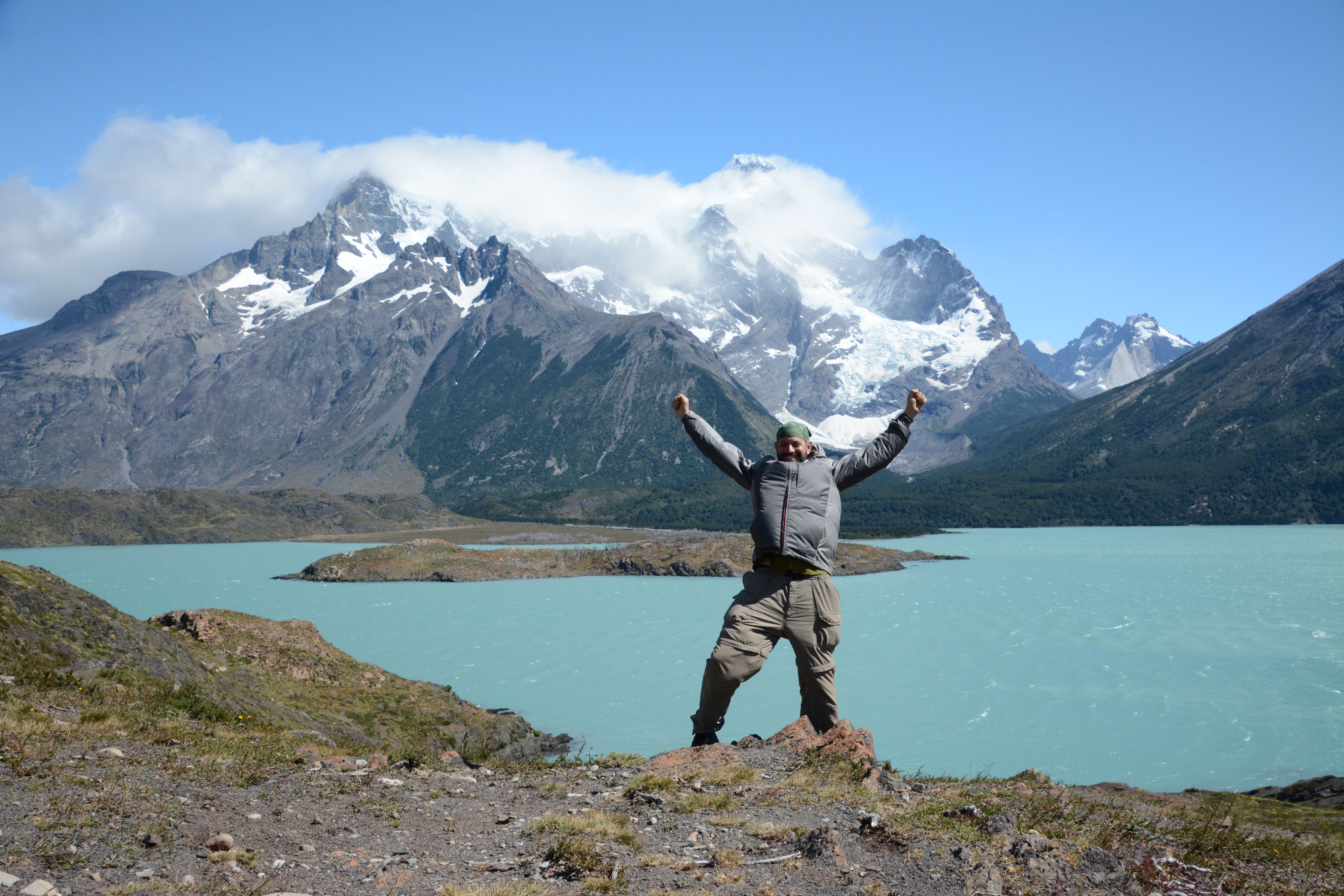
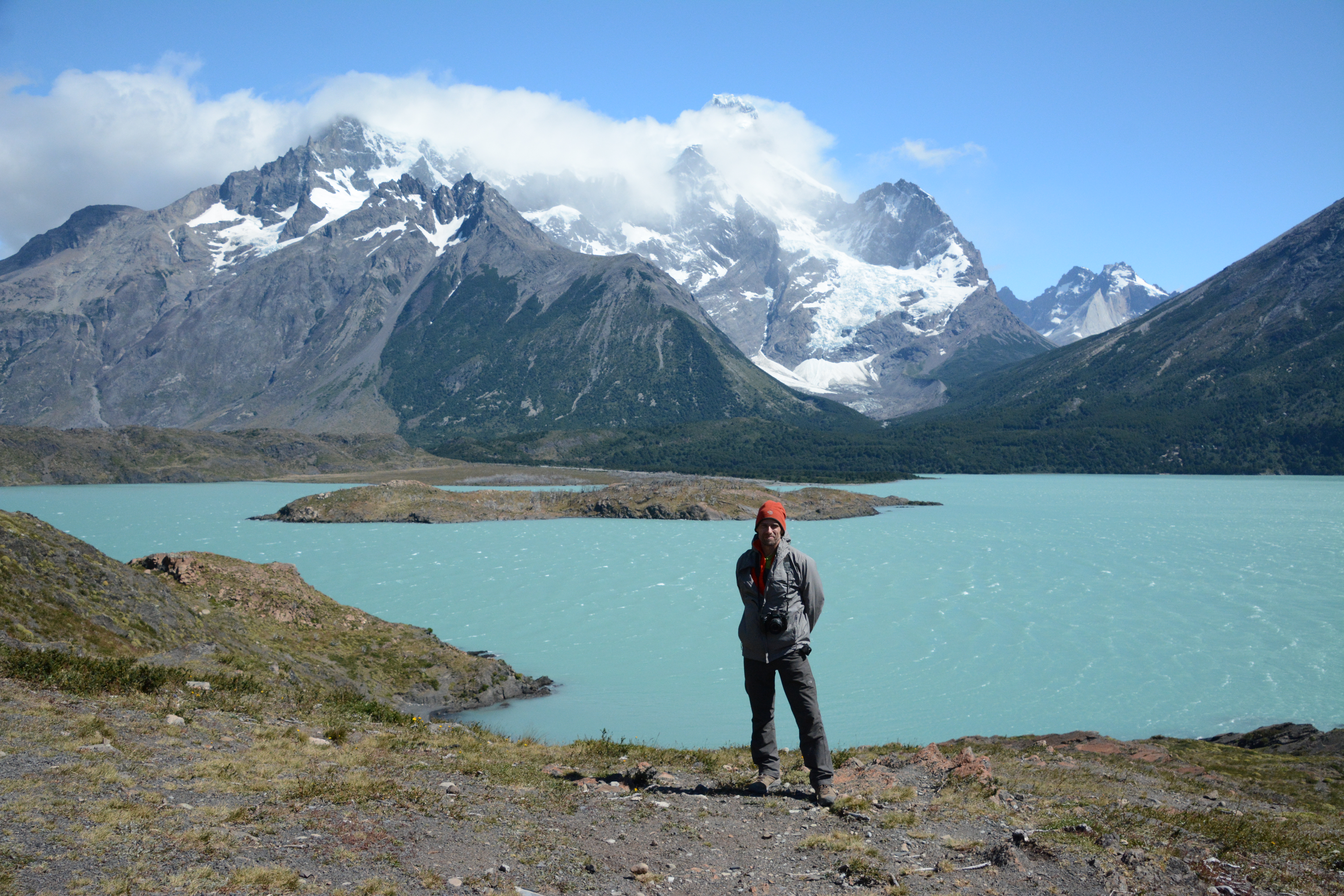
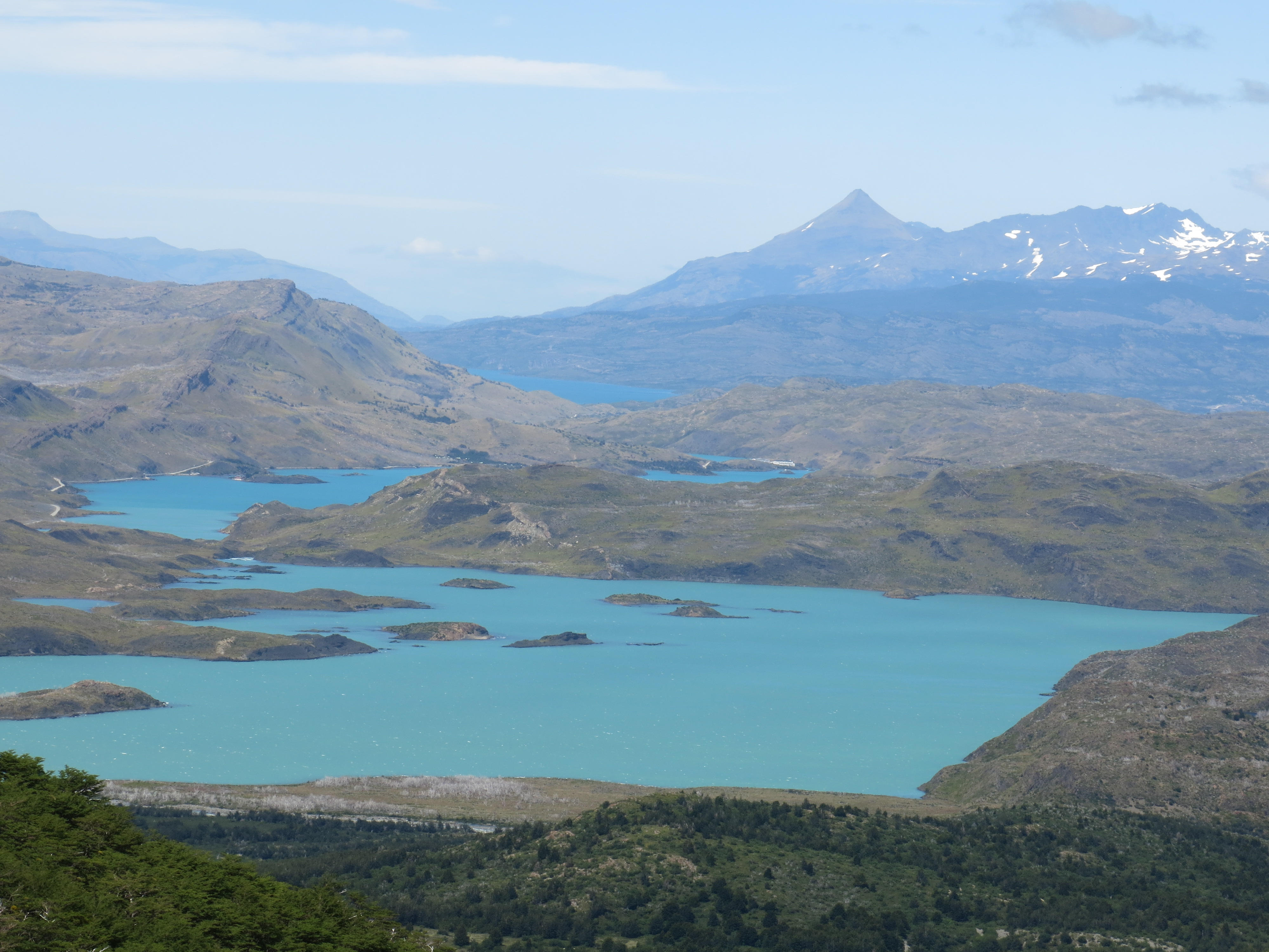 Our view of the lakes from the mirador was pretty sweet.
Paine Grande, last night's camp, is just off the above photo to the right, on the lake shore.
Our view of the lakes from the mirador was pretty sweet.
Paine Grande, last night's camp, is just off the above photo to the right, on the lake shore.
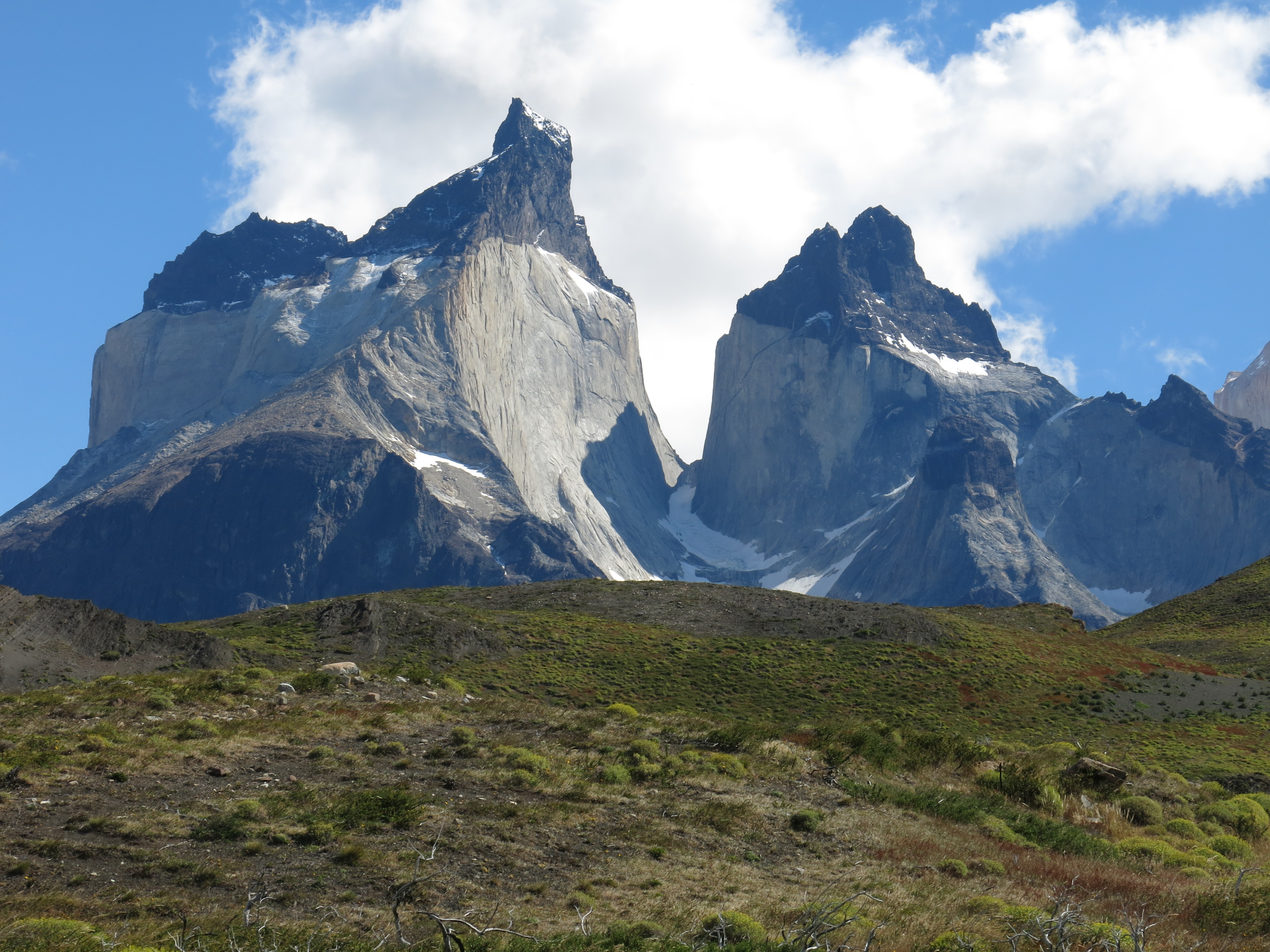
OK, lets keep heading up the Valle Frances. Where we will find ourselves in a granite wonderland.

 Check out the contact between the granite and the sedimentary rock there! So cool!
That's the edge of a magma chamber!
Check out the contact between the granite and the sedimentary rock there! So cool!
That's the edge of a magma chamber!
 The other side of the magma chamber.
 Close-ups!
 Even closer-ups!
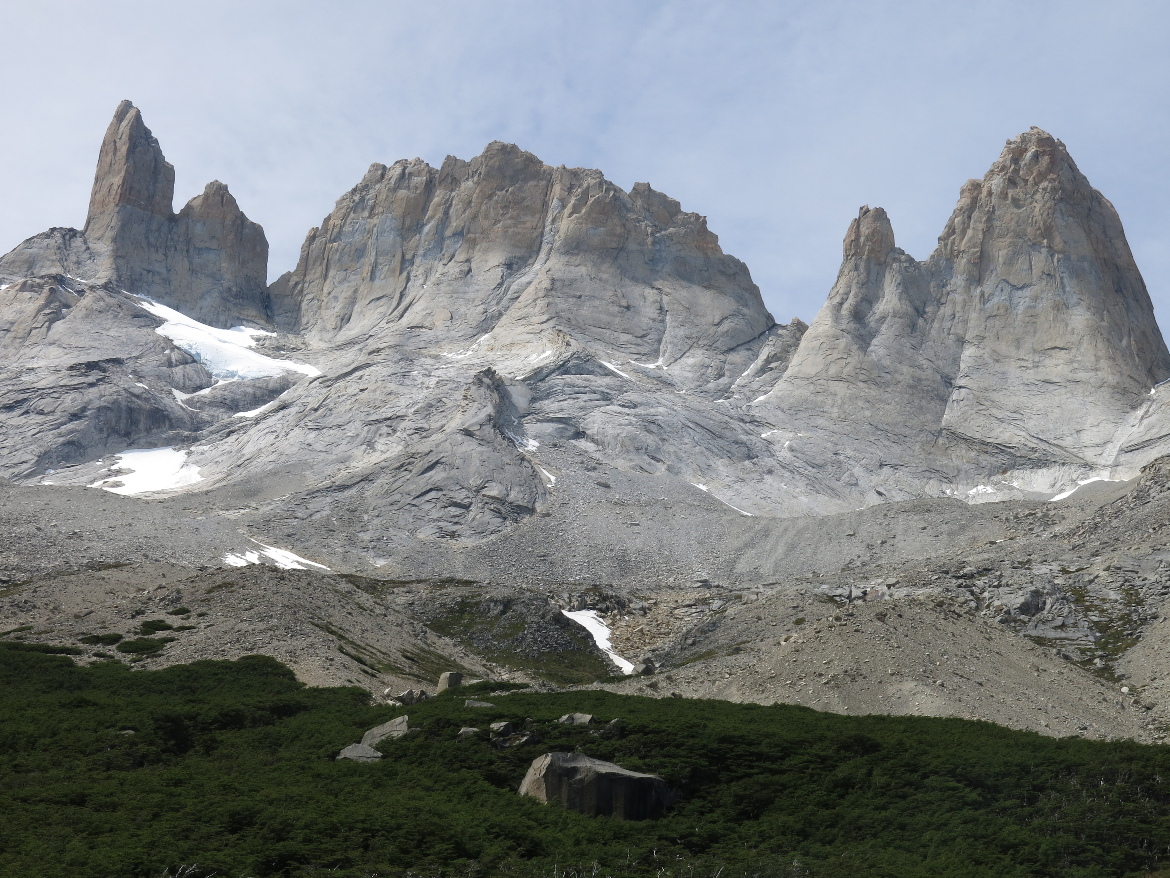
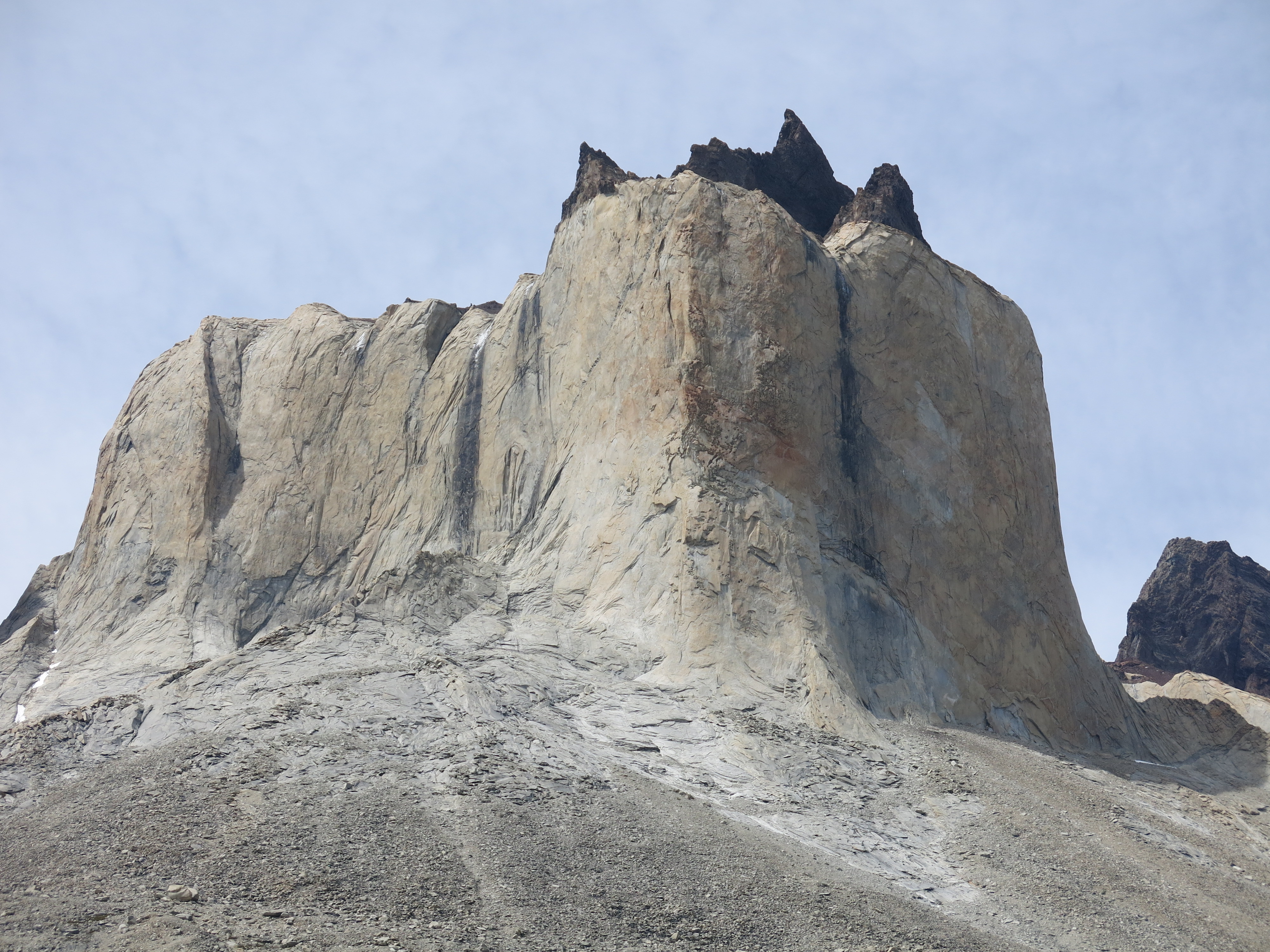 Granite glory
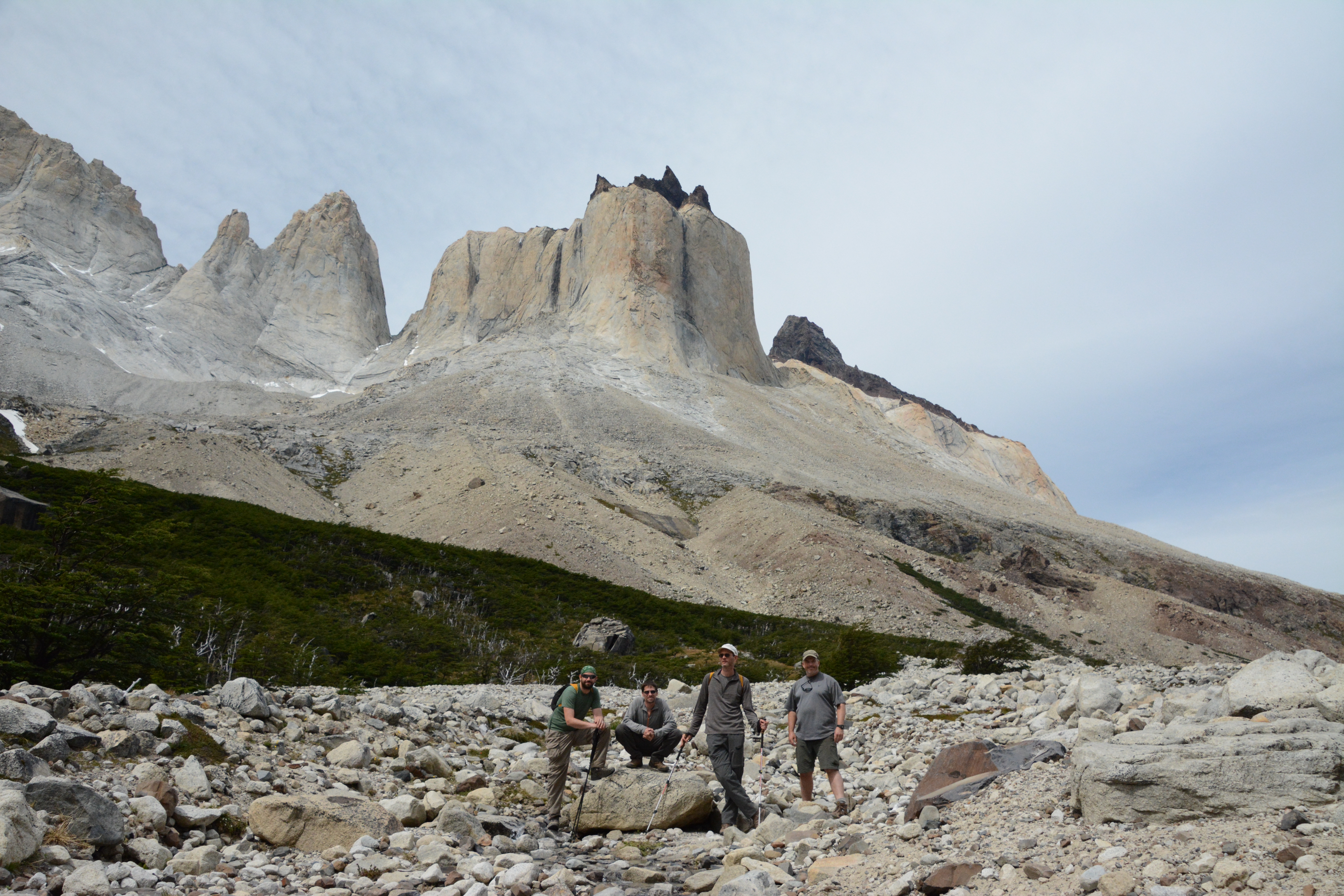
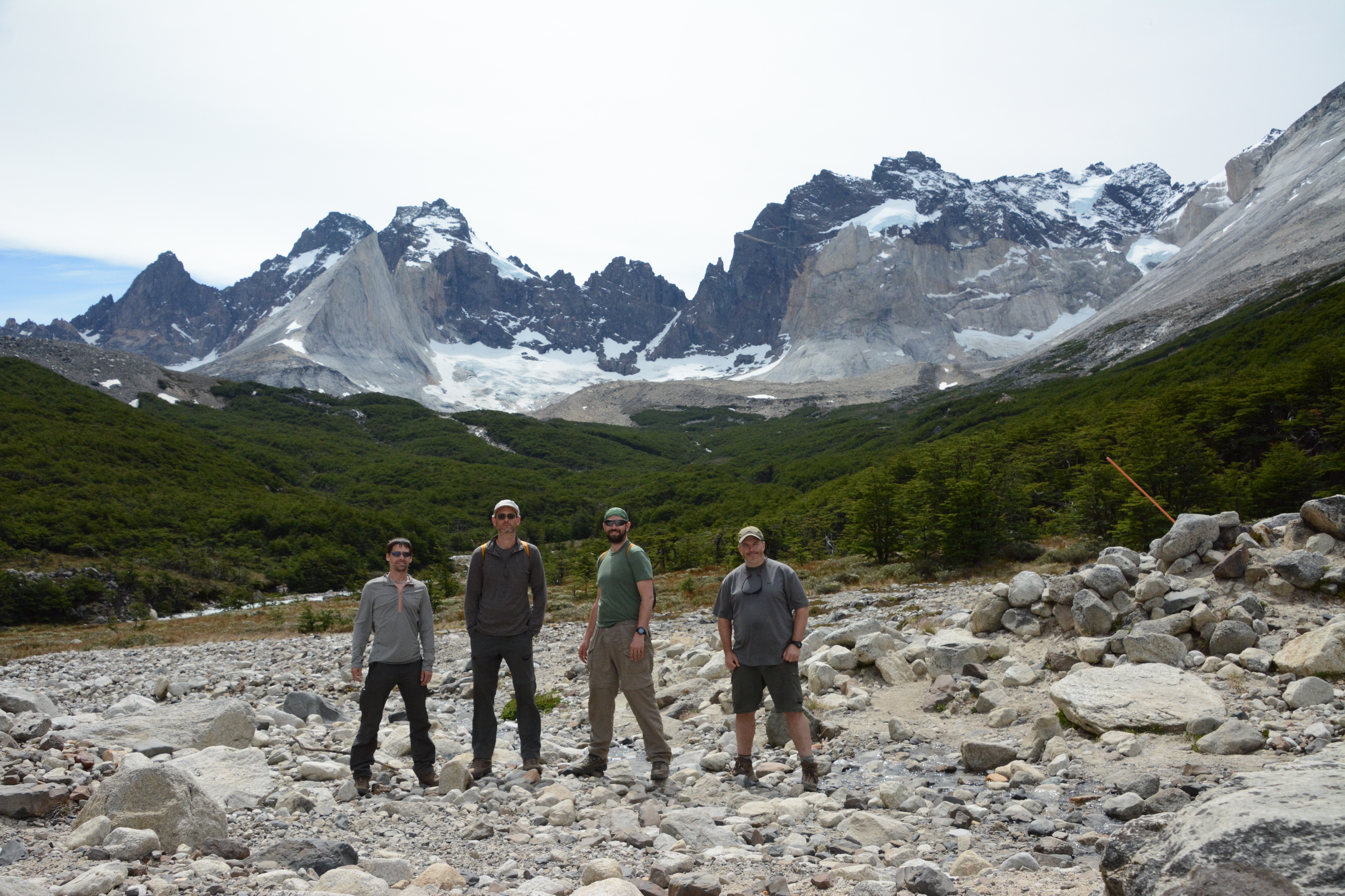
 We kept hiking up the Valle Frances to Camp Britanico, a small camp near a viewpoint at the top of the valley.
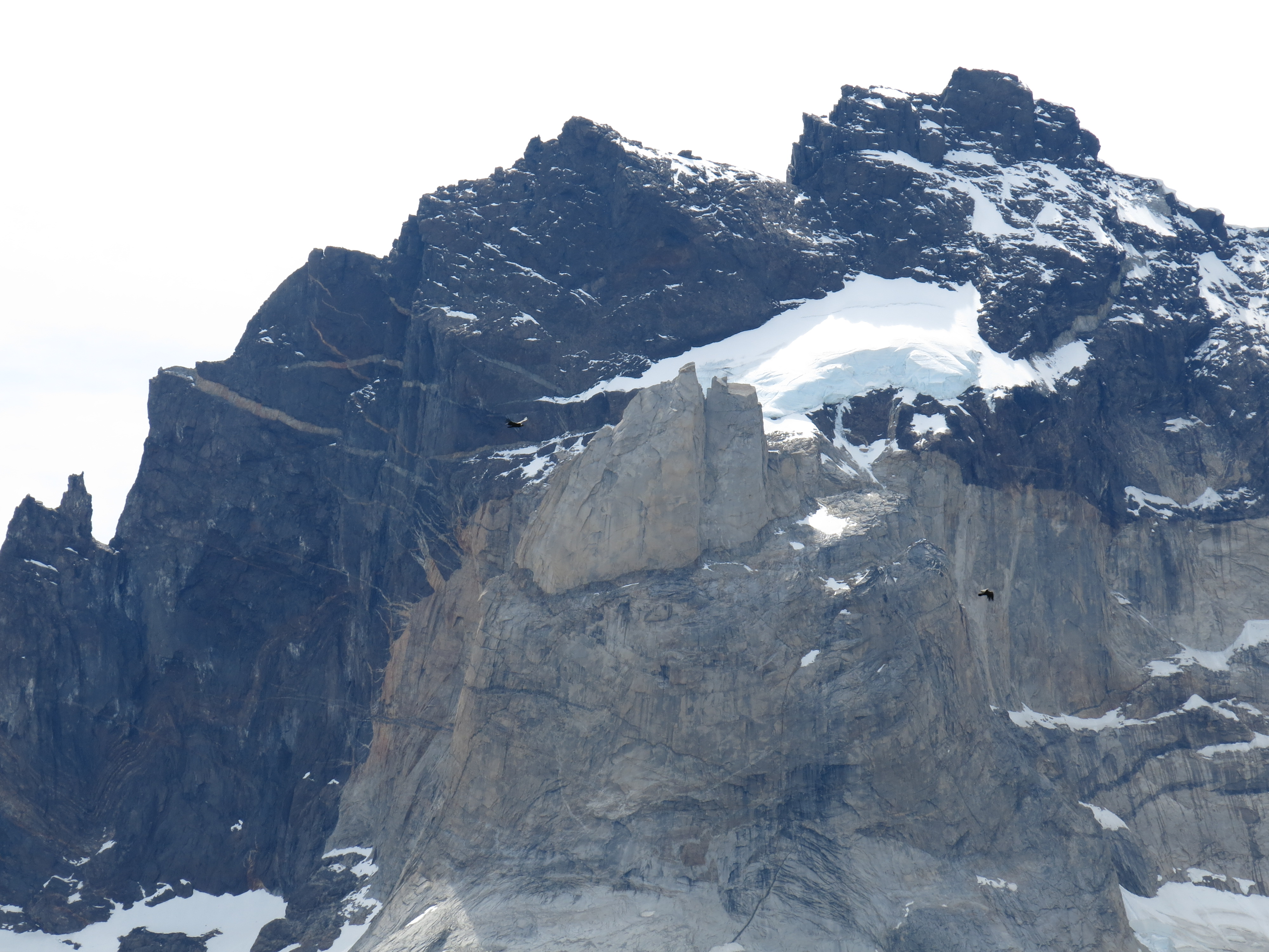 Condors soaring around the granite wonderland.
Not a bad life.
Condors soaring around the granite wonderland.
Not a bad life.
 What a day.
...but it's not over yet.
What a day.
...but it's not over yet.
 The hike out.
 One last look back.
I tell you, putting those big packs back on at Camp Italiano was not exactly a happy reunion.
We hiked another couple of k's to reach Camp Frances, where we were told (at Italiano) that they had camping space.
Well, when we arrived, it was late, we were beat, and the campground looked pretty packed.
To make things worse, the camp manager's office was about a half k away, down a steep side road.
So, yeah, we had to walk all the way down there to ask if there was any room in the campground and then hear a resounding "No".
...crushing....
Then, just before we attacked, Paul said, "Hey, what about those dome-thingies"?
...and then Paul proceeded to hook us up with four beds under a roof with a bathroom and shower. He paid for it too.
What a guy.
That deserved a round of $7 beers.
One last look back.
I tell you, putting those big packs back on at Camp Italiano was not exactly a happy reunion.
We hiked another couple of k's to reach Camp Frances, where we were told (at Italiano) that they had camping space.
Well, when we arrived, it was late, we were beat, and the campground looked pretty packed.
To make things worse, the camp manager's office was about a half k away, down a steep side road.
So, yeah, we had to walk all the way down there to ask if there was any room in the campground and then hear a resounding "No".
...crushing....
Then, just before we attacked, Paul said, "Hey, what about those dome-thingies"?
...and then Paul proceeded to hook us up with four beds under a roof with a bathroom and shower. He paid for it too.
What a guy.
That deserved a round of $7 beers.
 Our home for the night.
 My bed, at last.
Another day down. Whew!
Tomorrow, we hike back to Las Torres and complete the loop!
My bed, at last.
Another day down. Whew!
Tomorrow, we hike back to Las Torres and complete the loop!
Torres del Paine
Day 7
Frances to Las Torres - 18 km
 This day felt longer than it was.
The weather was gloomy, windy (of course), and cold.
We were just trying to put the miles behind us and get back to Las Torres.
We hiked along Lago Nordenskjold all day.
We hiked along the lake itself, over streams feeding the lake, and over the occasional headland.
The wind blew constantly. It rained off and on.
We chatted at times, and plodded along silently at times.
The miles went by.
This day felt longer than it was.
The weather was gloomy, windy (of course), and cold.
We were just trying to put the miles behind us and get back to Las Torres.
We hiked along Lago Nordenskjold all day.
We hiked along the lake itself, over streams feeding the lake, and over the occasional headland.
The wind blew constantly. It rained off and on.
We chatted at times, and plodded along silently at times.
The miles went by.
 We had a few sun breaks.

 Seagull
(Hah, just kiddin', Dan!)
Seagull
(Hah, just kiddin', Dan!)

 See how the wind is whipping up the water? We spotted a few water spouts, actual vortexes, out there on the lake.
The wind was incredible, blowing us off the trail at times.
See how the wind is whipping up the water? We spotted a few water spouts, actual vortexes, out there on the lake.
The wind was incredible, blowing us off the trail at times.

 My one bird photo.
It looks like I accidentally got some mountains in there, behind the condor.
My one bird photo.
It looks like I accidentally got some mountains in there, behind the condor.
 Textbook syncline.
 bird
bird

 What's that in the distance? Those white shapes...
Las Torres! We're almost there!
What's that in the distance? Those white shapes...
Las Torres! We're almost there!
 Exciting! I now know most of those places!
The loop is almost complete!
Exciting! I now know most of those places!
The loop is almost complete!
 Outta the way horses!
 ...and we are back to where we started!
We did it! We completed the Torres del Paine circuit!
We set up our tents at the campground, and then went to enjoy some pisco sours and sandwiches at the restaurant.
At the restaurant, we studied the calendar and the bus schedule to decide if we had another day in the park or not.
We debated and discussed our various options, there weren't very many.
There was another hike, an 8 hour round-trip hike to the Valle del Silencio, that we wanted to do. The trailhead was right here in Las Torres.
... but we were out of time! Damn you, American Airlines!
Oh well. We decided to rest on our laurels and pass on the Valle del Silencio. We'd hit the road tomorrow.
We had booked a trip to Tierra del Fuego on our last day in Chile, and that was a priority for all of us.
We did find that there would be time for one more short hike, so long as we caught the morning bus into the park and then caught it again on the way out.
That would allow for the perfect capstone, a hike to the Mirador Cuernos, the viewpoint from the other side of Lago Nordenskjold!
From there we'd be able to see the Valle Frances, and the whole Torres del Paine massif!
Best of all, it was an easy 3-4 mile round-trip hike that we could do without our large packs!
See you tomorrow.
...and we are back to where we started!
We did it! We completed the Torres del Paine circuit!
We set up our tents at the campground, and then went to enjoy some pisco sours and sandwiches at the restaurant.
At the restaurant, we studied the calendar and the bus schedule to decide if we had another day in the park or not.
We debated and discussed our various options, there weren't very many.
There was another hike, an 8 hour round-trip hike to the Valle del Silencio, that we wanted to do. The trailhead was right here in Las Torres.
... but we were out of time! Damn you, American Airlines!
Oh well. We decided to rest on our laurels and pass on the Valle del Silencio. We'd hit the road tomorrow.
We had booked a trip to Tierra del Fuego on our last day in Chile, and that was a priority for all of us.
We did find that there would be time for one more short hike, so long as we caught the morning bus into the park and then caught it again on the way out.
That would allow for the perfect capstone, a hike to the Mirador Cuernos, the viewpoint from the other side of Lago Nordenskjold!
From there we'd be able to see the Valle Frances, and the whole Torres del Paine massif!
Best of all, it was an easy 3-4 mile round-trip hike that we could do without our large packs!
See you tomorrow.
Torres del Paine
Day 8
Mirador Cuernos
 Nice view, just a little ways from the trailhead!
 Seagull?
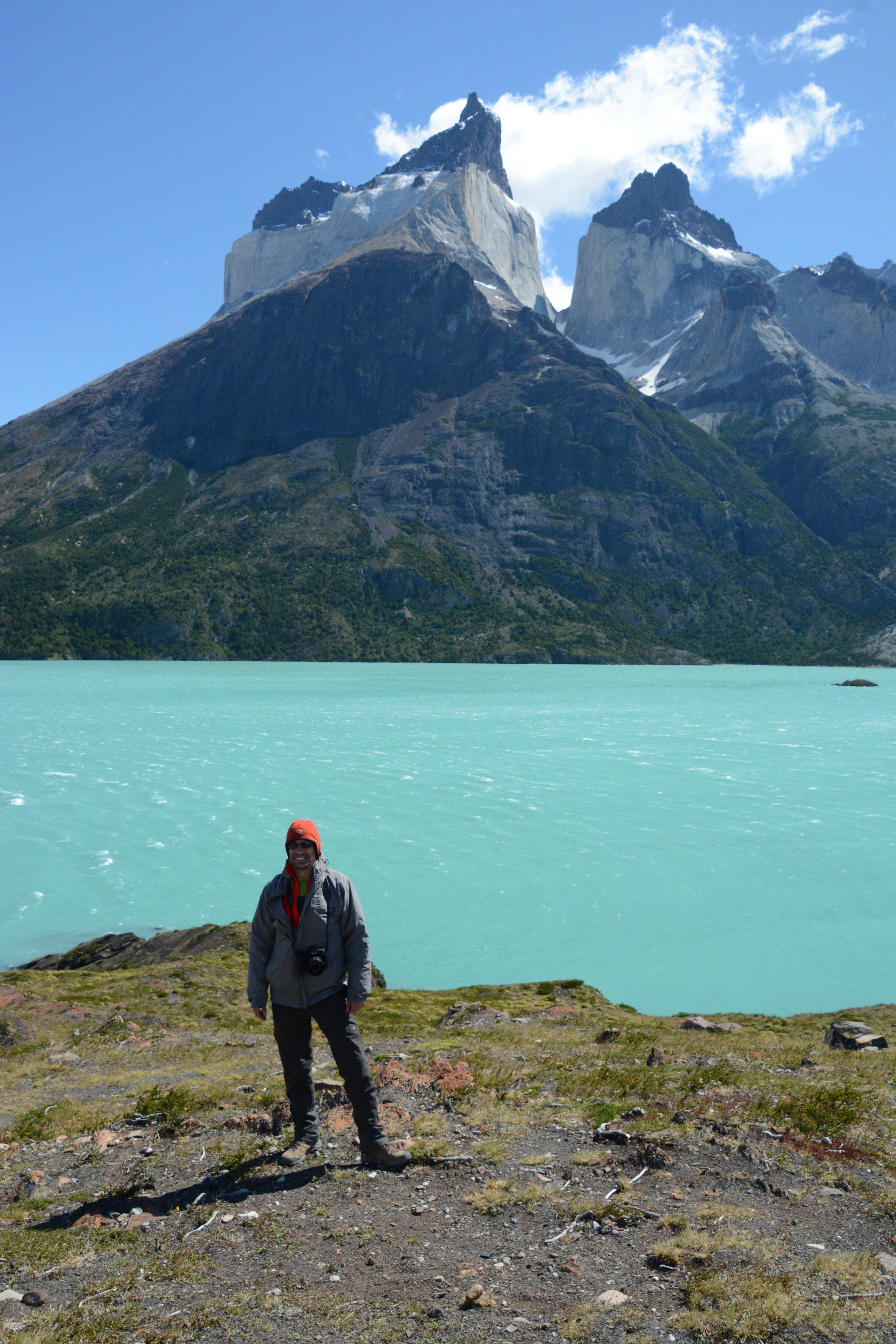
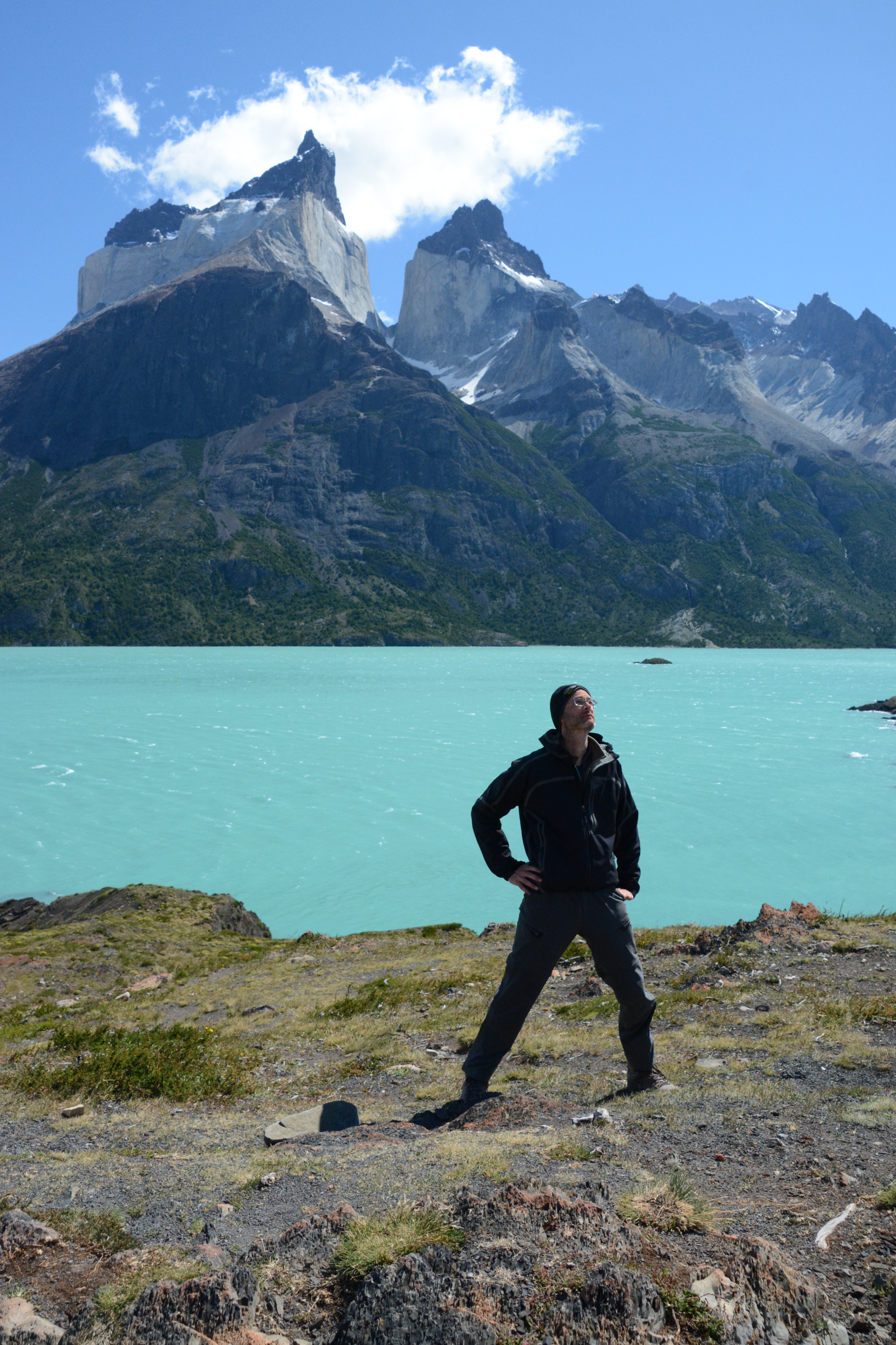
 Here we are, Mirador Cuernos, on the south shore of Lago Nordenskjold.
 Outta here, we have a bus to catch.
Sigh.
Farewell Torres del Paine!
Outta here, we have a bus to catch.
Sigh.
Farewell Torres del Paine!
Puerto Natales
The bus brought us to Puerto Natales, half-way back to Punta Arenas. In order to avoid a late-night arrival in Punta Arenas, and to see a new place, we decided to stay. We were glad we did. We had a good time in Puerto Natales.
 The extinct giant sloth, Mylodon, is a popular icon of Patagonia.
Charles Darwin found a complete lower jaw while he was here!
The extinct giant sloth, Mylodon, is a popular icon of Patagonia.
Charles Darwin found a complete lower jaw while he was here!
birds.
 I thought this was creative.
 The Chileans like their meat. This place, Don Jorge, specialized in it.
The brewery, next door, was closed for repairs.
The Chileans like their meat. This place, Don Jorge, specialized in it.
The brewery, next door, was closed for repairs.
 It was great to sleep in a bed again.
Punta Arenas
The next day we caught the bus back to Punta Arenas. We had booked a trip to Tierra del Fuego the following day, and then we were flying home the day after that. So, this was our last open day. We'd spend part of it on the bus, and part of it in Punta Arenas.
 We had booked rooms in this cool little horse-themed boutique hotel on the hill in the center of town.
It is run by two friendly and energetic women who speak a little English and are fantastic cooks.
We had booked rooms in this cool little horse-themed boutique hotel on the hill in the center of town.
It is run by two friendly and energetic women who speak a little English and are fantastic cooks.
 There was a nice mirador just above the hotel, on top of the hill.
We were treated to a spectacular sunset and views of Punta Arenas.
There was a nice mirador just above the hotel, on top of the hill.
We were treated to a spectacular sunset and views of Punta Arenas.
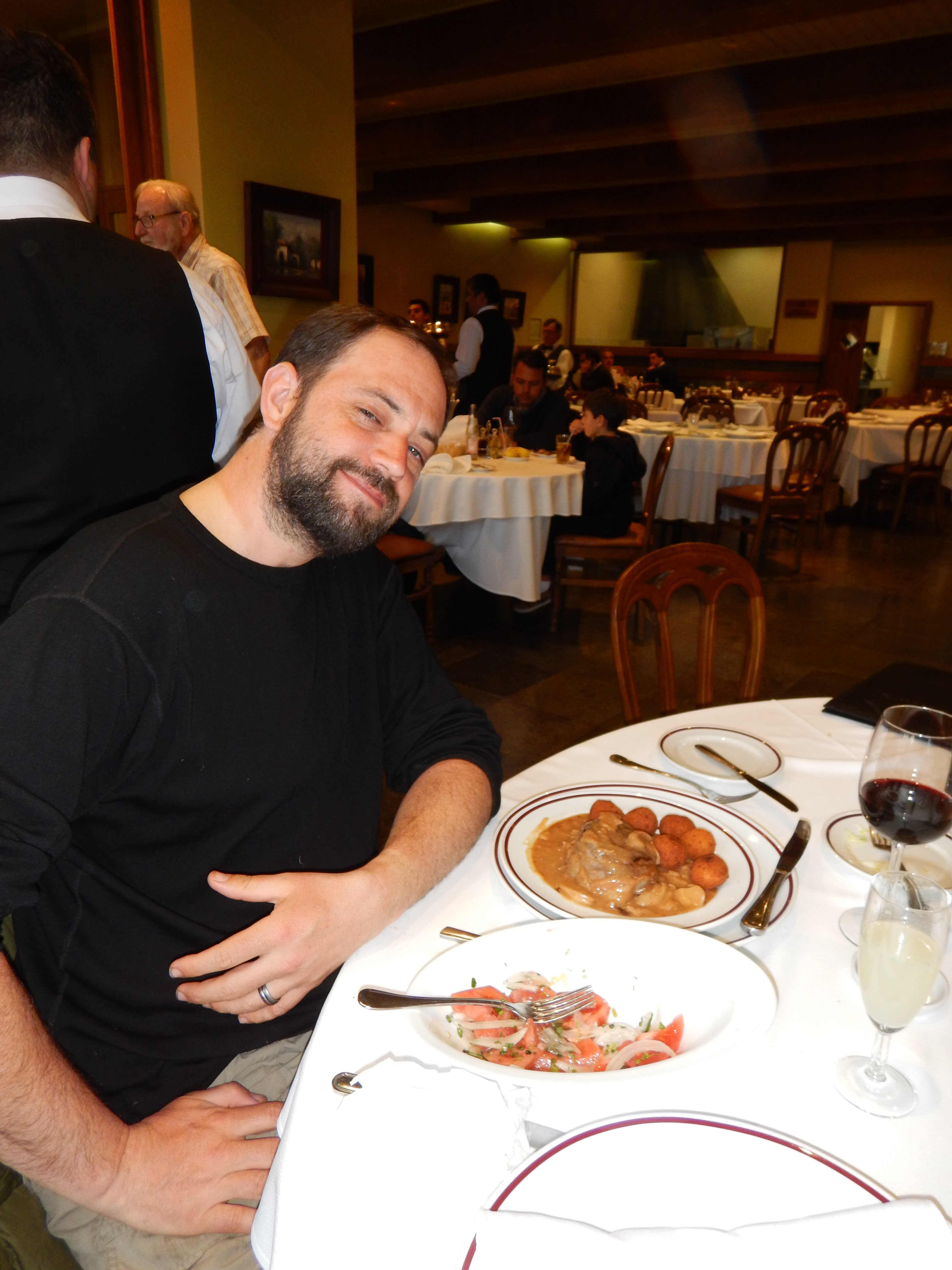
 We went to a fancy restaurant and had an awesome meal.
Our waiter, dressed in a tuxedo, invited us in from the street.
We felt under-dressed, but he assured us it was no problem.
We went to a fancy restaurant and had an awesome meal.
Our waiter, dressed in a tuxedo, invited us in from the street.
We felt under-dressed, but he assured us it was no problem.
 This has been a great trip.
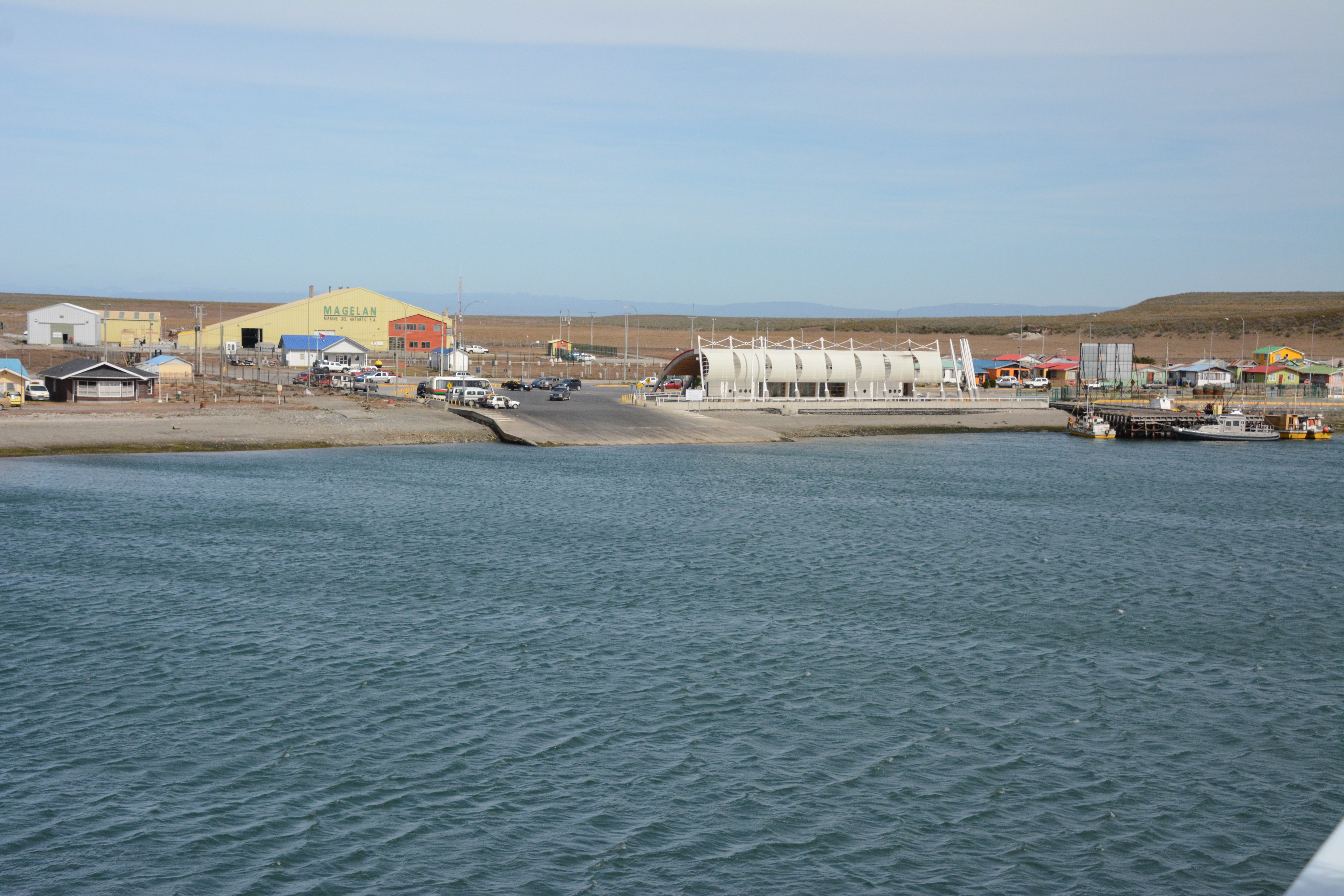
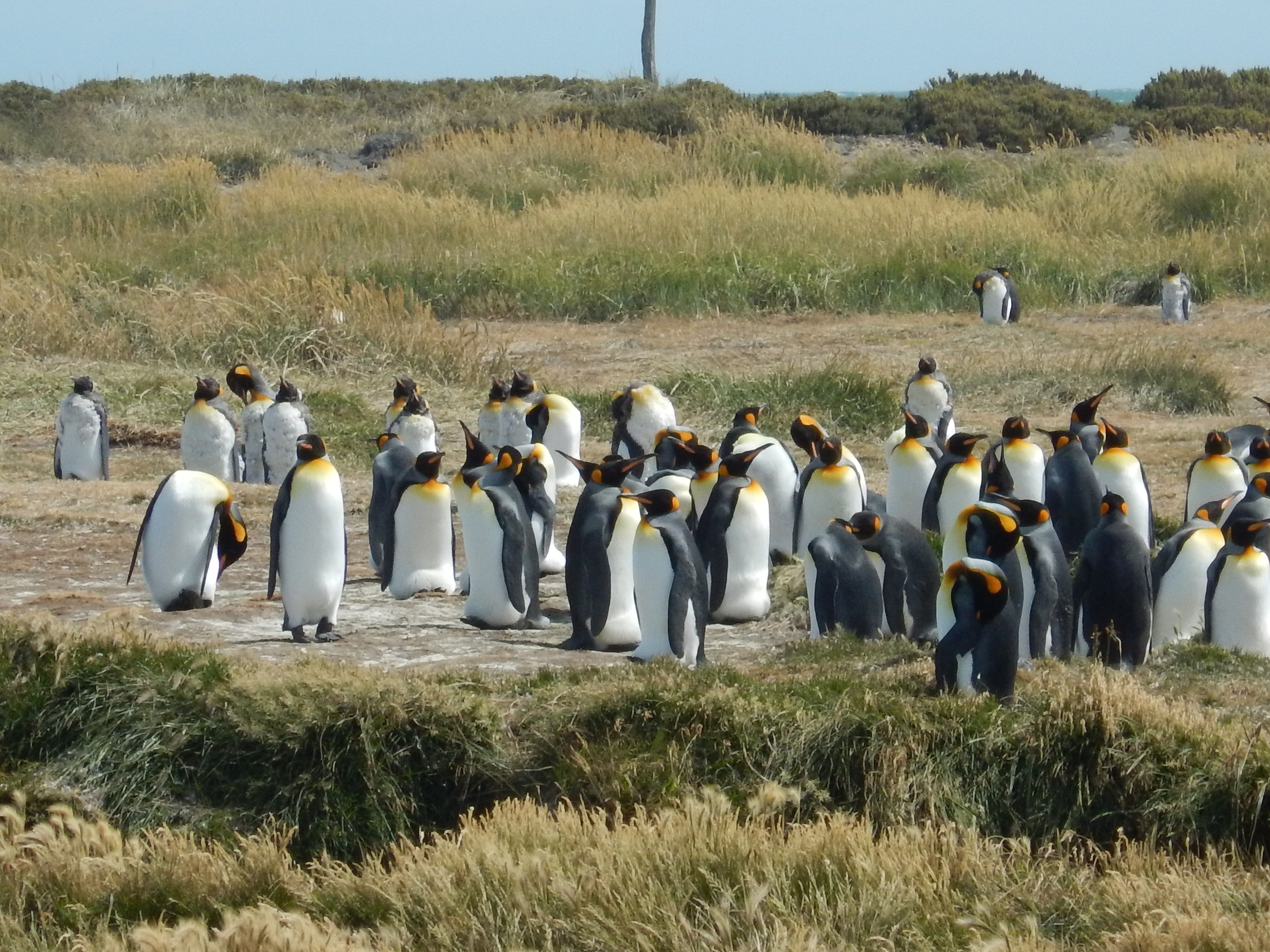
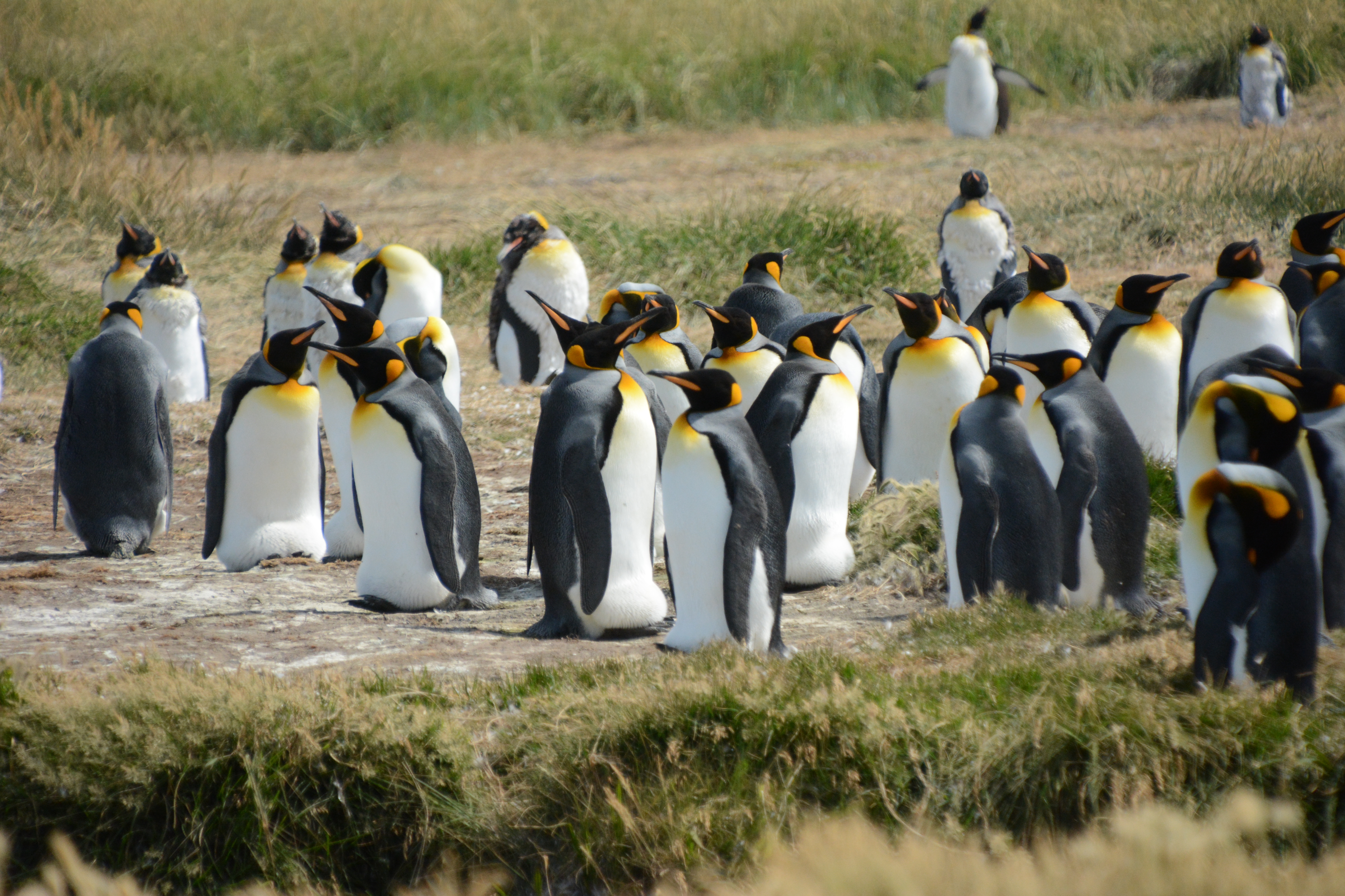
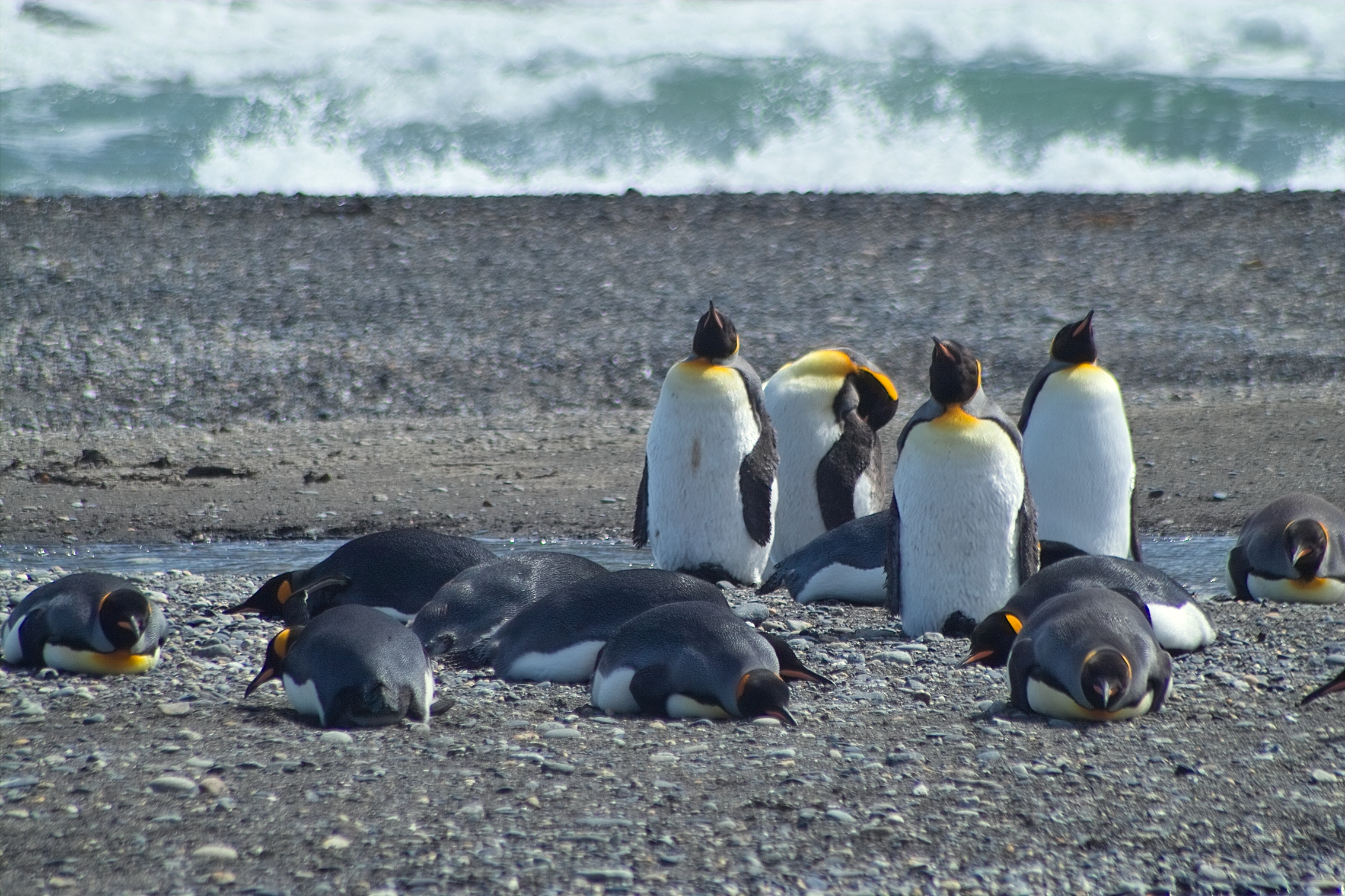
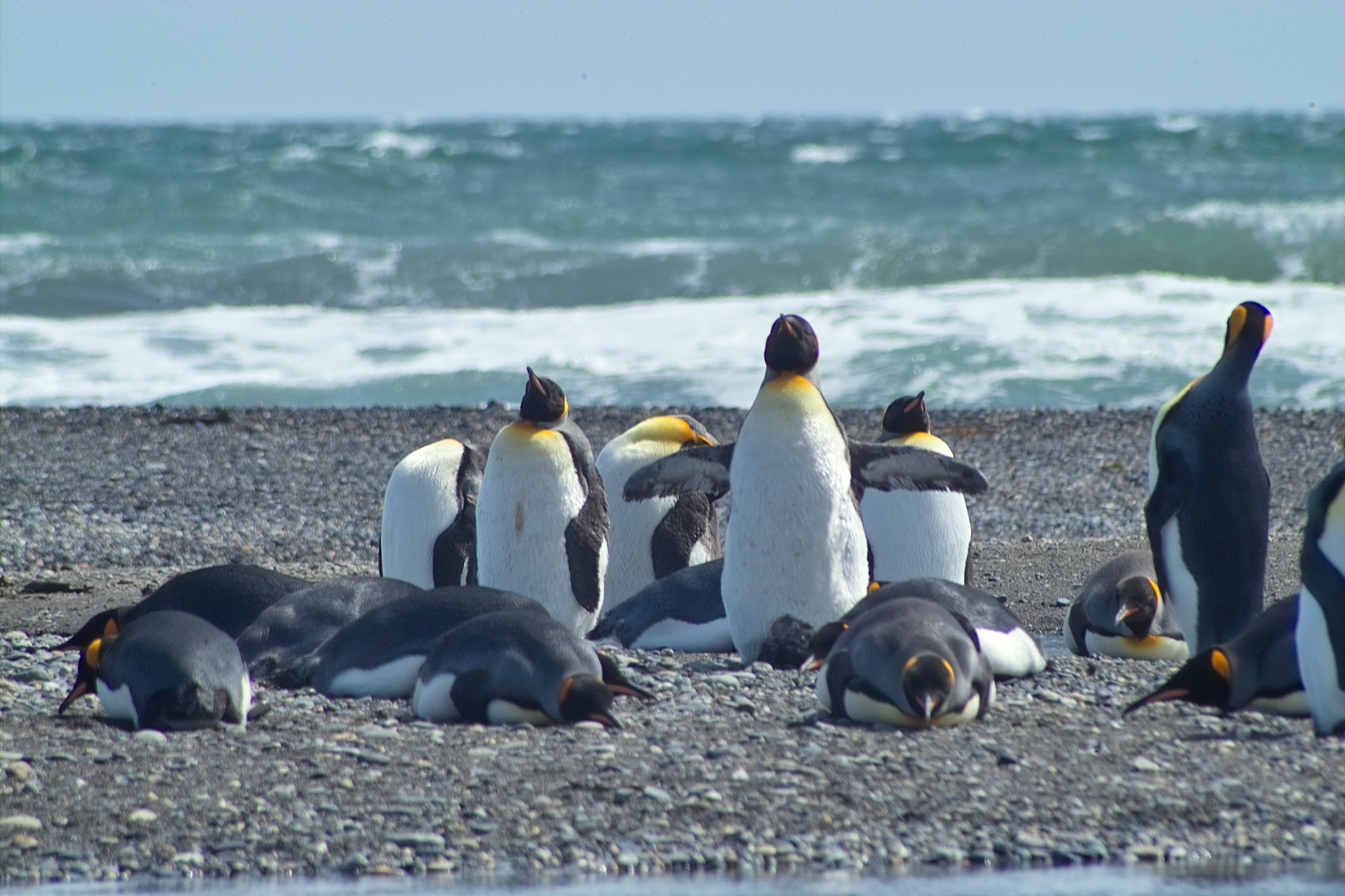
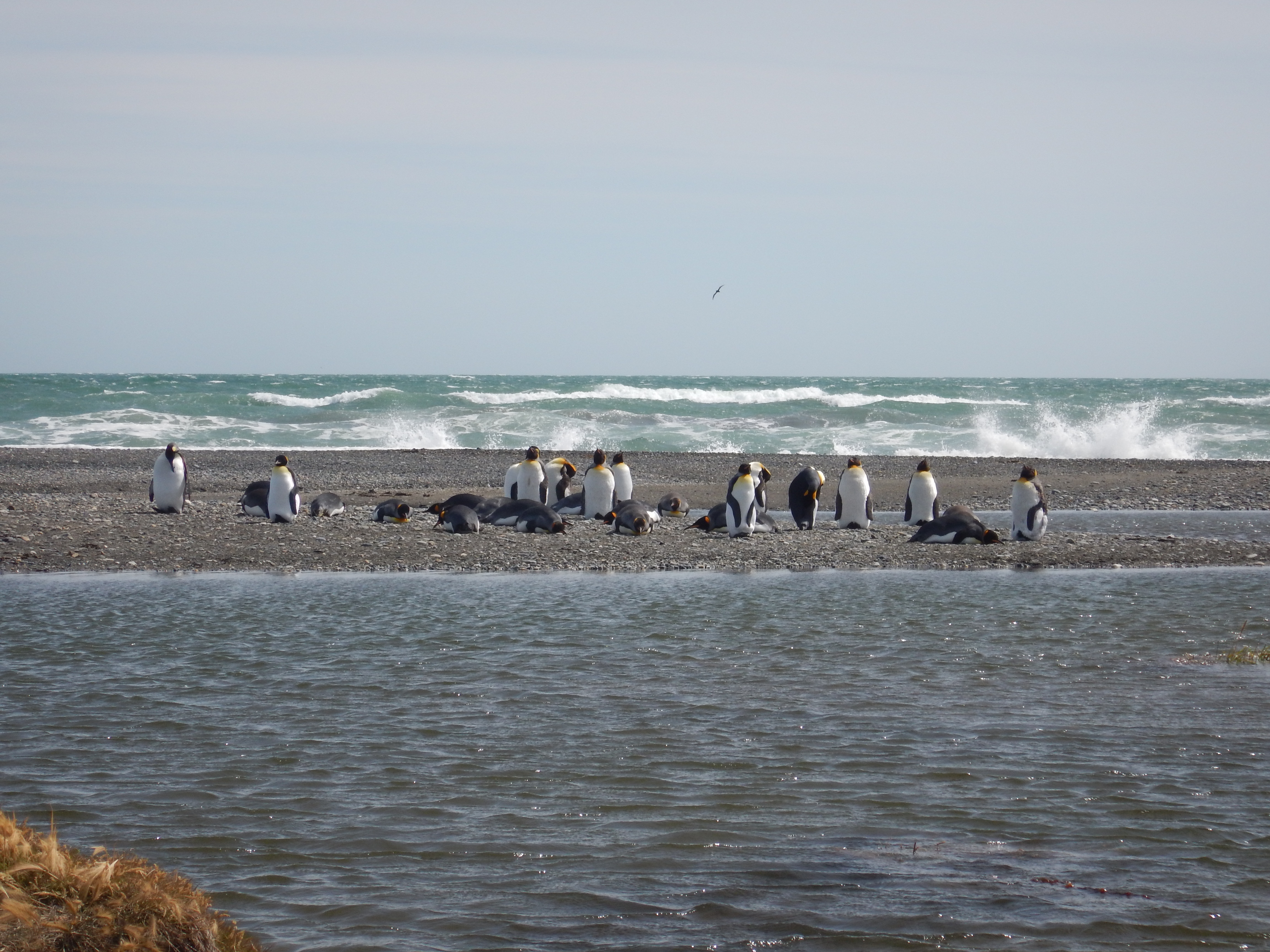
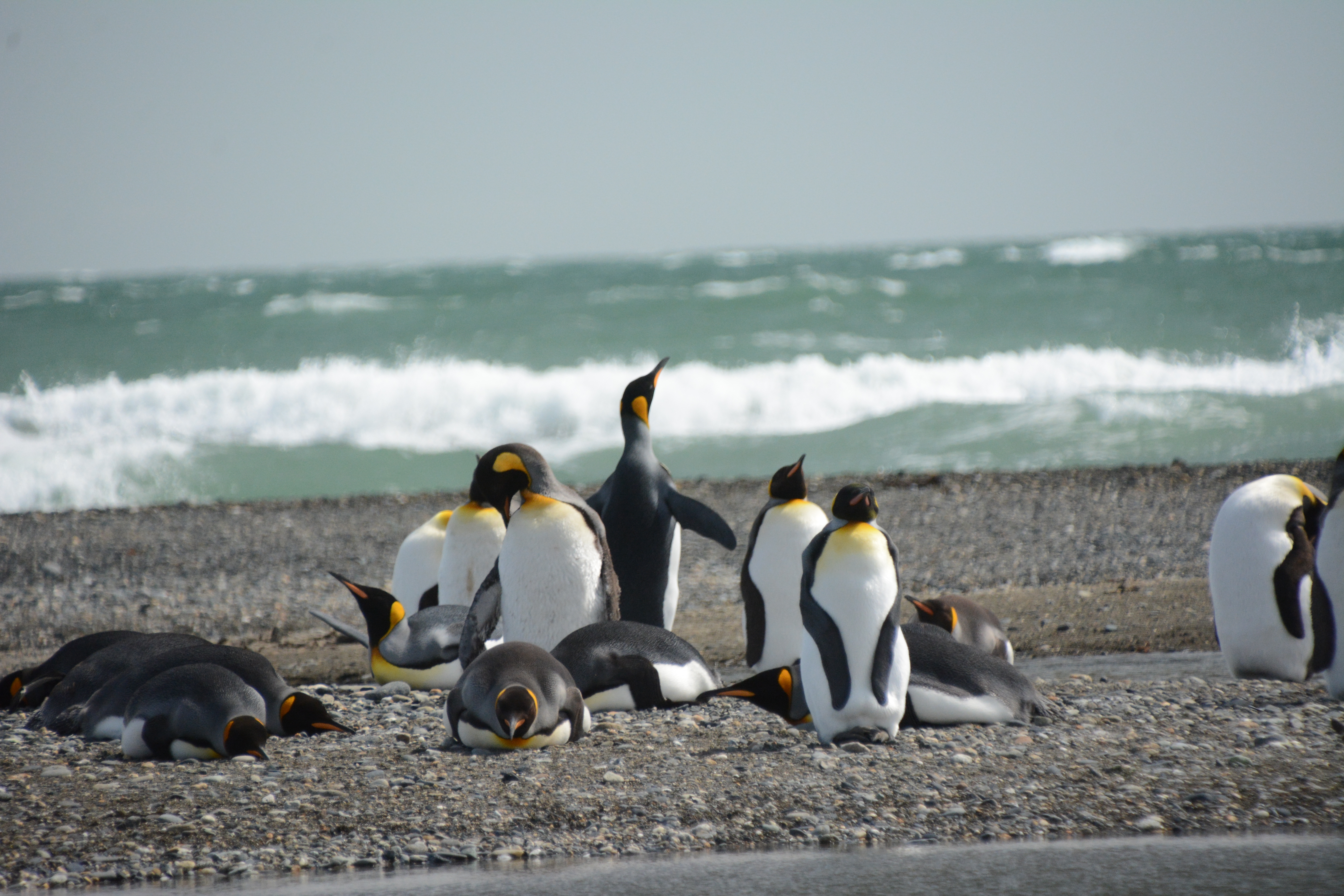
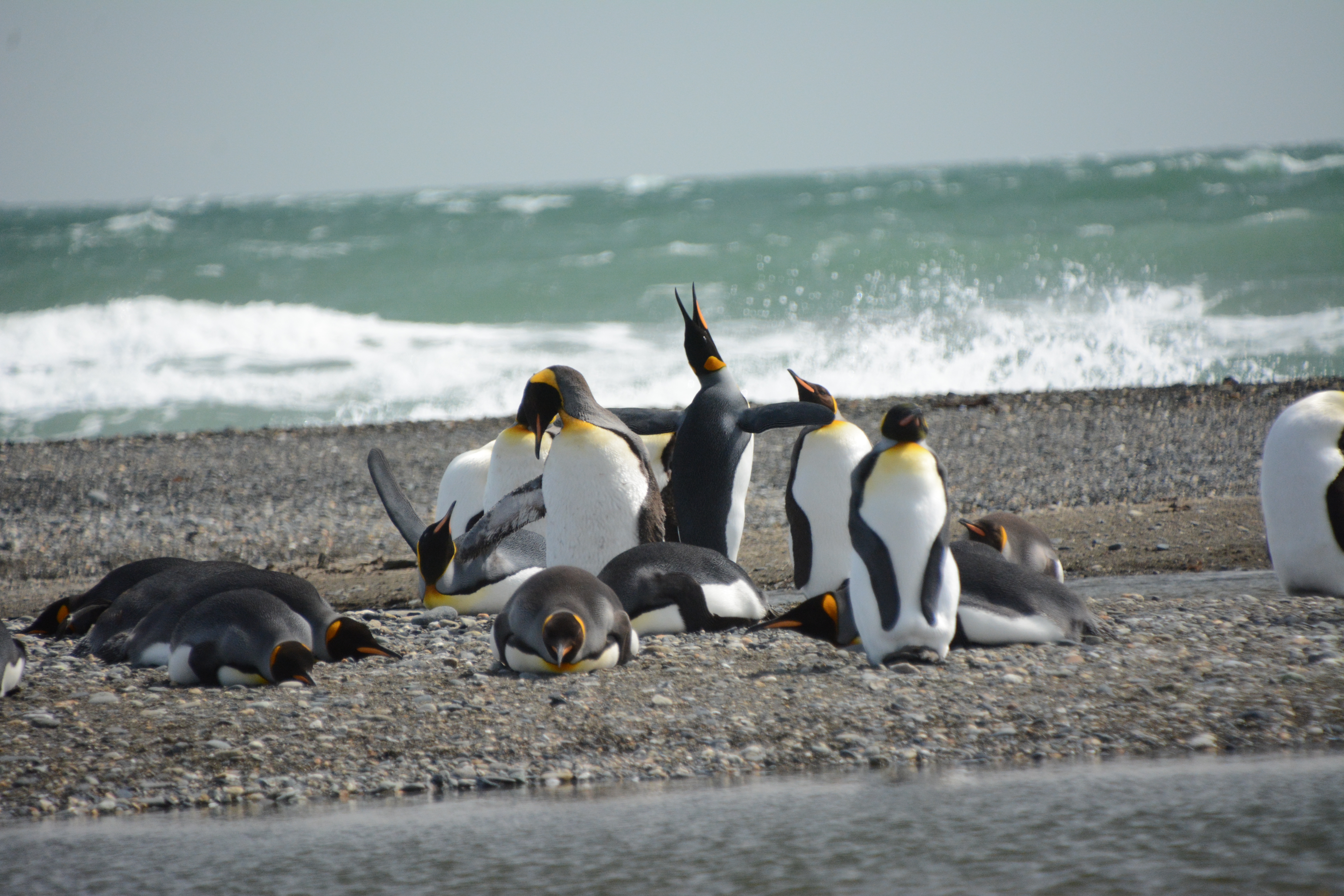
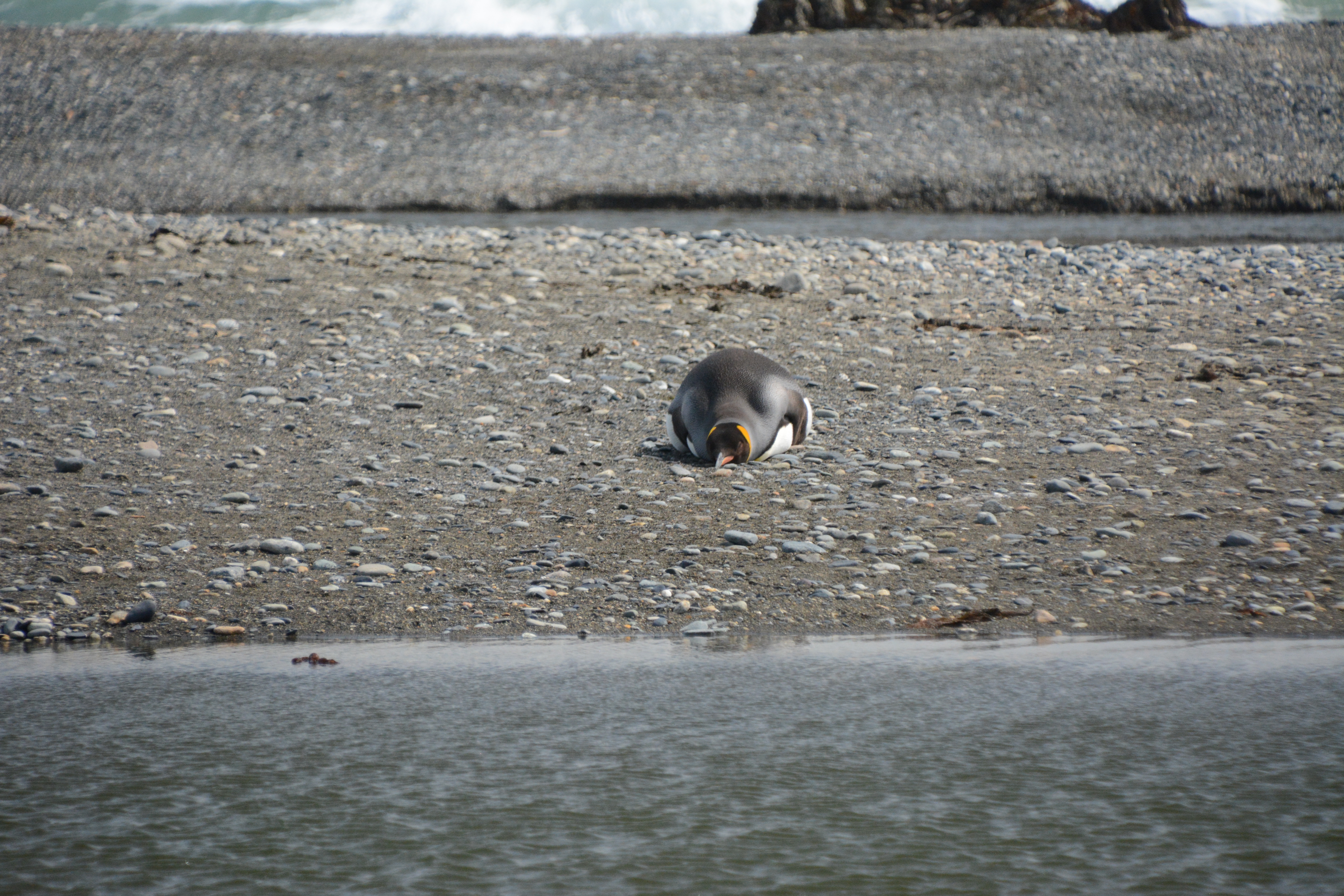
Tierra del Fuego
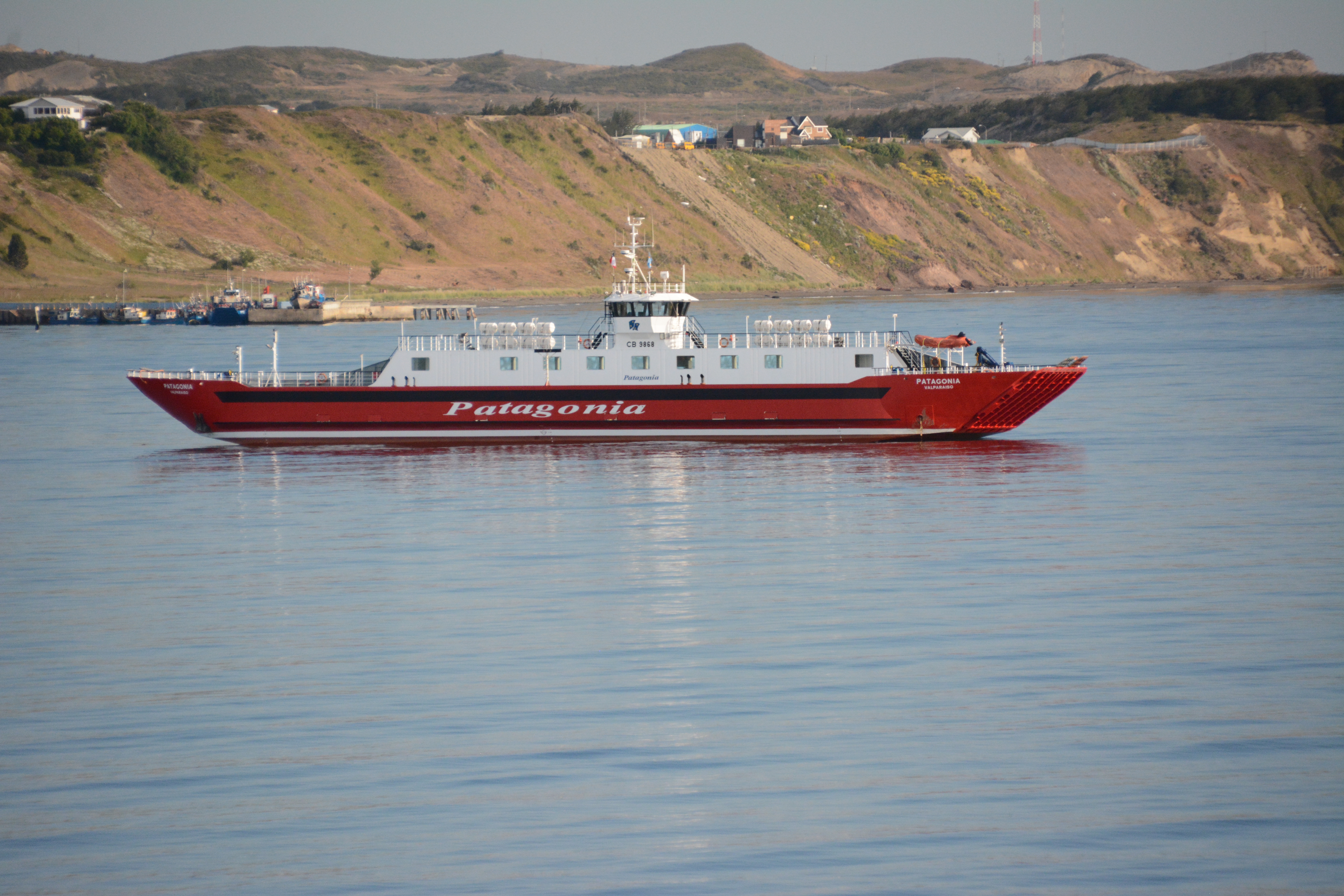
We had booked four seats on a tourist van that would spend the day in Tierra del Fuego. We visited a small museum, where we learned about the Selk'nam people, and a King penguin colony.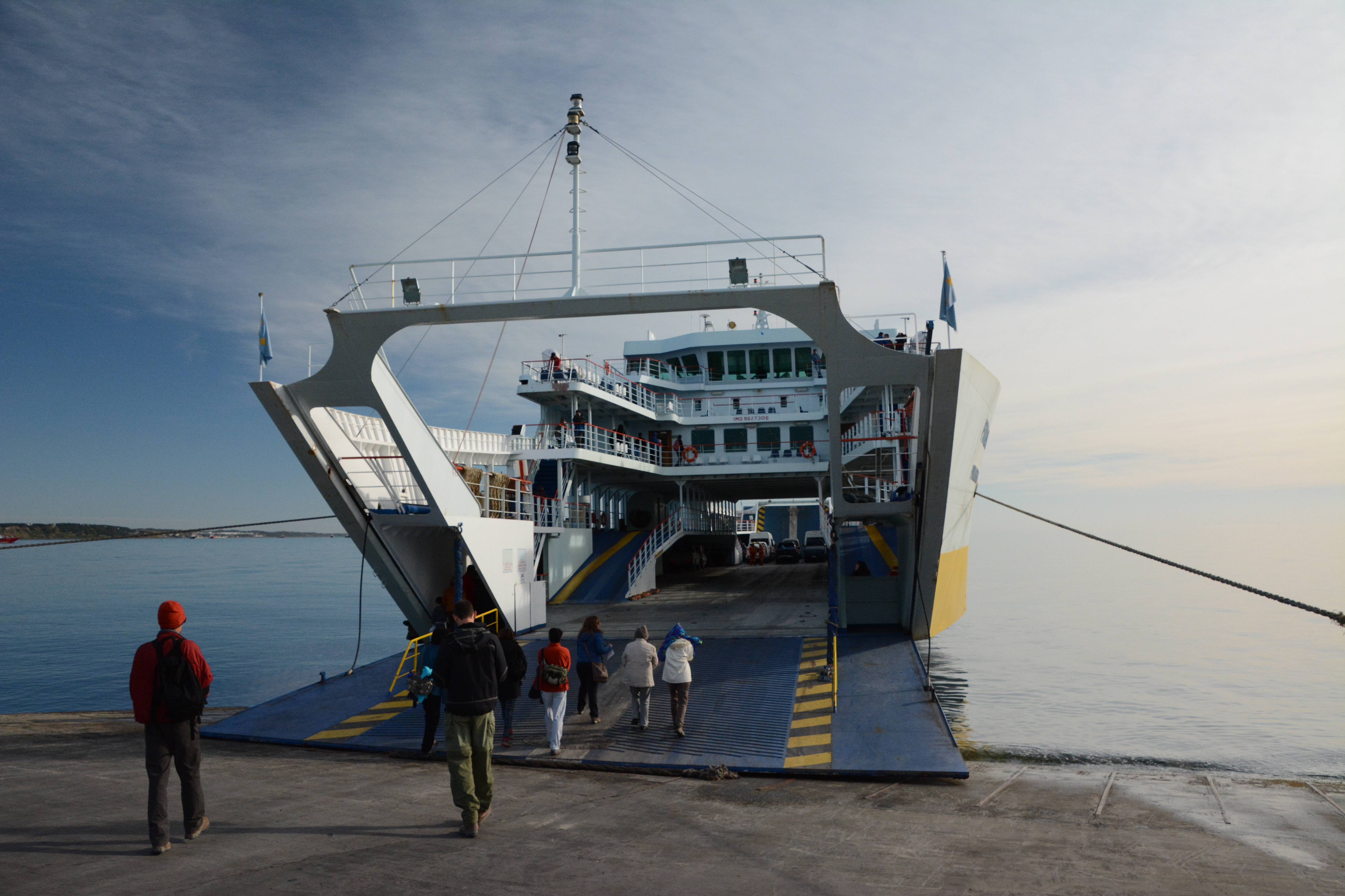 We boarded this ferry that took the Porvenir Crossing, bound for Tierra del Fuego.
Even though it was sunny, the ever-present wind made the deck really cold. The cabin was packed, mostly with locals.
The ferry sailed for over an hour.
We boarded this ferry that took the Porvenir Crossing, bound for Tierra del Fuego.
Even though it was sunny, the ever-present wind made the deck really cold. The cabin was packed, mostly with locals.
The ferry sailed for over an hour.
 Tierra del Fuego is a pretty barren place.
It's also a lot bigger than I had previously thought.
Tierra del Fuego is a pretty barren place.
It's also a lot bigger than I had previously thought.
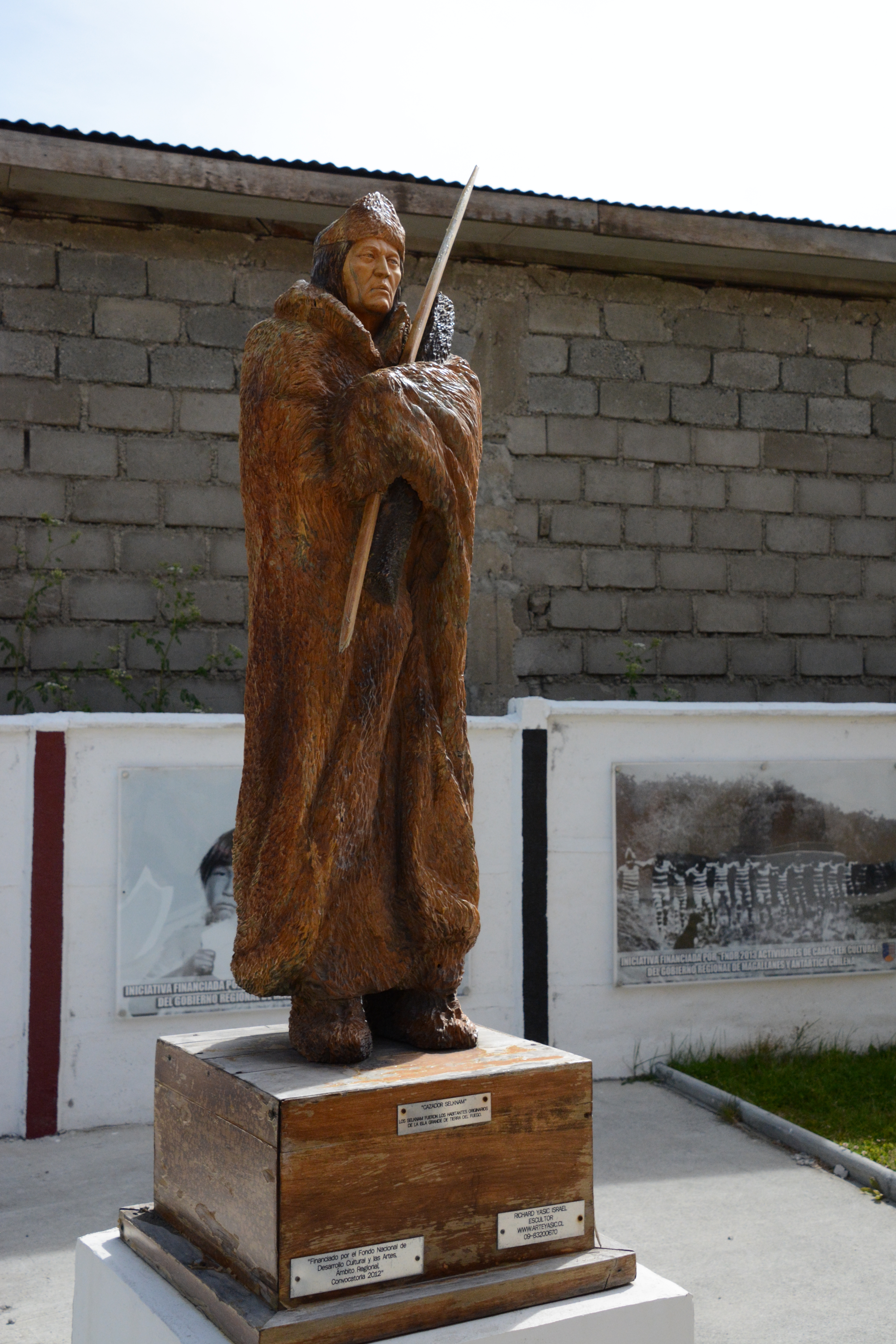
 These people were tough.
They were also huge for the time, the men averaging about six feet tall.
According to Charles Darwin's account, they canoed (naked!) around the Tierra del Fuego area, year-round.
Yeah... That's tough.
They kept warm (sort of) by coating themselves in seal oil and with open fires in their canoes!
These people were tough.
They were also huge for the time, the men averaging about six feet tall.
According to Charles Darwin's account, they canoed (naked!) around the Tierra del Fuego area, year-round.
Yeah... That's tough.
They kept warm (sort of) by coating themselves in seal oil and with open fires in their canoes!
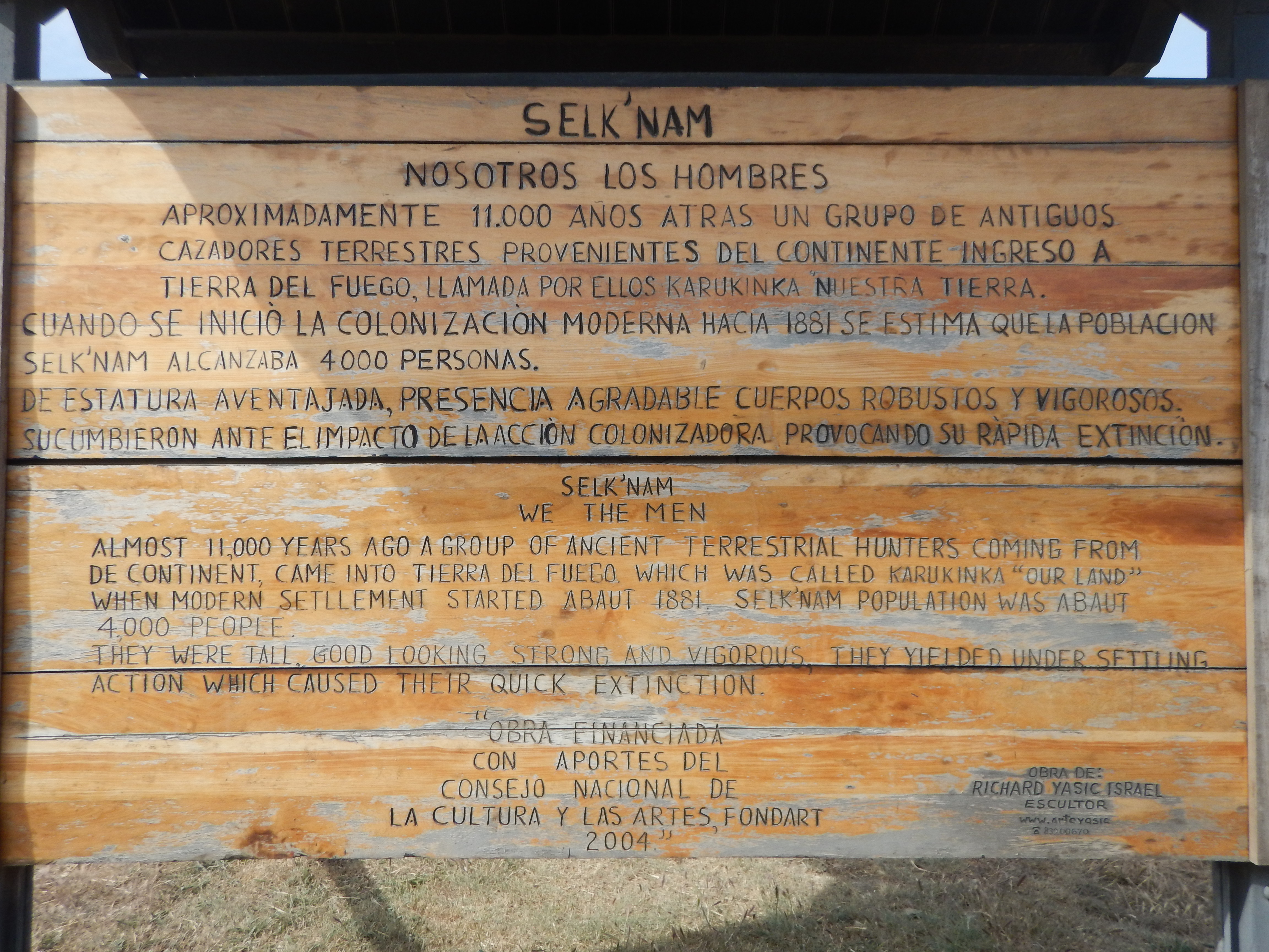
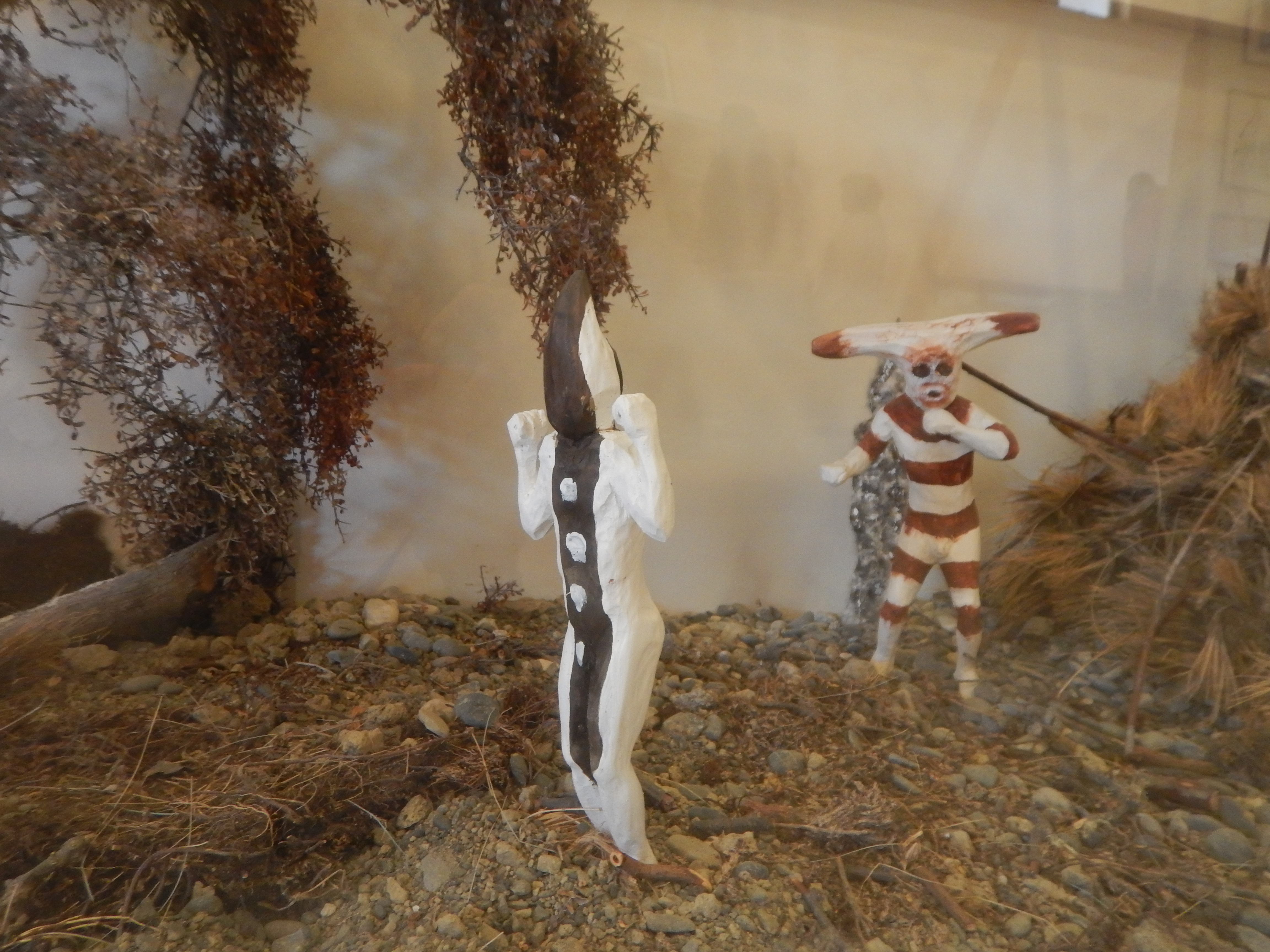 From a display at the museum. The Selk'nam and their 'Hain' ritual.
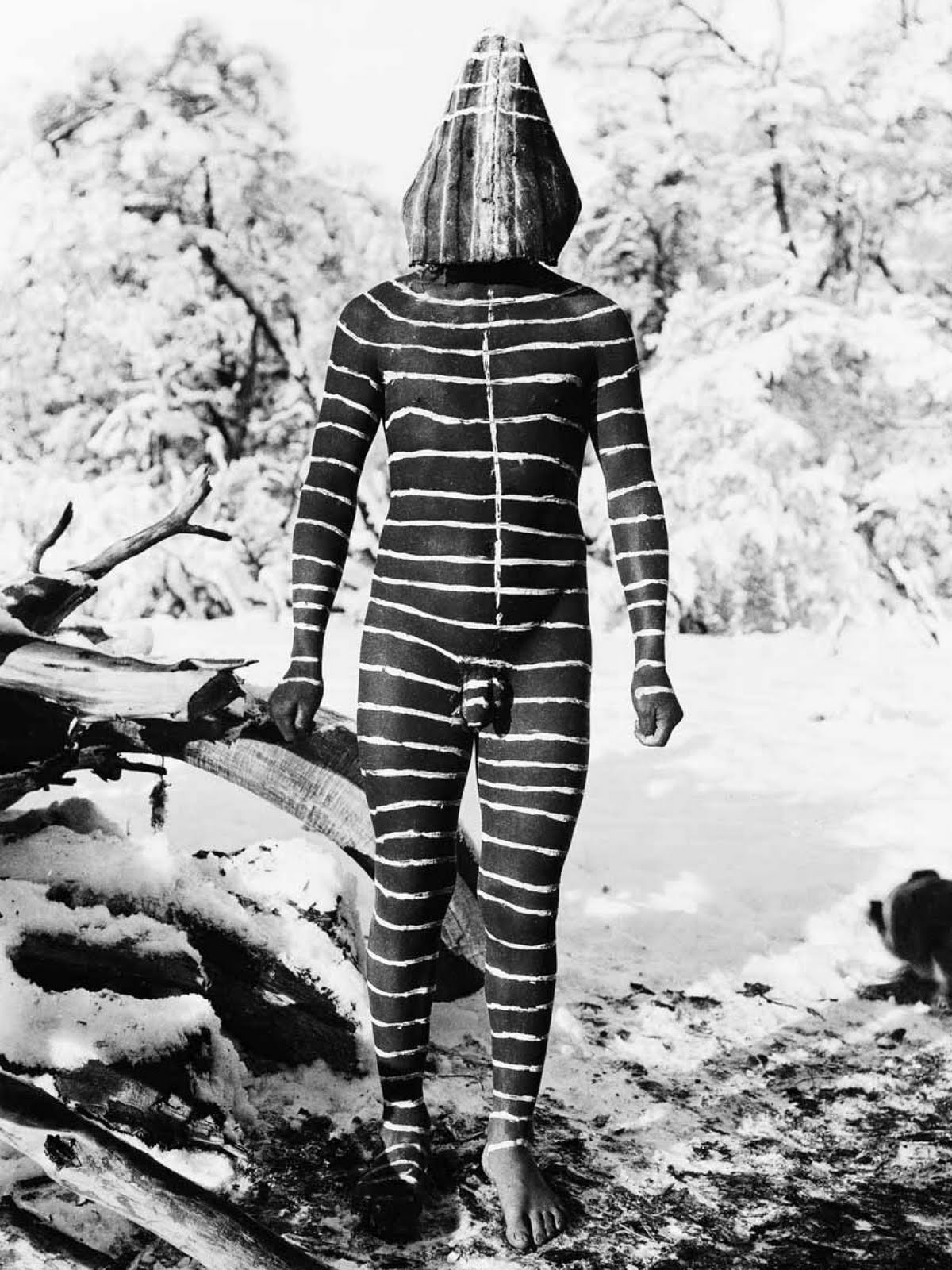
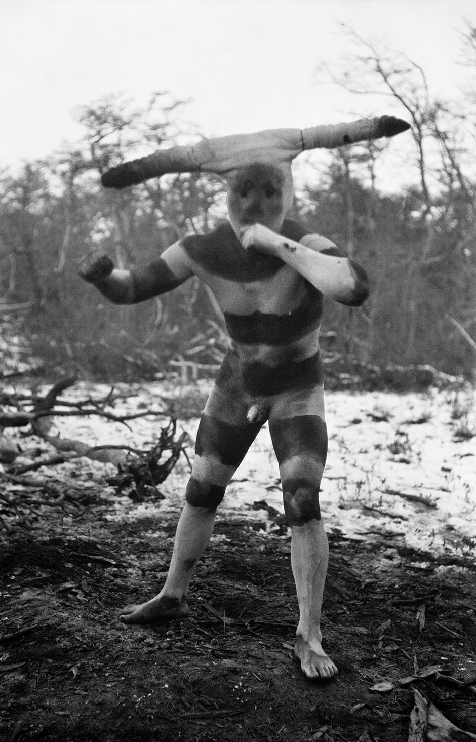 (Above and Below) A couple of old photos of Selk'nam men painted up for the 'Hain' ritual, a coming-of-age ceremony.
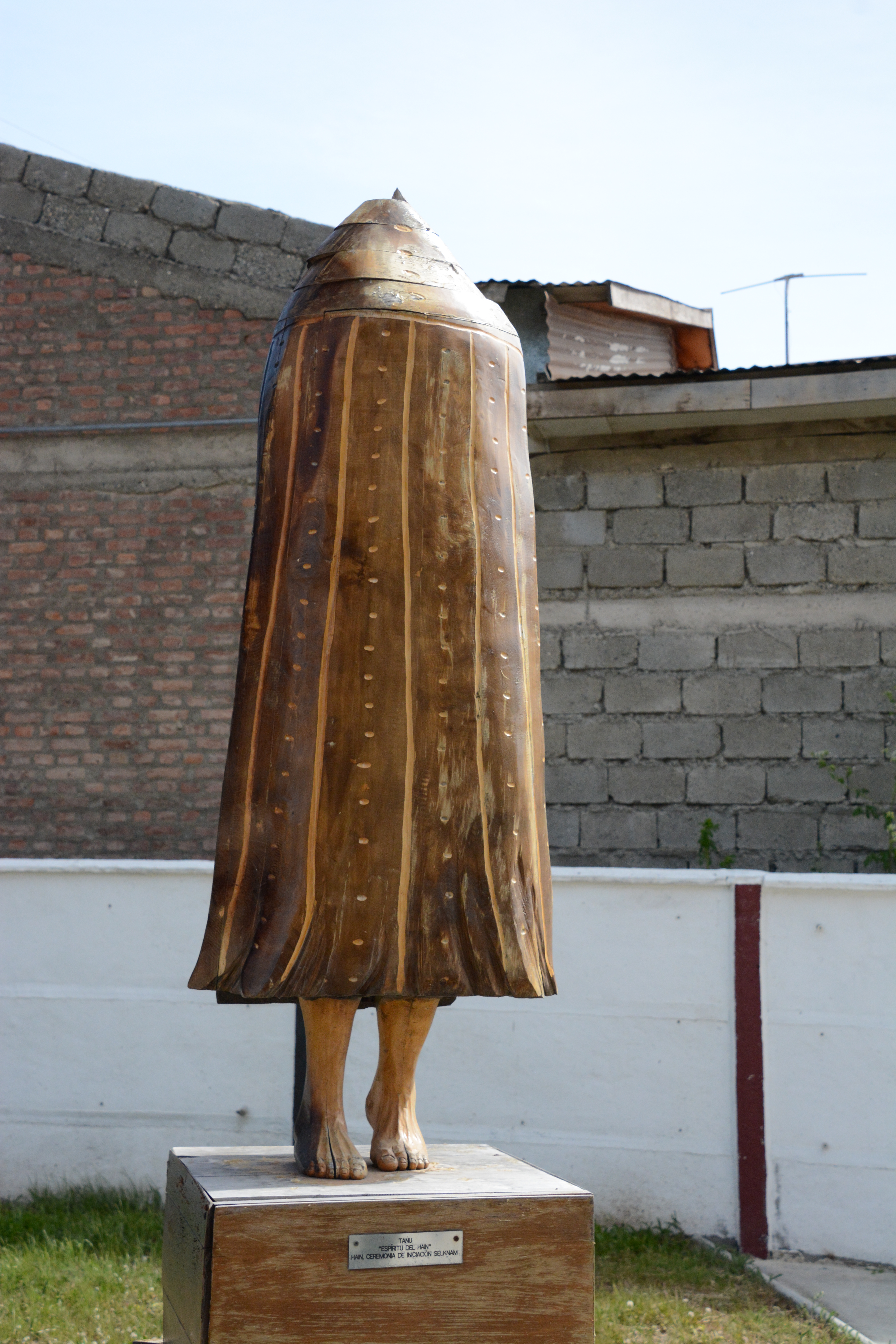 The wind god. A fierce presence down here, without a doubt.
 Chief Porvenir
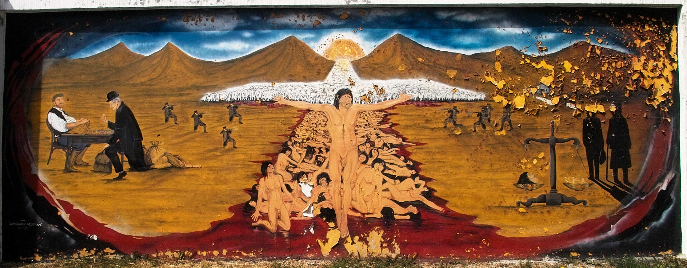 The story of these people, as depicted in this mural, is sadly familiar.
(colonialism, racism, theft, missionaries, internment, disease, genocide)
They are all gone now. The last one died in 1974.
The story of these people, as depicted in this mural, is sadly familiar.
(colonialism, racism, theft, missionaries, internment, disease, genocide)
They are all gone now. The last one died in 1974.
 We saw many guanaco along the way. Dan and Paul got some good photos.
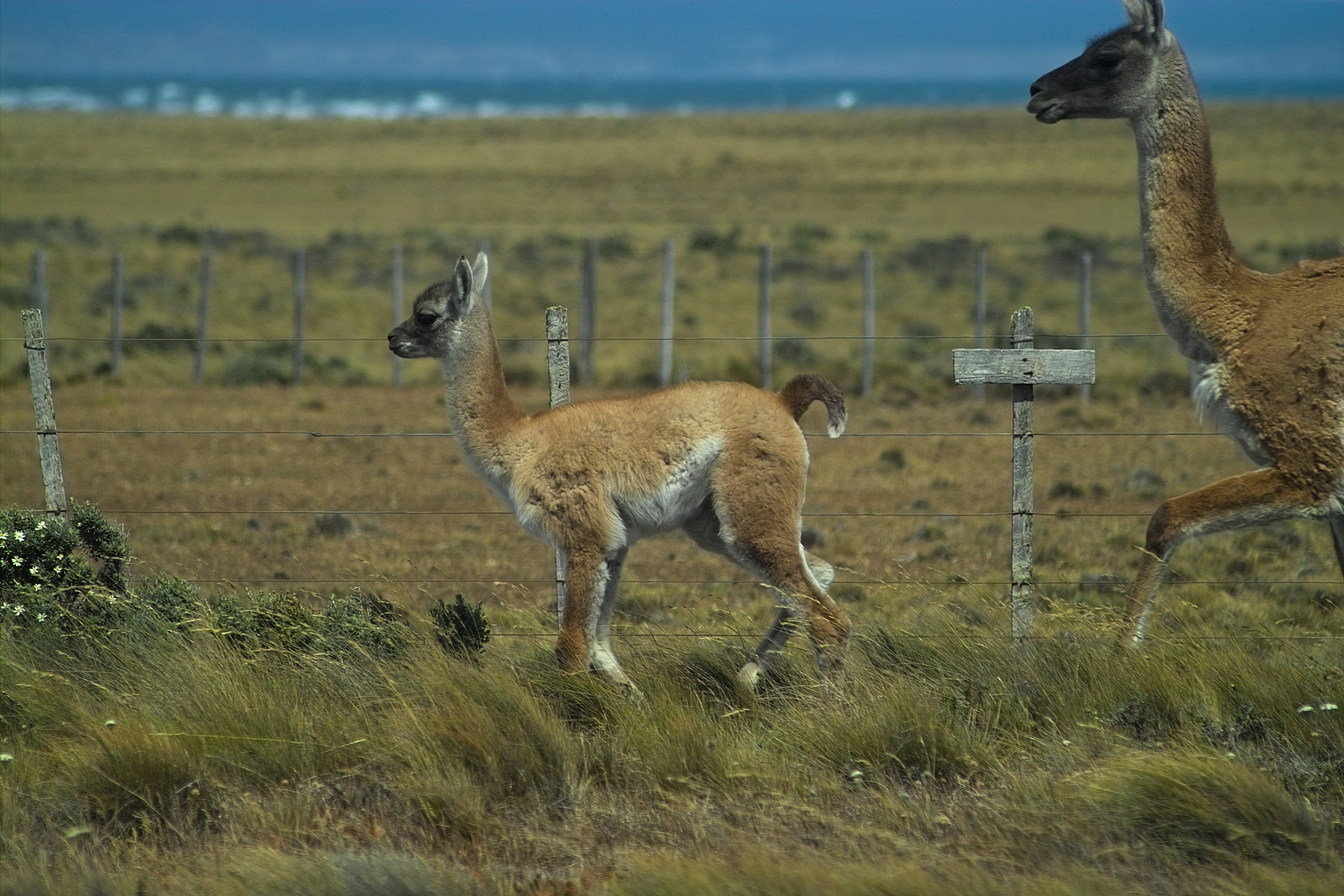
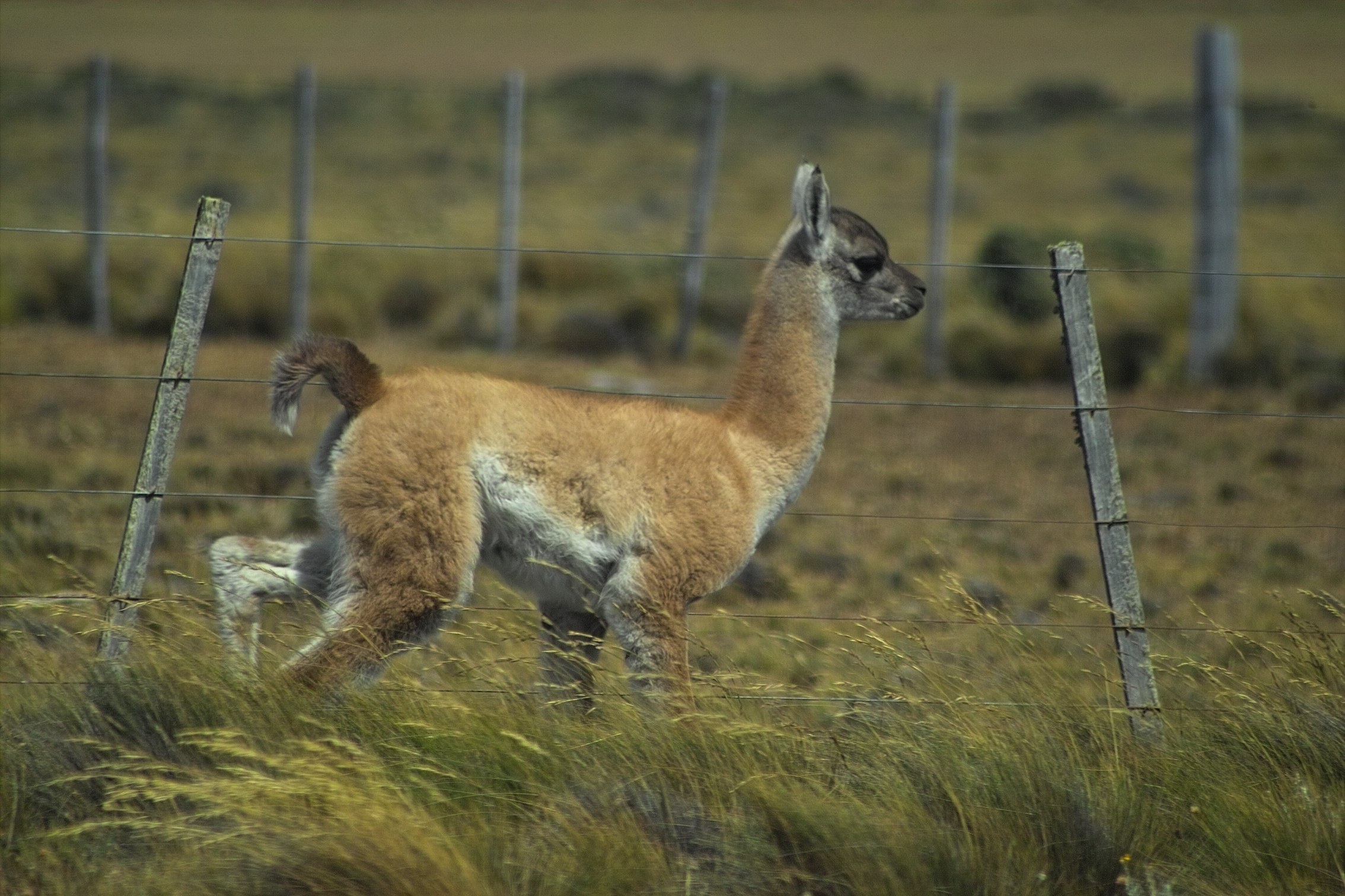 Awww. Baby Guanaco!
 More birds!
(Darwin's Rhea)
pretty weird birds, really.
More birds!
(Darwin's Rhea)
pretty weird birds, really.
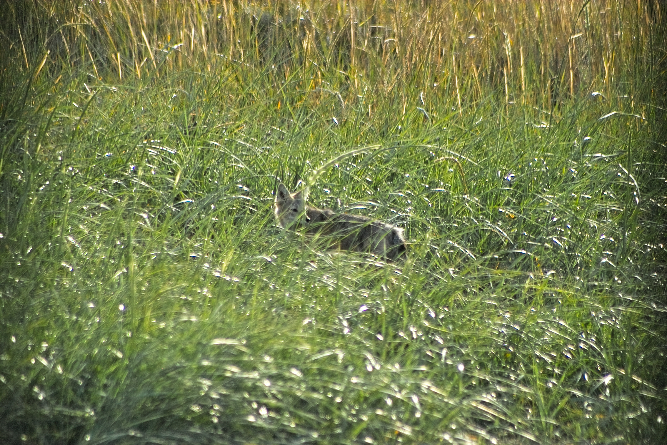 We spotted this fox near the ferry terminal on the way back.
 This is as far south as I have ever been.
53.47 degrees south latitude!
This is as far south as I have ever been.
53.47 degrees south latitude!


Video loading... Please be patient - or (more likely) its not working on your device
 Ok, those were some pretty cool birds.
 Three guys at the end of the world.
It's about time to head back to Cascadia.
The ride back was long, loud, bumpy, and dusty.
We travelled along many miles of dirt highway that were under construction. I was worried the van would rattle itself apart.
That struck me as an especially bad place to break down. It was fine, though.
Then it was another ferry, another night in the hotel, and another 28 hours of flights to get back home.
I was thrilled to see my family at the Sea-Tac baggage claim. We had missed each other.
At the same time, I was definitely sad to turn the final page on this great adventure!
Three guys at the end of the world.
It's about time to head back to Cascadia.
The ride back was long, loud, bumpy, and dusty.
We travelled along many miles of dirt highway that were under construction. I was worried the van would rattle itself apart.
That struck me as an especially bad place to break down. It was fine, though.
Then it was another ferry, another night in the hotel, and another 28 hours of flights to get back home.
I was thrilled to see my family at the Sea-Tac baggage claim. We had missed each other.
At the same time, I was definitely sad to turn the final page on this great adventure!
Farewell Patagonia!
