Glacier Peak July 8-12, 2012
View Larger Map Glacier Peak is just east of the Cascade crest, in the northern part of Washington State. It is just south of the North Cascades National Park, in the Glacier Peak Wilderness.
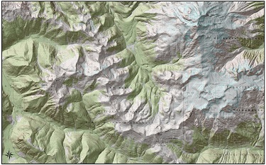 The above image links to the 24K topo map, and it's kind of a big file.
Right-click and 'Save As..' if you want to check it out.
The above image links to the 24K topo map, and it's kind of a big file.
Right-click and 'Save As..' if you want to check it out.
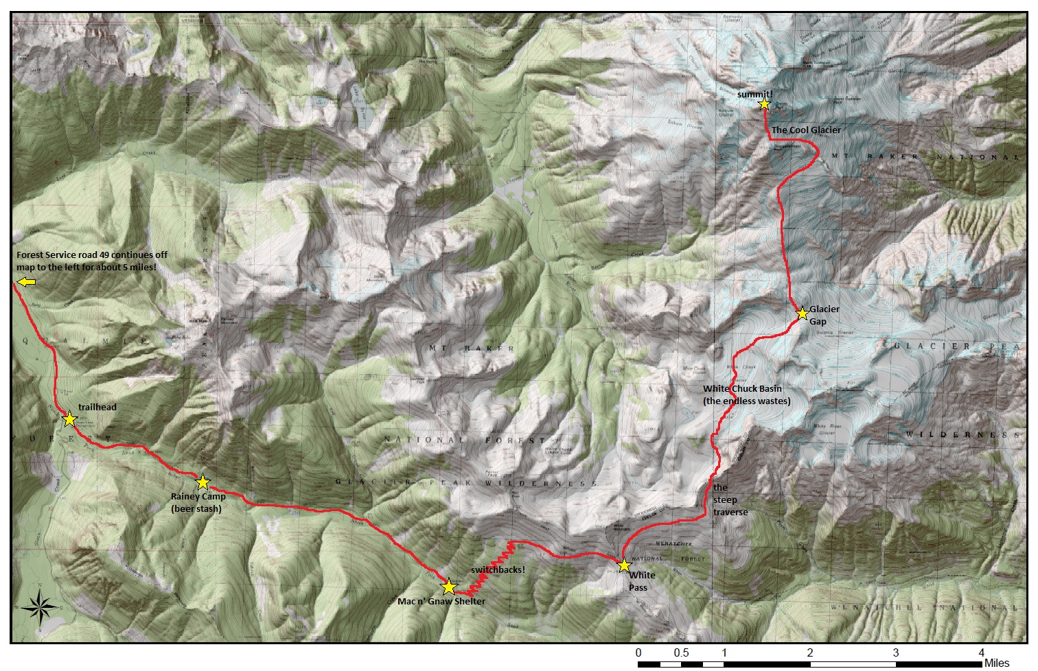 I highly recommend clicking on the above map to gigantify it. It'll help you understand details of our five-day journey.
The route we took is shown in red. There are also landmarks along the way that I will refer to in the story below.
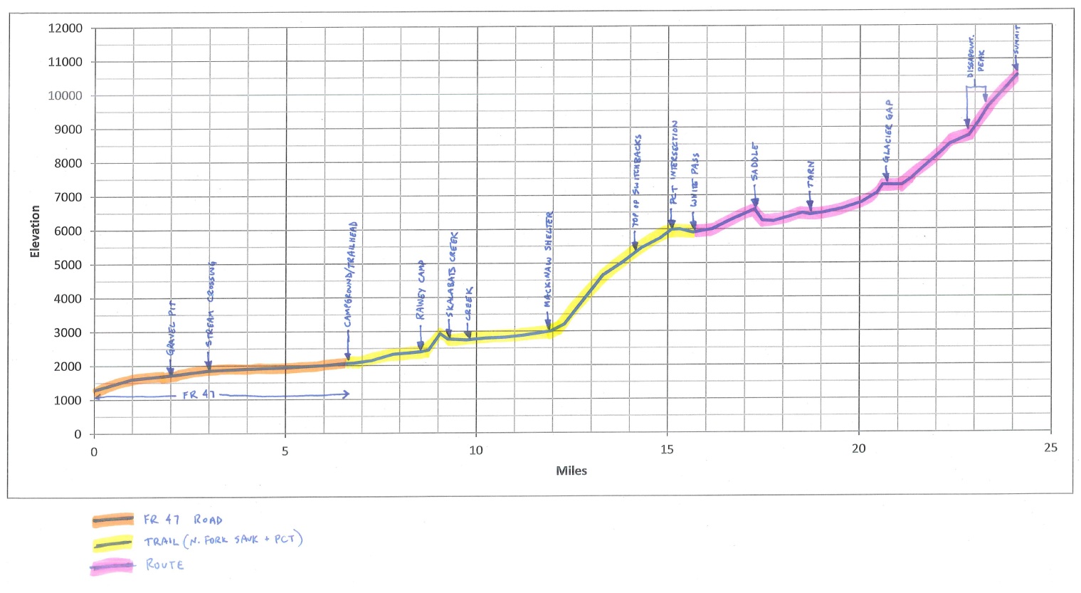 This is an image of the trip profile that I generated before we left. It was fairly accurate, but not perfect.
We referred to the profile regularly during the trip. It helped us make decisions on how far to push it on any particular day.
This is an image of the trip profile that I generated before we left. It was fairly accurate, but not perfect.
We referred to the profile regularly during the trip. It helped us make decisions on how far to push it on any particular day.
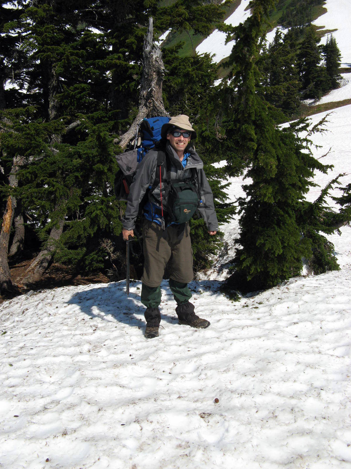
Day 1: Road closures, bear poop, and Thor
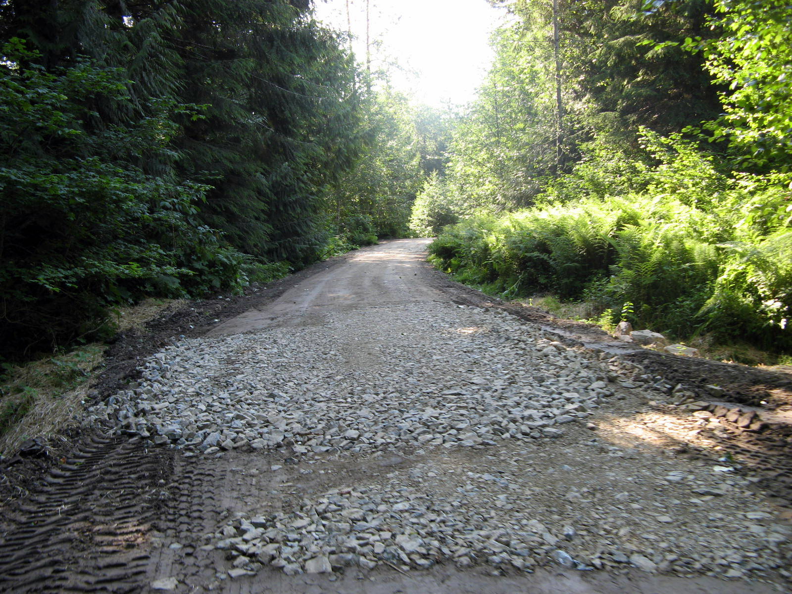 The Forest Service road that leads to the trailhead (shown in orange on the profile above) was closed.
Yeah... serious bummer. The road closure added 6.5 miles (each way) onto an already long hike.
Being a bit of a scofflaw, I decided to go ahead and see what all this road-closure fuss was about, using the Jeep of course.
Kevin and Dan moved the barricade to one side, I drove through, and then the guys replaced it.
We were able to drive all the way up the closed road to the trailhead, passing a few day-hikers and some construction equipment on the way up.
We dropped Dan with the three packs at the top of the road and then drove back down and parked the Jeep at the bottom.
As Kevin and I were hiking (without packs!) back up the road, we were passed by a white pickup truck, driven by one of the road crew workers.
Eventually we caught up to the pickup truck. It was parked in the middle of the road, and the driver was working on a piece of equipment nearby.
I was glad that our timing with the Jeep worked out. I would have hated explaining to the pickup driver why I needed him to move his truck so that I could drive back down through his work zone.
... Anyway, we kind of half cheated our way around the road closure. It still took Kevin and me a couple of hours to walk the whole road while Dan was chillin' with the packs at the trailhead.
The Forest Service road that leads to the trailhead (shown in orange on the profile above) was closed.
Yeah... serious bummer. The road closure added 6.5 miles (each way) onto an already long hike.
Being a bit of a scofflaw, I decided to go ahead and see what all this road-closure fuss was about, using the Jeep of course.
Kevin and Dan moved the barricade to one side, I drove through, and then the guys replaced it.
We were able to drive all the way up the closed road to the trailhead, passing a few day-hikers and some construction equipment on the way up.
We dropped Dan with the three packs at the top of the road and then drove back down and parked the Jeep at the bottom.
As Kevin and I were hiking (without packs!) back up the road, we were passed by a white pickup truck, driven by one of the road crew workers.
Eventually we caught up to the pickup truck. It was parked in the middle of the road, and the driver was working on a piece of equipment nearby.
I was glad that our timing with the Jeep worked out. I would have hated explaining to the pickup driver why I needed him to move his truck so that I could drive back down through his work zone.
... Anyway, we kind of half cheated our way around the road closure. It still took Kevin and me a couple of hours to walk the whole road while Dan was chillin' with the packs at the trailhead.
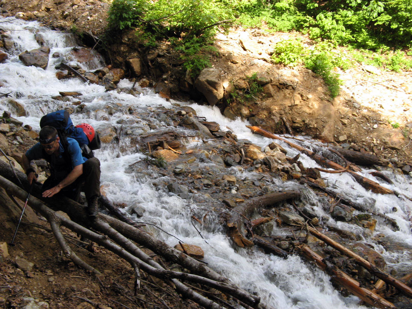 The trail follows the north fork of the Sauk River. There were a few stream crossings, including the one shown above.
About two miles down the trail, at a place called Rainey Camp, we stashed three beers in an old stump. That's thinking ahead!
The trail follows the north fork of the Sauk River. There were a few stream crossings, including the one shown above.
About two miles down the trail, at a place called Rainey Camp, we stashed three beers in an old stump. That's thinking ahead!
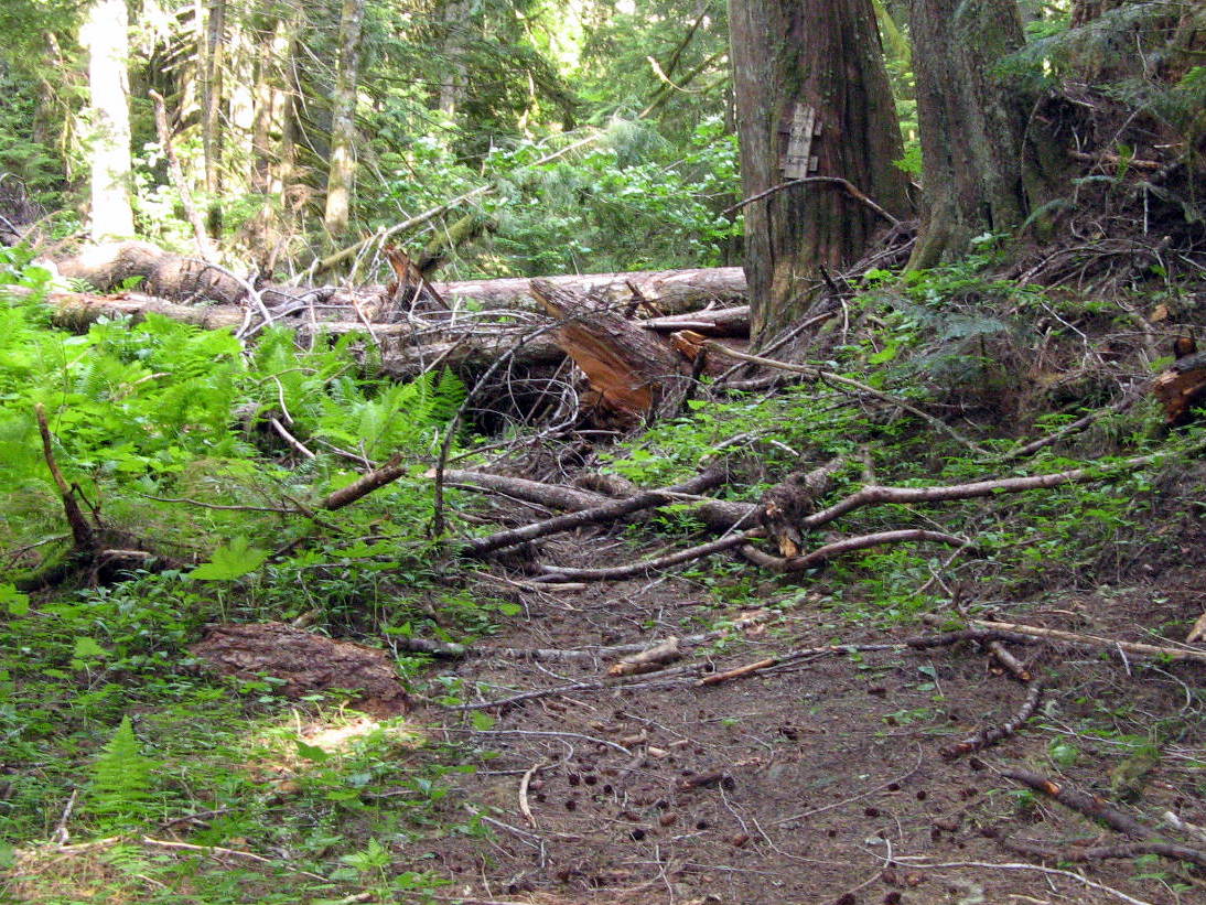
 There was a lot of debris from the winter still across the trail.
We clambered over and under logs and crashed through the brush to get around a dozen or so of these obstacles.
There was a lot of debris from the winter still across the trail.
We clambered over and under logs and crashed through the brush to get around a dozen or so of these obstacles.
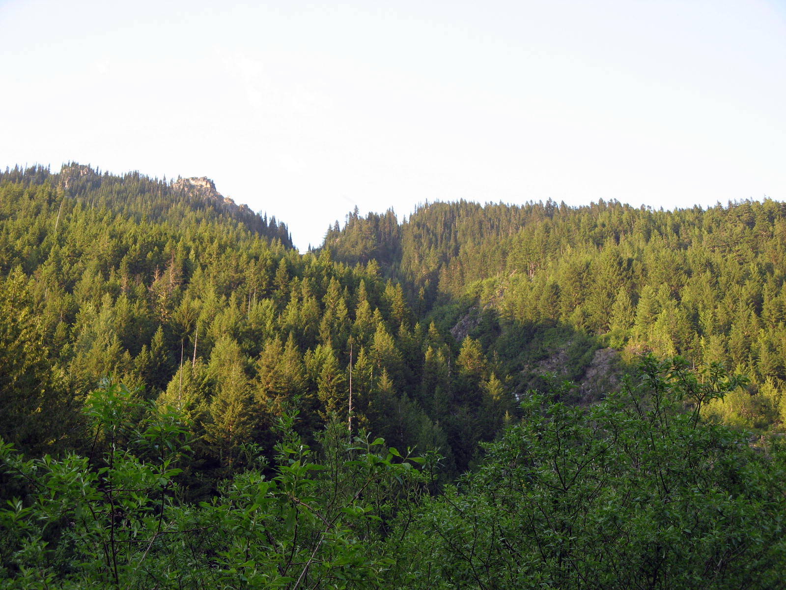
 The trail crossed several low-lying meadows that were thick with brush.
Amidst the berry bushes and nettles, were many large fresh piles of bear scat. Yikes.
The trail crossed several low-lying meadows that were thick with brush.
Amidst the berry bushes and nettles, were many large fresh piles of bear scat. Yikes.
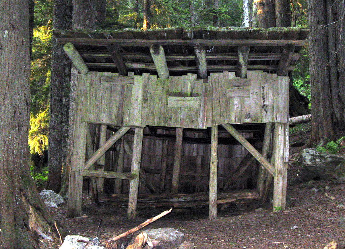 The bear scat was so common on the trail leading up to Mackinaw shelter, that we started calling it 'Mac an' gnaw Shelter'.
We came upon the shelter in the late afternoon. We didn't intend to camp in the shelter, as it wasn't very inviting. We found some semi-flat bivy sites down by the river nearby.
Around sunset we rigged a food bag up on the rope and tried to hang it high in a tree. When the branch broke and almost clocked Kevin in the head, we decided to simply hang the food bag from the shelter roof.
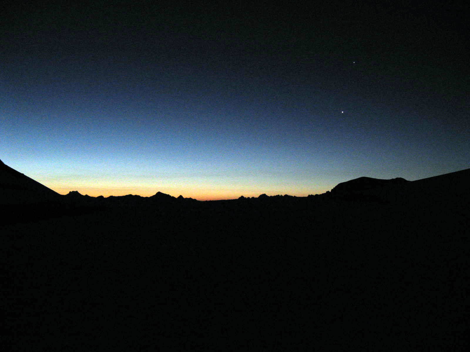
The stars were out as I zipped myself into my bivy that evening. I recall the loud rush of the river nearby as I tossed and turned trying to get comfortable on roots sticking out of the hard ground.
Then I saw the first flash of lightning in the southern sky. 'Oh boy' I thought. We had seen a 30% chance of thunderstorms in the forecast.
The first raindrops began to fall around midnight, accompanied by distant rolling thunder and flashes of lightning.
I recall counting seconds between the flash and the thunder as I lay there. For some time it was eight seconds. Then, all of the sudden, it seemed to be right on top of us.
For a couple of hours, we lay in our bivies under that thunderstorm, being pelted by hard rain and subjected to the insanely loud cracks and roars of thunder.
The lightning would illuminate the sky and then, an instant later, the thunder would rip through the air, as if the sky was being torn apart and the mountains and rivers were crashing down around us.
The lightning was close enough to start a forest fire in the next valley over. The thunder was terrifyingly loud and violent.
I laid there through the whole thing, imagining the mountain sliding down into our camp and discovering leaks in my bivy.
Needless to say, there was no sleep for us until the storm passed around dawn. We were soaked.
The bear scat was so common on the trail leading up to Mackinaw shelter, that we started calling it 'Mac an' gnaw Shelter'.
We came upon the shelter in the late afternoon. We didn't intend to camp in the shelter, as it wasn't very inviting. We found some semi-flat bivy sites down by the river nearby.
Around sunset we rigged a food bag up on the rope and tried to hang it high in a tree. When the branch broke and almost clocked Kevin in the head, we decided to simply hang the food bag from the shelter roof.
The stars were out as I zipped myself into my bivy that evening. I recall the loud rush of the river nearby as I tossed and turned trying to get comfortable on roots sticking out of the hard ground.
Then I saw the first flash of lightning in the southern sky. 'Oh boy' I thought. We had seen a 30% chance of thunderstorms in the forecast.
The first raindrops began to fall around midnight, accompanied by distant rolling thunder and flashes of lightning.
I recall counting seconds between the flash and the thunder as I lay there. For some time it was eight seconds. Then, all of the sudden, it seemed to be right on top of us.
For a couple of hours, we lay in our bivies under that thunderstorm, being pelted by hard rain and subjected to the insanely loud cracks and roars of thunder.
The lightning would illuminate the sky and then, an instant later, the thunder would rip through the air, as if the sky was being torn apart and the mountains and rivers were crashing down around us.
The lightning was close enough to start a forest fire in the next valley over. The thunder was terrifyingly loud and violent.
I laid there through the whole thing, imagining the mountain sliding down into our camp and discovering leaks in my bivy.
Needless to say, there was no sleep for us until the storm passed around dawn. We were soaked.
Day 2: Switchbacks and sunshine
 Beaten down and set back, but not defeated, we ate a quick breakfast (powdered eggs and tortillas), packed up our wet gear, and hit the trail, heading for the switchbacks.
It was a late start. A little disheartened and grumpy, we didn't leave Mac an' Gnaw until about noon.
Every climb seems to have this component: the steep forested switchbacks that get you up into the subalpine. It's just part of the deal.
We climbed about 2500 feet over a little more than 2 miles that morning. The exercise felt good and woke us all up.
Beaten down and set back, but not defeated, we ate a quick breakfast (powdered eggs and tortillas), packed up our wet gear, and hit the trail, heading for the switchbacks.
It was a late start. A little disheartened and grumpy, we didn't leave Mac an' Gnaw until about noon.
Every climb seems to have this component: the steep forested switchbacks that get you up into the subalpine. It's just part of the deal.
We climbed about 2500 feet over a little more than 2 miles that morning. The exercise felt good and woke us all up.
 We started to hit the snow at about 5500 feet, where we lost the trail and began following some flagging in the trees that led us northeast, toward a prominent saddle called White Pass.
We kept our eyes on the skies, watching the cumulous clouds suspiciously.
We started to hit the snow at about 5500 feet, where we lost the trail and began following some flagging in the trees that led us northeast, toward a prominent saddle called White Pass.
We kept our eyes on the skies, watching the cumulous clouds suspiciously.
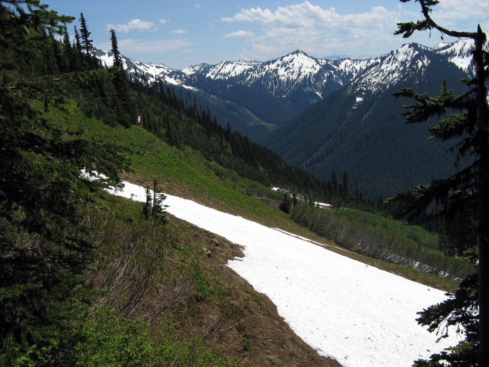
 We got our first view of White Pass around 1:00 in the afternoon. This was our intended lunch spot. We planned to eat lunch and then push on to the White Chuck Basin, or maybe even to Glacier Gap.
White Pass is at about 6000 feet, at the top of the treeline. Beyond White Pass, there would be no trees and no shade.
We held a quick vote once we arrived at the pass and decided to call the day early so that we could attempt to dry our gear in the sun.
By staying here on the second night we would assure ourselves a full day to climb toward Glacier Peak and establish a good high camp for our summit attempt.
We also feared a second thunderstorm, and didn't want to be exposed on some cold bare slope in the snow, wind, and lightning.
We got our first view of White Pass around 1:00 in the afternoon. This was our intended lunch spot. We planned to eat lunch and then push on to the White Chuck Basin, or maybe even to Glacier Gap.
White Pass is at about 6000 feet, at the top of the treeline. Beyond White Pass, there would be no trees and no shade.
We held a quick vote once we arrived at the pass and decided to call the day early so that we could attempt to dry our gear in the sun.
By staying here on the second night we would assure ourselves a full day to climb toward Glacier Peak and establish a good high camp for our summit attempt.
We also feared a second thunderstorm, and didn't want to be exposed on some cold bare slope in the snow, wind, and lightning.
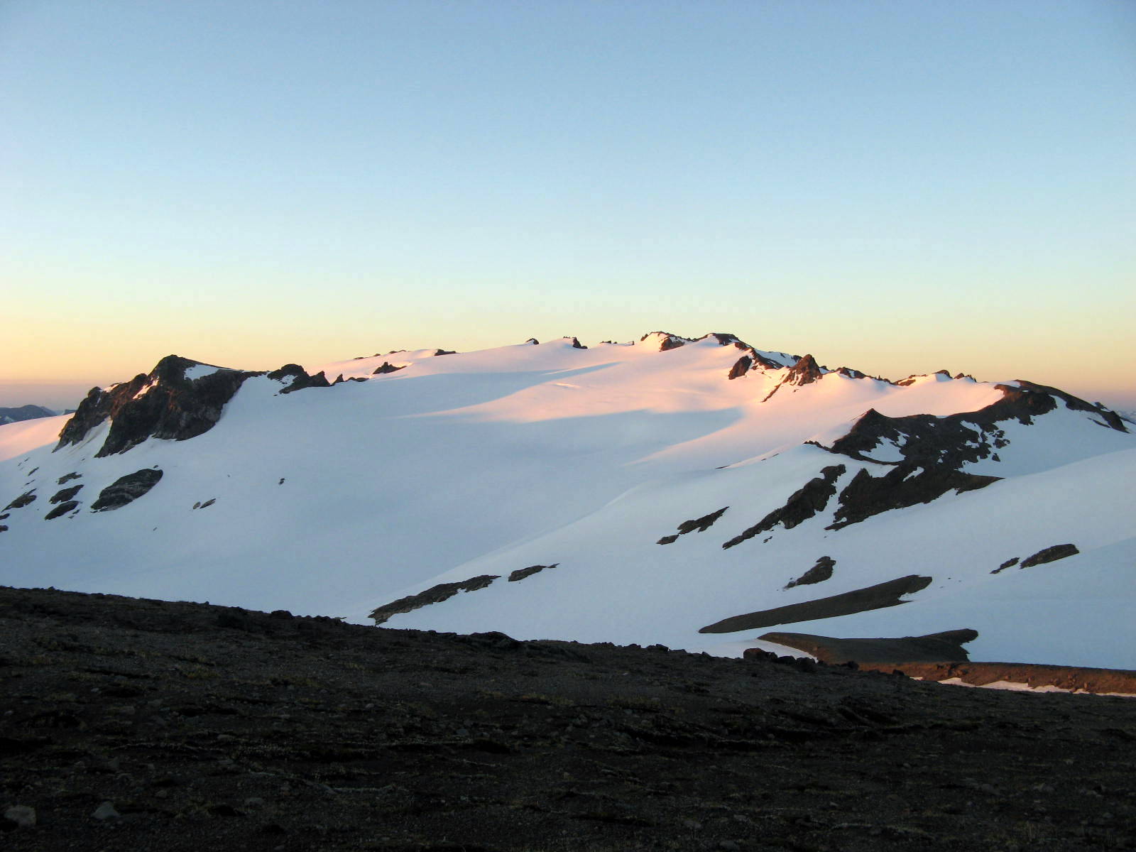
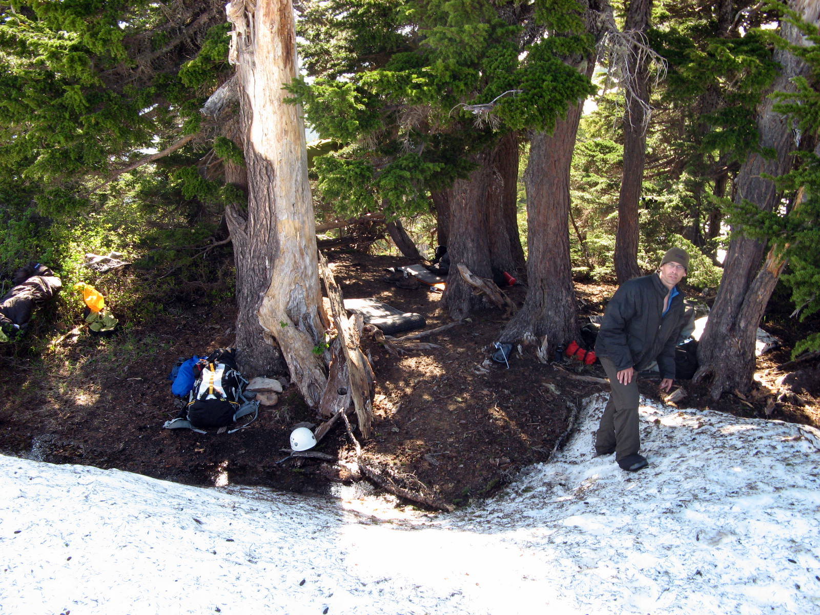 Our camp at White Pass was great, especially compared to the crummy experience at Mac an' Gnaw.
There were snow-free patches in the trees and we were able to find semi-level bivy spots and hang all of our wet gear out to dry in the trees.
There was no sign of bears up here. Instead, we heard the sound of marmots warning each other of our presence with thier long monotone whistles.
By sunset, we had completely recovered from the thunderstorm. Our gear was dry and our spirits were up. We had our dinner and a shot of whiskey before crawling into the bivies again.
The second night was pretty windy, but the skies were clear and there were no more thunderstorms.
Our camp at White Pass was great, especially compared to the crummy experience at Mac an' Gnaw.
There were snow-free patches in the trees and we were able to find semi-level bivy spots and hang all of our wet gear out to dry in the trees.
There was no sign of bears up here. Instead, we heard the sound of marmots warning each other of our presence with thier long monotone whistles.
By sunset, we had completely recovered from the thunderstorm. Our gear was dry and our spirits were up. We had our dinner and a shot of whiskey before crawling into the bivies again.
The second night was pretty windy, but the skies were clear and there were no more thunderstorms.
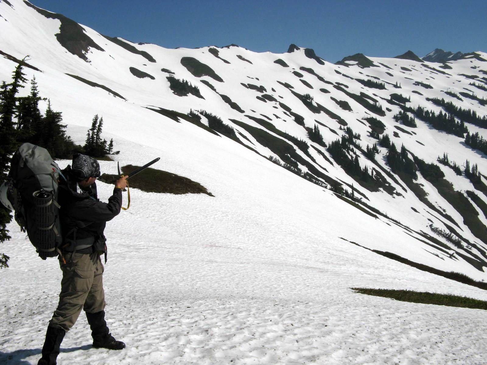
Day 3: Snow trudge - Traversing the wasteland
 We felt a lot better the next morning. The night had been fairly windy, and Kevin hadn't slept too well, but we were feeling much refreshed.
 That way!
We managed to get out of camp by 10:00 AM that morning, which is pretty good for us. This is a vacation after all!
That way!
We managed to get out of camp by 10:00 AM that morning, which is pretty good for us. This is a vacation after all!
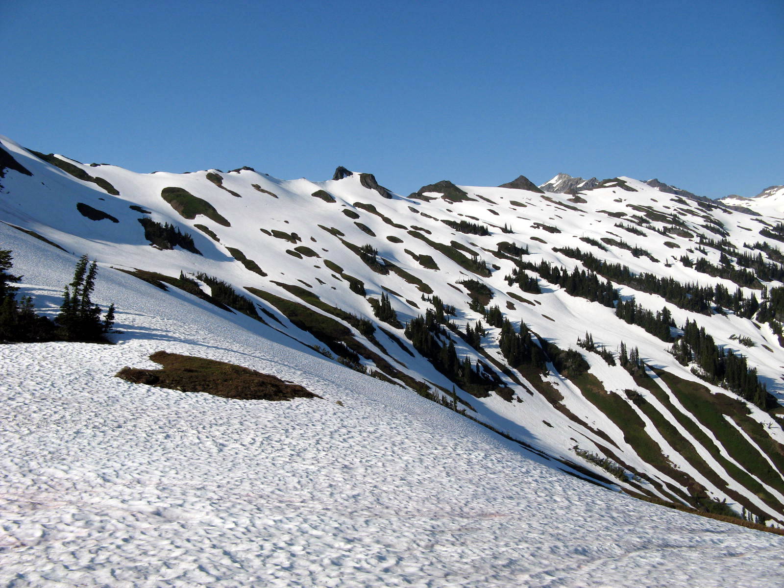 The first part of our day would be contouring across the slope shown above, near the tree line, toward a distant saddle that would be crossed to get us into the White Chuck Basin.
This was all off-trail from here on out, and we weren't sure what kind of terrain we were going to encounter that day.
We decided to stay high on the slope and cross over the distant ridge at about 6000+ feet. We hoped to find an easy traverse from there to the saddle.
The first part of our day would be contouring across the slope shown above, near the tree line, toward a distant saddle that would be crossed to get us into the White Chuck Basin.
This was all off-trail from here on out, and we weren't sure what kind of terrain we were going to encounter that day.
We decided to stay high on the slope and cross over the distant ridge at about 6000+ feet. We hoped to find an easy traverse from there to the saddle.
 No such luck.
When we crossed over the distant ridge, we got our first glimpse of Glacier Peak. Spittin' distance!
But more pressing was the immediate traverse to the next saddle. We saw that we were way too high on the slope.
Between us and the saddle was a very steep and long icy slope. We would have to backtrack and drop hundreds of feet or attempt a steep traverse.
No such luck.
When we crossed over the distant ridge, we got our first glimpse of Glacier Peak. Spittin' distance!
But more pressing was the immediate traverse to the next saddle. We saw that we were way too high on the slope.
Between us and the saddle was a very steep and long icy slope. We would have to backtrack and drop hundreds of feet or attempt a steep traverse.
 Steep traverse it is!
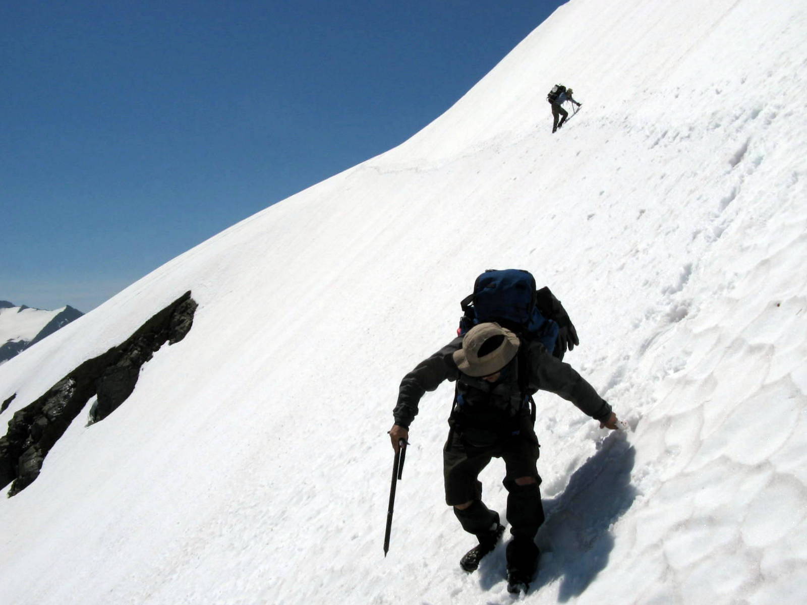
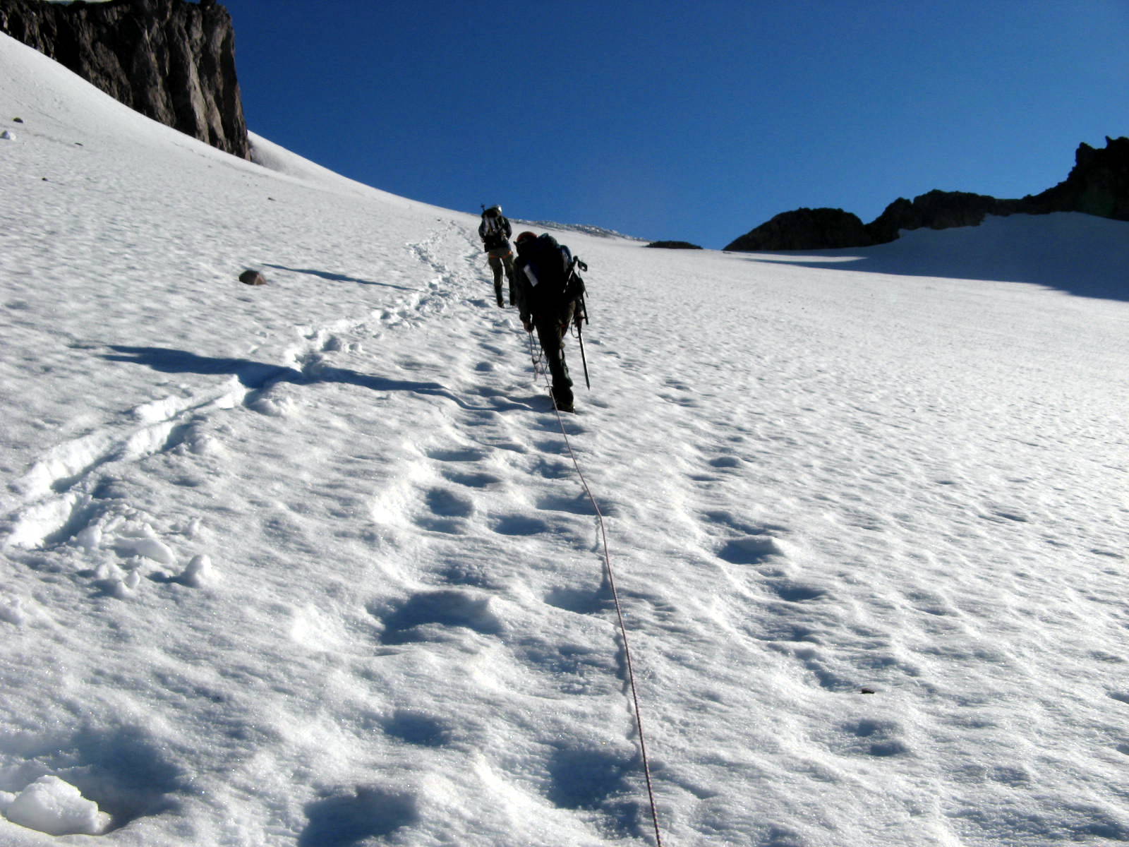
 I was feeling some chutzpah and led the way on the traverse. We managed to cross over to the saddle, though it took an hour or so.
You can see our tracks in the photo above, taken from the saddle and looking back. The photo doesn't really do justice to the angle.
Sketchy. We resolved to find a different way back.
I was feeling some chutzpah and led the way on the traverse. We managed to cross over to the saddle, though it took an hour or so.
You can see our tracks in the photo above, taken from the saddle and looking back. The photo doesn't really do justice to the angle.
Sketchy. We resolved to find a different way back.
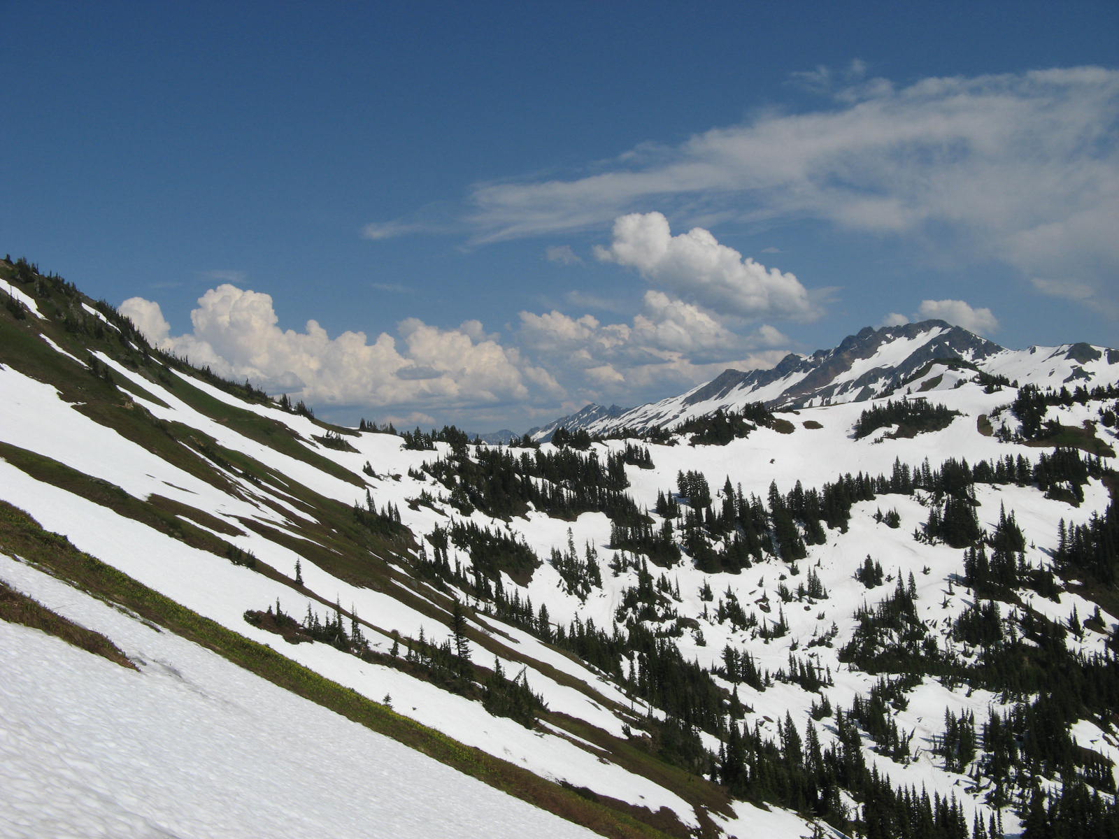
 The White Chuck Basin is where, up until recently, the White Chuck Glacier was located. The glacier is now extinct.
What remains in this wide and open basin is a lifeless wasteland consisting of miles of gently rolling hills, gravely moraines, a few large boulders, and some frozen over lakes (tarns).
The entire basin was blanketed in a thick mantle of bright snow. The afternoon sun was beating down on us relentlessly and there was no shade... anywhere... for miles.
The White Chuck Basin is where, up until recently, the White Chuck Glacier was located. The glacier is now extinct.
What remains in this wide and open basin is a lifeless wasteland consisting of miles of gently rolling hills, gravely moraines, a few large boulders, and some frozen over lakes (tarns).
The entire basin was blanketed in a thick mantle of bright snow. The afternoon sun was beating down on us relentlessly and there was no shade... anywhere... for miles.
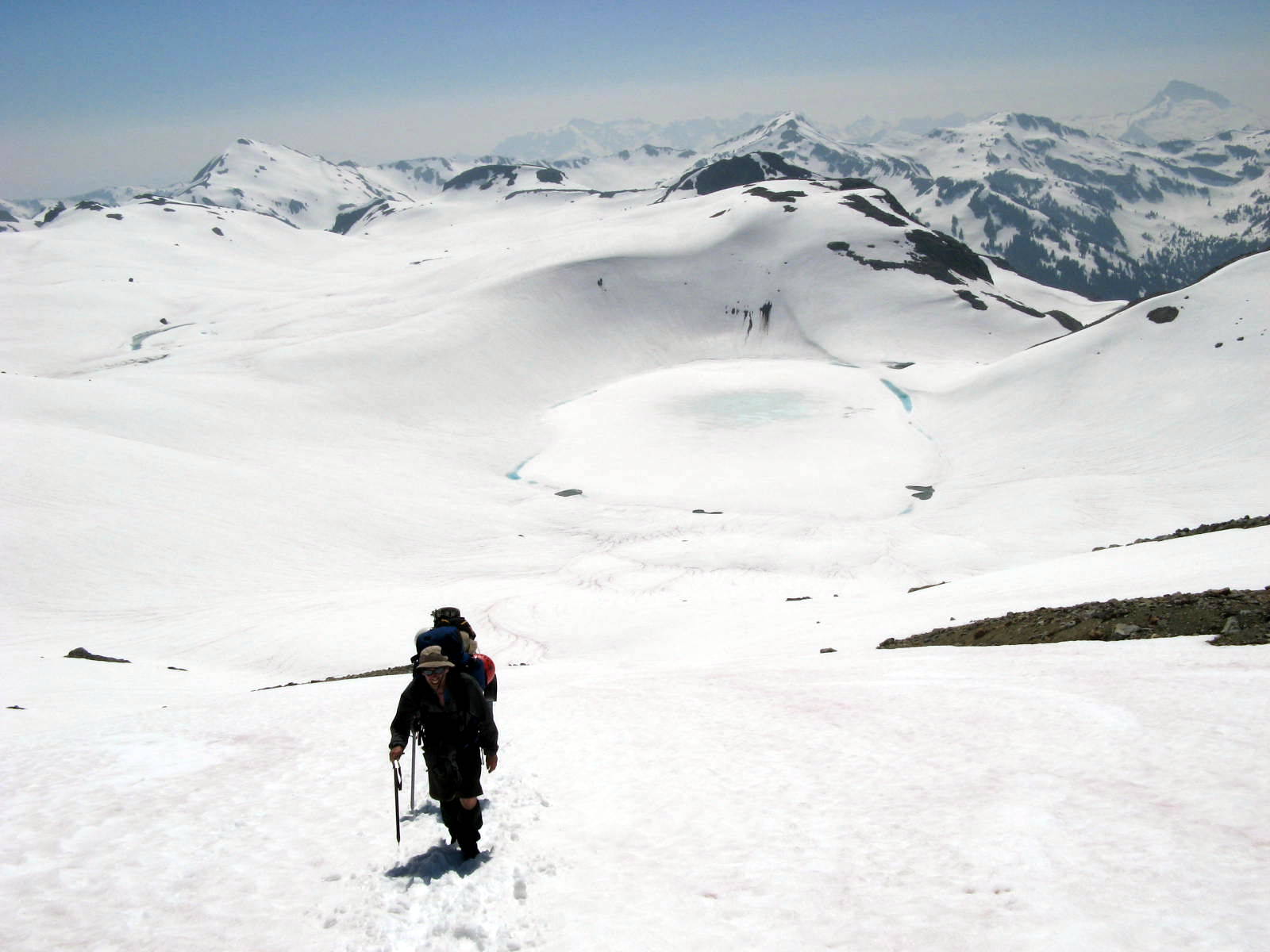
 We walked for hours and hours across this wide open feature, always walking on an angle, always trying to maintain or gain in elevation.
The basin is a huge sweeping landscape. The goal was to ascend the far side, which always seemed to be miles away.
I felt like an ant in a giant microwave.
We walked for hours and hours across this wide open feature, always walking on an angle, always trying to maintain or gain in elevation.
The basin is a huge sweeping landscape. The goal was to ascend the far side, which always seemed to be miles away.
I felt like an ant in a giant microwave.
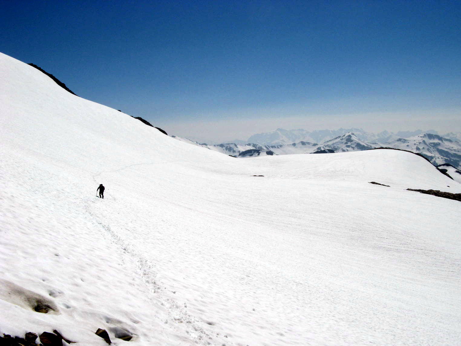
 By late afternoon, we had crossed the White Chuck Basin and began to ascend the wall at the northwest end, climbing toward a high saddle known as Glacier Gap.
 After the long hike across the largely featureless waste of the White Chuck Basin, we ascended a gravel moraine and a few outcrops of rock to gain a gap in the ridge. Glacier Gap.
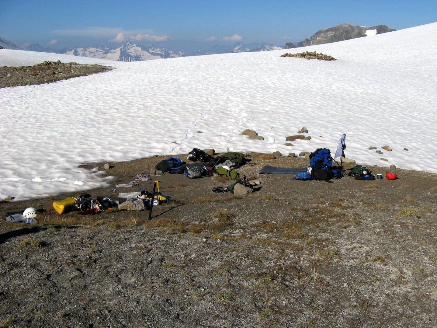
Glacier Gap (~7300 feet) was a welcome site.
We had been told that there was dry ground and running water there. Sure enough, there was a large bare patch on the saddle and a small thin stream of melt water heading down into the basin.
Although there was still no shade in this fairly inhospitable land, we were very glad to shed the packs and call it a day.
We spent an hour or so discussing the summit bid and decided to set the alarm for 3:15 AM.
We boiled some water for our dehydrated dinners, laid out our ropes and climbing gear, crawled into the bivies and tried our best to fall asleep as the sun was setting.
After the long hike across the largely featureless waste of the White Chuck Basin, we ascended a gravel moraine and a few outcrops of rock to gain a gap in the ridge. Glacier Gap.
Glacier Gap (~7300 feet) was a welcome site.
We had been told that there was dry ground and running water there. Sure enough, there was a large bare patch on the saddle and a small thin stream of melt water heading down into the basin.
Although there was still no shade in this fairly inhospitable land, we were very glad to shed the packs and call it a day.
We spent an hour or so discussing the summit bid and decided to set the alarm for 3:15 AM.
We boiled some water for our dehydrated dinners, laid out our ropes and climbing gear, crawled into the bivies and tried our best to fall asleep as the sun was setting.
Day 4: Glacier Peak
 The alarm went off at 3:15.
 With few words spoken, we found our headlights in the dark and emerged from our sleeping bags in the cold and started pulling on down jackets, boots, and crampons.
 We left camp at about 4:00 AM.
We took only what we needed for the summit bid, leaving the rest of our gear tucked into our bivies at Glacier Gap. We weighted the bivies down with rocks.
We left camp at about 4:00 AM.
We took only what we needed for the summit bid, leaving the rest of our gear tucked into our bivies at Glacier Gap. We weighted the bivies down with rocks.
 The snow was hard and slick like icy concrete. The crampons gripped the ground well and allowed us to ascend.
We climbed the north side of the saddle and began our hike toward the 'Cleaver'.
The Cleaver is a long ramp that leads up the flank of the volcano toward Disappointment Peak, a false summit (~9700 feet) and an enourmous obstabcle between us and the true summit.
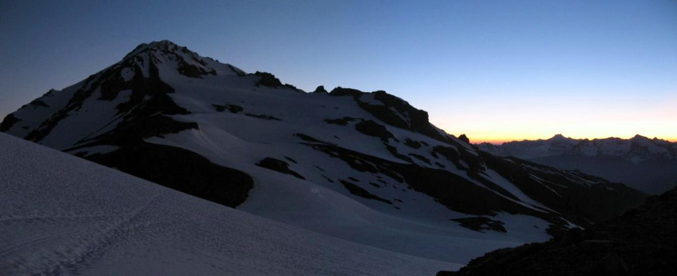
The picture above (click to enlarge) shows our first great view of the volcano from near Glacier Gap, just as dawn was beginning to light up the sky.
The snow was hard and slick like icy concrete. The crampons gripped the ground well and allowed us to ascend.
We climbed the north side of the saddle and began our hike toward the 'Cleaver'.
The Cleaver is a long ramp that leads up the flank of the volcano toward Disappointment Peak, a false summit (~9700 feet) and an enourmous obstabcle between us and the true summit.
The picture above (click to enlarge) shows our first great view of the volcano from near Glacier Gap, just as dawn was beginning to light up the sky.
 Once we were on the Cleaver and heading up toward Disappointment Peak, the dawn arrived. We turned off the headlights.
The Cleaver is a great earthen ramp composed of ash and rock. It allowed us to progress way up the side of the volcano while off of the snow. I loved it.
Once we were on the Cleaver and heading up toward Disappointment Peak, the dawn arrived. We turned off the headlights.
The Cleaver is a great earthen ramp composed of ash and rock. It allowed us to progress way up the side of the volcano while off of the snow. I loved it.
 Looking back toward Glacier Gap and the Suiattle Glacier as dawn spread across the landscape.
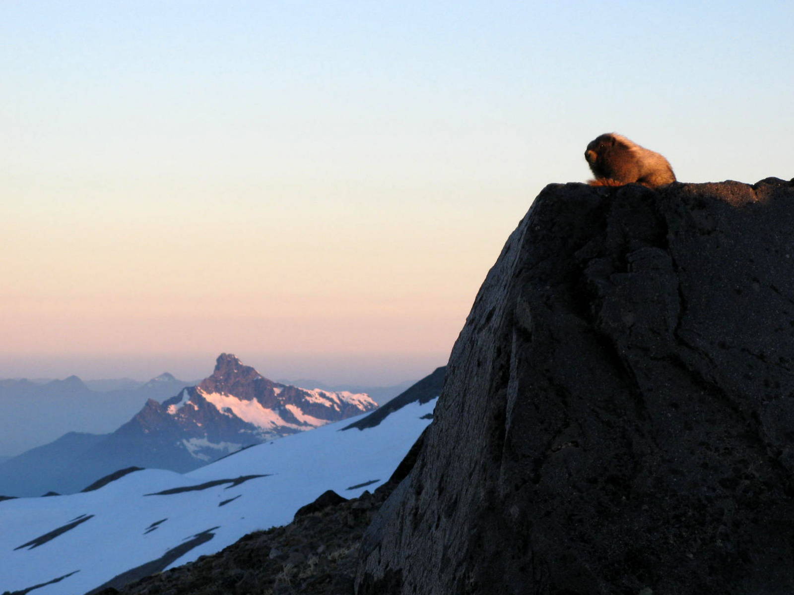 A marmot was taking in the dawn on a boulder outside of his burrow on the Cleaver.
 We stopped at this point and roped up. We would want to be on rope for the rest of the summit bid.
Kevin took the lead and I took the rear.
We stopped at this point and roped up. We would want to be on rope for the rest of the summit bid.
Kevin took the lead and I took the rear.
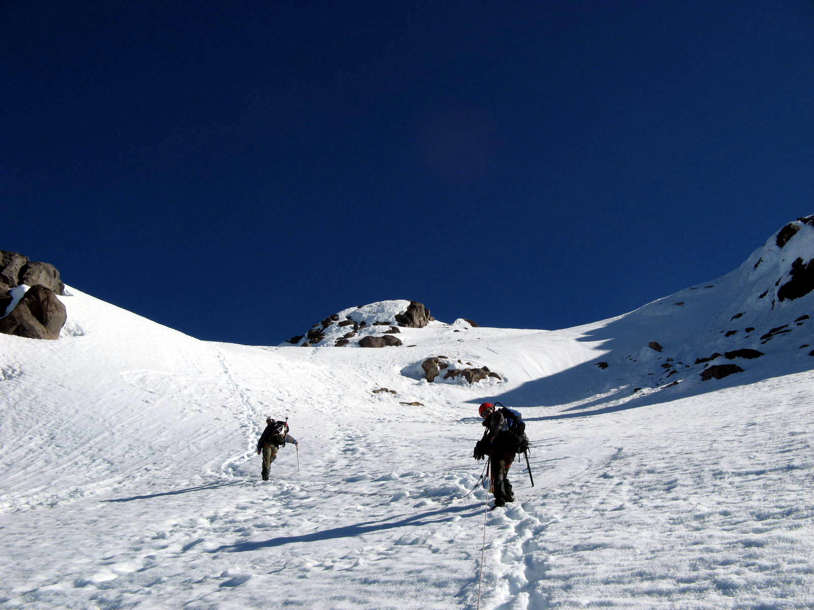
 We crossed under Disappointment Peak, climbing the steep snowfield that would get us up and onto the Cool Glacier.
 By the time we had crossed under Disappointment Peak and reached the little saddle that would allow us to get onto the Cool Glacier, the morning sun was up. It was about 6:30 AM.
I took this photo looking back across our route from where we had first roped up. That's Mt. Rainier in the distance on the right.
By the time we had crossed under Disappointment Peak and reached the little saddle that would allow us to get onto the Cool Glacier, the morning sun was up. It was about 6:30 AM.
I took this photo looking back across our route from where we had first roped up. That's Mt. Rainier in the distance on the right.
 I didn't get any photos while on the Cool Glacier, but it was basically a slow trudge up steep snow with crevasses open about a hundred feet away on the right side of the route.
Kevin set a steady pace and we climbed about 300-400 feet up the Cool with hardly a pause.
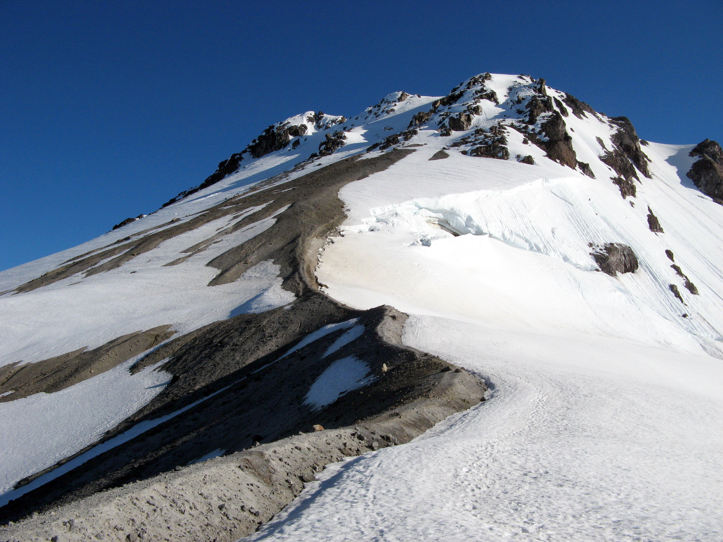
The above photo was taken from the top of the Cool Glacier, looking upward at the remaining portion of the route.
We would follow the dirt and rock approximately two-thirds of the way to the top before climbing the remaining distance in the snow.
I didn't get any photos while on the Cool Glacier, but it was basically a slow trudge up steep snow with crevasses open about a hundred feet away on the right side of the route.
Kevin set a steady pace and we climbed about 300-400 feet up the Cool with hardly a pause.
The above photo was taken from the top of the Cool Glacier, looking upward at the remaining portion of the route.
We would follow the dirt and rock approximately two-thirds of the way to the top before climbing the remaining distance in the snow.
 This photo was taken while pausing for a breath at about 10,000 feet.
We continued to climb the pumice and ash ramp toward the ice cap.
This photo was taken while pausing for a breath at about 10,000 feet.
We continued to climb the pumice and ash ramp toward the ice cap.
 Finally, at over 10,000 feet, we ascended the final segment of the route.
Gasping for breath with every step, at 9:15 AM, we hauled ourselves up the side of the ice cap and onto the summit!
Finally, at over 10,000 feet, we ascended the final segment of the route.
Gasping for breath with every step, at 9:15 AM, we hauled ourselves up the side of the ice cap and onto the summit!
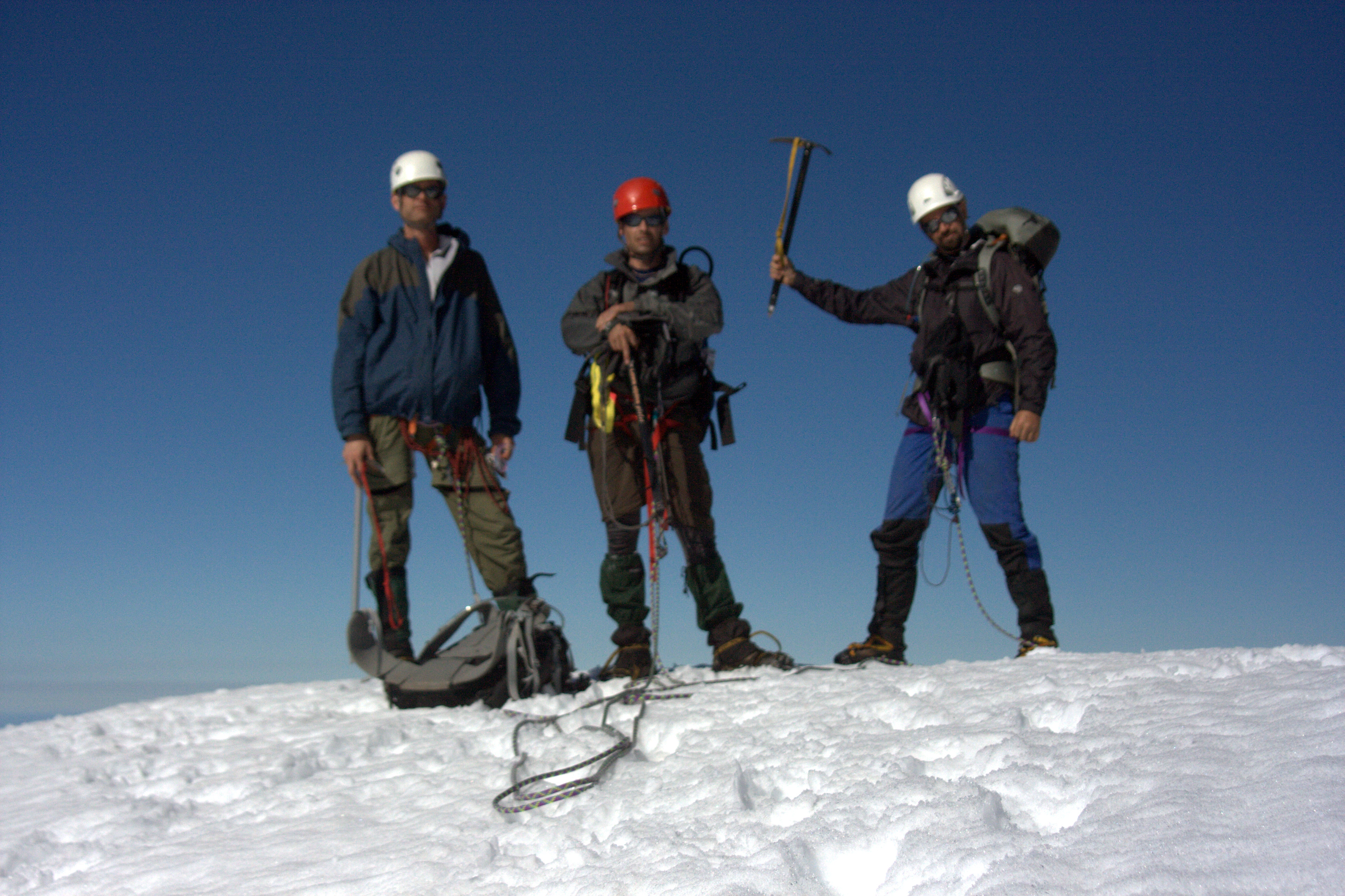 The summit shot! A little blurry...
 Oh yeah! Another Cascade volcano under my feet!
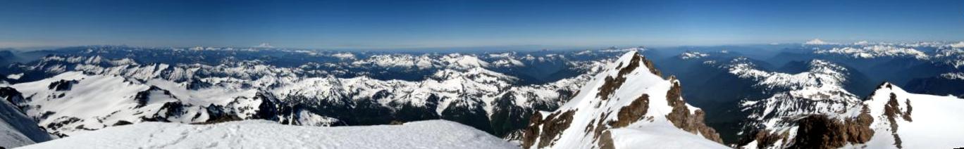 The view... Well, there's no photo that does it justice.
The distances are often judged by which volcanos are visible. From Glacier Peak we could see from Mt. Baker past Mt. Rainier to Mt. Adams.
We could make out the Olympic Range in the west, and we could see a huge swath of the Cascades from our lofty perch here at 10,541 feet.
The view... Well, there's no photo that does it justice.
The distances are often judged by which volcanos are visible. From Glacier Peak we could see from Mt. Baker past Mt. Rainier to Mt. Adams.
We could make out the Olympic Range in the west, and we could see a huge swath of the Cascades from our lofty perch here at 10,541 feet.
 After about 15 minutes, we started heading back down the route. We knew that we had a very long day still ahead of us.
 Heading down and near the top of the Cool Glacier. Nice crevasses on the left there.
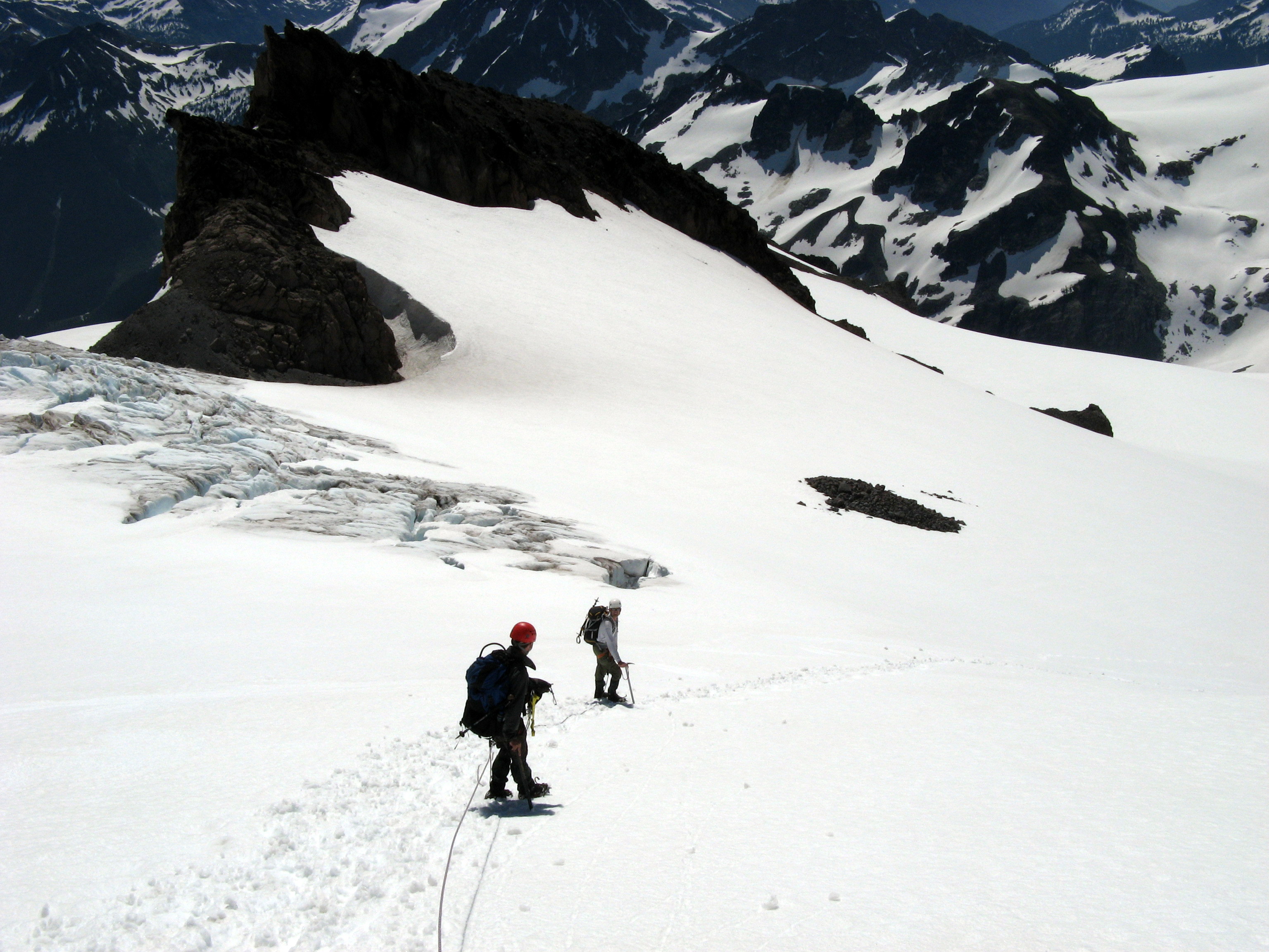
 By about 10:30 AM, we had reached the Cleaver again and we went off-rope. The crampons were no longer necessary as the snow was softening to slush under the early afternoon sun.
I went well ahead of the guys and looked back for this photo, near Glacier Gap.
By about 10:30 AM, we had reached the Cleaver again and we went off-rope. The crampons were no longer necessary as the snow was softening to slush under the early afternoon sun.
I went well ahead of the guys and looked back for this photo, near Glacier Gap.
 We reached our camp at Glacier Gap at 12:15 PM.
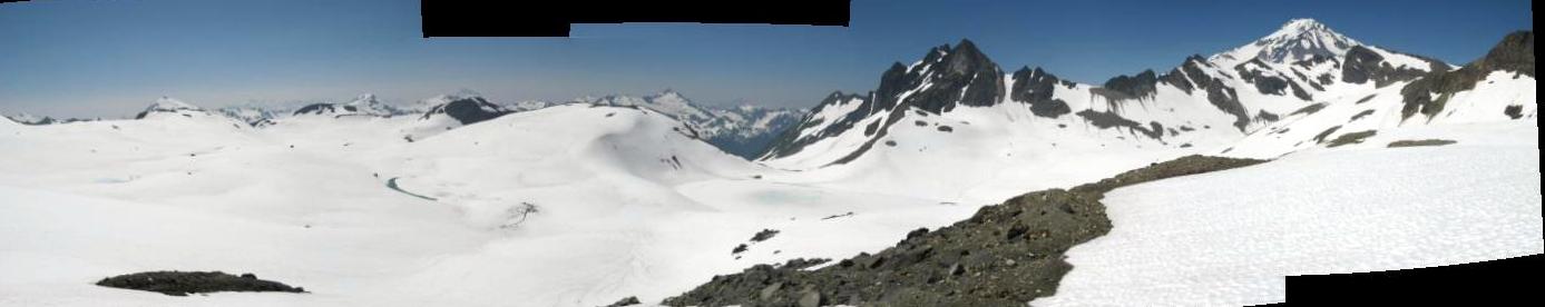
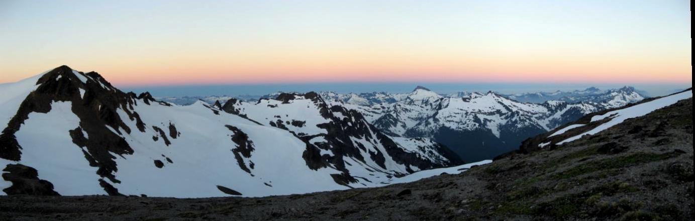
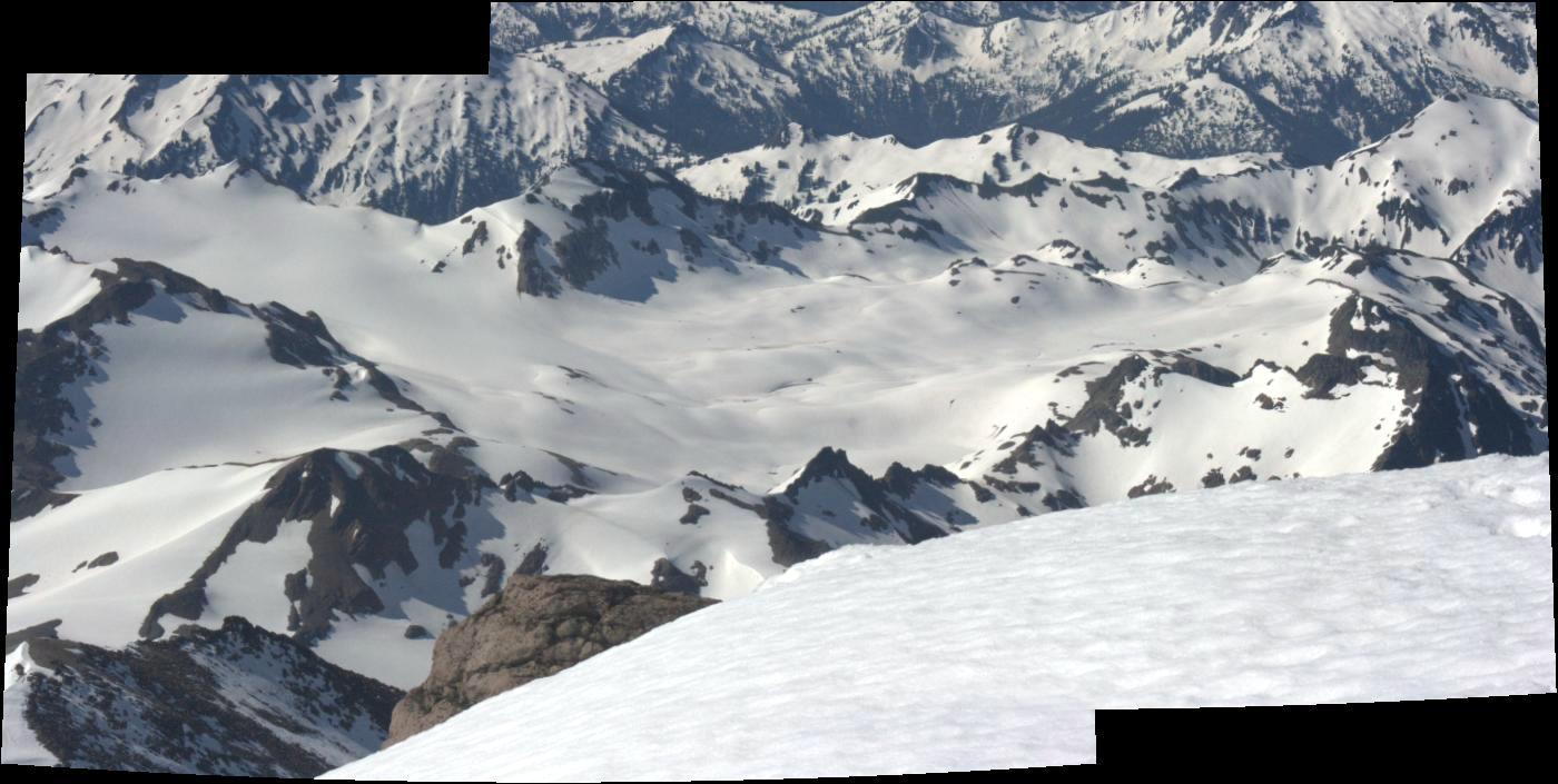
The panoramic photo above shows the White Chuck Basin from up on the Cleaver. We knew that we would need to cross this inhospitable wasteland again. Today!
Glacier Gap is off the photo to the left. The saddle that we had to cross back over is near the center of the photo.
White Pass, our next shade, is hidden behind the mountain on the right of the photo.
After a hell of a morning workout, we still had a long afternoon ahead.
Well, we did it.
After returning to camp, we crashed at Glacier Gap for about 2-3 hours and then packed up and hiked all the way out to White Pass, yearning for shade.
We trudged across the White Chuck Basin back to our saddle. Once we climbed over the saddle, we took a lower route to avoid the sketchy traverse.
We contoured over countless little gulleys and drainages on our way back to White Pass and reached our camp spot in the shade at about 7:00 PM. Whew!
We reached our camp at Glacier Gap at 12:15 PM.
The panoramic photo above shows the White Chuck Basin from up on the Cleaver. We knew that we would need to cross this inhospitable wasteland again. Today!
Glacier Gap is off the photo to the left. The saddle that we had to cross back over is near the center of the photo.
White Pass, our next shade, is hidden behind the mountain on the right of the photo.
After a hell of a morning workout, we still had a long afternoon ahead.
Well, we did it.
After returning to camp, we crashed at Glacier Gap for about 2-3 hours and then packed up and hiked all the way out to White Pass, yearning for shade.
We trudged across the White Chuck Basin back to our saddle. Once we climbed over the saddle, we took a lower route to avoid the sketchy traverse.
We contoured over countless little gulleys and drainages on our way back to White Pass and reached our camp spot in the shade at about 7:00 PM. Whew!
Day 5: The long march home
 We recovered our beers at Rainey Camp around 3:00 PM. Mmmmmm... Ahh.... That godly sparkling hoppy beverage gave us what we needed to push onward.
We decided to hike out that day! After all, there were three more beers in the Jeep!
Fortunately for us, after 12 miles, about halfway down the closed road, we were given a ride back down to the Jeep by the road crew who were calling it quits themselves.
We were extremely happy to have the ride, as our feet were about worn out by this point. Dan was limping and my feet were starting to seriously rebel.
It was kind of funny to be sitting in the back of the same white pickup that we had narrowly avoided during our run up the closed road four days earlier.
While breathing in the diesel fumes from the dump truck in front of us, and smiling at each other in the evening sunshine, we all had the same thing in mind: Victory!
..and beer.
We recovered our beers at Rainey Camp around 3:00 PM. Mmmmmm... Ahh.... That godly sparkling hoppy beverage gave us what we needed to push onward.
We decided to hike out that day! After all, there were three more beers in the Jeep!
Fortunately for us, after 12 miles, about halfway down the closed road, we were given a ride back down to the Jeep by the road crew who were calling it quits themselves.
We were extremely happy to have the ride, as our feet were about worn out by this point. Dan was limping and my feet were starting to seriously rebel.
It was kind of funny to be sitting in the back of the same white pickup that we had narrowly avoided during our run up the closed road four days earlier.
While breathing in the diesel fumes from the dump truck in front of us, and smiling at each other in the evening sunshine, we all had the same thing in mind: Victory!
..and beer.