Dege Peak
Mount Rainier National Park
September 20, 2014
|
Though only 3 miles round-trip, this hike deserves its place in the Alpine Adventures due to the hike's prominence, locale, and ... well, because it was Morgan's first summit!
|
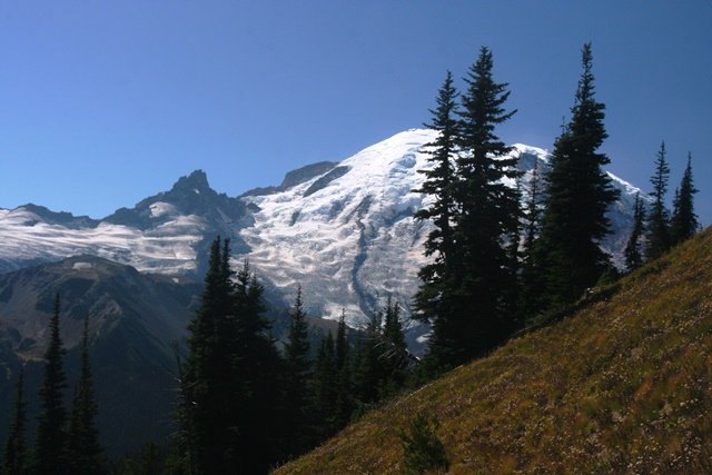
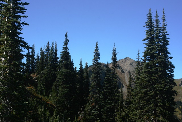 Here's what Dege Peak looks like from the trailhead at Sunrise Point. Its at the end of a 1.5 mile-long trail, and about 850 vertical feet from the parking lot to the top.
|
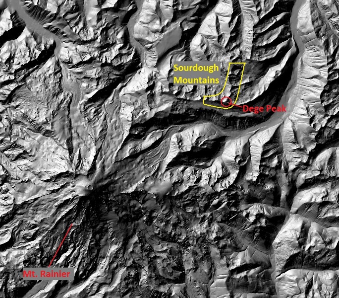 Dege Peak (7006 feet) is one of the high points of the Sourdough Mountains, a jagged spur on the northeast flank of Mt. Rainier. It's not quite half the height of Mt. Rainier.
|
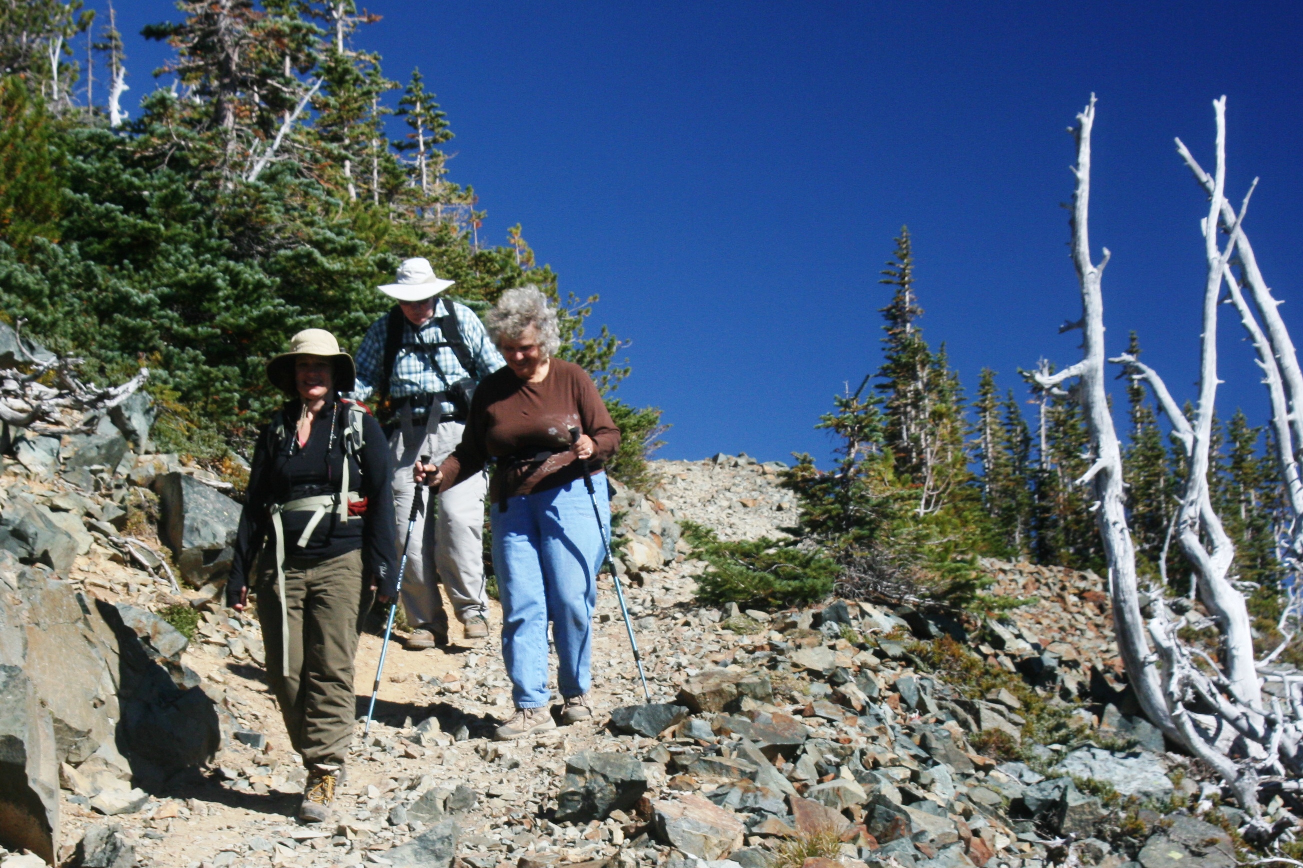
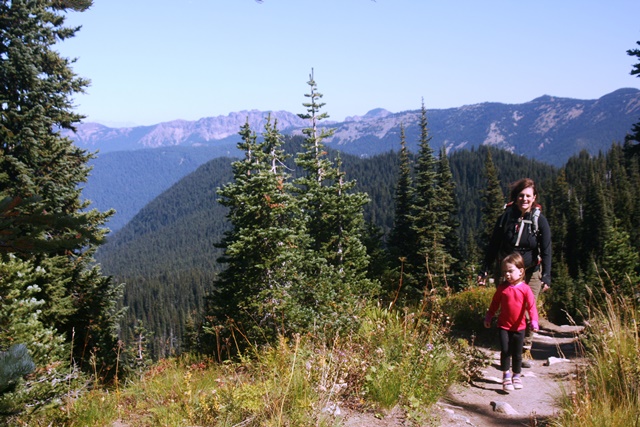 Cynthia and Morgan heading up the trail.
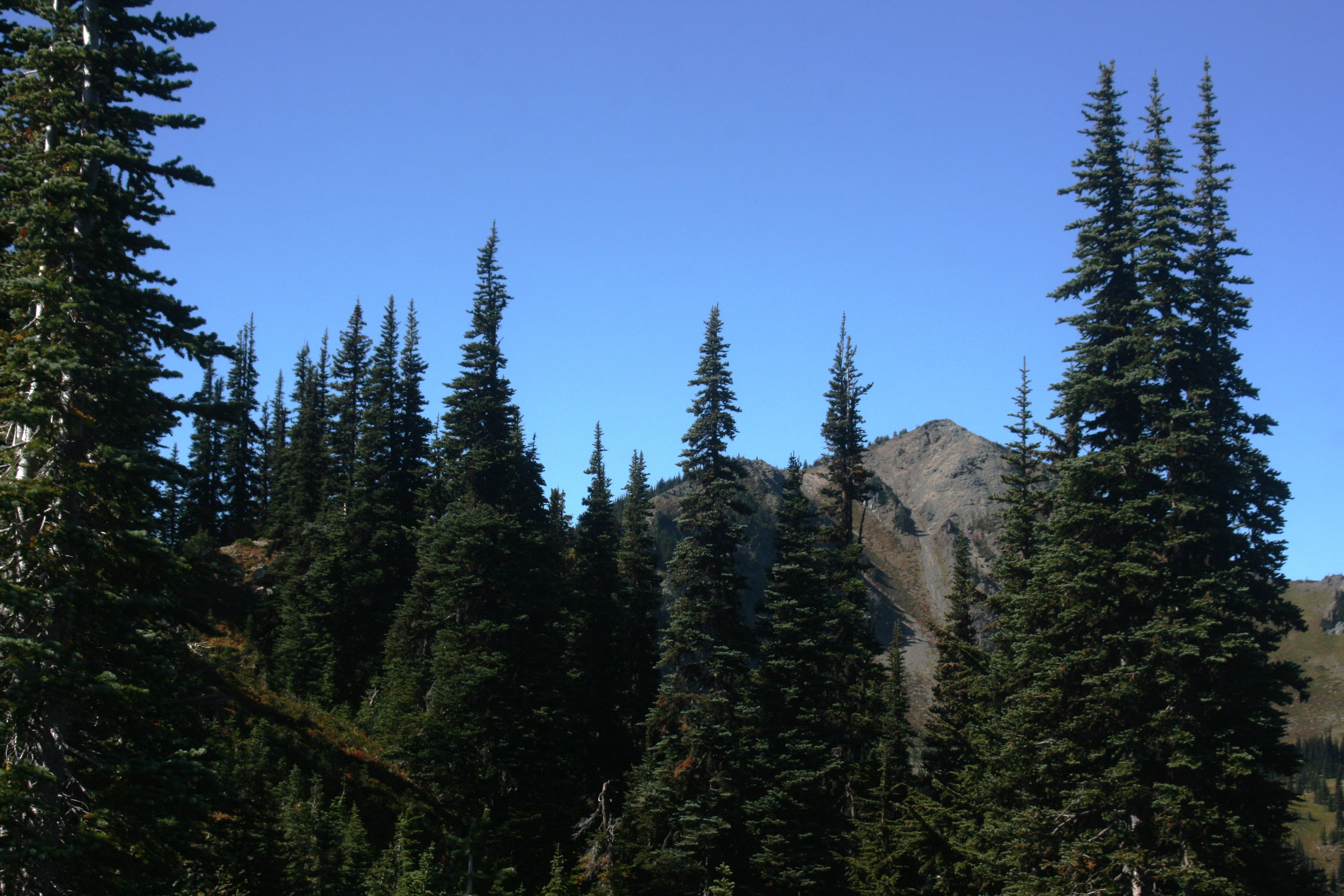
The trail follows a narrow ridge. It is really scenic. There are great views on each side of the ridge.
Cynthia and Morgan heading up the trail.
The trail follows a narrow ridge. It is really scenic. There are great views on each side of the ridge.
|
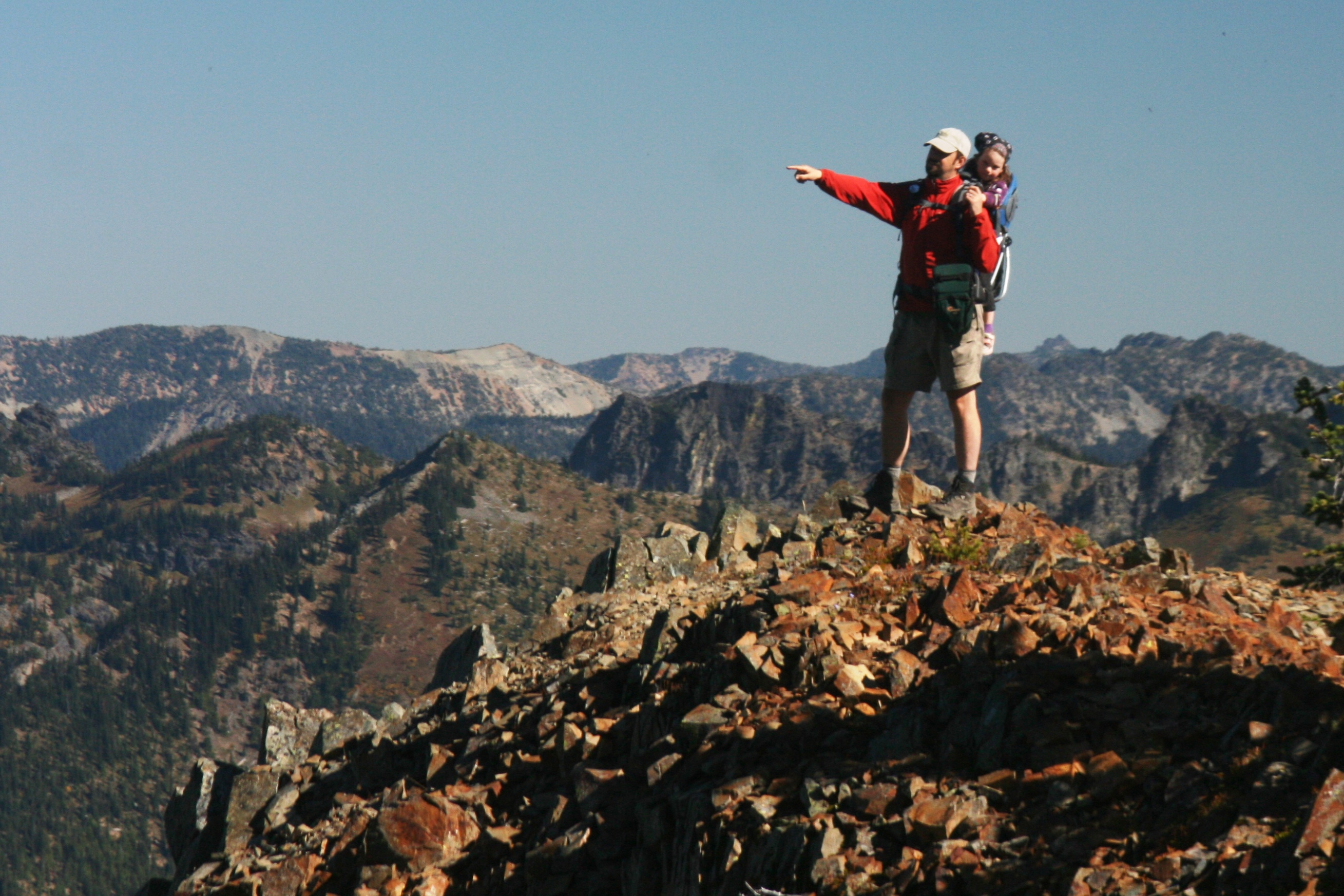
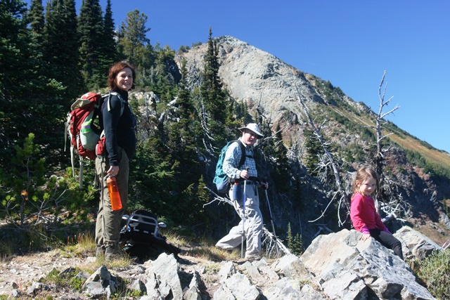 This hike was Lowell's idea. He found a peak that was in Morgan's reach, with a heck of a view.
We're taking a little break in this photo. Morgan wanted lots of breaks. In fact, she wanted me to carry her, and there was a little complaining, as I recall.
I really didn't have to push her too hard though. Motivated by M&M incentives, she made it to the top on her own!
This hike was Lowell's idea. He found a peak that was in Morgan's reach, with a heck of a view.
We're taking a little break in this photo. Morgan wanted lots of breaks. In fact, she wanted me to carry her, and there was a little complaining, as I recall.
I really didn't have to push her too hard though. Motivated by M&M incentives, she made it to the top on her own!
|
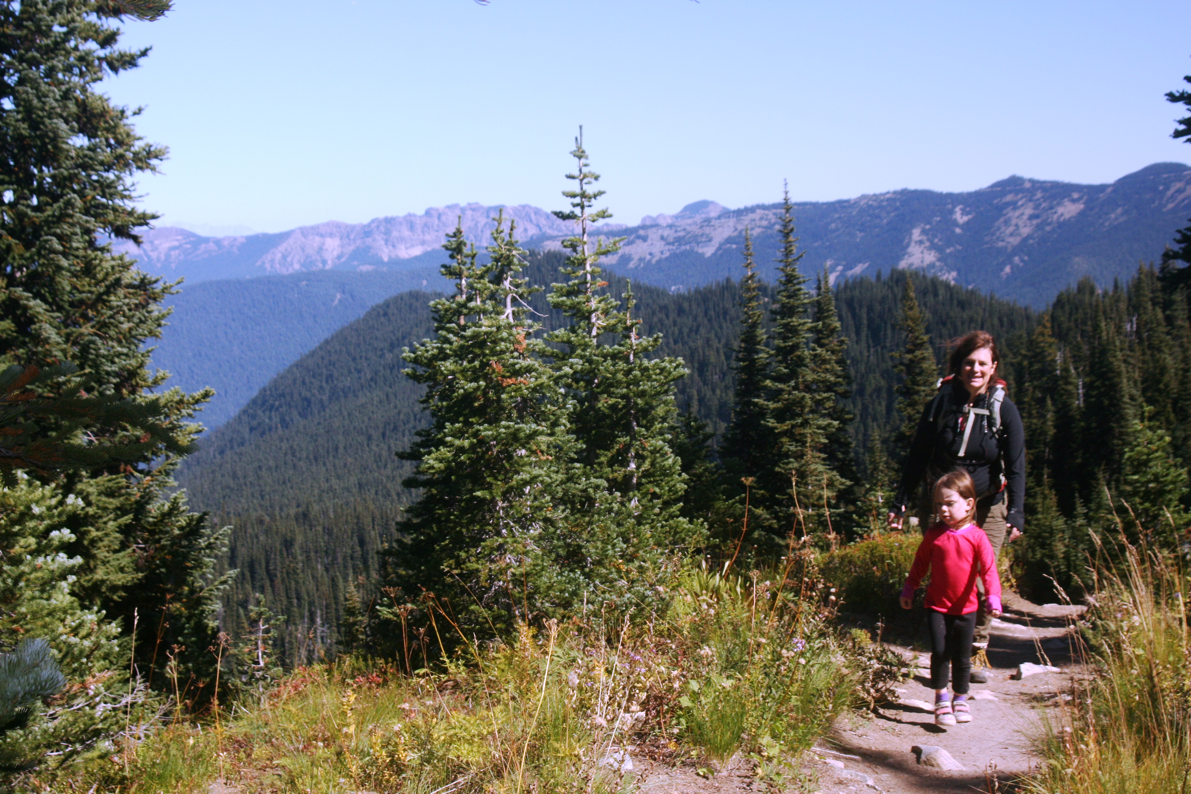
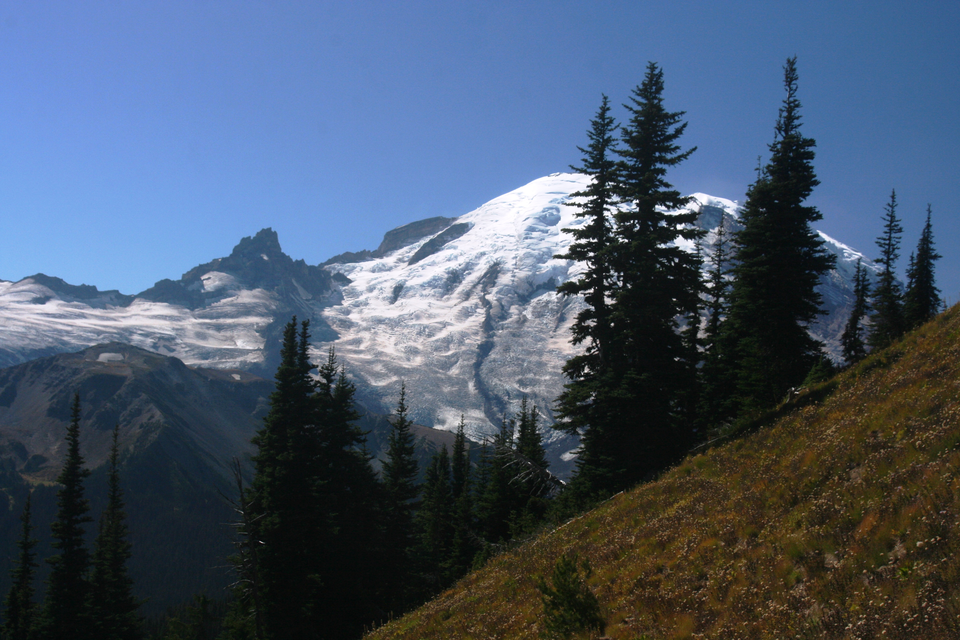
 The last of the trees obscuring the view of Rainier dropped away after about a mile.
The view of the volcano was incredible.
The last of the trees obscuring the view of Rainier dropped away after about a mile.
The view of the volcano was incredible.
|
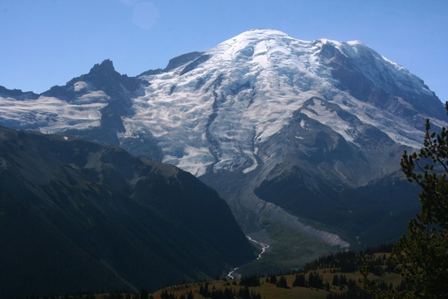 That's Little Tahoma, Disappointment Cleaver, and Gibraltar Rock on the left side of Rainier.
Those are all features I passed below or over last year.
The triangular rock pointing toward the summit about halfway down the mountain, is Steamboat Prow.
That's the location of Camp Schurman, another high camp for climbers. I'm going to go check that place out one of these days.
That's Little Tahoma, Disappointment Cleaver, and Gibraltar Rock on the left side of Rainier.
Those are all features I passed below or over last year.
The triangular rock pointing toward the summit about halfway down the mountain, is Steamboat Prow.
That's the location of Camp Schurman, another high camp for climbers. I'm going to go check that place out one of these days.
|
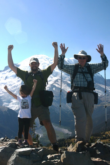 Summit Shot!
|
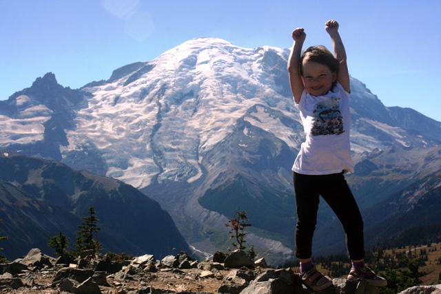 Morgan's first summit!
Yeah! We have a fourth generation mountain climber here!
Morgan's first summit!
Yeah! We have a fourth generation mountain climber here!
|
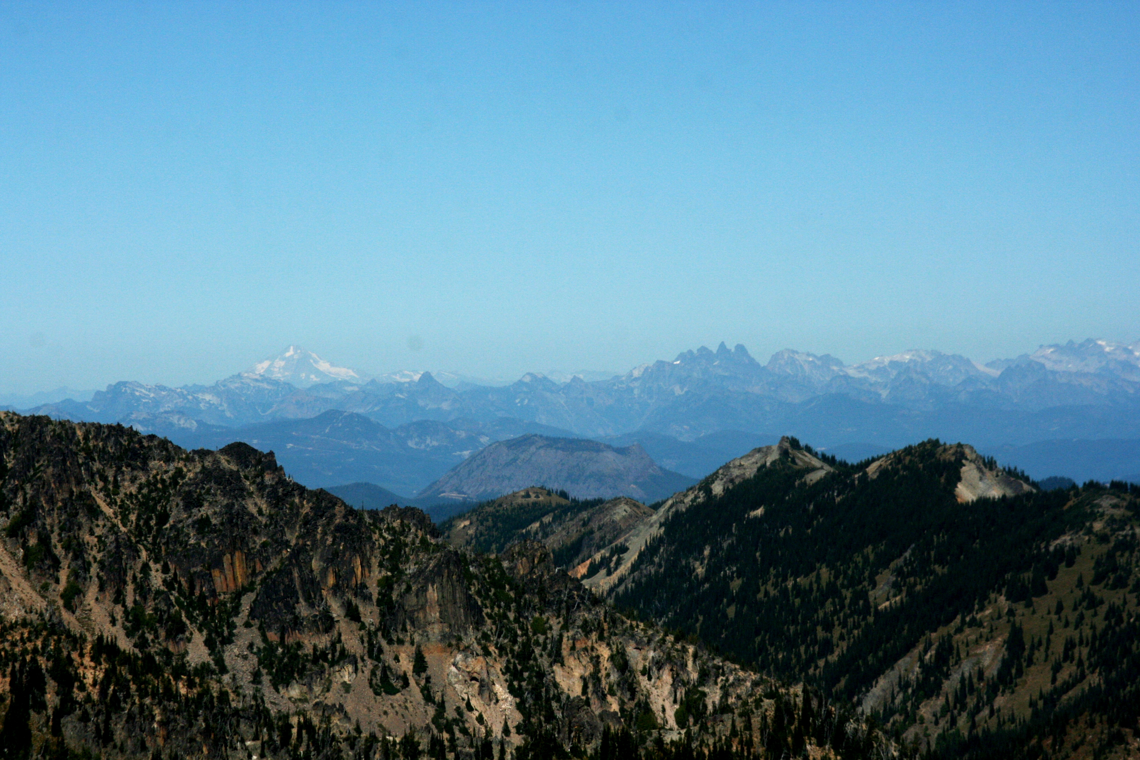
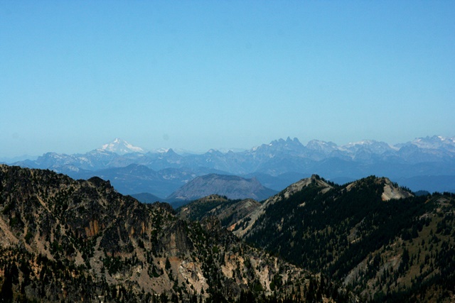 Volcano sightings to the north:
That's Glacier Peak! We could see Mt. Baker to the north as well, but the photo didn't turn out.
Volcano sightings to the north:
That's Glacier Peak! We could see Mt. Baker to the north as well, but the photo didn't turn out.
|
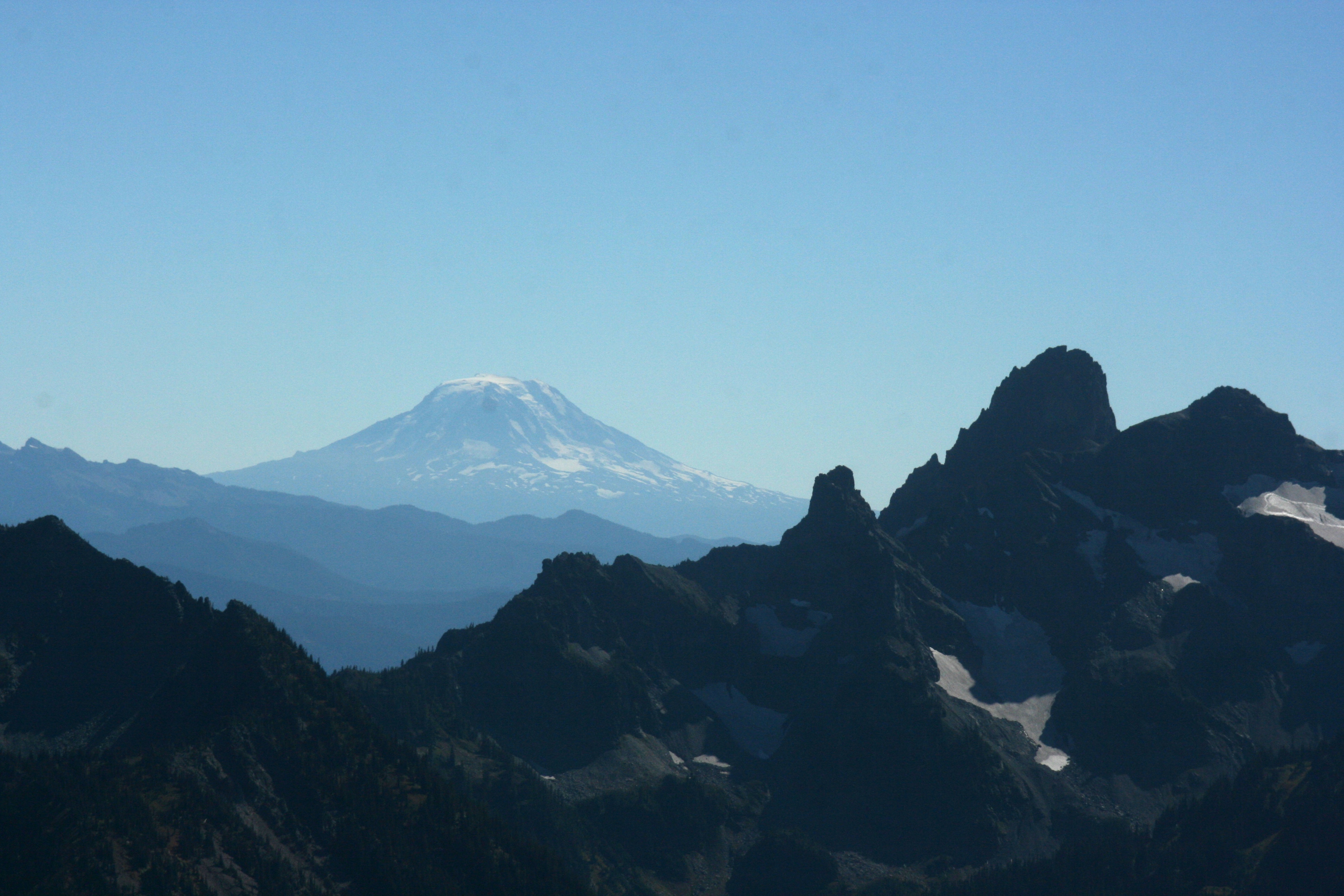
 Volcano sightings to the south:
That's Mt Adams....and Mt St. Helens was hidden behind Mt. Rainier.
Volcano sightings to the south:
That's Mt Adams....and Mt St. Helens was hidden behind Mt. Rainier.
|
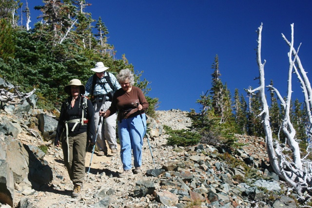 Cynthia, Lowell, and Emily hiking back down.
|
 Morgan had it easy on the way out.
|
 Here's what Dege Peak looks like from the trailhead at Sunrise Point. Its at the end of a 1.5 mile-long trail, and about 850 vertical feet from the parking lot to the top.
 Dege Peak (7006 feet) is one of the high points of the Sourdough Mountains, a jagged spur on the northeast flank of Mt. Rainier. It's not quite half the height of Mt. Rainier.
 Cynthia and Morgan heading up the trail.
The trail follows a narrow ridge. It is really scenic. There are great views on each side of the ridge.
Cynthia and Morgan heading up the trail.
The trail follows a narrow ridge. It is really scenic. There are great views on each side of the ridge.
 This hike was Lowell's idea. He found a peak that was in Morgan's reach, with a heck of a view.
We're taking a little break in this photo. Morgan wanted lots of breaks. In fact, she wanted me to carry her, and there was a little complaining, as I recall.
I really didn't have to push her too hard though. Motivated by M&M incentives, she made it to the top on her own!
This hike was Lowell's idea. He found a peak that was in Morgan's reach, with a heck of a view.
We're taking a little break in this photo. Morgan wanted lots of breaks. In fact, she wanted me to carry her, and there was a little complaining, as I recall.
I really didn't have to push her too hard though. Motivated by M&M incentives, she made it to the top on her own!
 The last of the trees obscuring the view of Rainier dropped away after about a mile.
The view of the volcano was incredible.
The last of the trees obscuring the view of Rainier dropped away after about a mile.
The view of the volcano was incredible.
 That's Little Tahoma, Disappointment Cleaver, and Gibraltar Rock on the left side of Rainier.
Those are all features I passed below or over last year.
The triangular rock pointing toward the summit about halfway down the mountain, is Steamboat Prow.
That's the location of Camp Schurman, another high camp for climbers. I'm going to go check that place out one of these days.
That's Little Tahoma, Disappointment Cleaver, and Gibraltar Rock on the left side of Rainier.
Those are all features I passed below or over last year.
The triangular rock pointing toward the summit about halfway down the mountain, is Steamboat Prow.
That's the location of Camp Schurman, another high camp for climbers. I'm going to go check that place out one of these days.
 Summit Shot!
 Morgan's first summit!
Yeah! We have a fourth generation mountain climber here!
Morgan's first summit!
Yeah! We have a fourth generation mountain climber here!
 Volcano sightings to the north:
That's Glacier Peak! We could see Mt. Baker to the north as well, but the photo didn't turn out.
Volcano sightings to the north:
That's Glacier Peak! We could see Mt. Baker to the north as well, but the photo didn't turn out.
 Volcano sightings to the south:
That's Mt Adams....and Mt St. Helens was hidden behind Mt. Rainier.
Volcano sightings to the south:
That's Mt Adams....and Mt St. Helens was hidden behind Mt. Rainier.
 Cynthia, Lowell, and Emily hiking back down.
 Morgan had it easy on the way out.